Red Mountain Mining District
The Red Mountain Mining District is a historic mining area located between Silverton and Ouray along US 550, the “Million Dollar Highway”. It was the site of a silver mining boom lasting rom 1882 until 1893. The Red Mountain Mining District extends for over five miles from Ironton Park in the north to just south of Red Mountain Pass along US 550. At its peak the district included some 40 mines and six small towns; Albany, Congress, Chattanooga, Guston, Ironton and Red Mountain Town. With the exception of Ironton, there is little left of any of the towns.
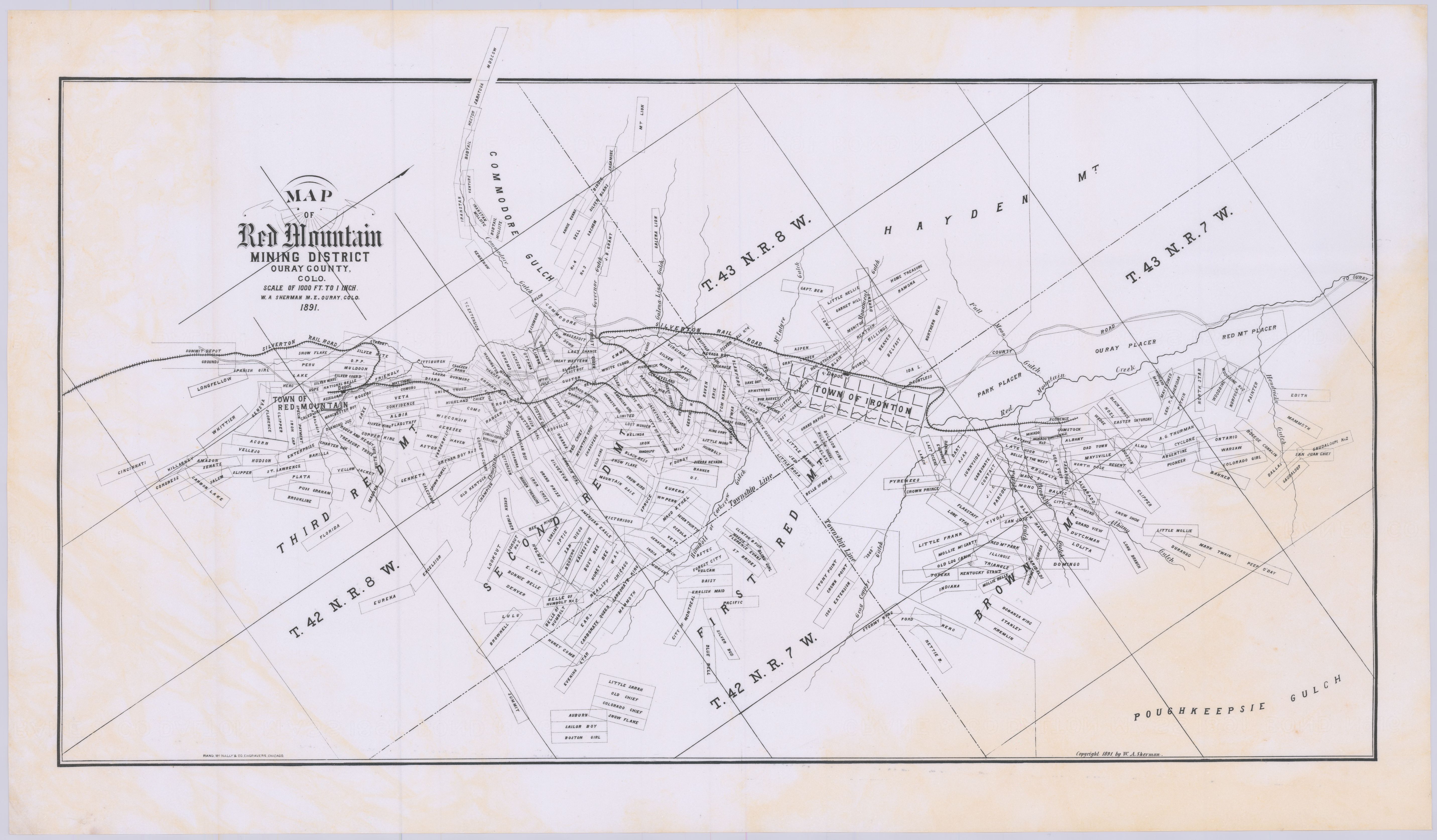
Red Mountain Mining District Map 1891

Red Mountain #1, 2, and 3
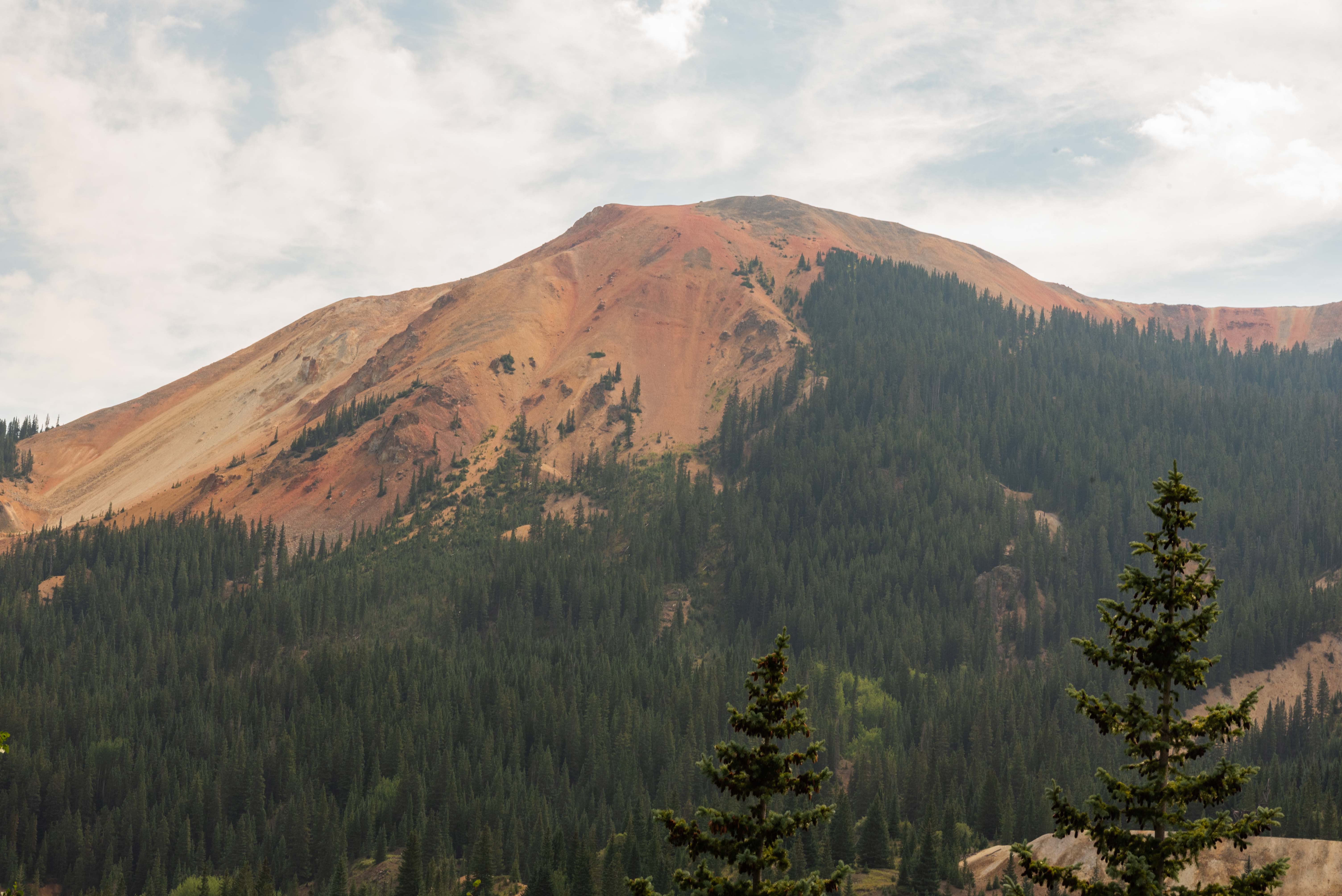
Red Mountain #2

Red Mountain #3
Ironton
Heading south from Ouray US 550 climbs steeply through some switchbacks before flattening
out around 9,600 feet at Ironton Park at the northern edge of the mining district. The
remains of the old mining town of Ironton are located along Ouray County Road 20D
on the east side of US 550. The northern end of CR 20D, located at the Mineral
Creek Staging Area, parallels US 550 for about a mile, then joins US 550 again at its
southern end. There are old buildings along the length of CR 20D, but the best preserved
are in the Ironton townsite at its southern end. There are camping areas located along
the middle portion of CR 20D.
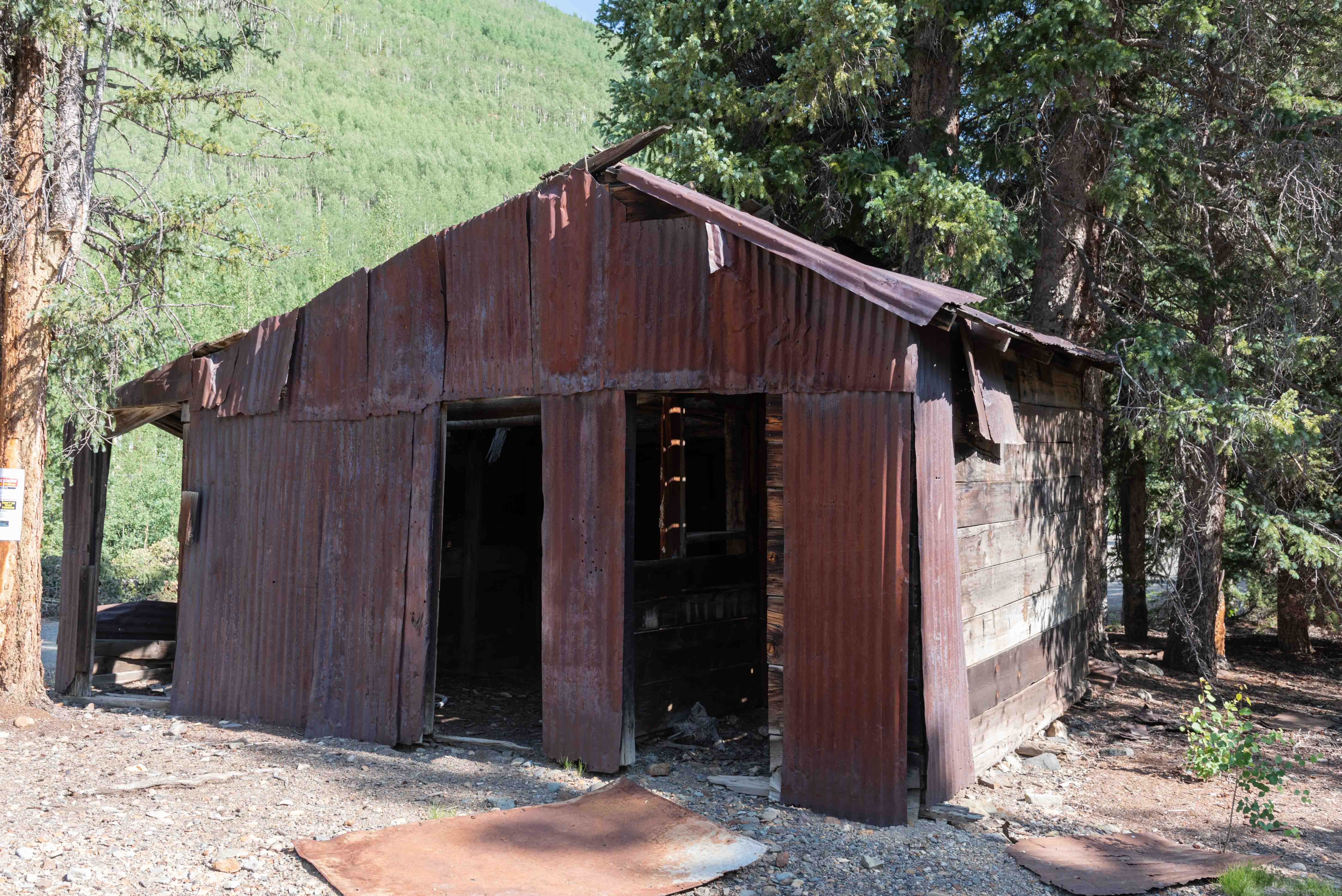
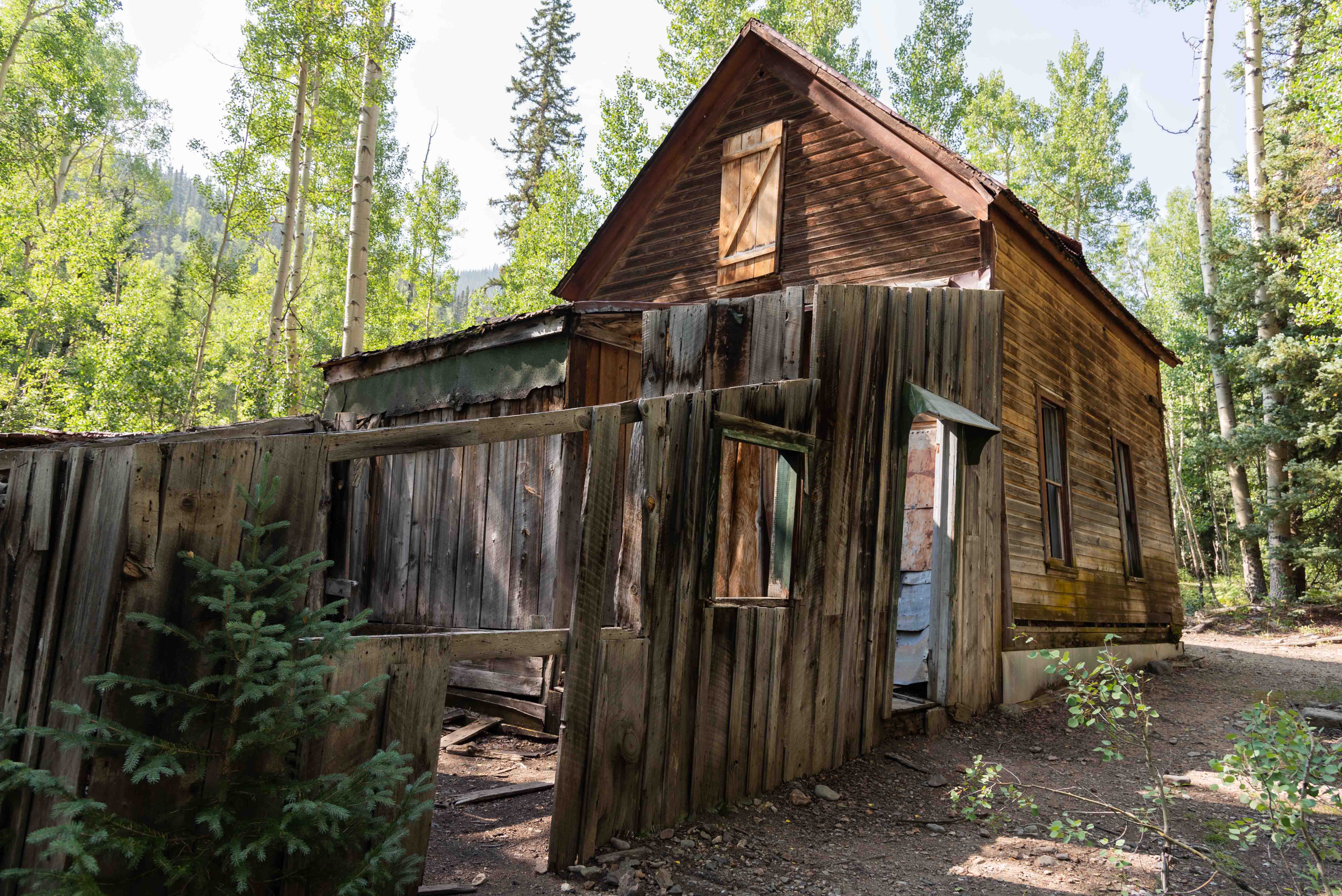
Still is a bulding, sort of
North end of CR 20D

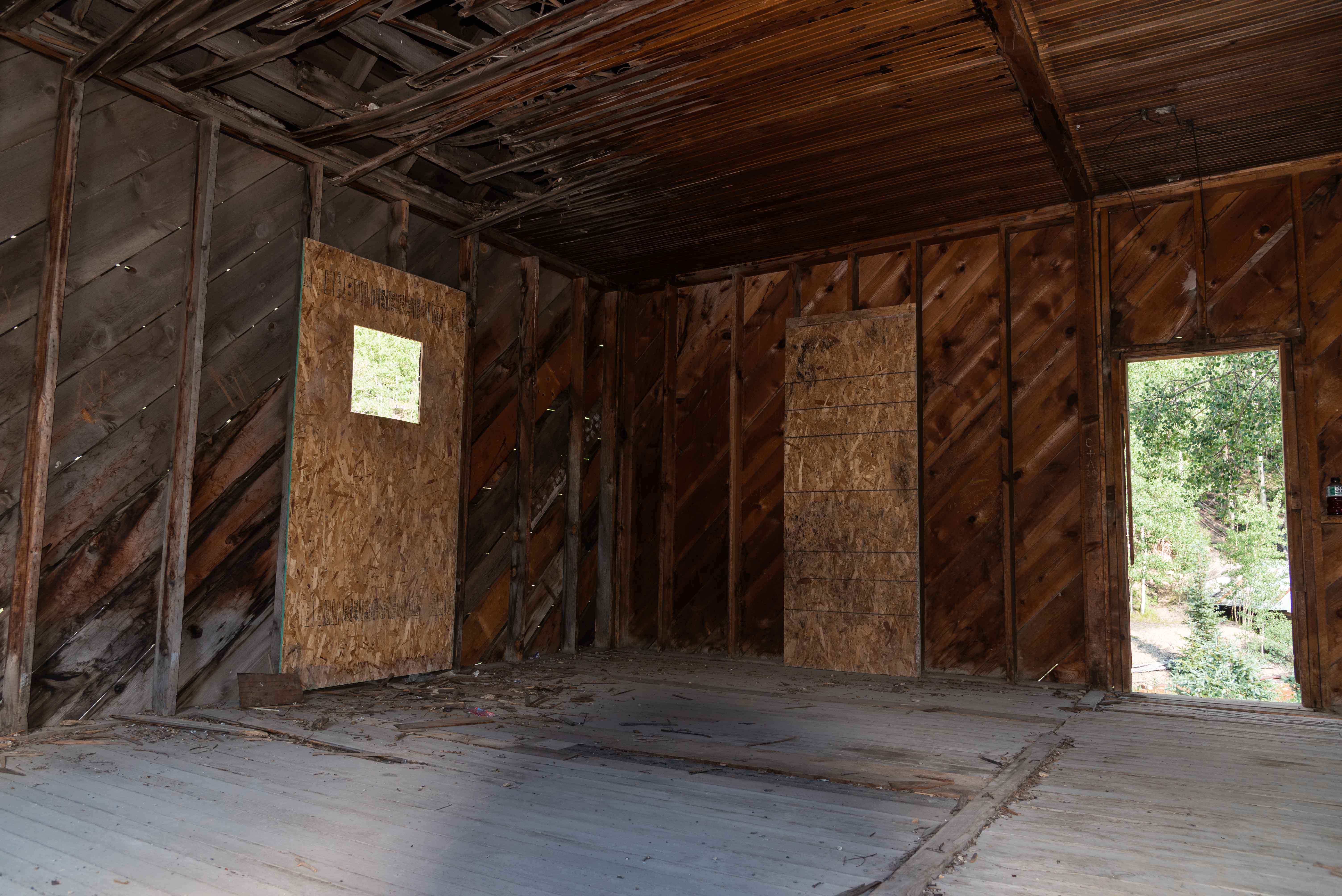
Building interior
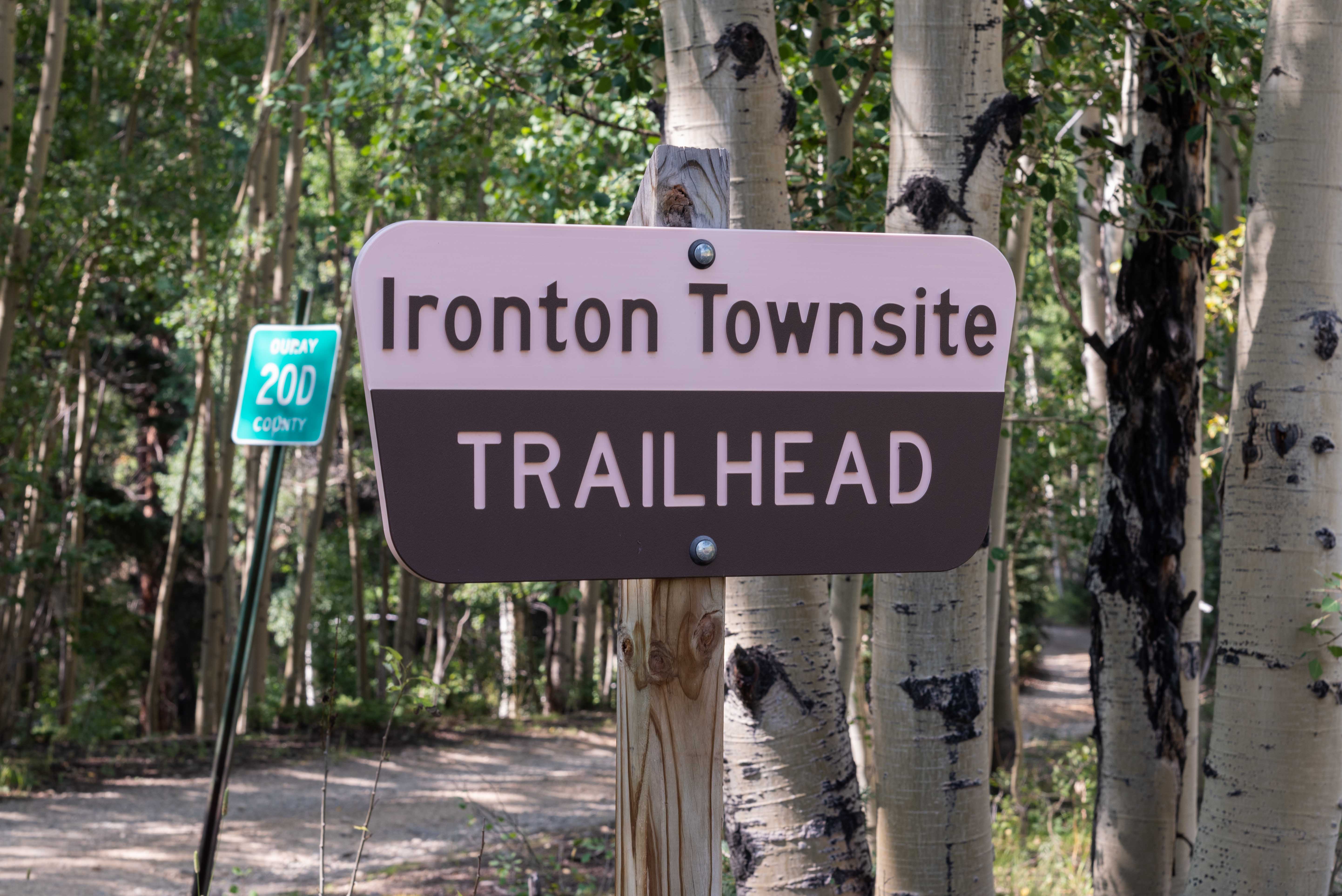
Sign at south junction of CR 20D and US 550
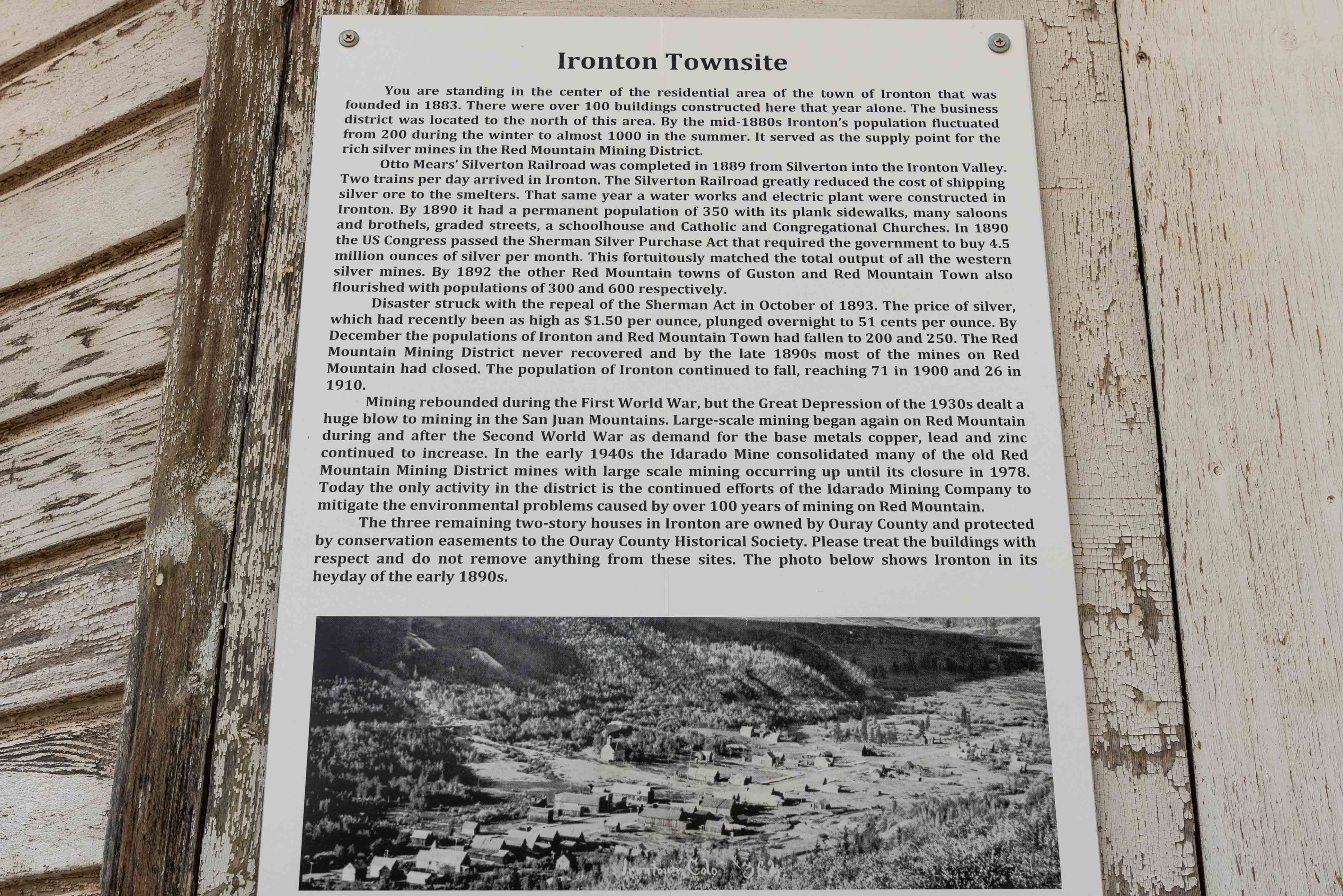
A little about Ironton
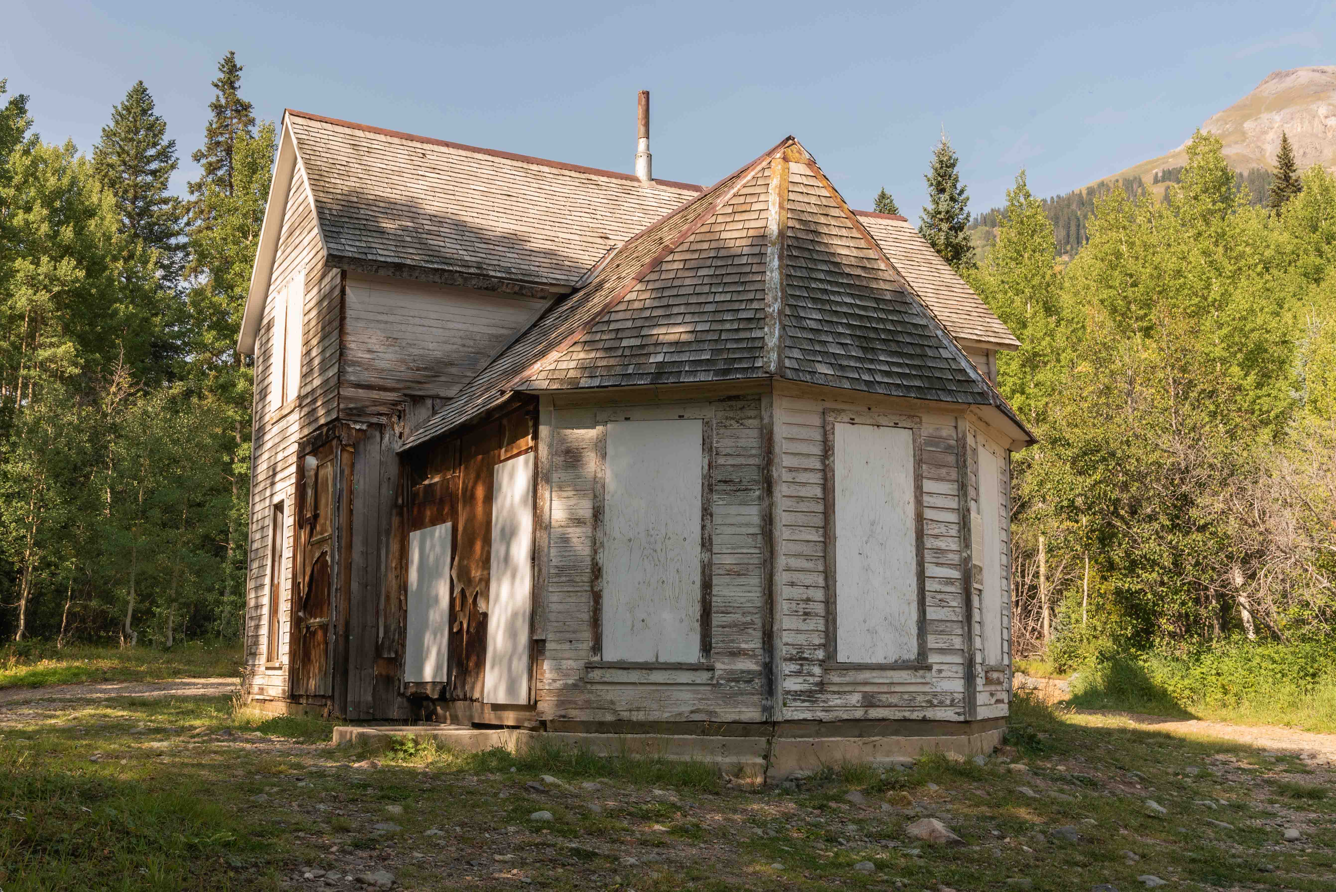
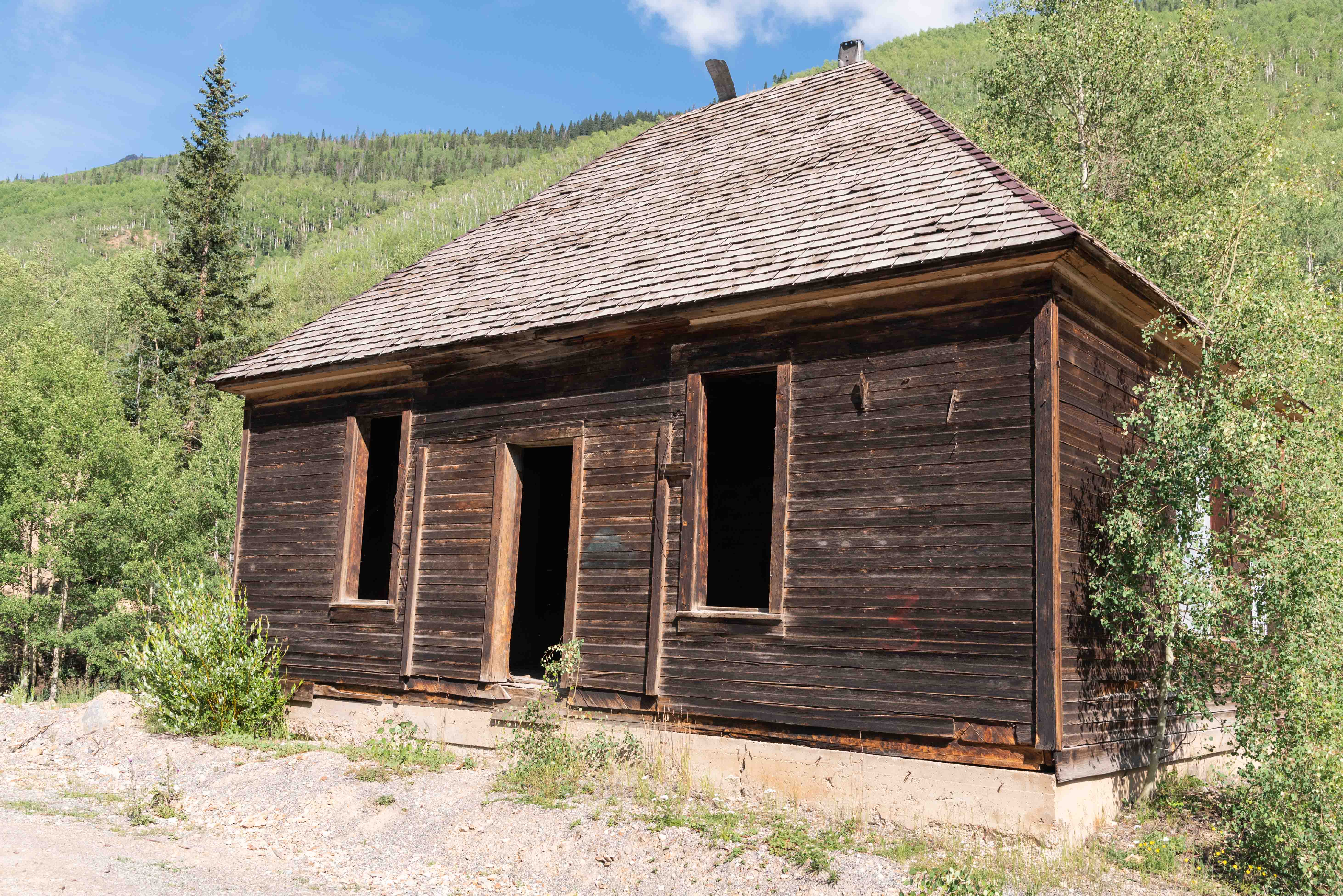
Well preserved two-story building
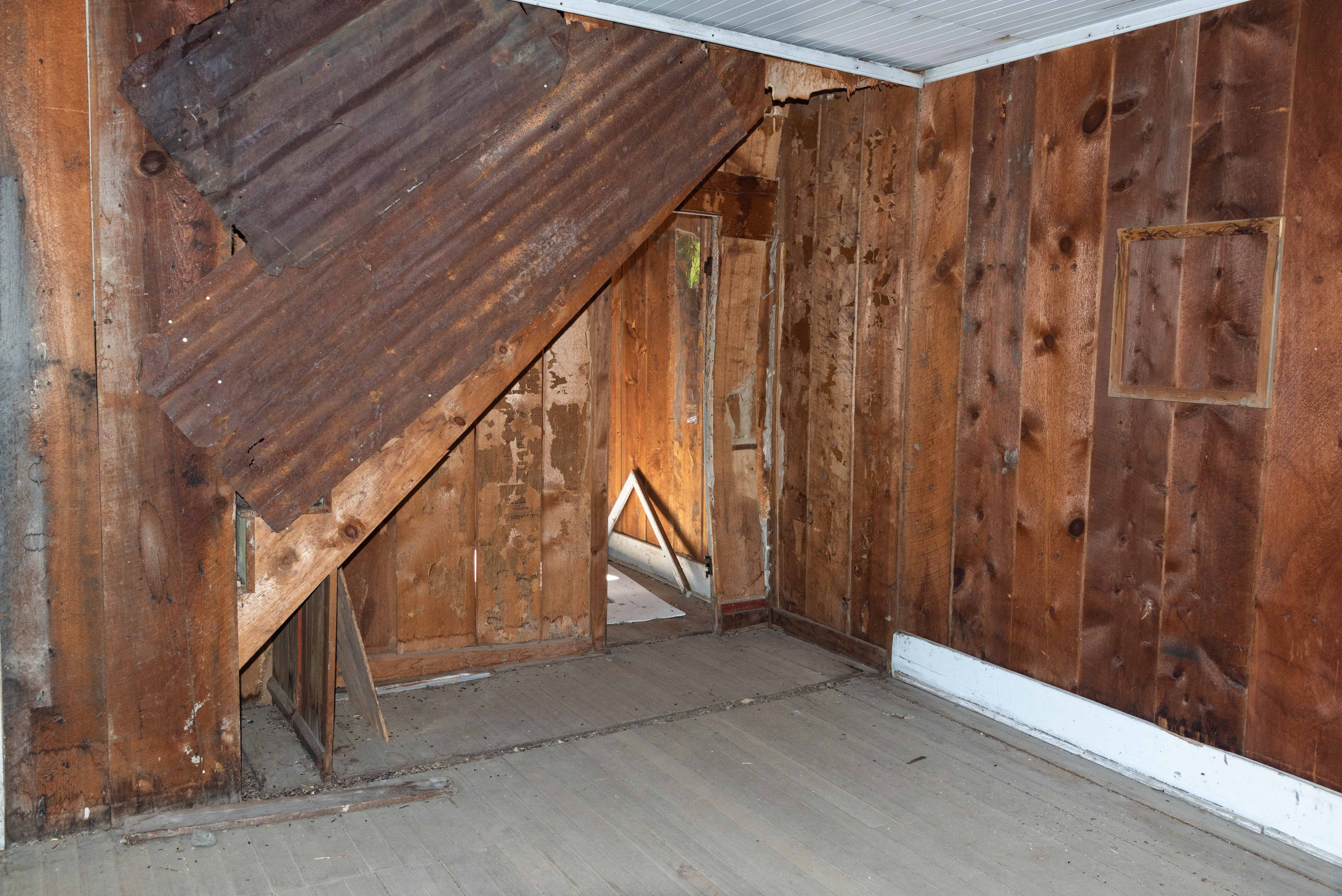
Building interior
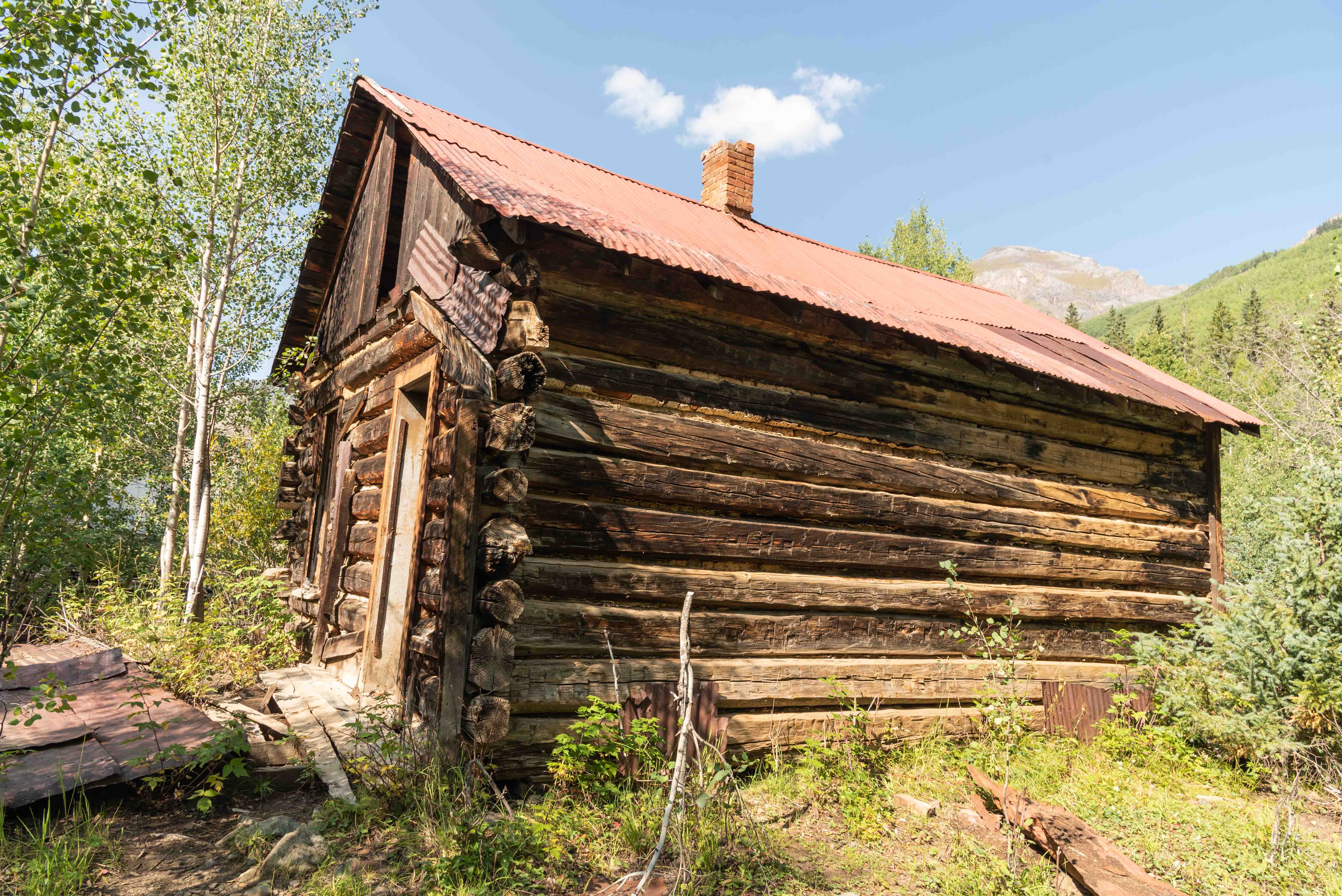
Milled log cabin
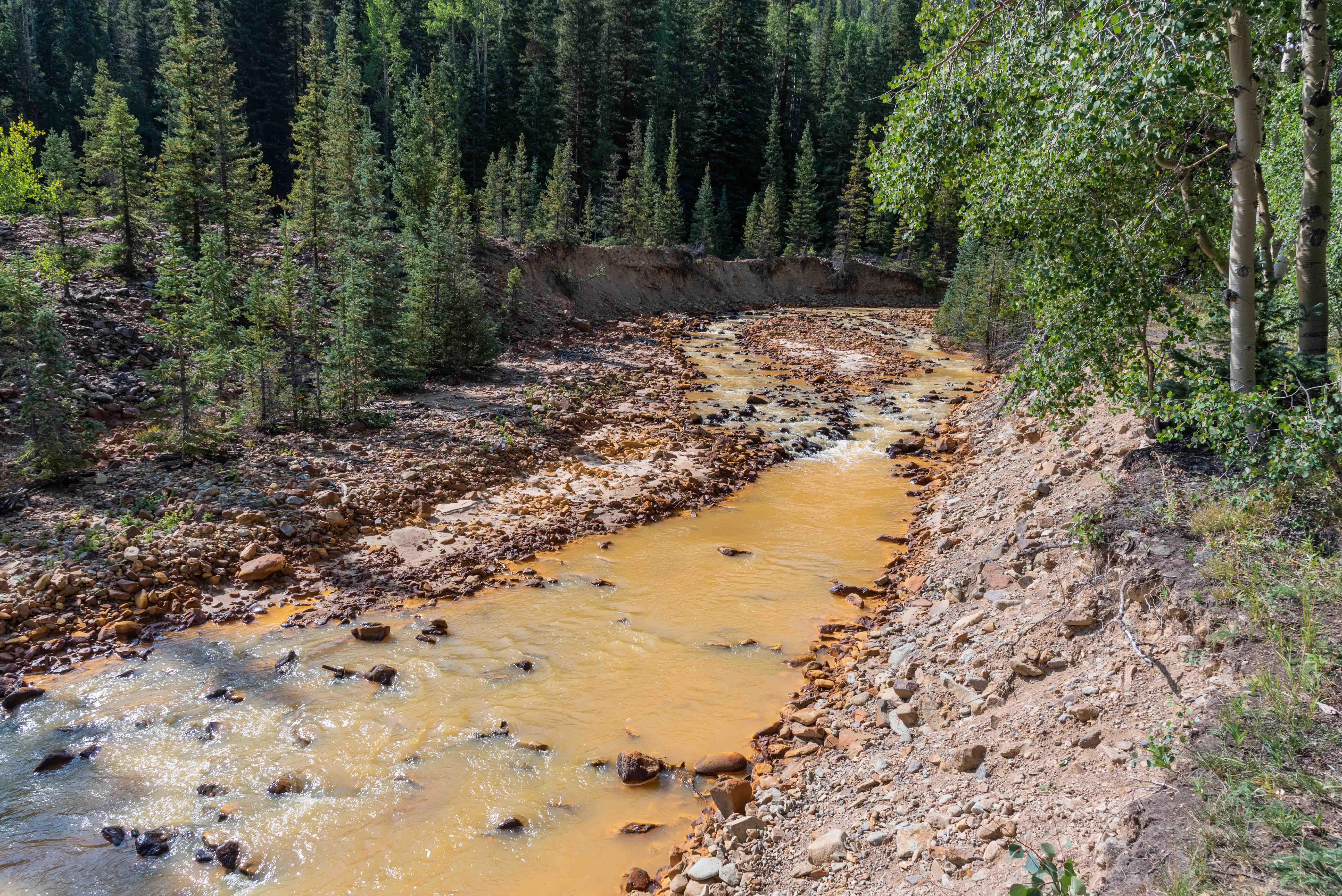
Red Mountain Creek
One more building
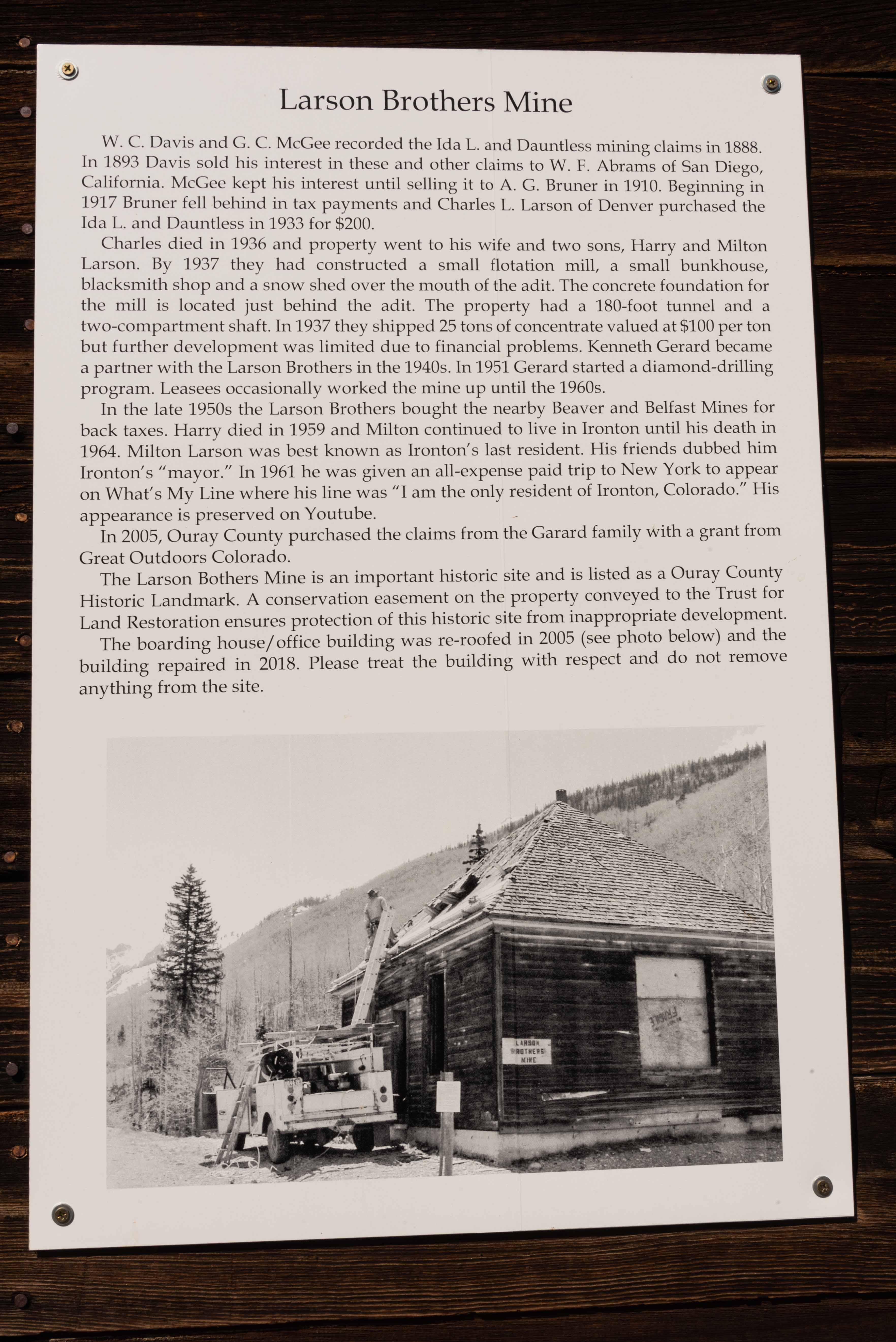
A few structures of the Larson Brothers Mine are located across US 550 from Ironton Park.
These include the boarding house and mine entrance.
Boarding house/office building
Larson Brothers Mine
Building interior
Larson Brothers Mine
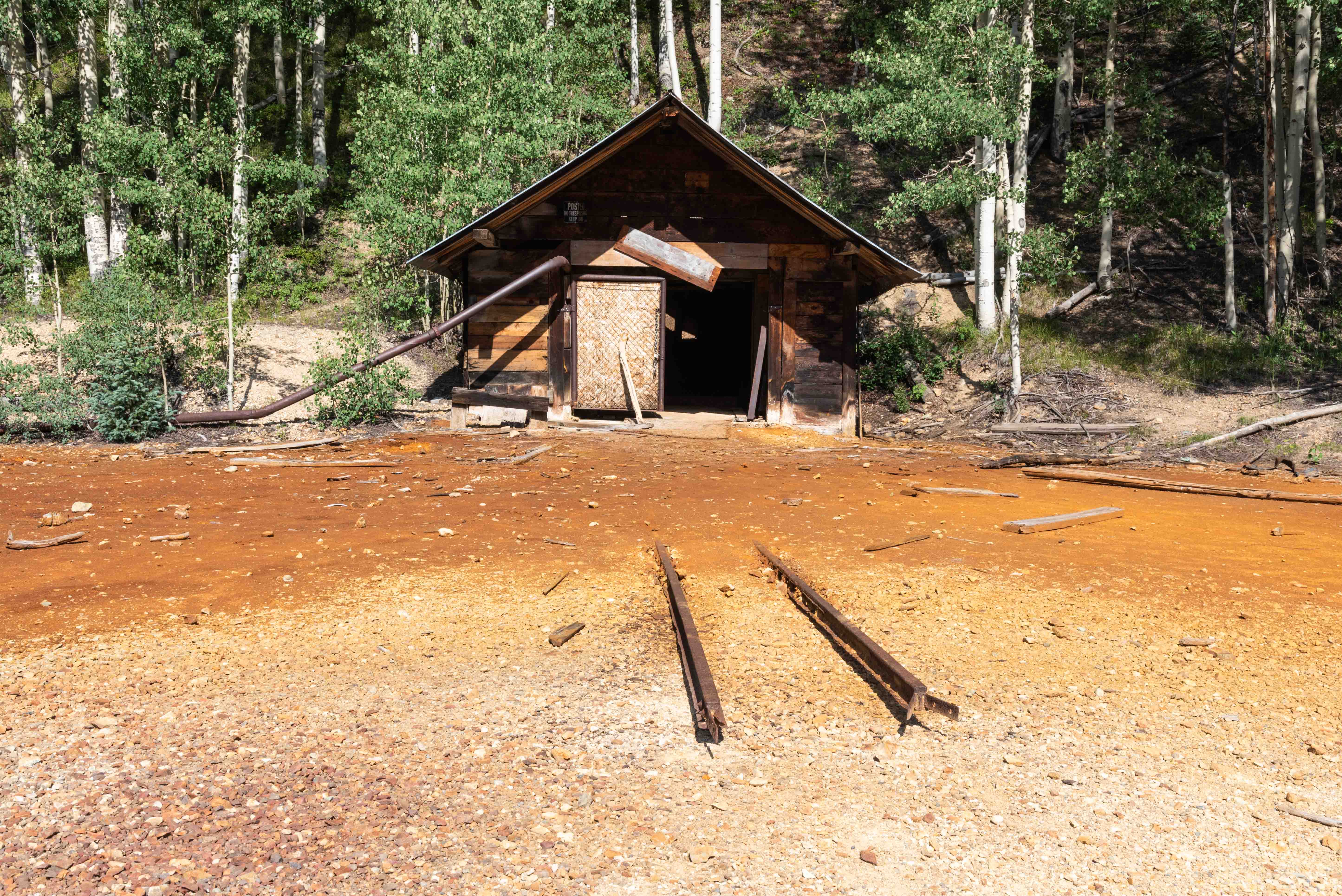
Ore cart rails leading into the mine adit
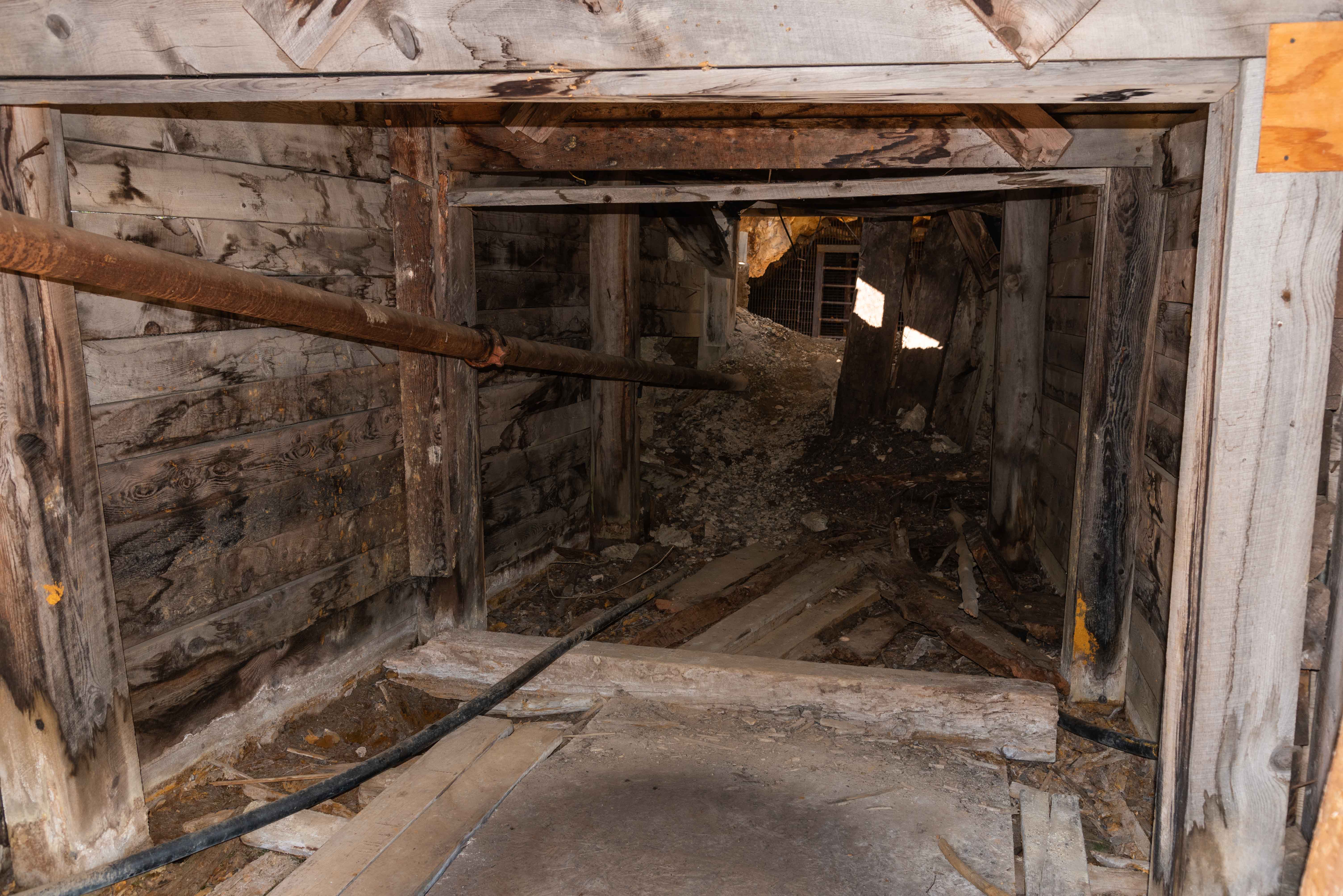
Adit interior leading to shaft
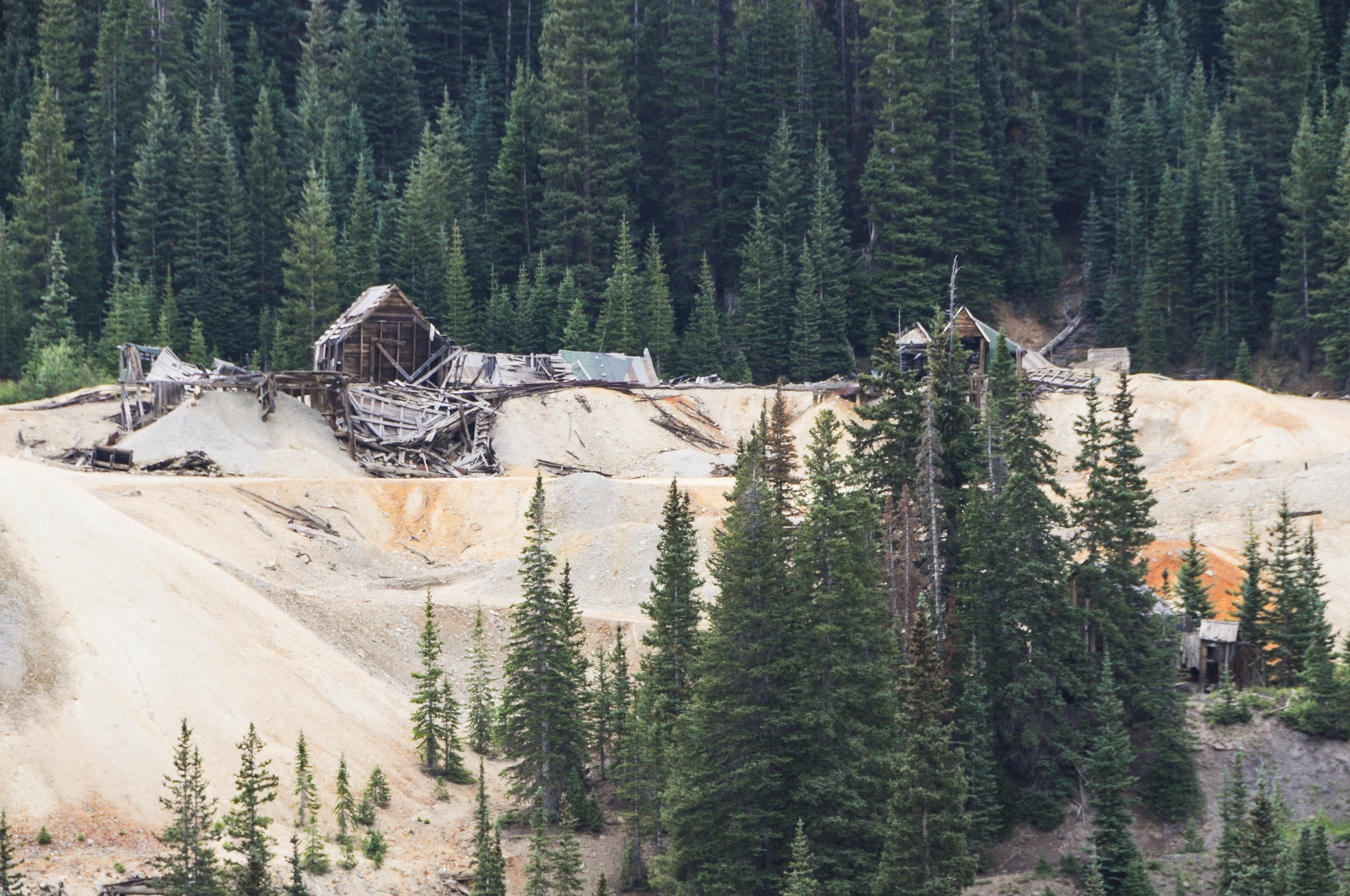
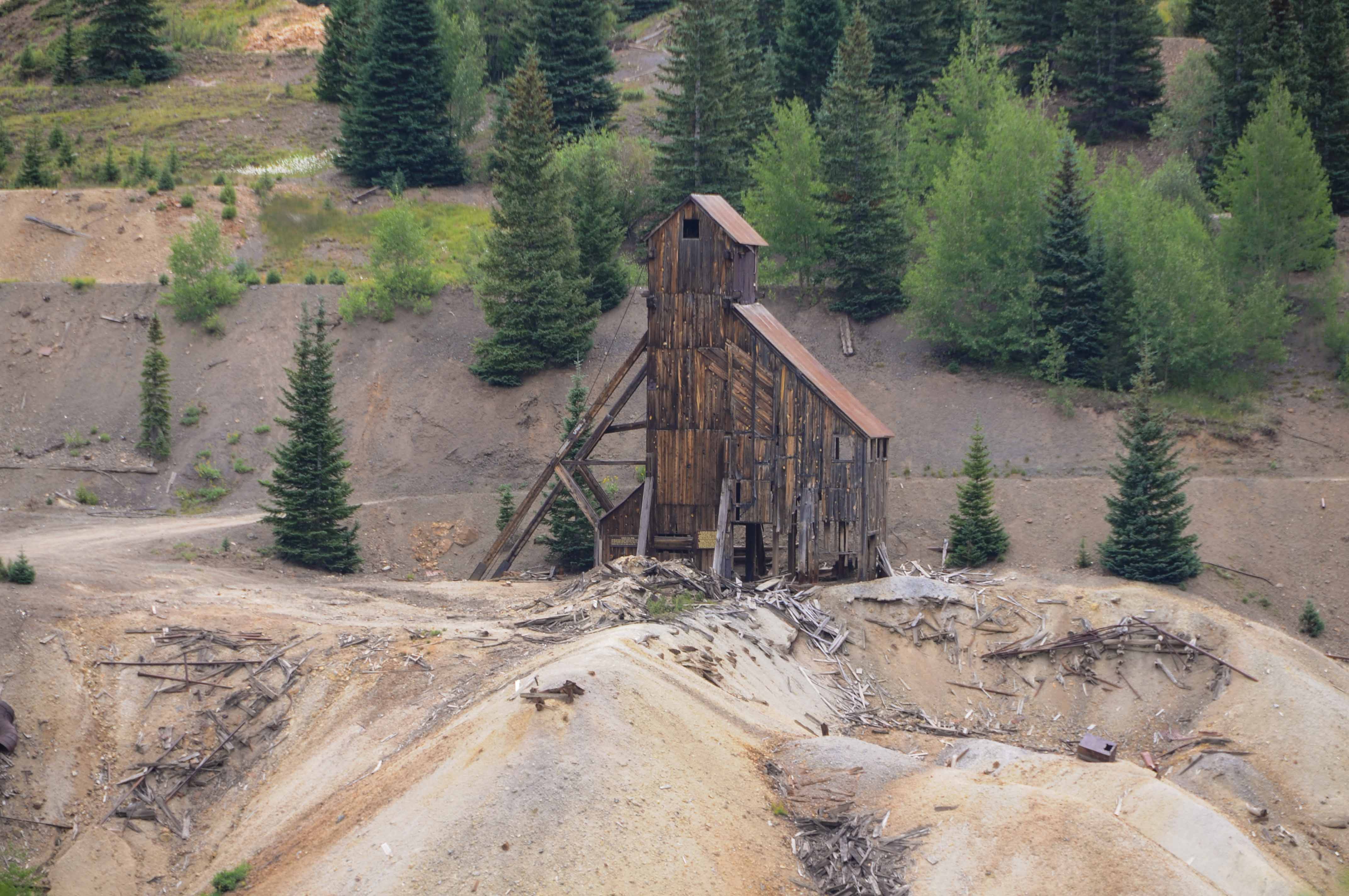
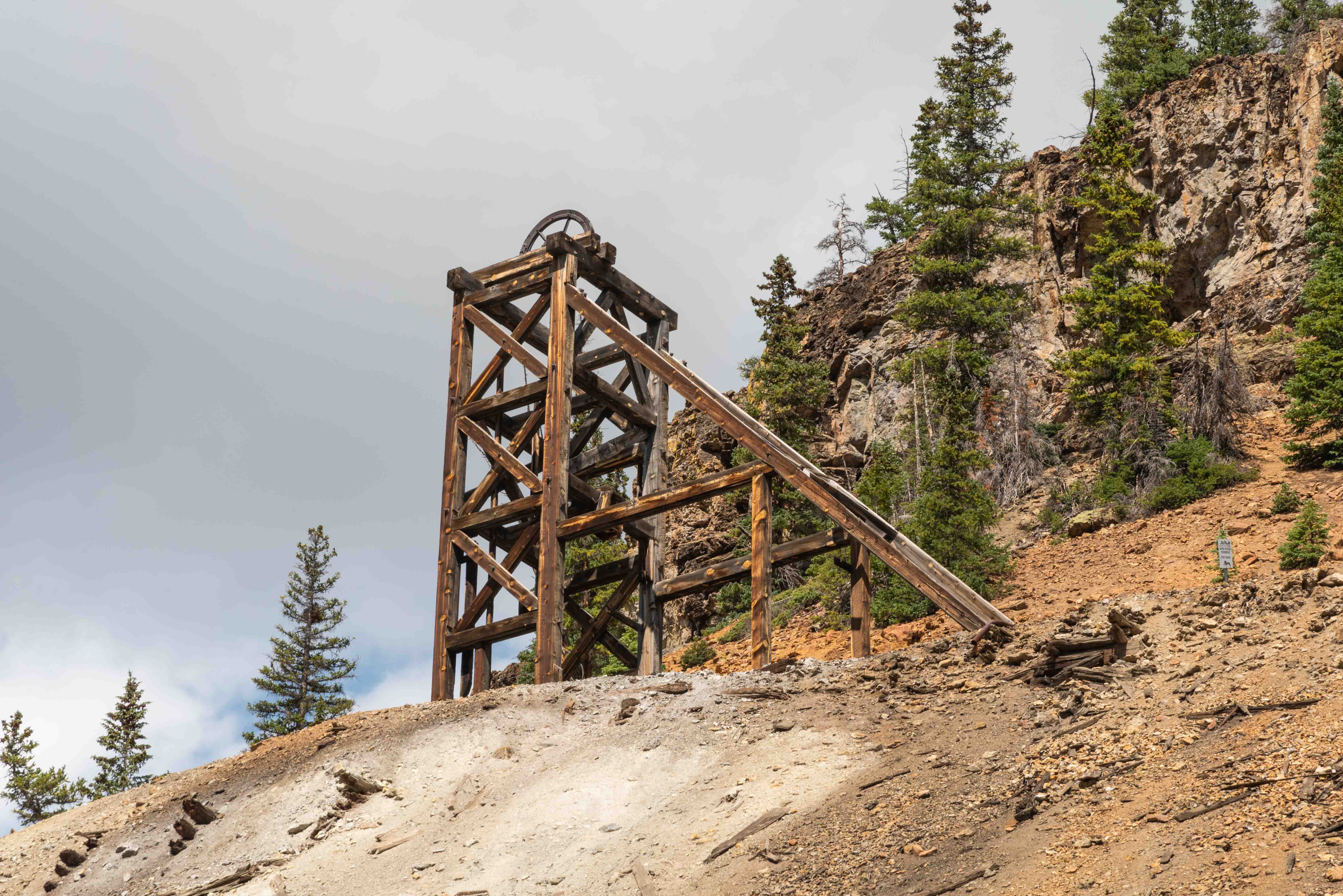
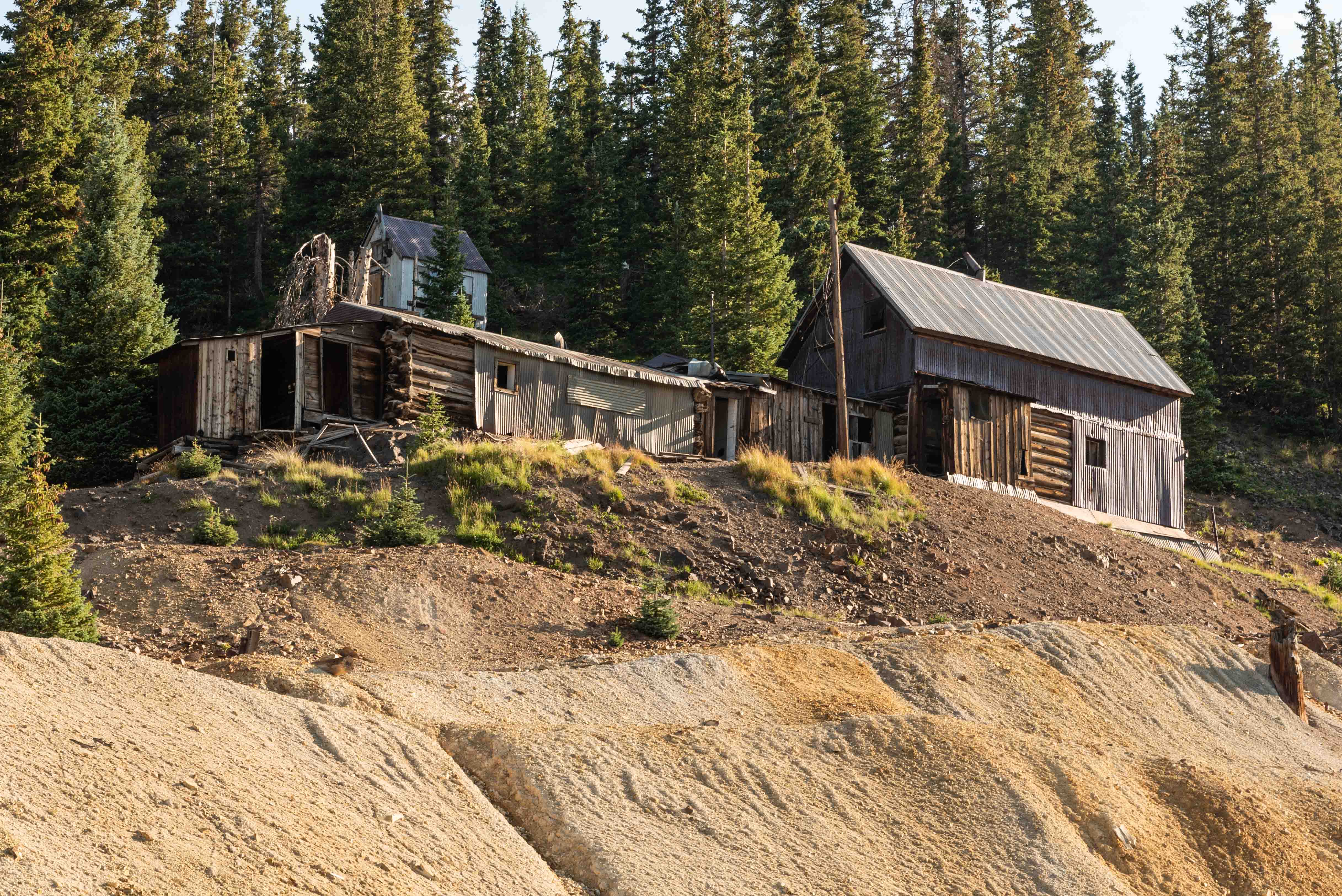
Joker Tunnel
The Joker Tunnel Mine is a gold mine located between Ironton and Red Mountain Overlook. It
was a gold mine located at an altitude of 10,200 ft. I came across it during my reasearch and wanted
to photograph it. Unfortunately access to the mine was closed off. I did get photos of
the mine dumps and old boarding house through the trees. Maybe better luck next time.
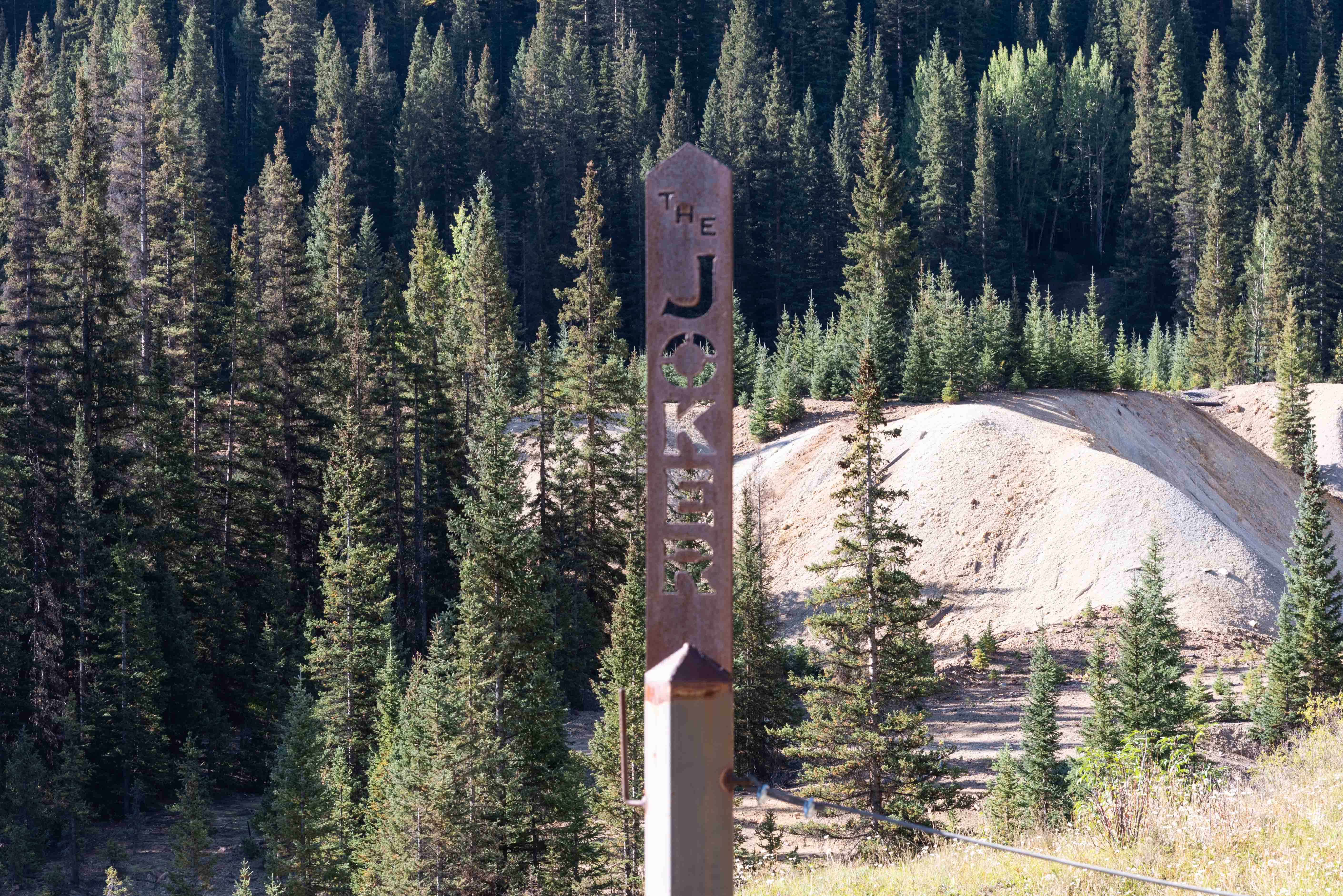
The Joker (37°55'20.2794"N, 107°41'35.16"W)
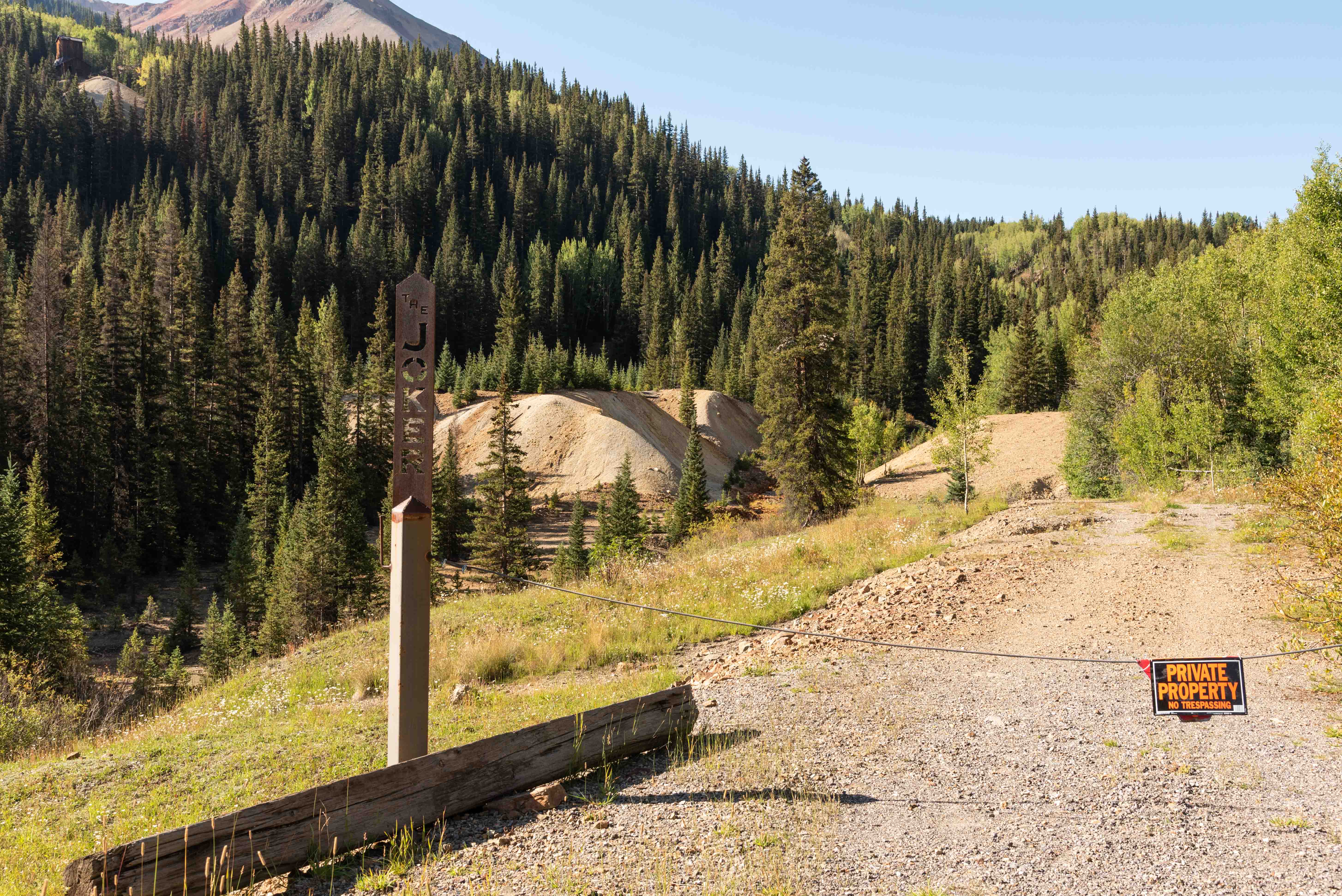
Unfortunately, off limits
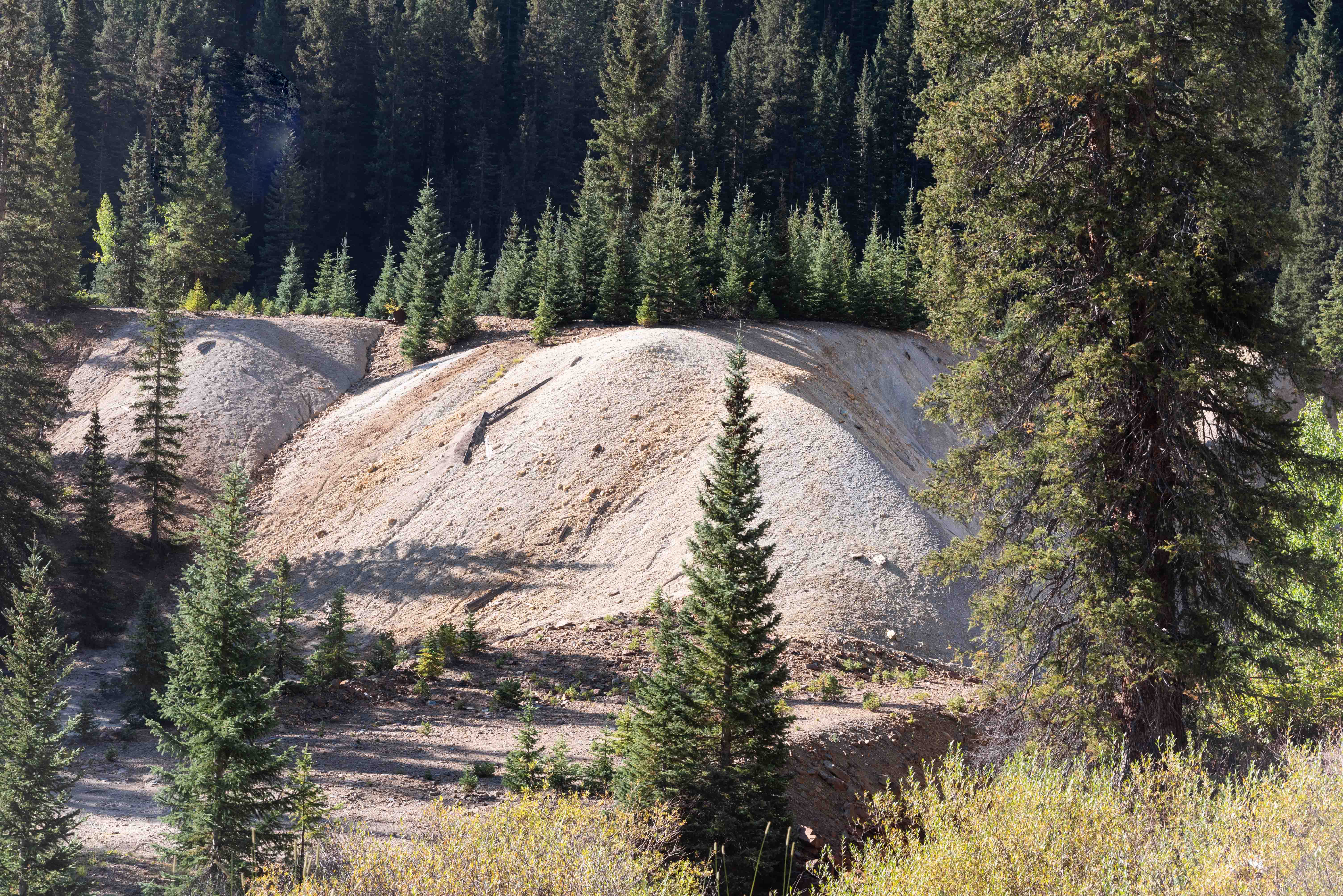
Mine dumps
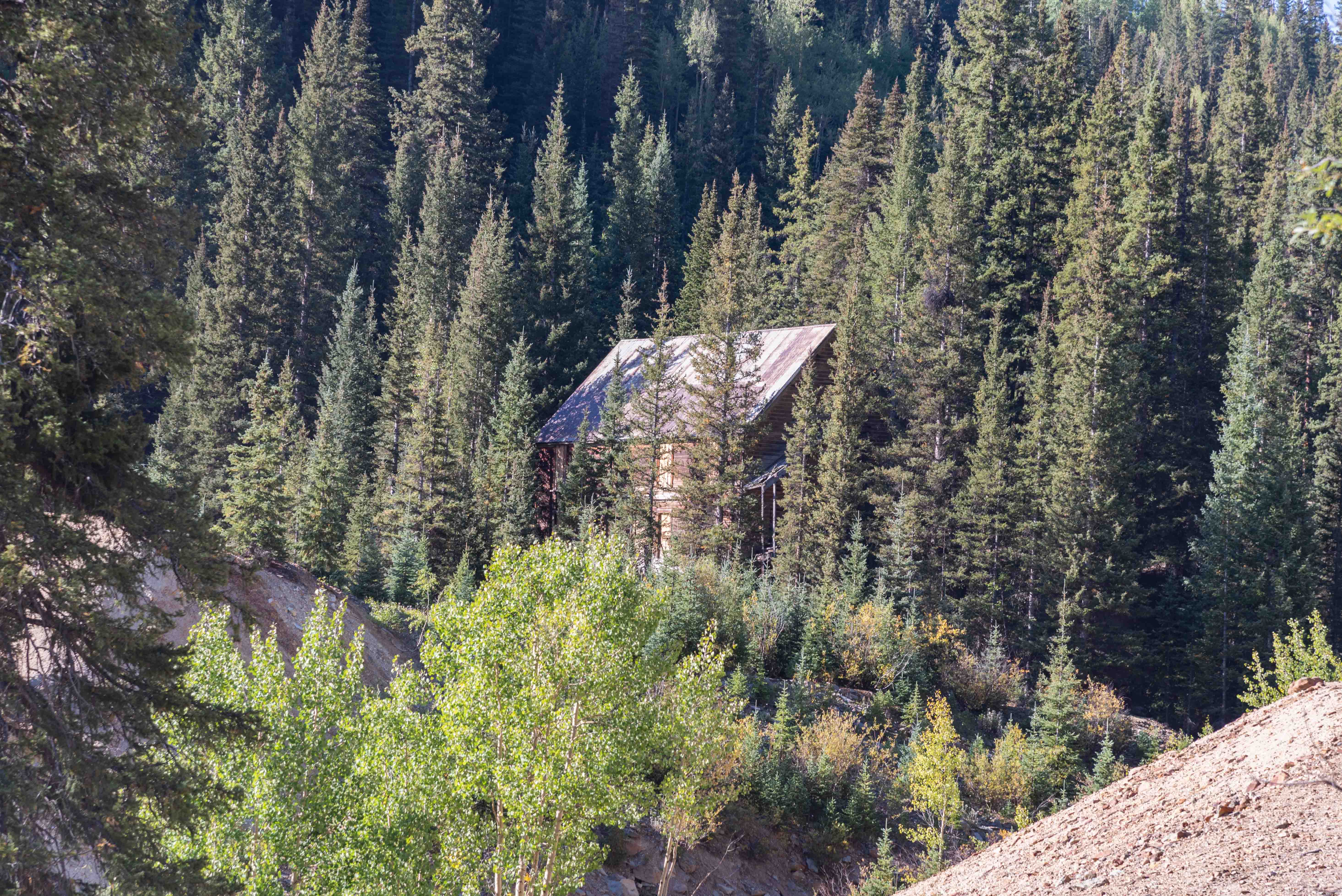
Boarding House near Joker Tunnel
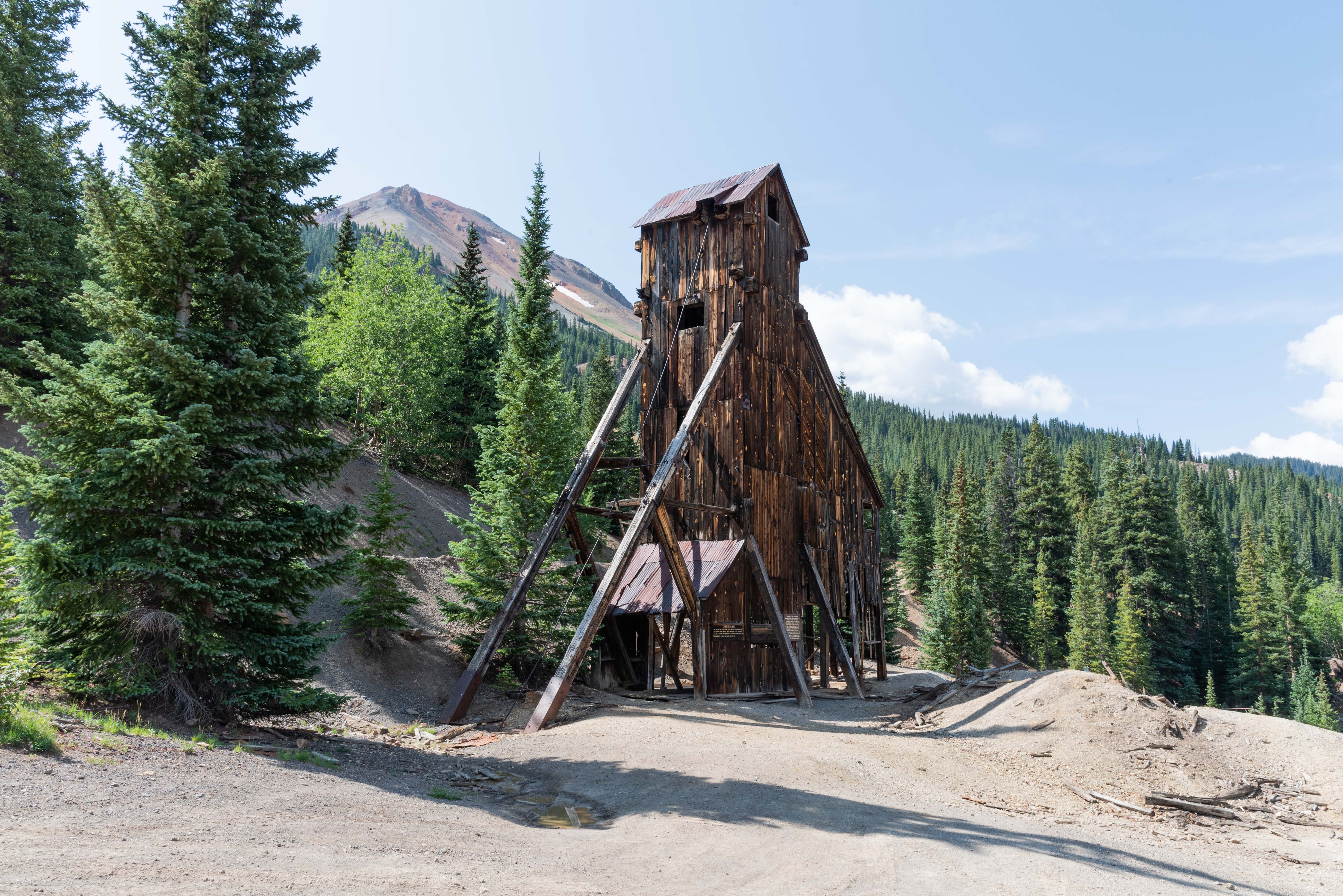
Red Mountain Overlook and Idarado Mining Company
The Red Mountain Overlook is a mandatory stop when touring the Red Mountain Mining District.
It's located midway between Ouray (11.4 miles) and Silverton (12.3 miles). Several viewing
areas and informational signs on the history of the Red Mountain Mining District are situated
around the overlook. There are views of some of the more iconic mines of the district to the
east across U.S. 550. The Idarado Mine is located just across the highway to the south.
The Idarado Mining Company is a conglomeration of old mines of the Red Mountain Mining District.
The company acquired the Treasury Tunnel and mill in Pandora in 1939. The treasury tunnel was
driven in 1896. The tunnel begins at the Idarado Mine and ends at the Pandora Mill near Telluride.
It extends 5 miles under the mountains via a series of adits and shafts that drop 1,500 feet.
The elevated trestle leading into the mine is across the highway from the overlook.
Idarado purchased ten houses from the bankrupt Sunnyside Mine in Eureka and moved them to Red
Mountain for employee housing. Four of these historic structures are still perched behind
Red Mountain Overlook. The houses were closed for renovation when I took the photos below in August of 2021.
Red Mountain Mining District continues for another mile south from the Idorado Mine, ending just beyond Red Mountain Pass.
Genesee-Vanderbilt Mine
View from Red Mountain Overlook
Yankee Girl Mine (1/4 mile east)
View from Red Mountain Overlook
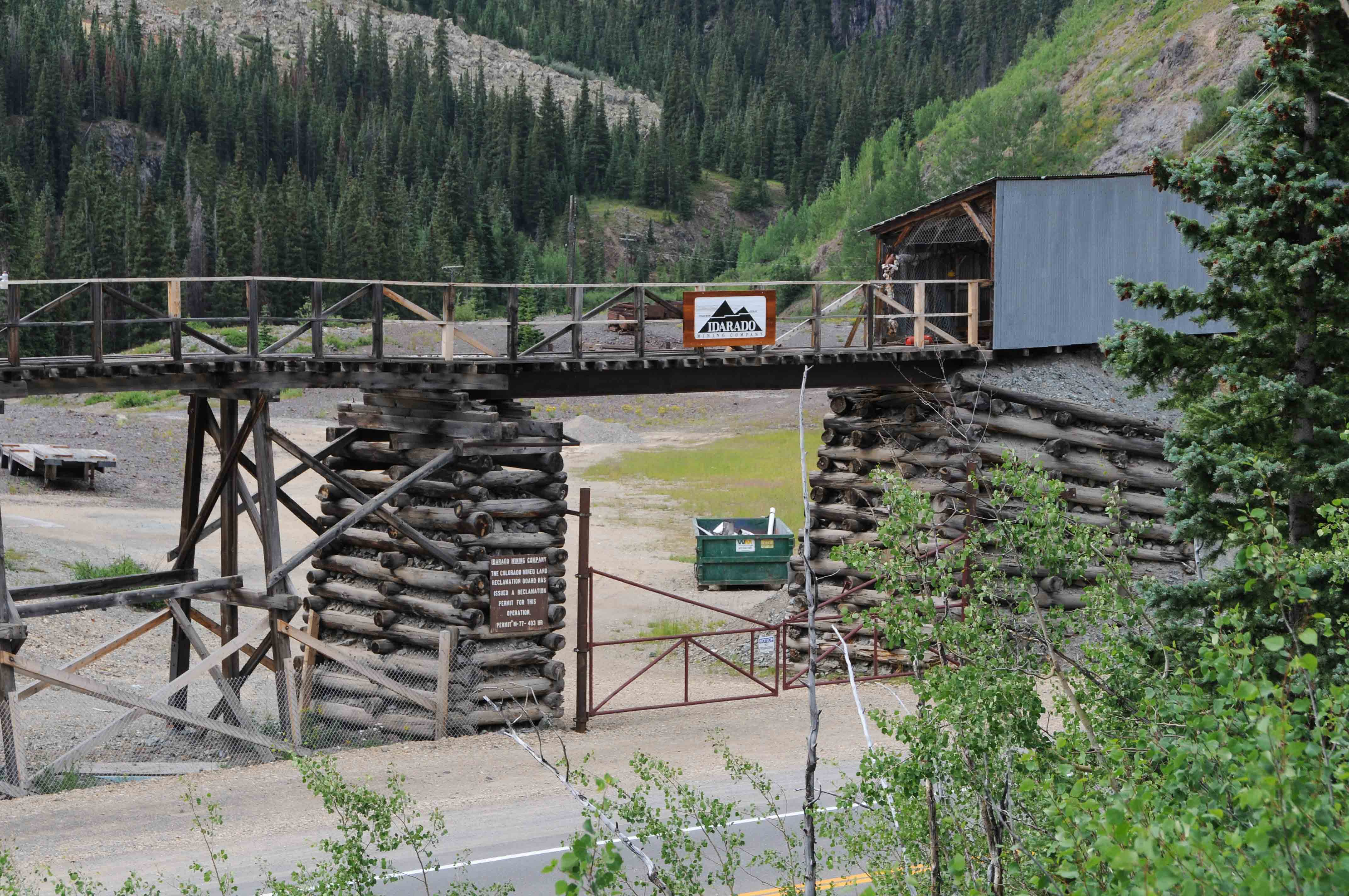
Idarado Mining Company
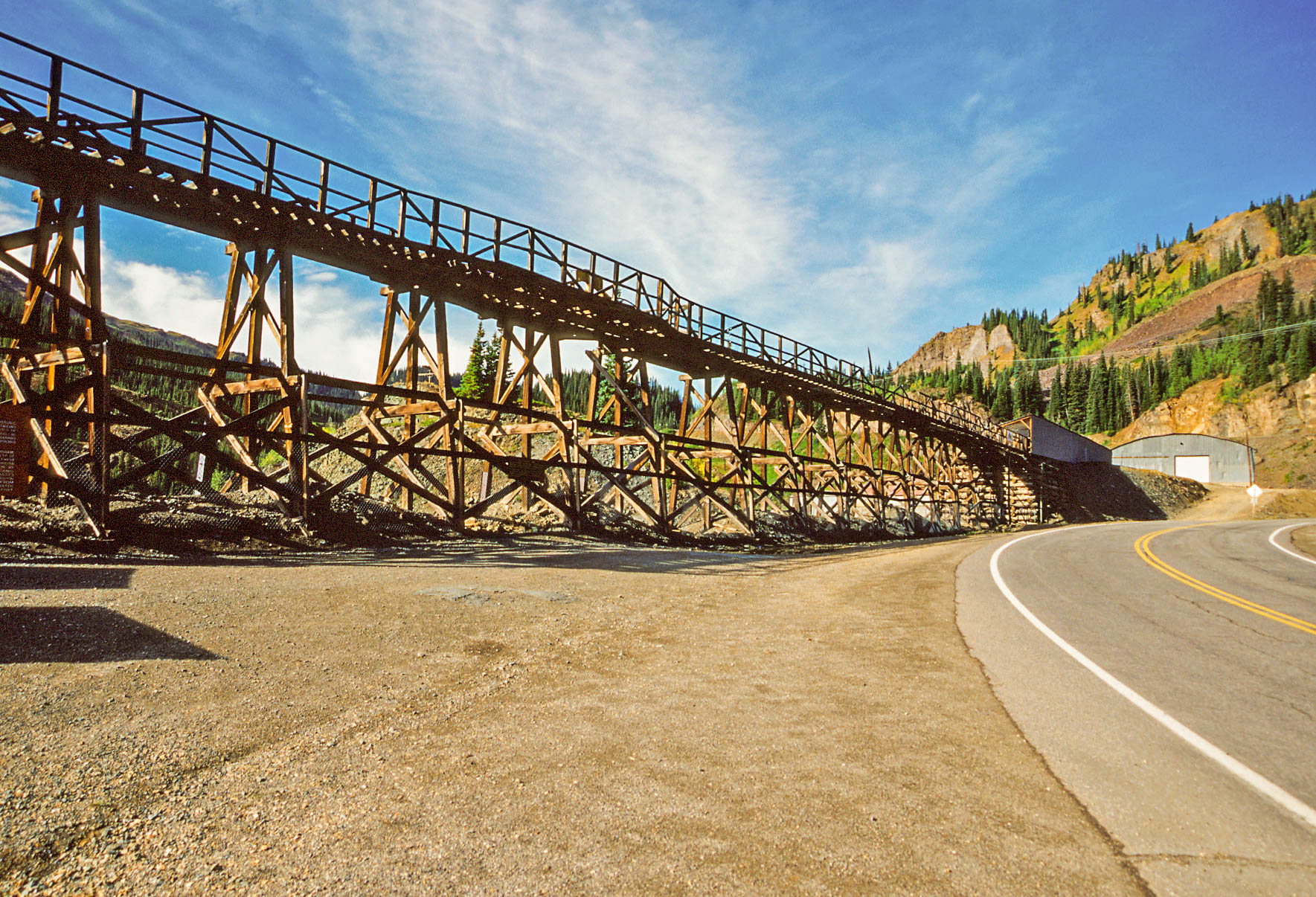
Idarado Mine trestle
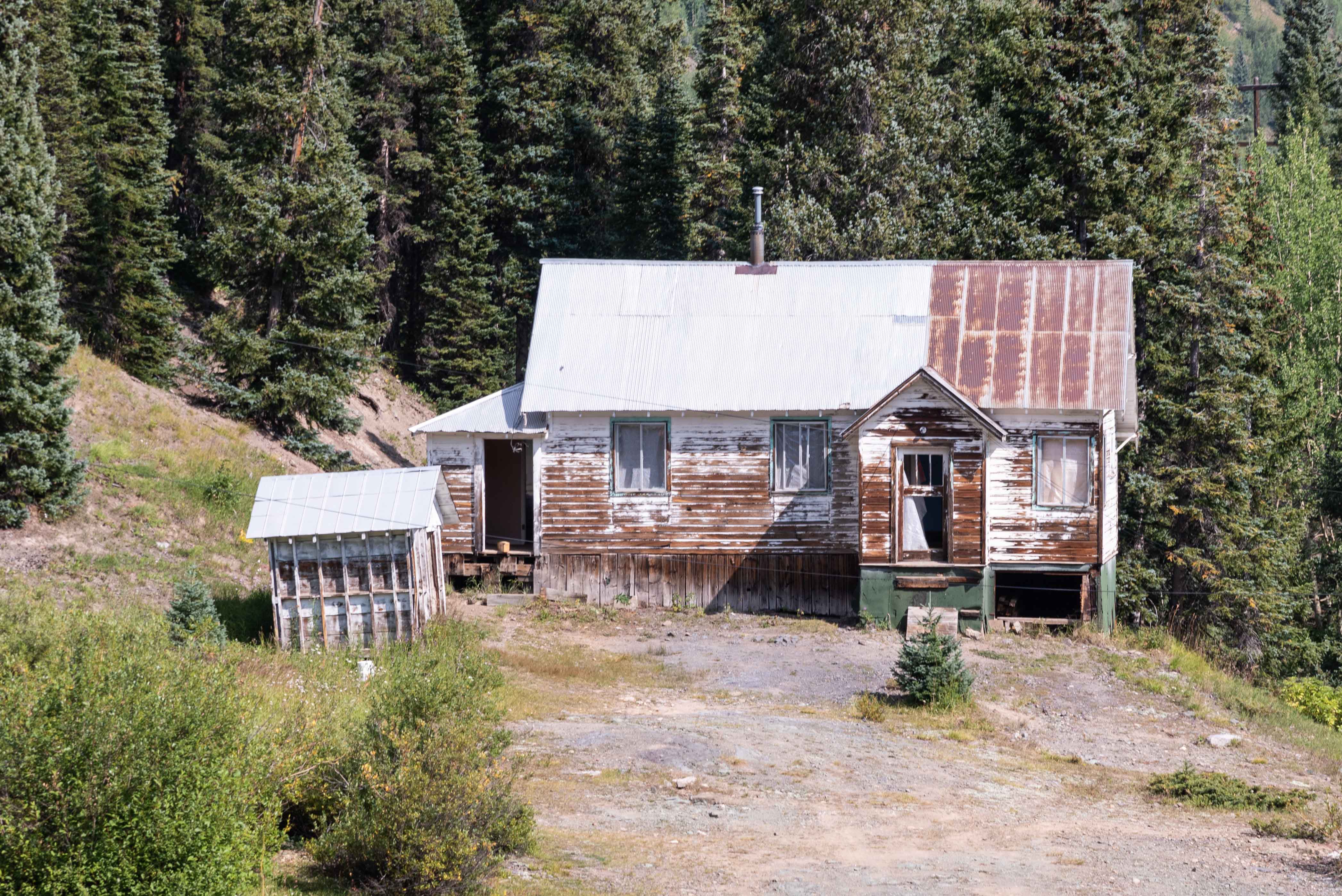
Miner's house
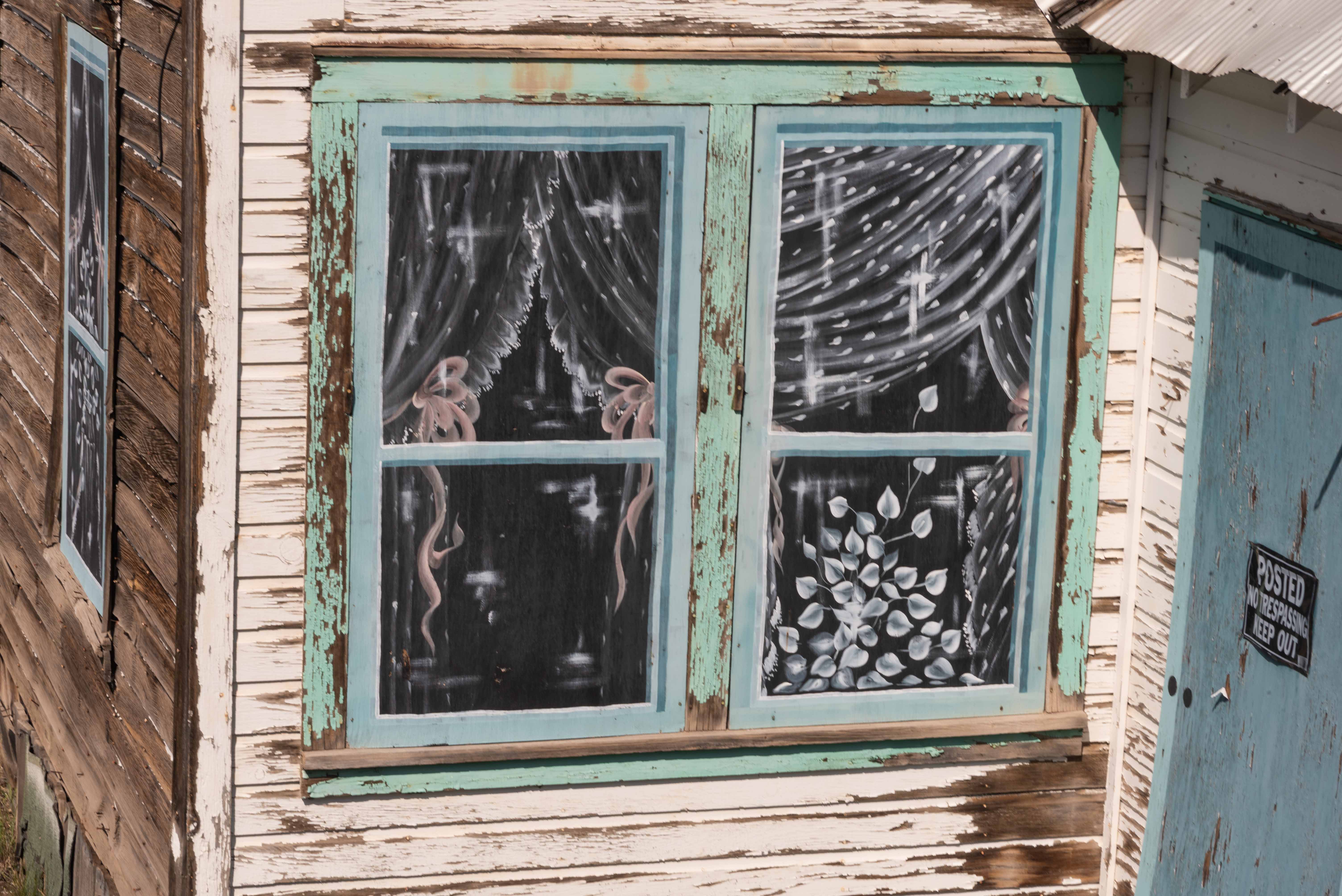
Painted curtains
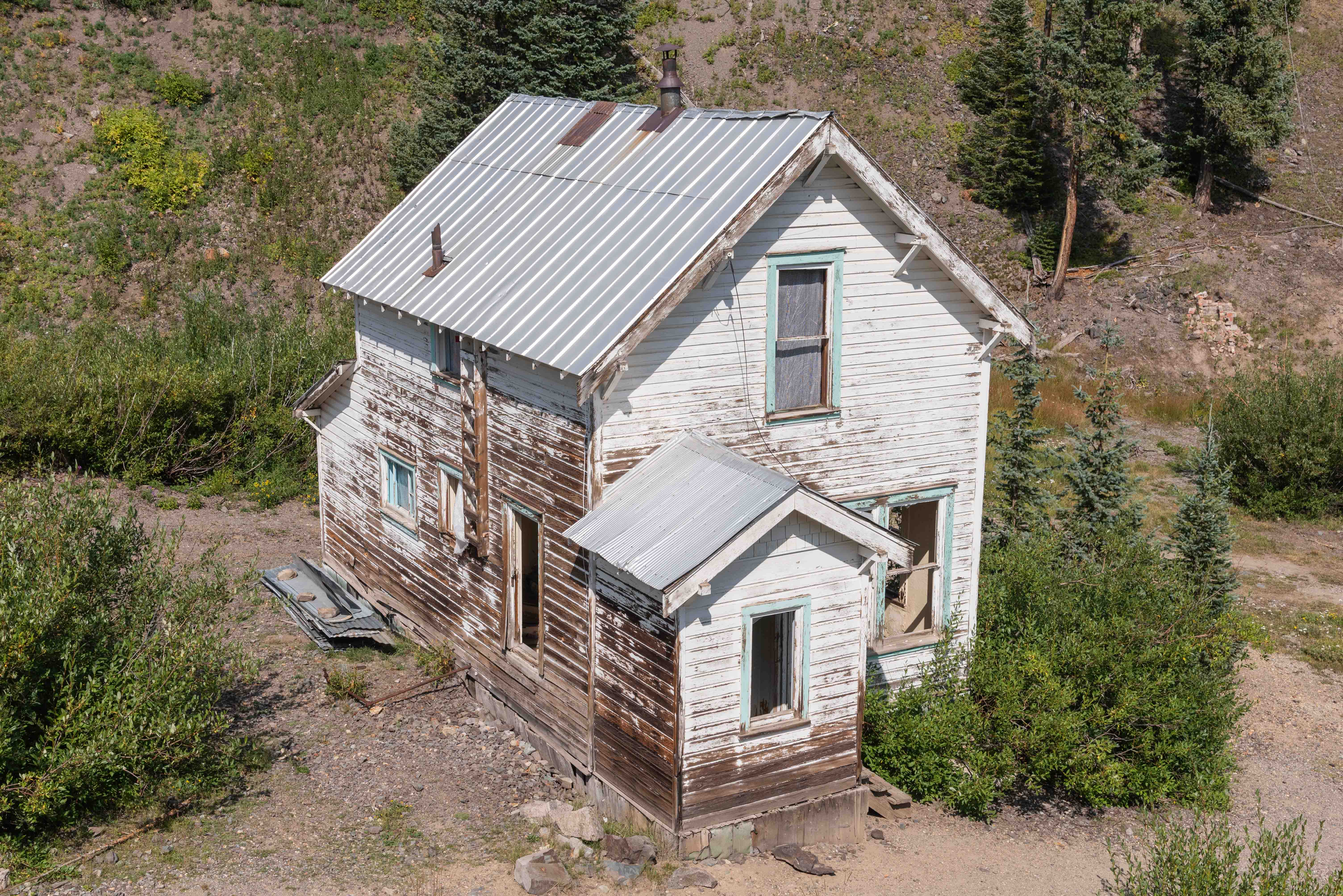
Two-story miner's house
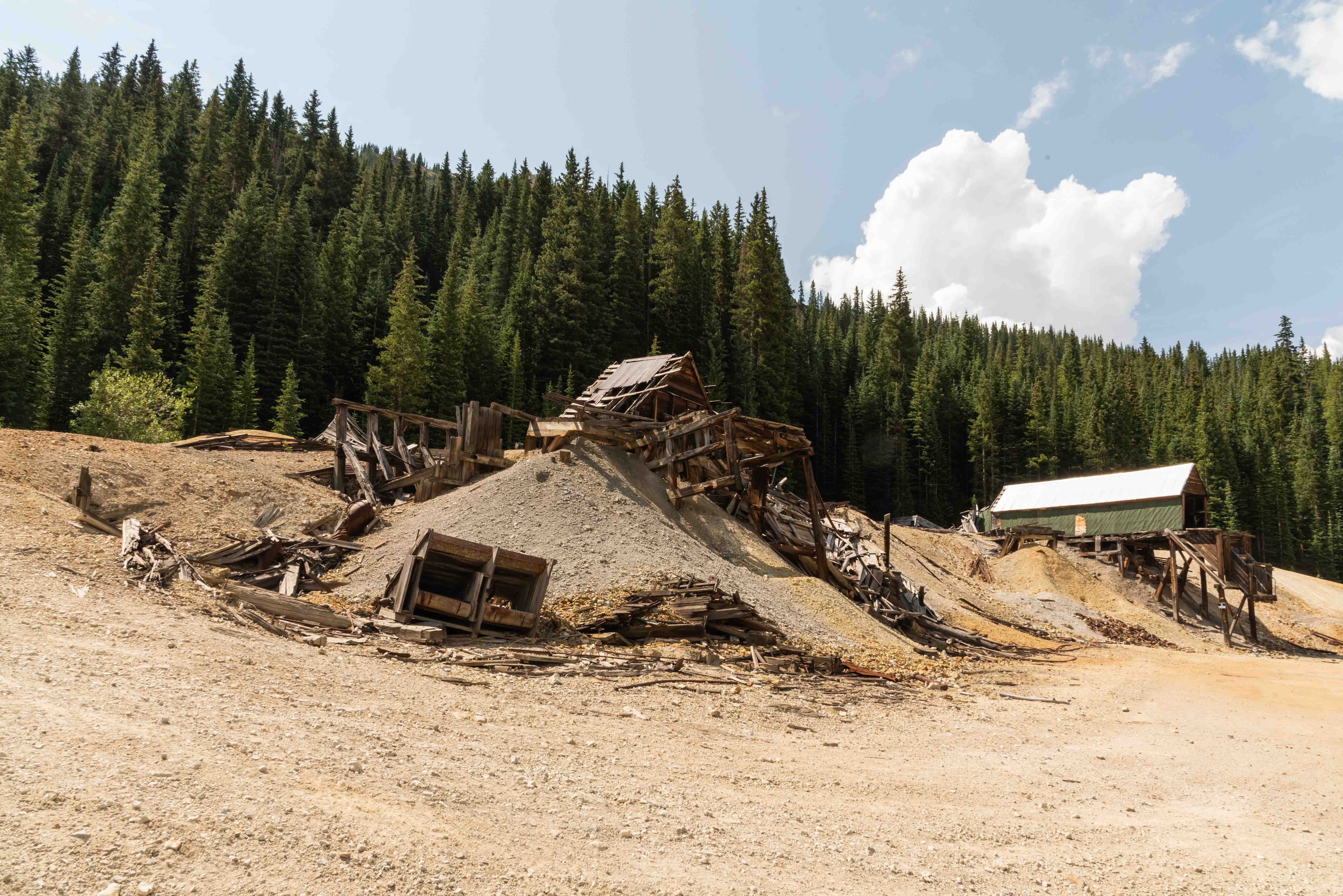
Mines along Ouray County Road 31
Some of the most famous mines of the Red Mountain Mining District are located along Ouray County Road 31.
The short (2.5 miles) road passes by the Guston, Yankee Girl, Genesee-Vanderbilt, and National Bell Mines.
A short side trip will also take you to the Cora Bell Mine. A 4-wheel drive vehicle is recommended. CR 31
connects with U.S. 550 at both its north and south ends. Click the link to drive Ouray CR 31.
Mines along Ouray County Road 31
Yankee Girl Mine
Genessee Mine
National Belle Mine
Mines along Forest Road 825
Forest Road 825 (aka San Juan CR 14) is located just to the east of US 550 and south of Red Mountain Pass.
Several mines that are historically part of the Red Mountain Mining District are located along this road.
These include Brooklyn, Congress, Carbon Lake, Koehler Tunnel, and Longfellow Mines. Click the link to visit some
of these mines.
Mines along Forest Road 825
Brooklyn Mine

Carbon Lake Mine

Longfellow Mine
Use the form on the Home Page to submit comments, questions, or suggestions. TD Productions Copyright © 2022