Ouray County Road 31
Ouray County Road 31 winds past some of the most iconic old silver mines in
the Red Mountain Mining District. The route, while short (2.5 miles), passes by the Guston,
Yankee Girl, Genesee-Vanderbilt, and National Bell Mines. A short side trip will also take
you to the Cora Bell Mine. Parts of the county road run on the old rail bed of the Otto Mears
narrow gauge railroad that carried supplies to and ore from the mines. CR 31 has north
(37°55'18.85"N, 107°41'54.71"W) and south
(37°54'11.54"N, 107°42'34.28"W) junctions
with U.S. 550. The road is dirt and gravel and is a fairly easy drive in a 4x4 vehicle
with moderate clearance. There are side roads off CR 31 and it's easy to get confused,
so a preplanned route on a map or GPS unit is a good idea.
This trip starts from the north end of CR 31, and I have included mileage to some of the potentially confusing intersections.
CR 31 crosses two bridges over Red Mountain Creek soon after leaving U.S. 550.
0.52 mile - Cr 31 and CR 31A fork. Take the left fork to stay on CR 31. There will be some mine buildings on the left
a short distance past the intersection. These may or may not be part of the Guston Mine.
0.82 mile - The Guston Road turnoff goes left. This will take you past the Robinson and Cora Bell mines. Keep right to stay on Cr 31.
0.96 mile - Yankee Girl Mine
1.1 miles - There will be a wide intersection. Take the sharp left turn up a switchback that leads to the Genesee Mine.
The road straight ahead ends at the Idarado Mine site and a gate that may or may not be locked.
The rest of CR 31 past the Genesee-Vanderbilt Mine is fairly straightforward. It will pass by the Red Mountain Townsite and National Belle
Mine and on to the south intersection with U.S. 550.
The old mines and buildings are very interesting and photogenic, but they are
also unstable and dangerous. DO NOT enter any mine shafts or tunnels, and enter
buildings at your own risk. Also, DO NOT remove anything from the sites; leave everything
for the next visitor to enjoy. Obey all NO TRESPASSING signs as some of the land
along the way is private property. GPS coordinates are based on WGS84 datum.
All that said, let's get on with our trip.
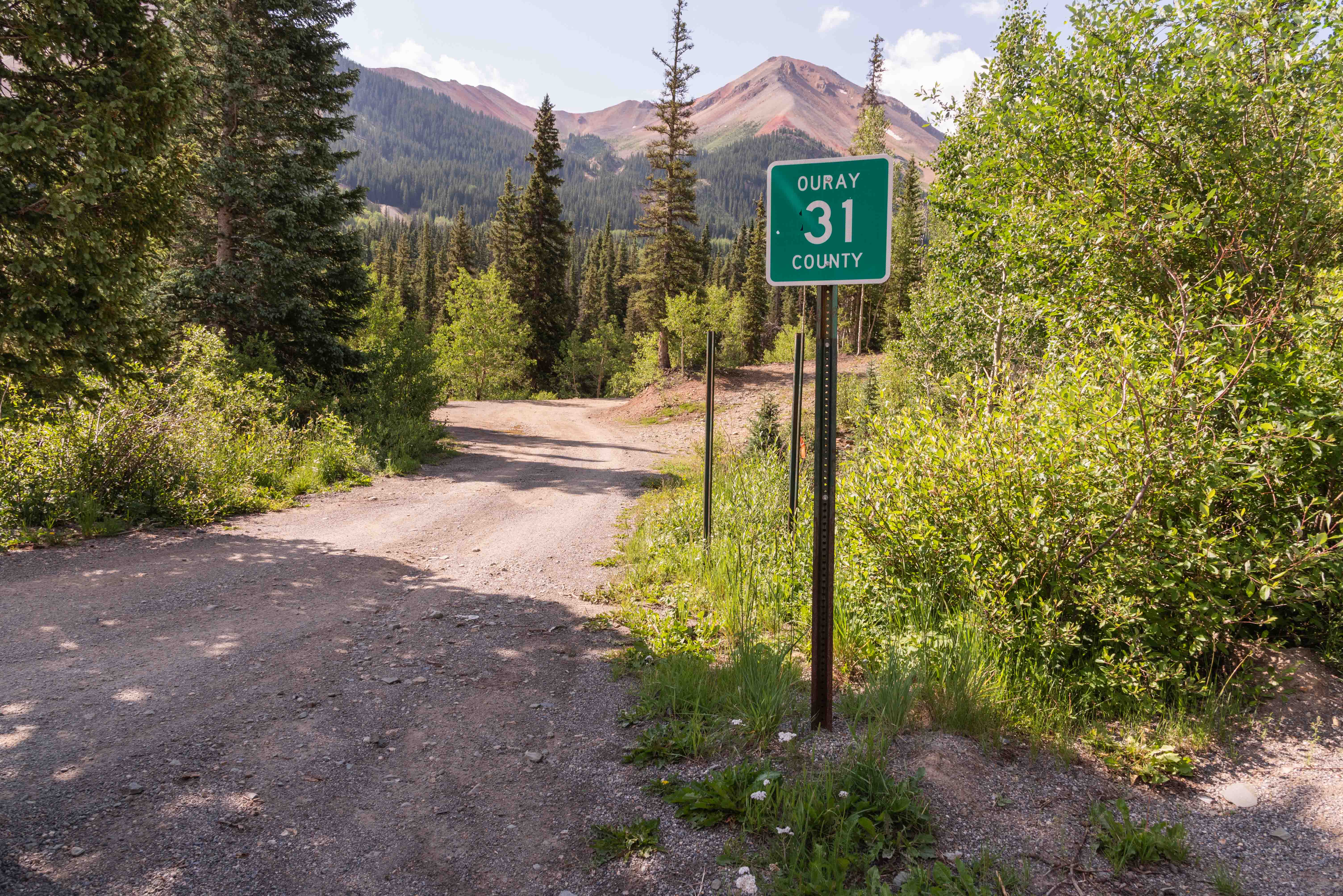
North end of Ouray County Road 31
37°55'18.85"N, 107°41'54.71"W
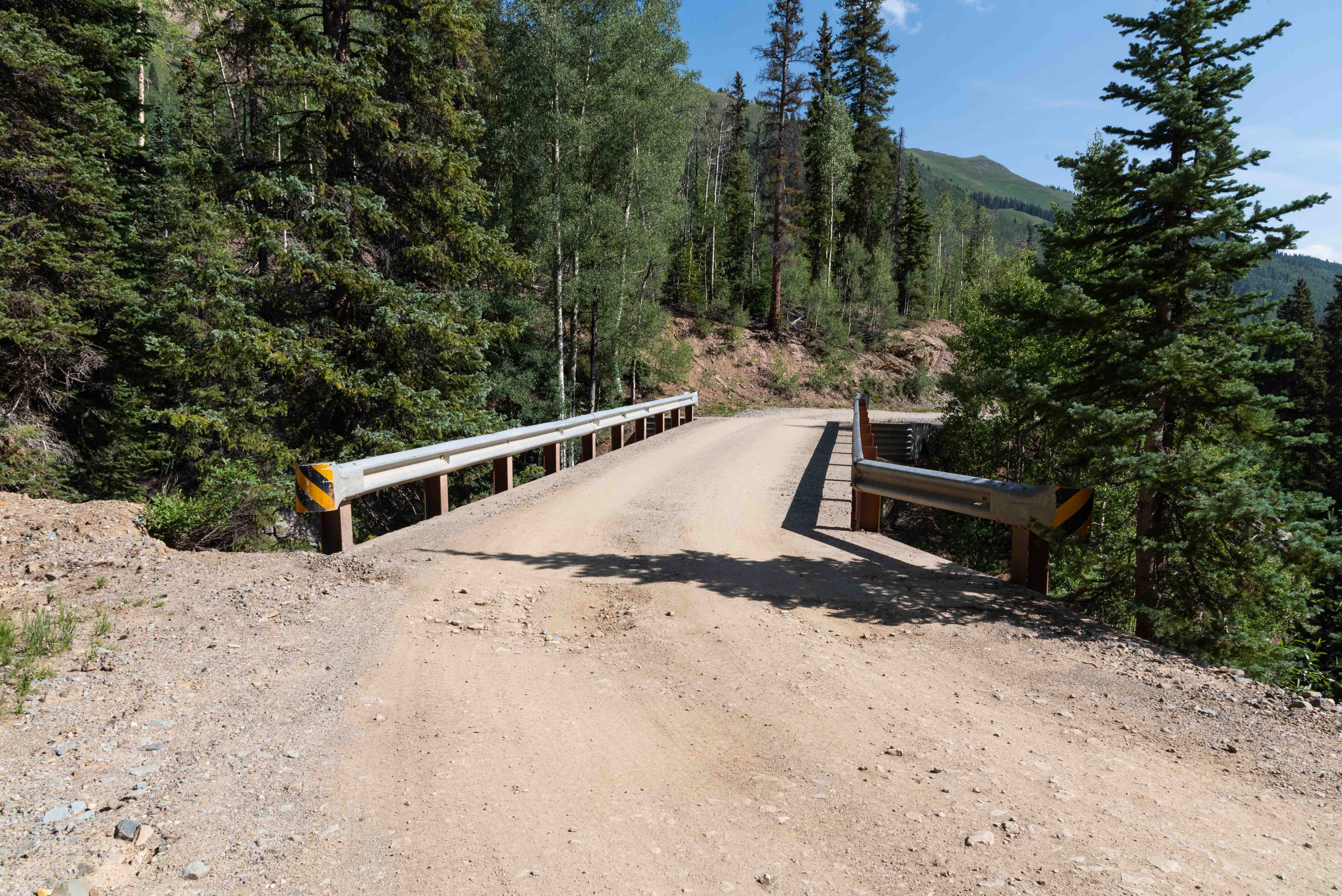
First Bridge
37°55'14.74"N, 107°41'55.09"W
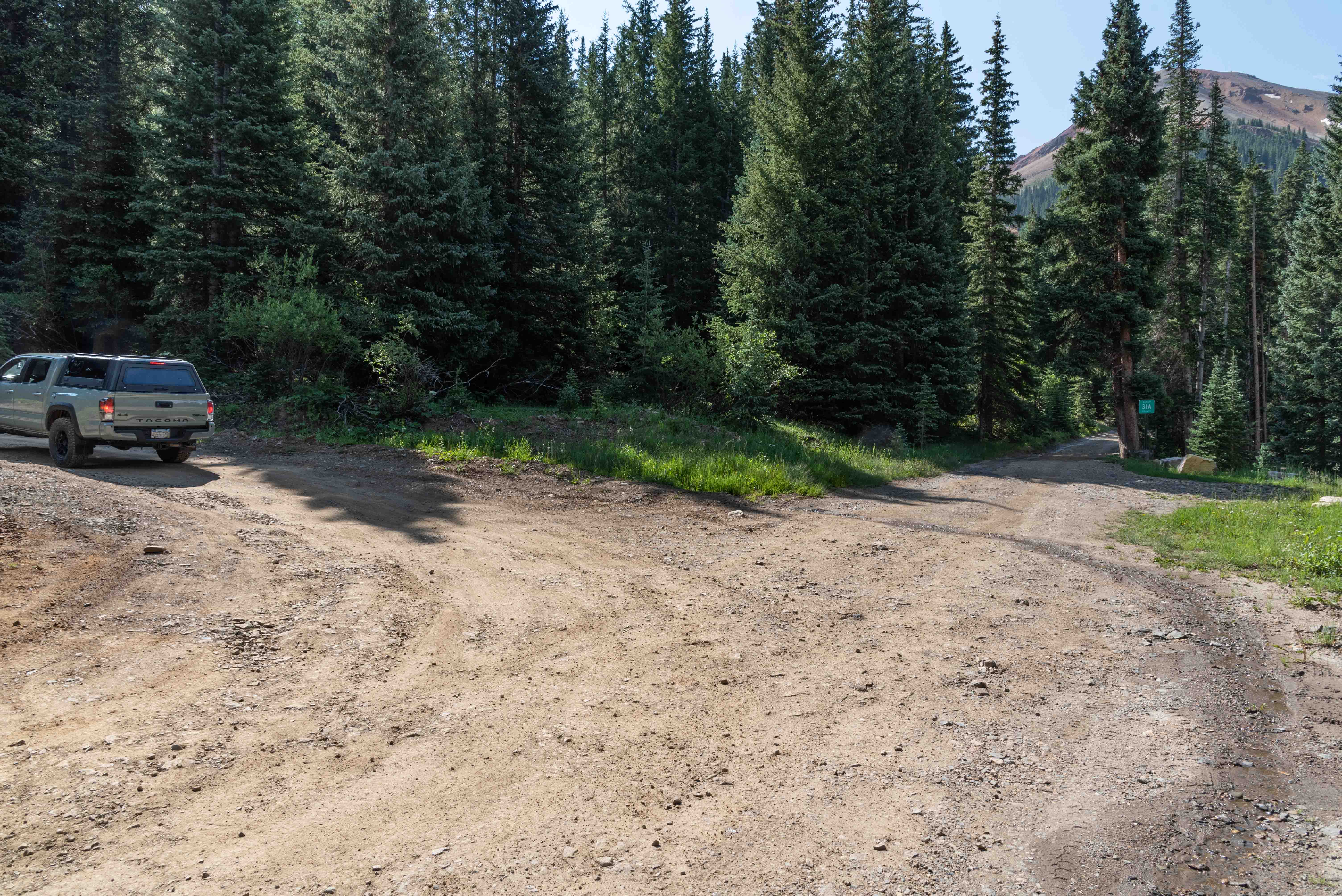
CR 31 and CR 31A split here
take the left fork
37°55'3.69"N, 107°41'43.38"W
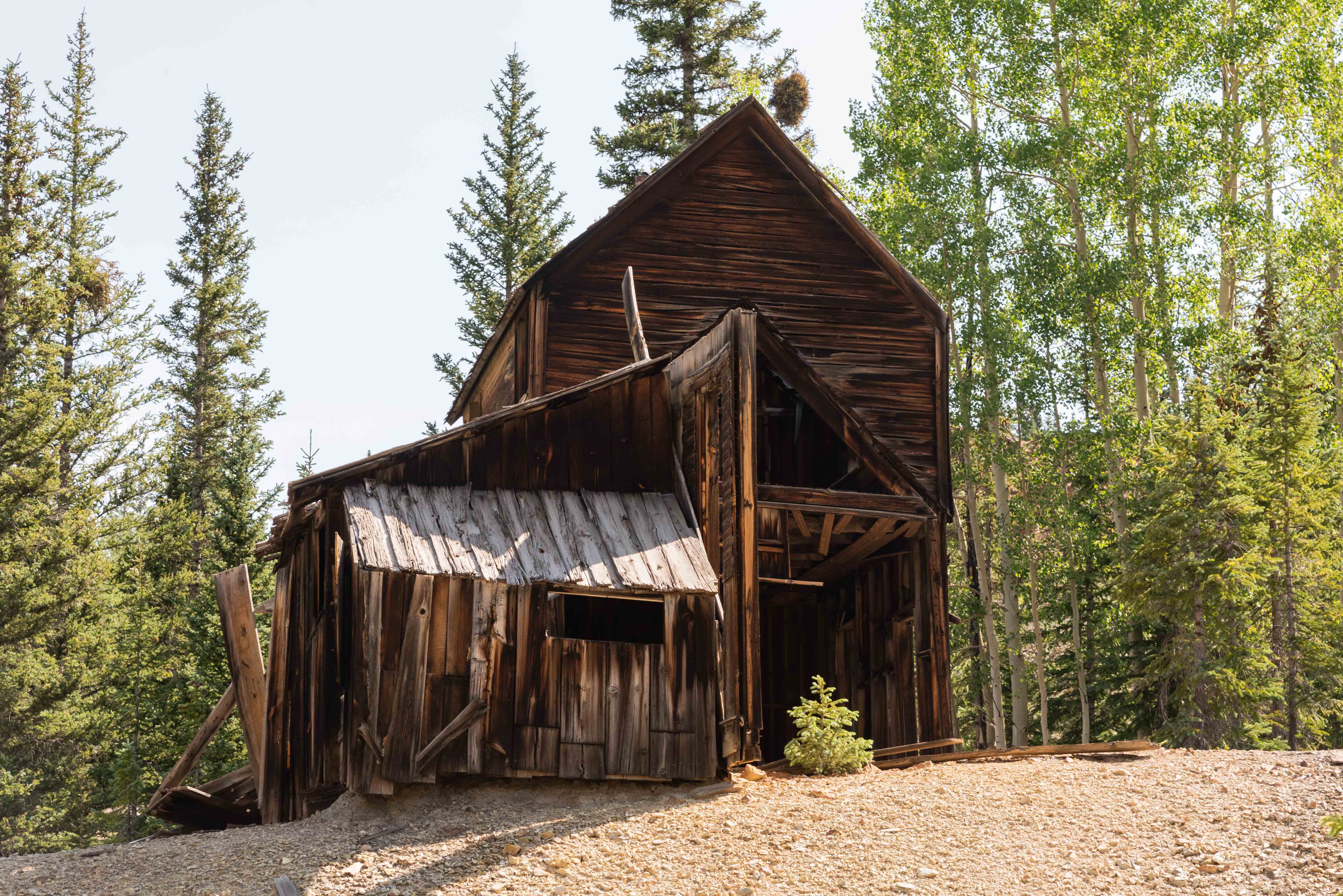
Could be the Guston Mine?
37°55'3.192"N, 107°41'38.562"W

Guston Mine?
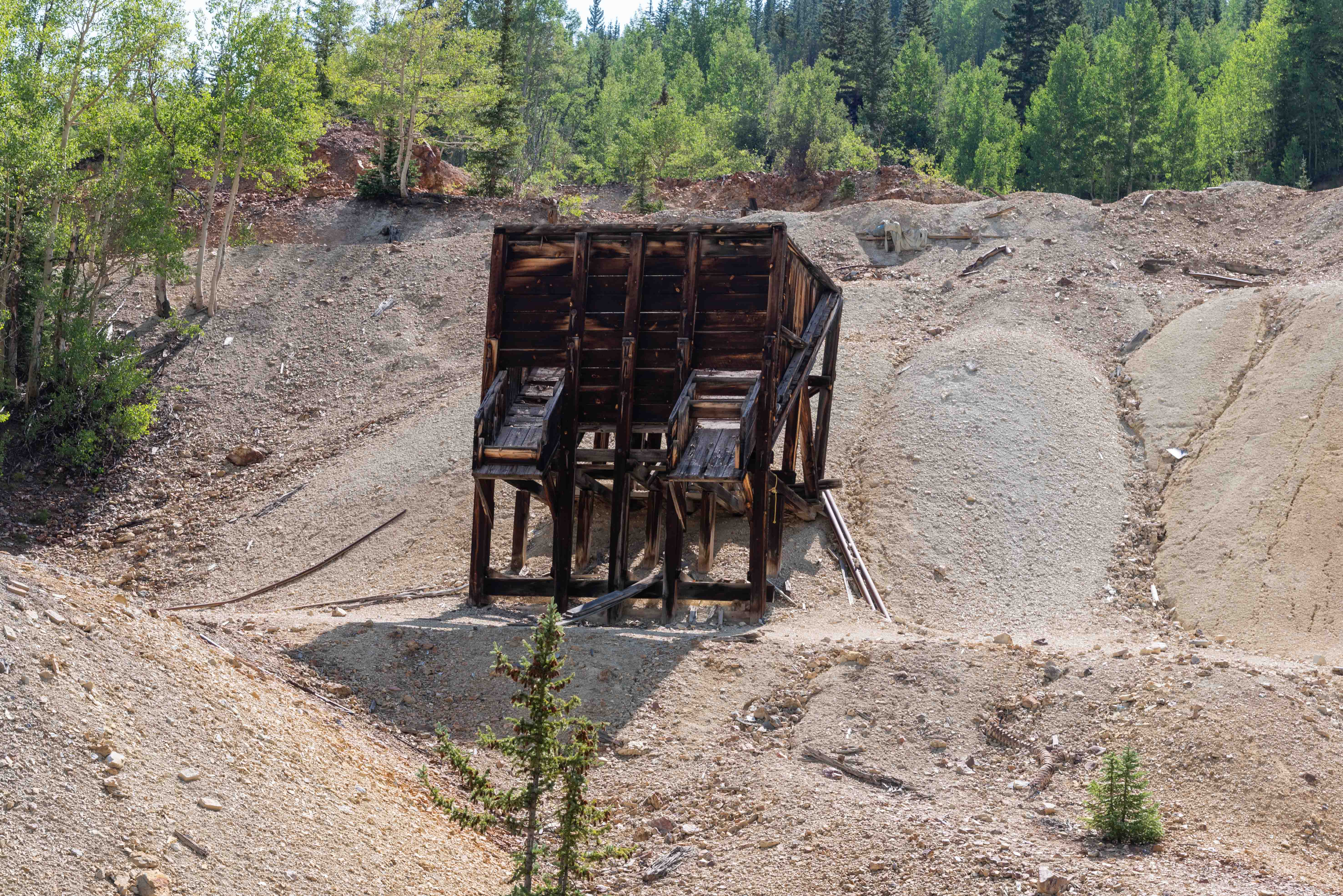
Definitely looks like an ore loader
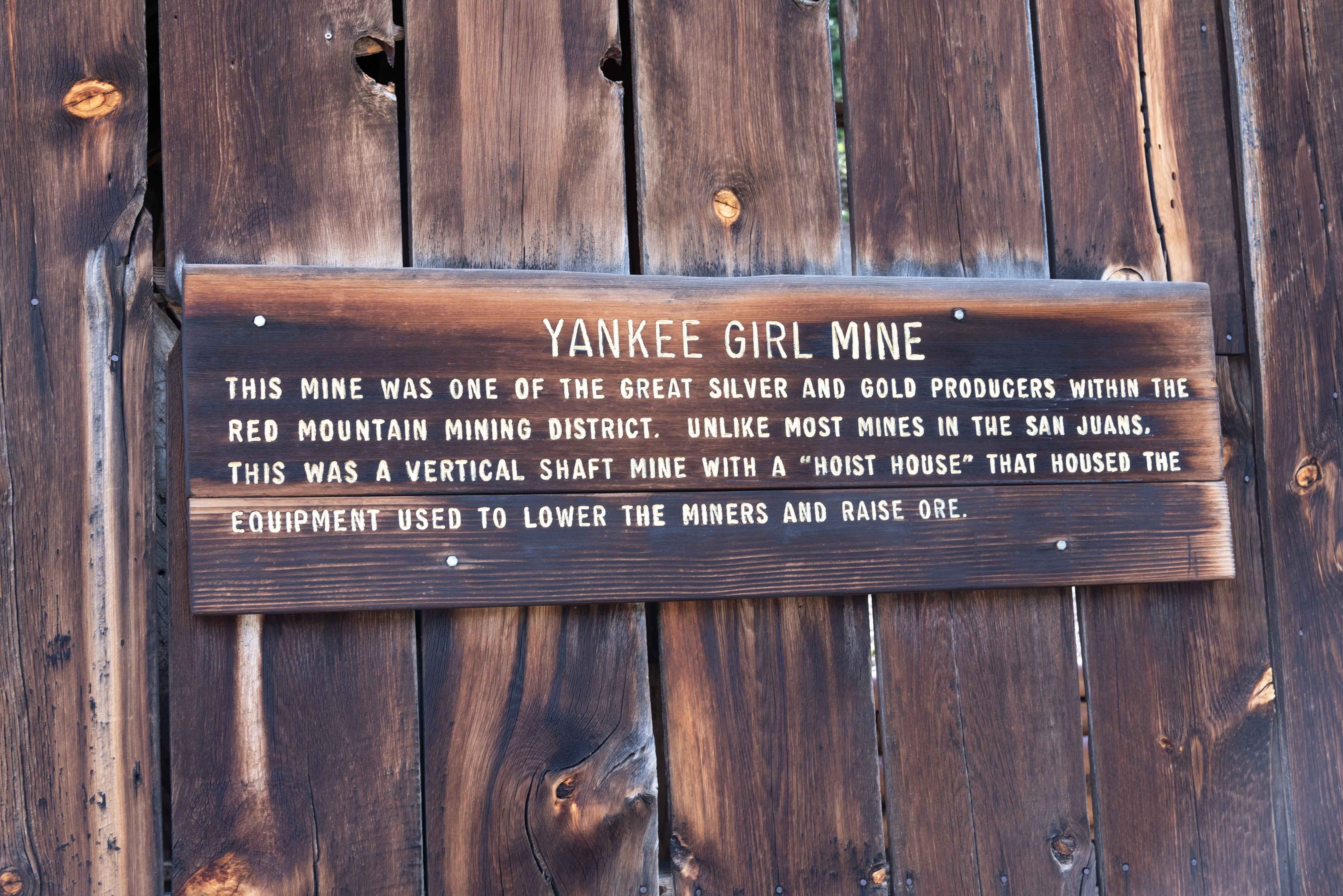
Yankee Girl Mine
Prospector John Robinson discovered an outcrop of the lead/silver mineral, galena, on August 12, 1882. As it turned out, the outcrop was on top of a chimney (vertical shaft) of solid ore. Robinson and his partners located the Yankee Girl, Robinson, and Orphan Boy mines around the ore vein. Initial amounts of ore sent to a Ouray mill assayed out at an average of 88 ounces of silver and 50% lead per ton, which made it a bonanza. In 1883, the Yankee Girl was joined with the Robinson and Orphan Boy mines by interconnecting tunnels that would eventually reach 25 miles in length. The original partners sold the combined mine for $125,000 (about $2.5 million in today’s dollars). The mining engineer, T.E Schwarts, became superintendent of the Yankee Girl Mine in 1884. He built the large hoist house seen today, made surface improvements, and extended the shaft to a depth of 1000 feet. The mine became so profitable under his supervision that the company was able to pay dividends of nearly $1,000,000.

Idarado Mine Trestle
View from Yankee Girl Mine
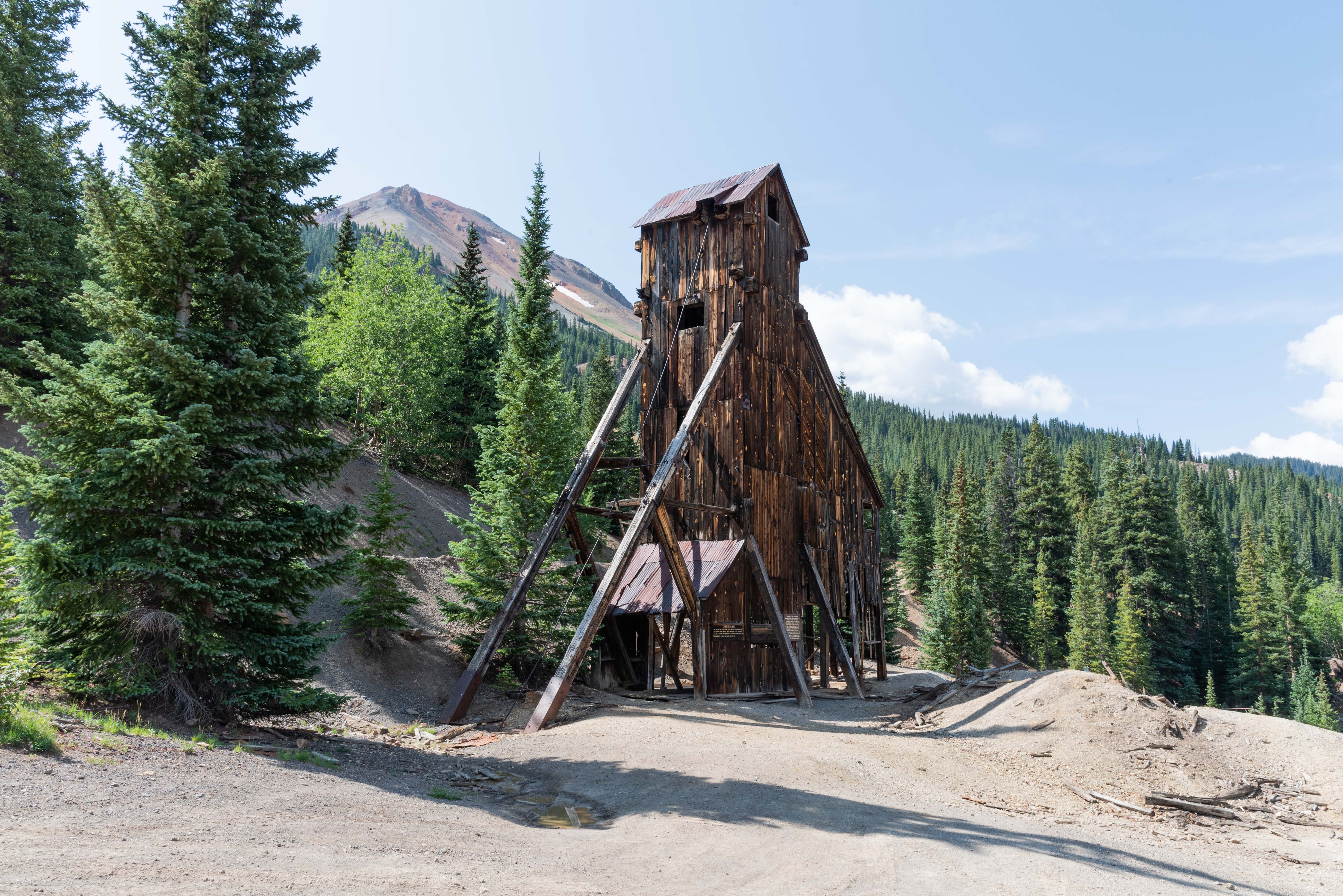
Yankee Girl Mine
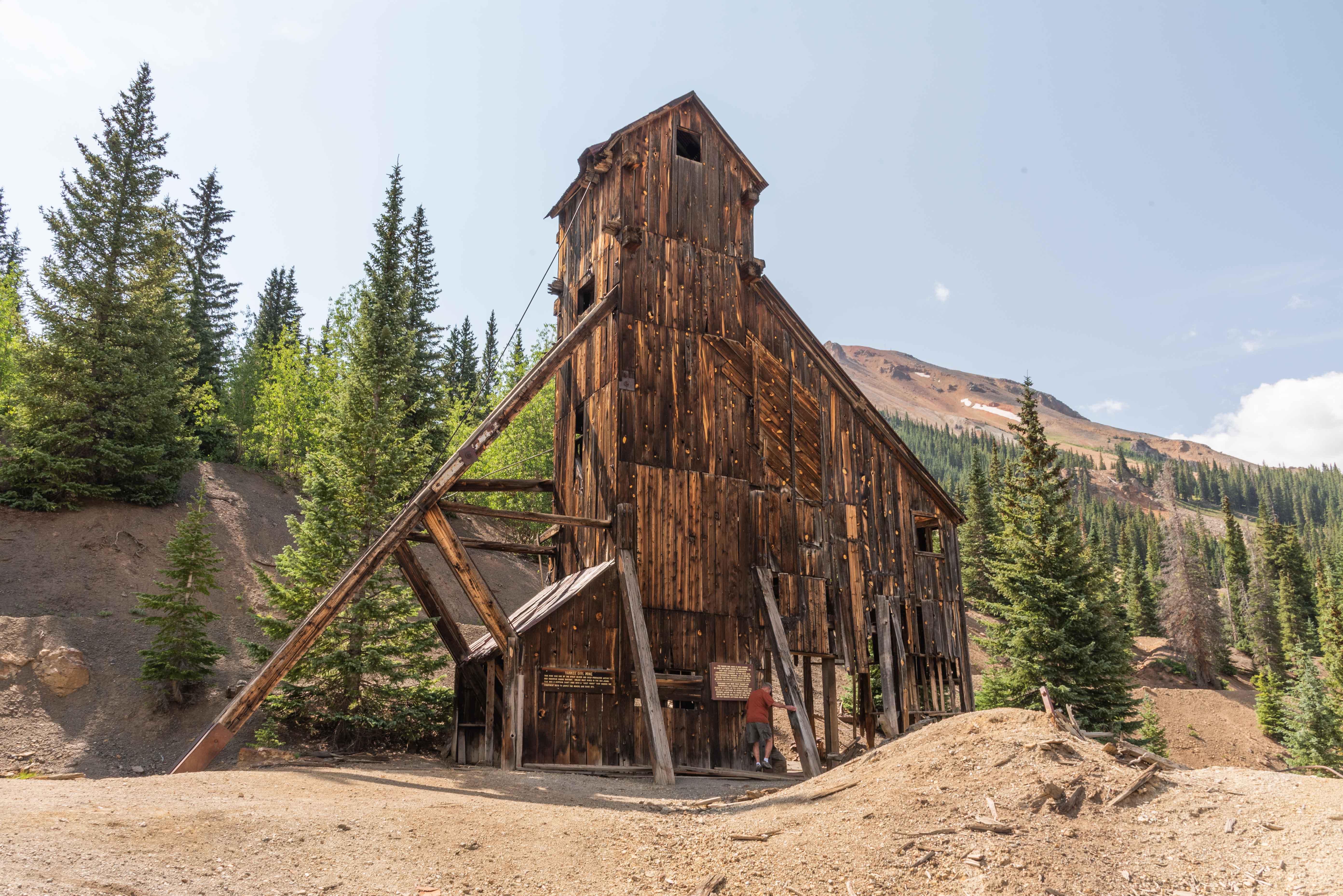
Yankee Girl Mine
37°54'53.514"N, 107°41'47.244"W
Yankee Girl Mine

Yankee Girl Mine
Yankee Girl Mine
Yankee Girl Mine
View to top of hoist house
Hoist House - Yankee Girl Mine
Genesee (Genesee-Vanderbilt) Mine
The Genesee-Vanderbilt mine is located on Ouray CR 31 about one-half mile north of the National Belle Mine and two-tenths mile south of Yankee Girl Mine. The Genesee mine was located in the summer of 1882 by Jasper Brown and Adelbert Parsell. The nearby Vanderbilt Mine was located on October 23, 1883 by Perry Terpenny. In Oct 1888 the owners of the Genesee bought the Vanderbilt for a reported half-million dollars, and early in 1889 the workings were combined when it was discovered that both mines were working the same ore body. The Genesee for the most part produced low to medium grade galena ore averaging 25 ounces of silver and 70% lead per ton. However, in 1885 a solid body of rich galena ore was discovered that averaged 200 ounces of silver per ton.
Genesee Mine
37°54'44.502"N, 107°41'45.762"W
Possibly a tramhouse and portion of a tramline
Genesee Mine Ruins
View ~ west-northwest from Genesee Mine (Idarado Mine center)
Ore Loader - Genesee Mine
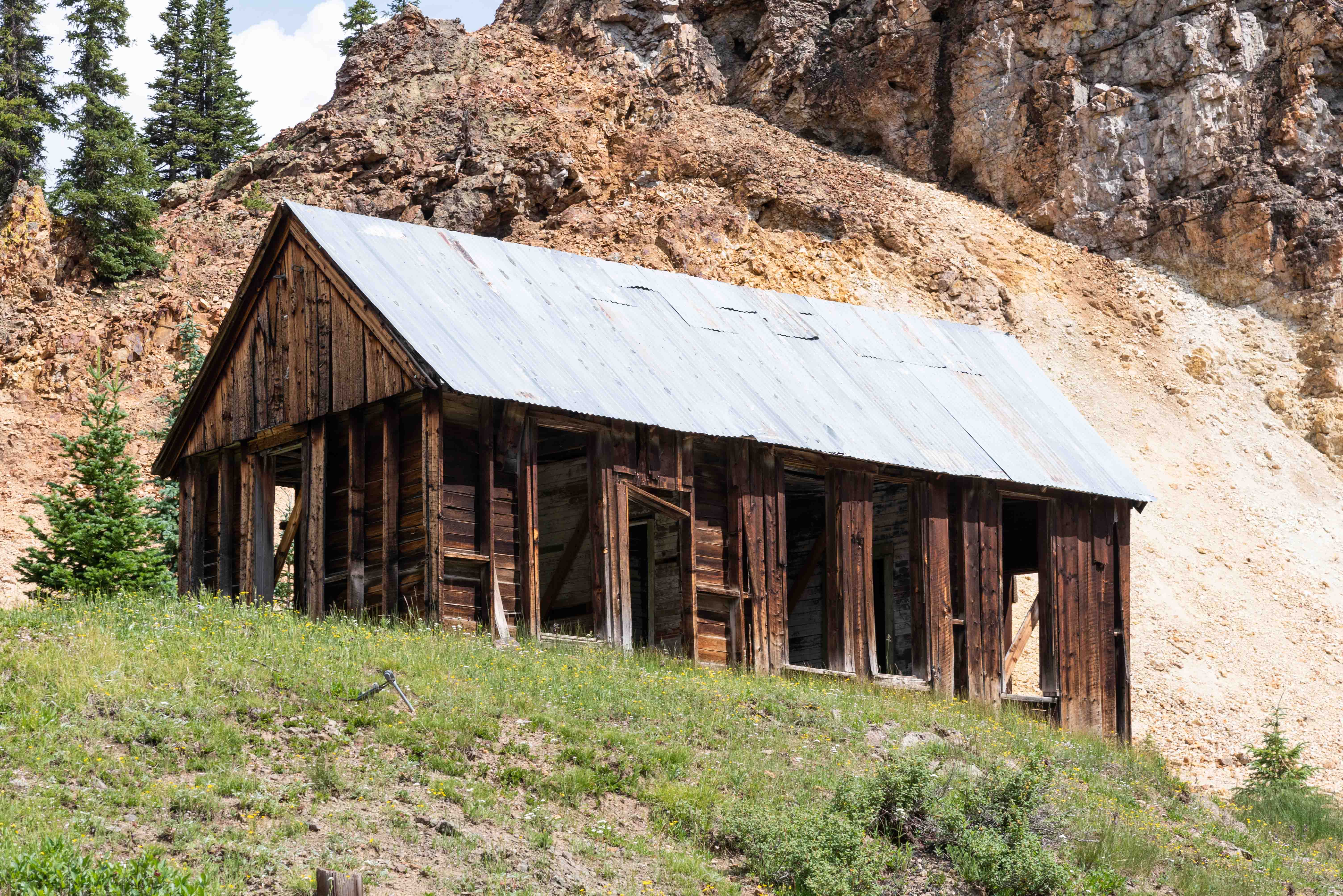
Bunkhouse? - Genesee Mine
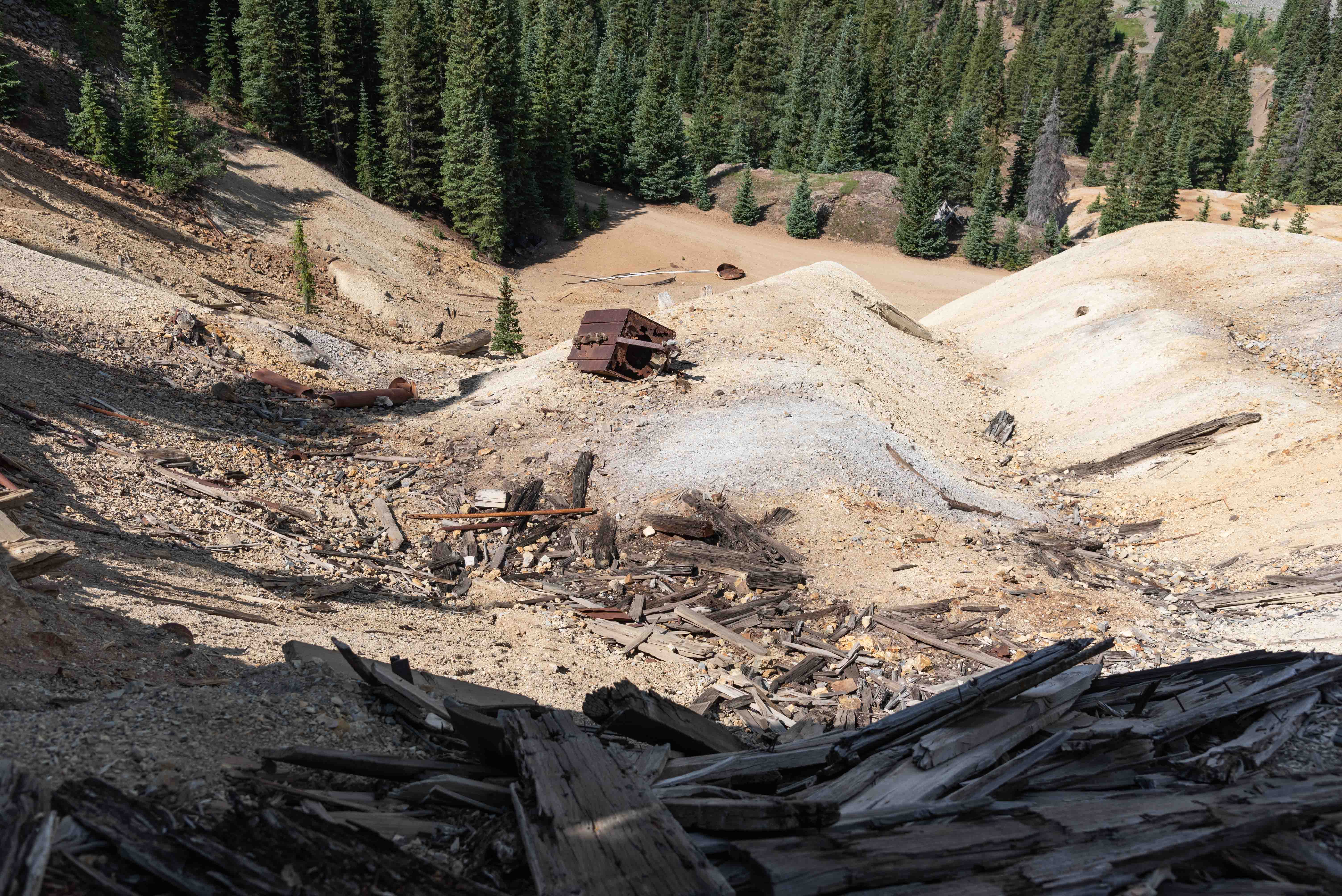
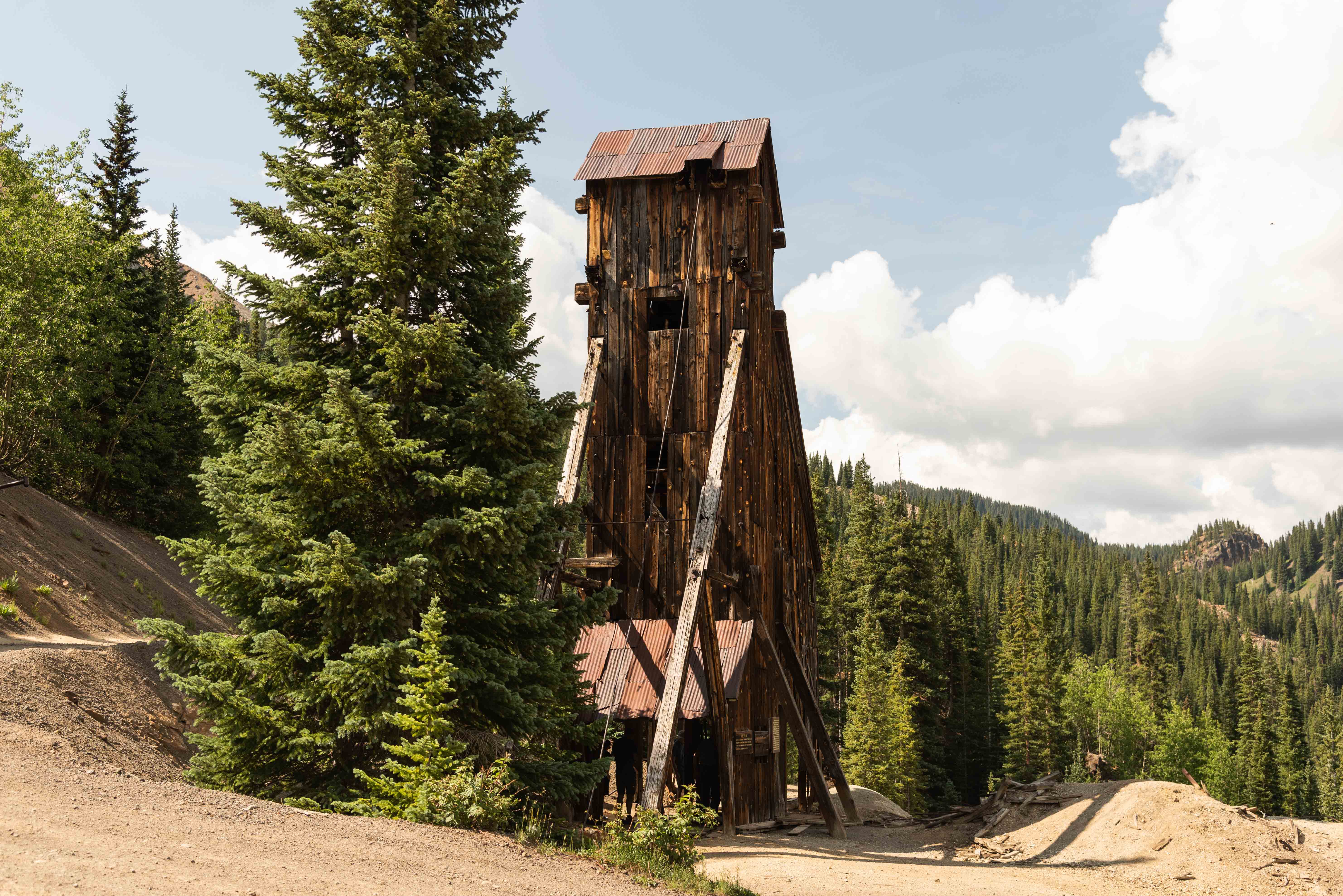
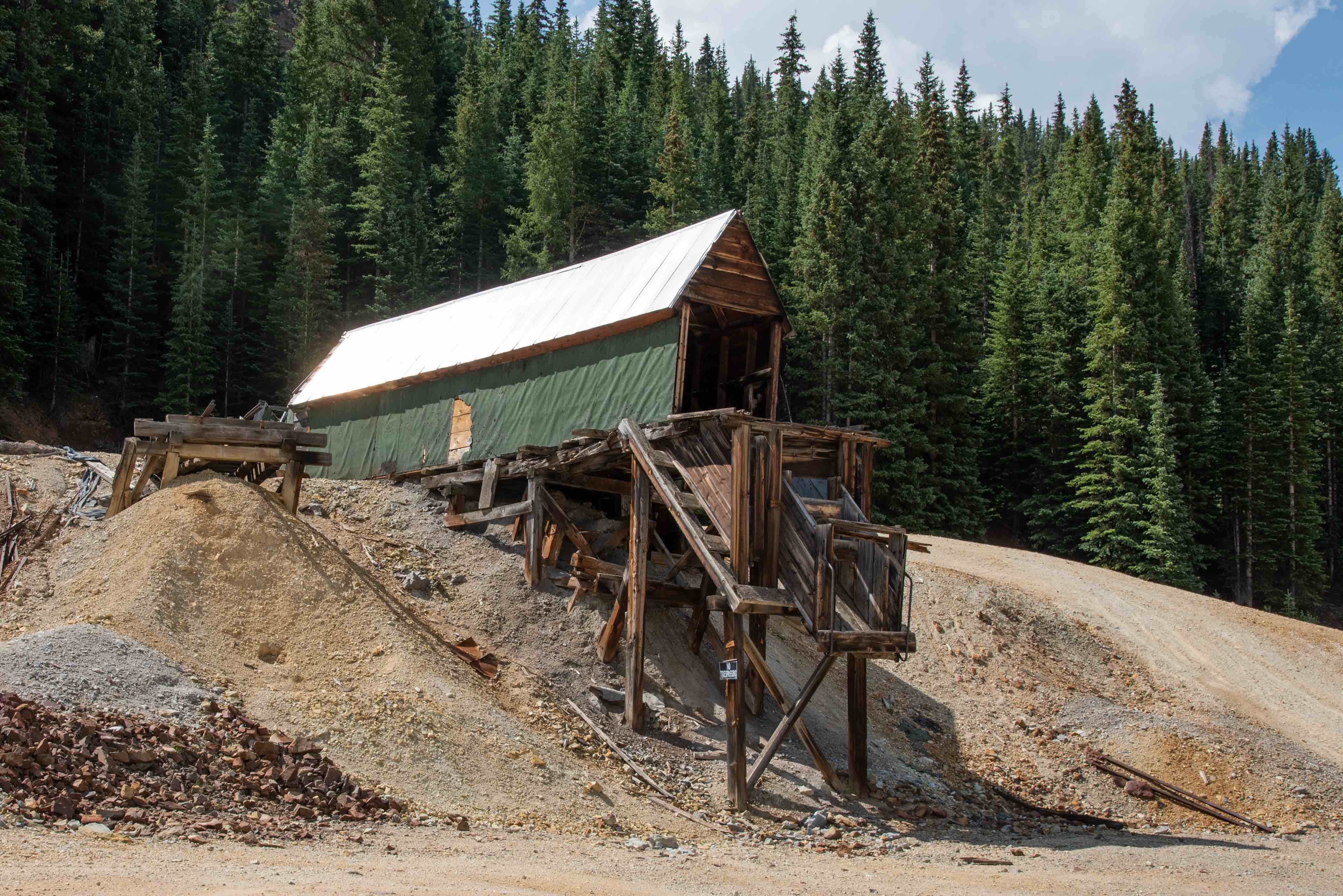
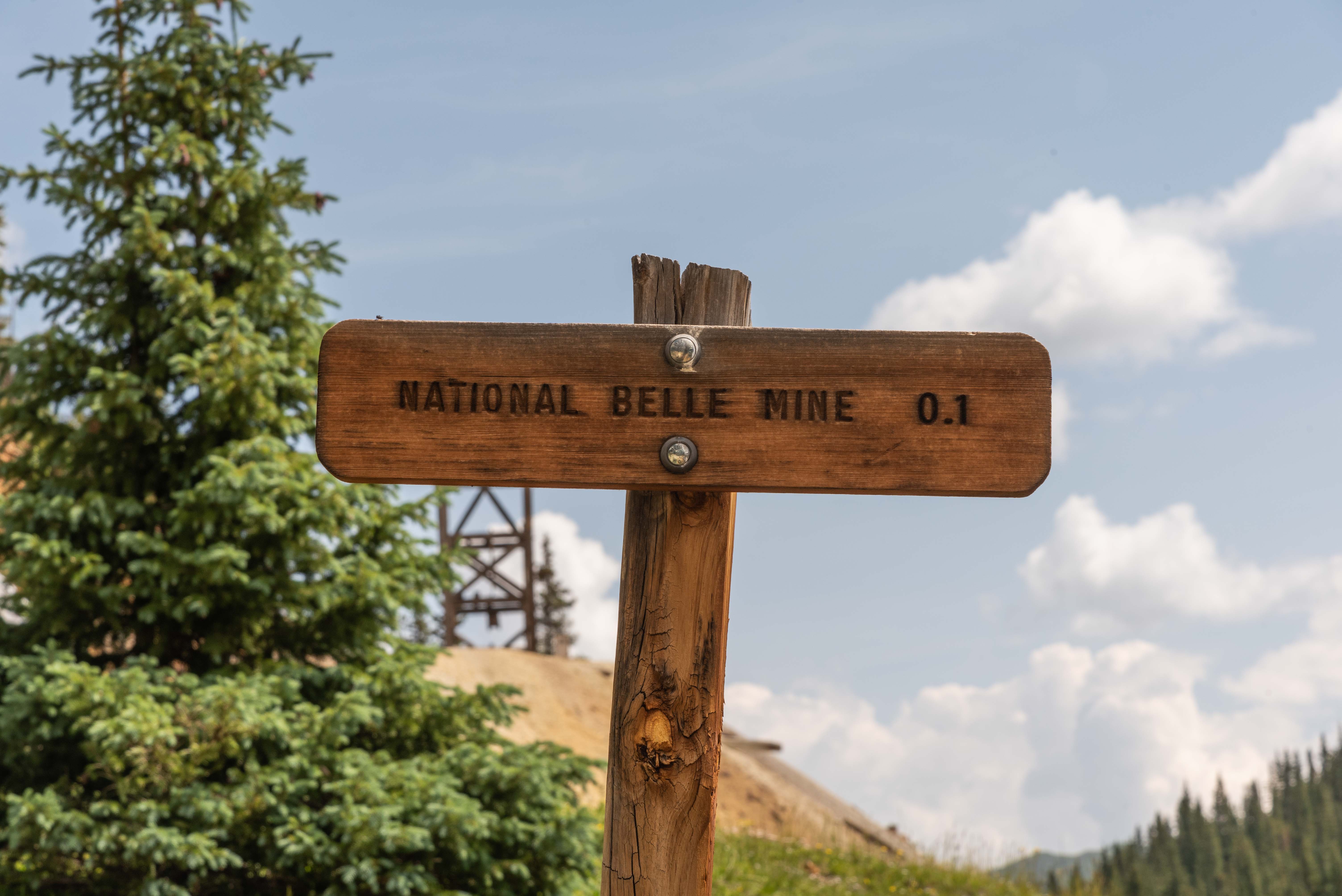
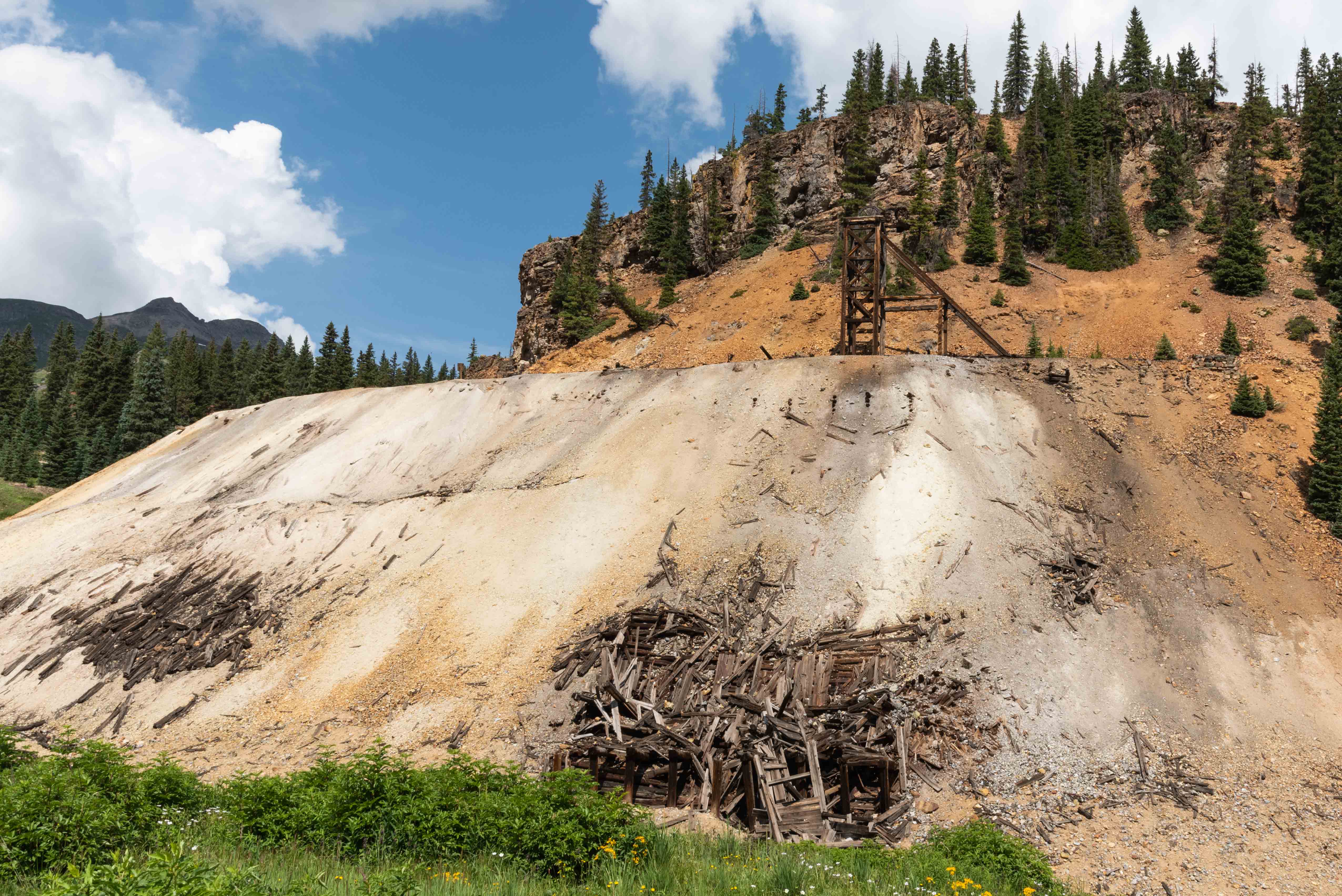
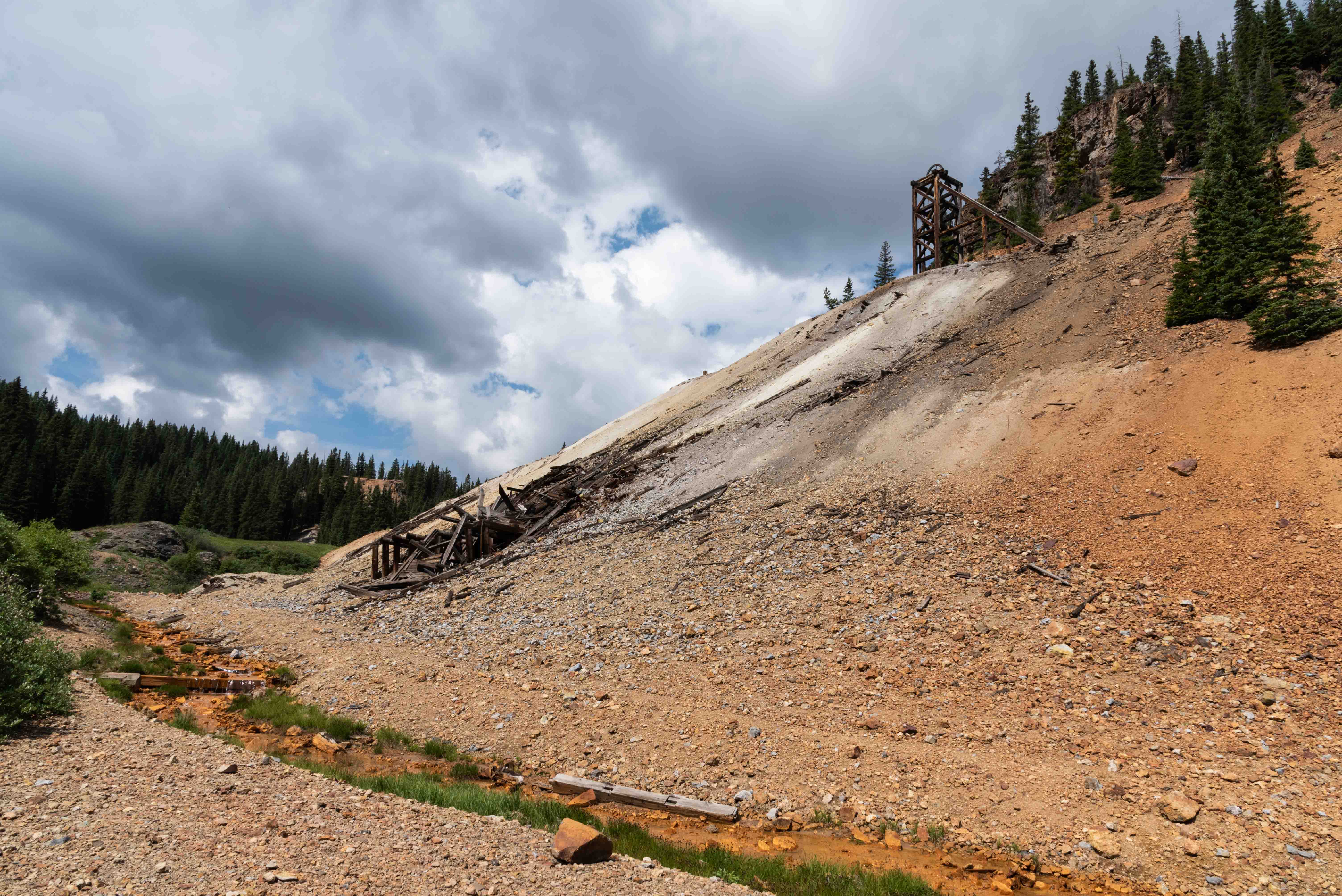
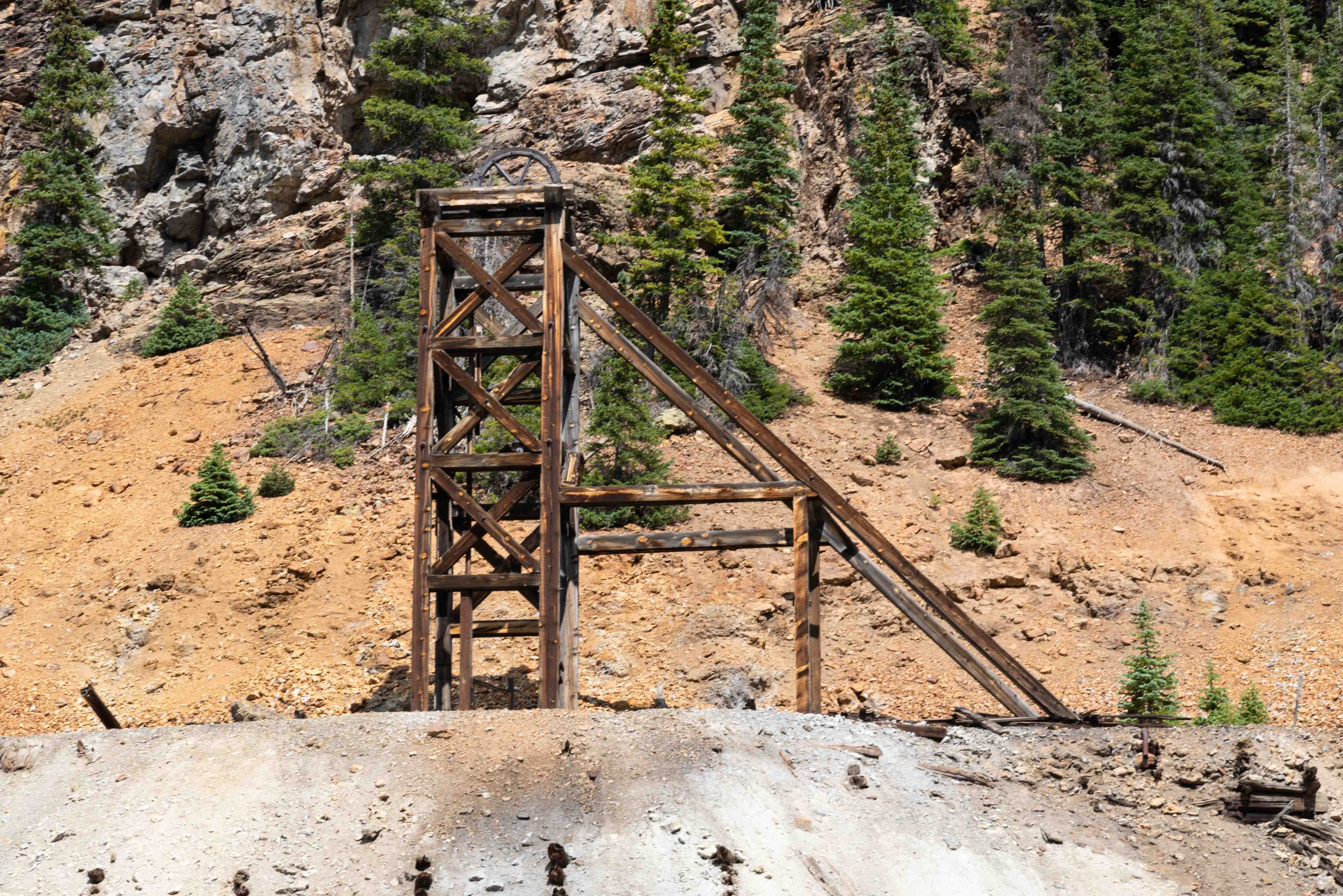
National Belle Mine
The National Belle is located at the southern end of ouray CR 31. It was inside the city limits of now defunct Red Mountain Town. The only thing left of the town is its jail. The National Belle mine was discovered by Richard Journey in 1882 when he found a 4 foot wide body of galena ore. It was one of the top producers in the district by the spring of 1883. A ton of it's ore from one mill run contained one hundred ounces of silver, five dollars in gold, 50% lead, and a fair amount of copper. The National Belle produced over two million dollars worth of silver ore before closing in 1897.
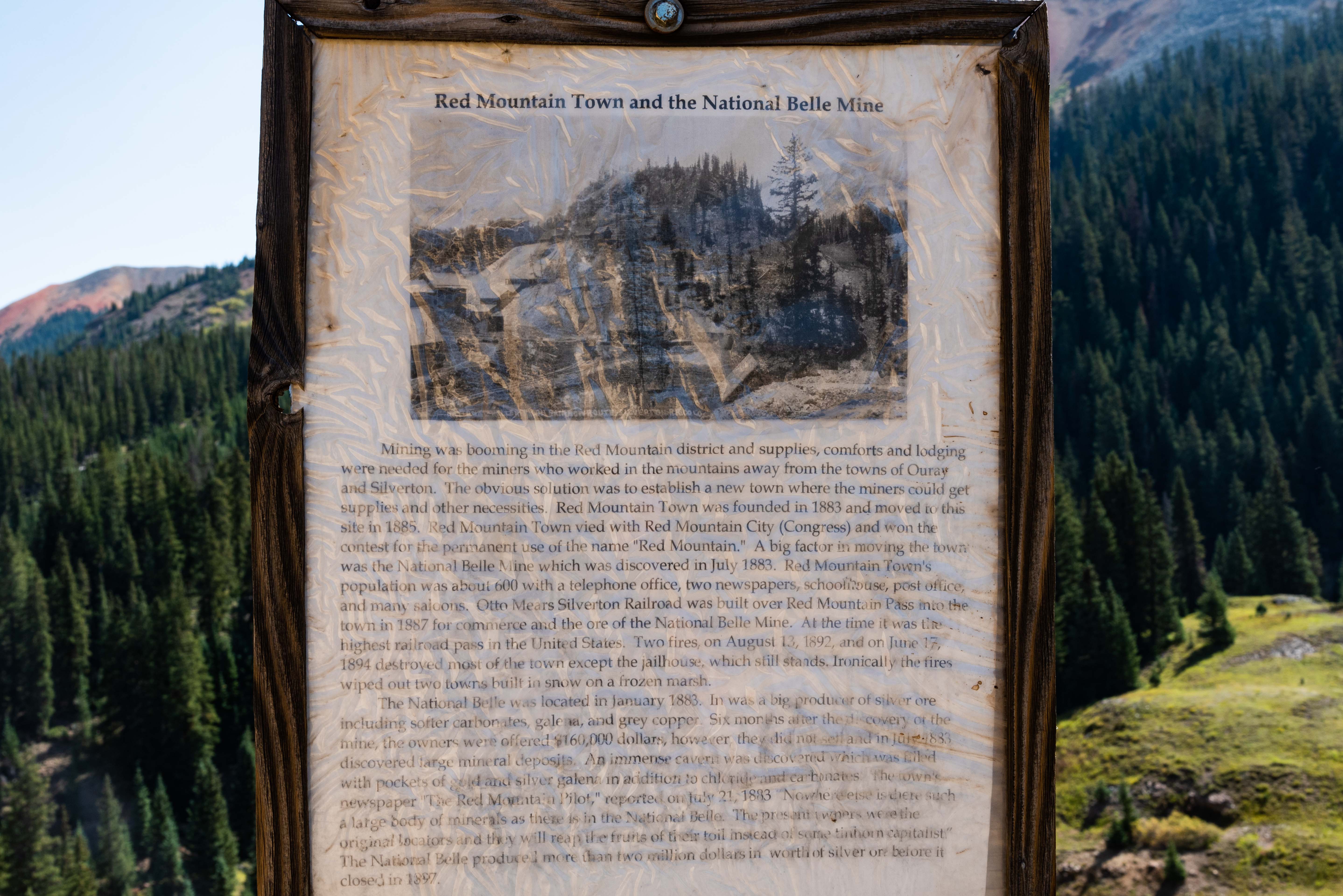
About Red Mountain Town
and the National Belle Mine
National Belle Mine
National Belle Mine
37°54'14.22"N, 107°42'12.228"W 10872ft elev
Mine ruins and Red Mountain Creek
National Belle Mine
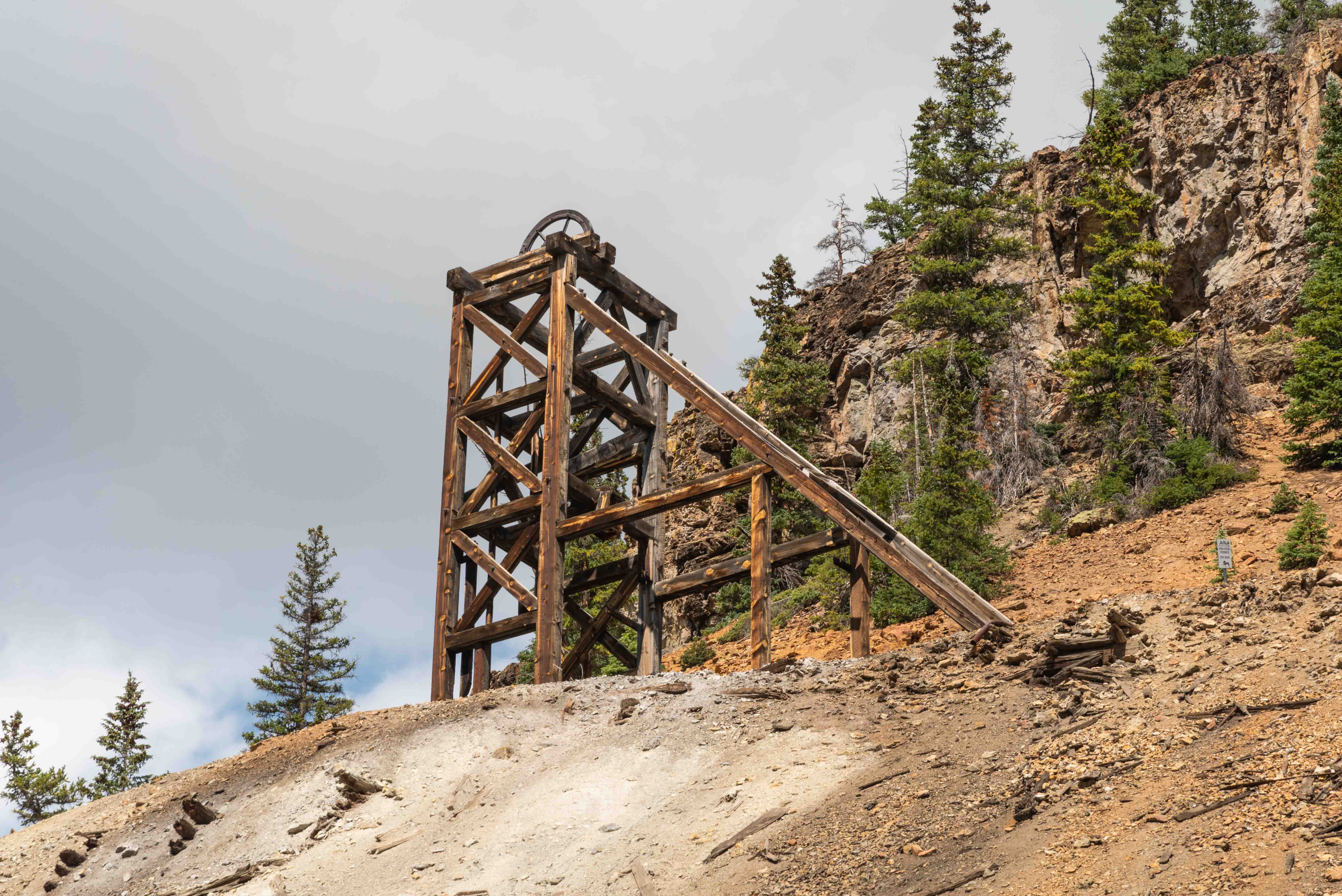
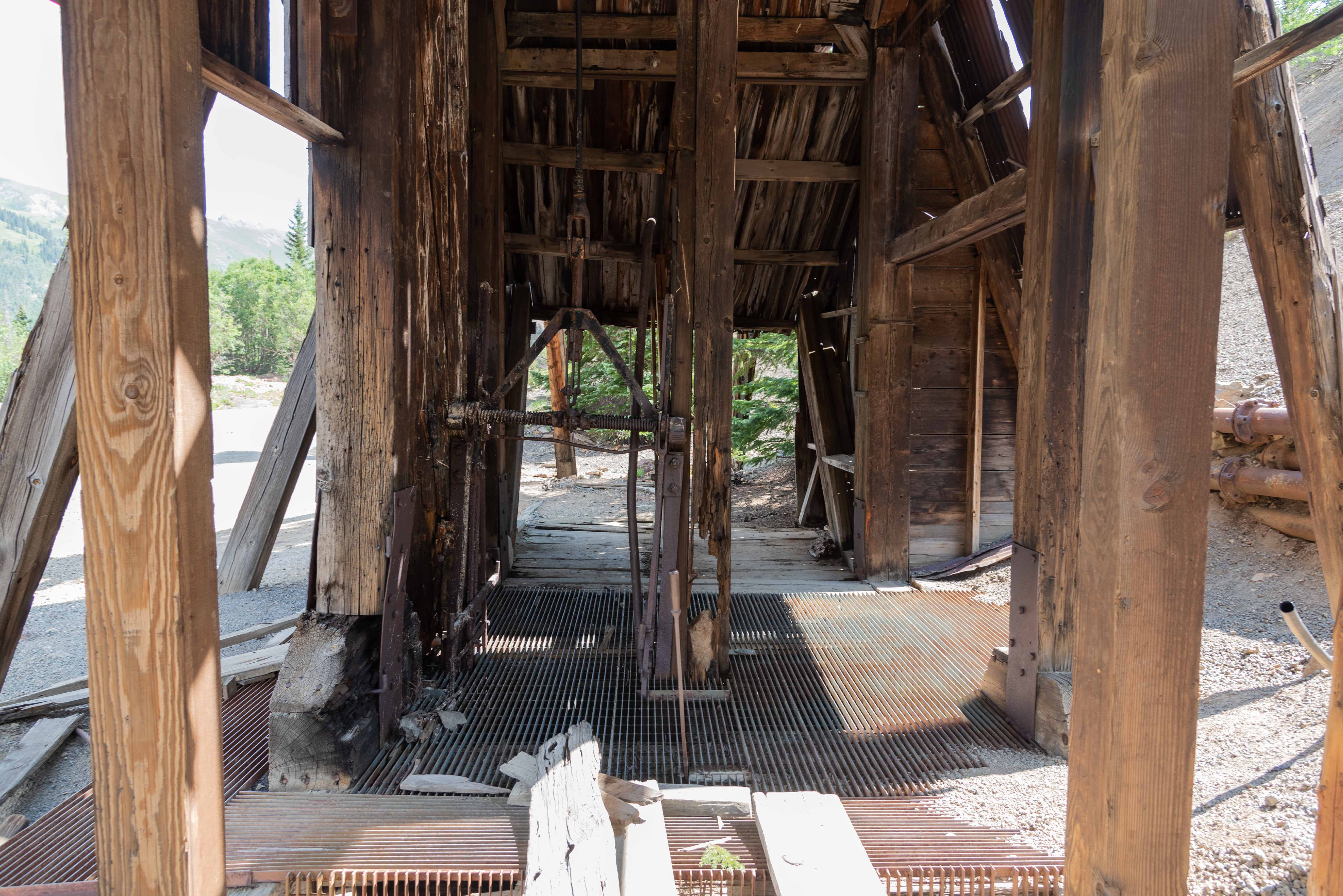
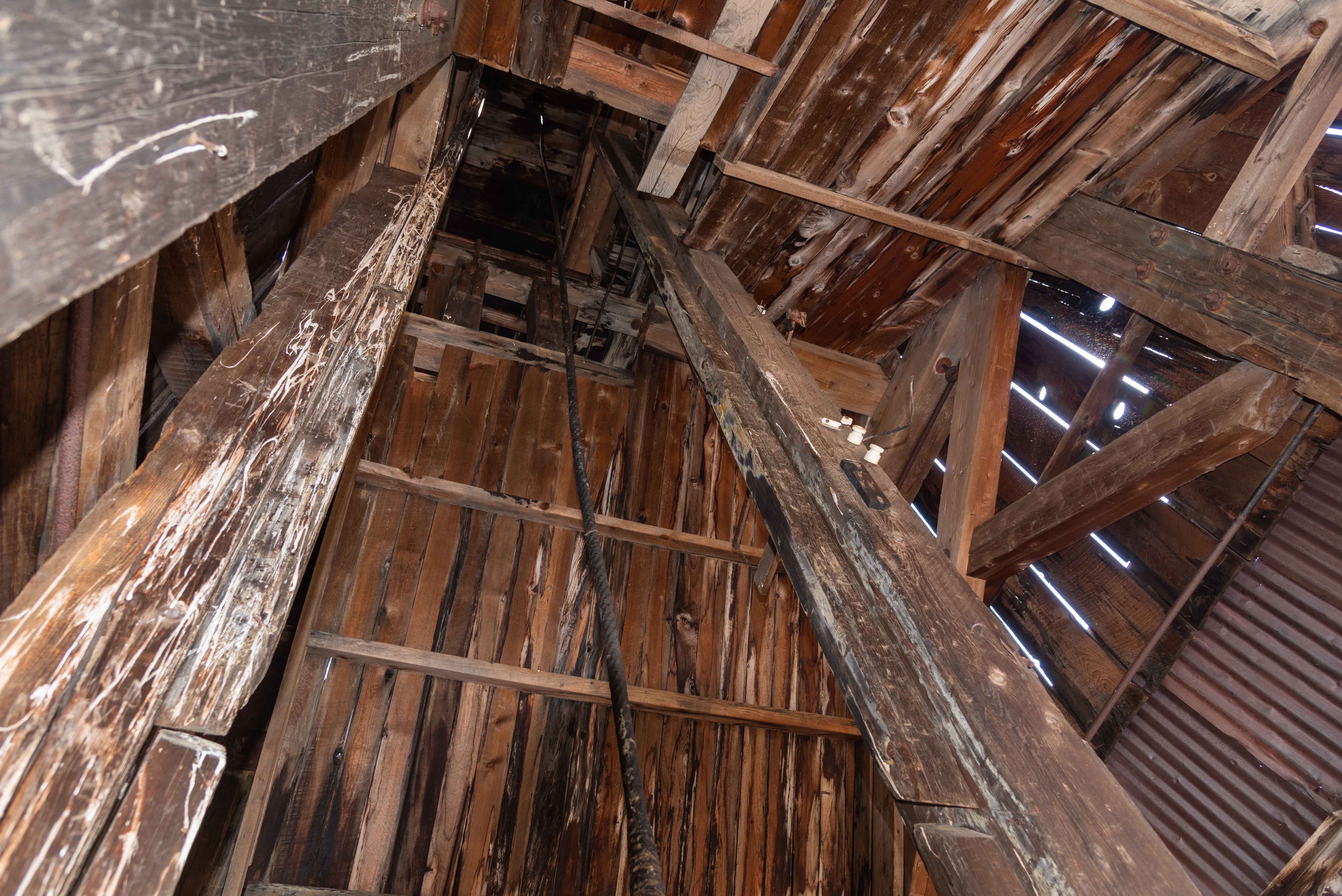
Headframe
National Belle Mine

Mine ruins
Headframe
National Belle Mine

Headframe
National Belle Mine
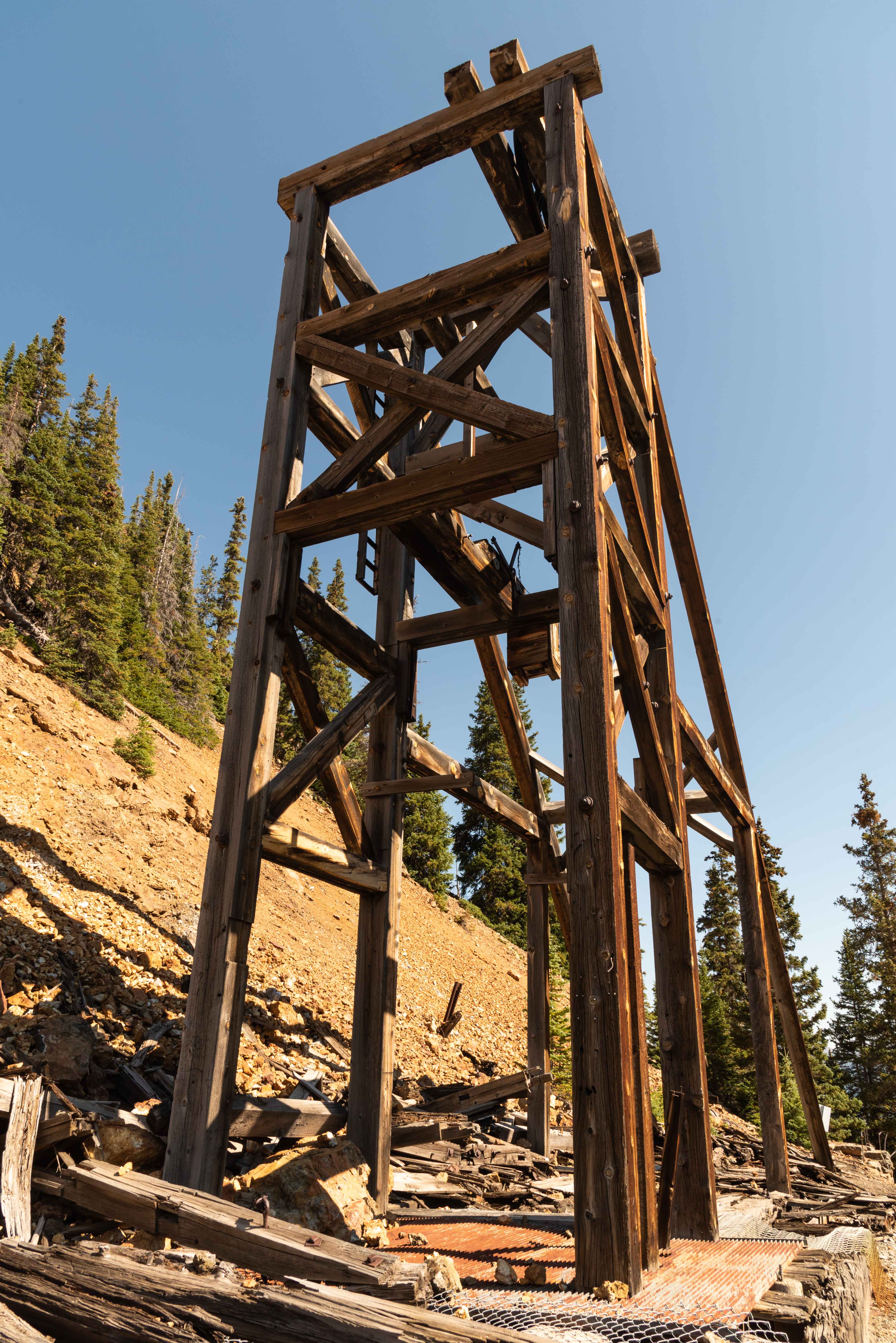
Headframe
National Belle Mine
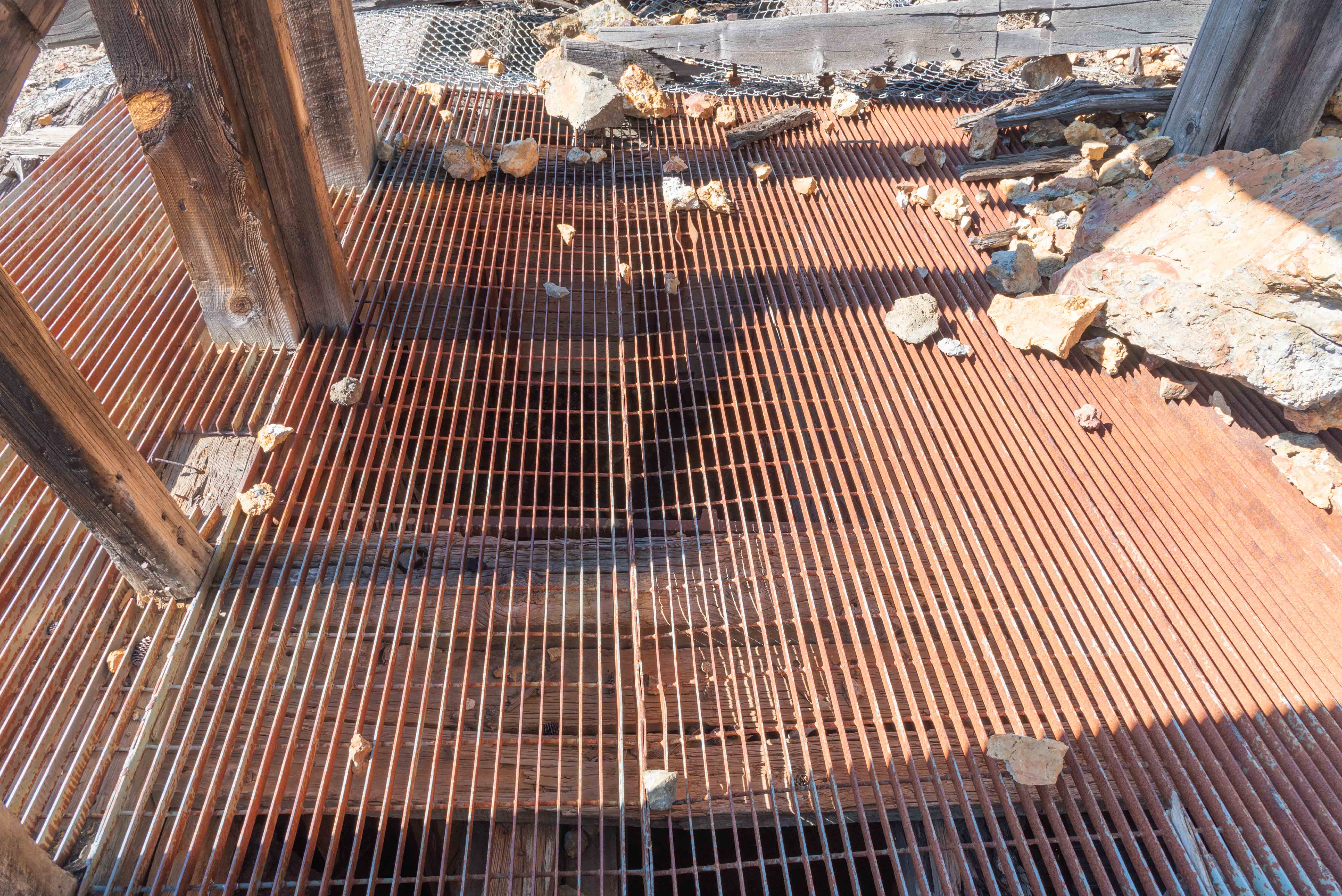
Grate over the mine shaft
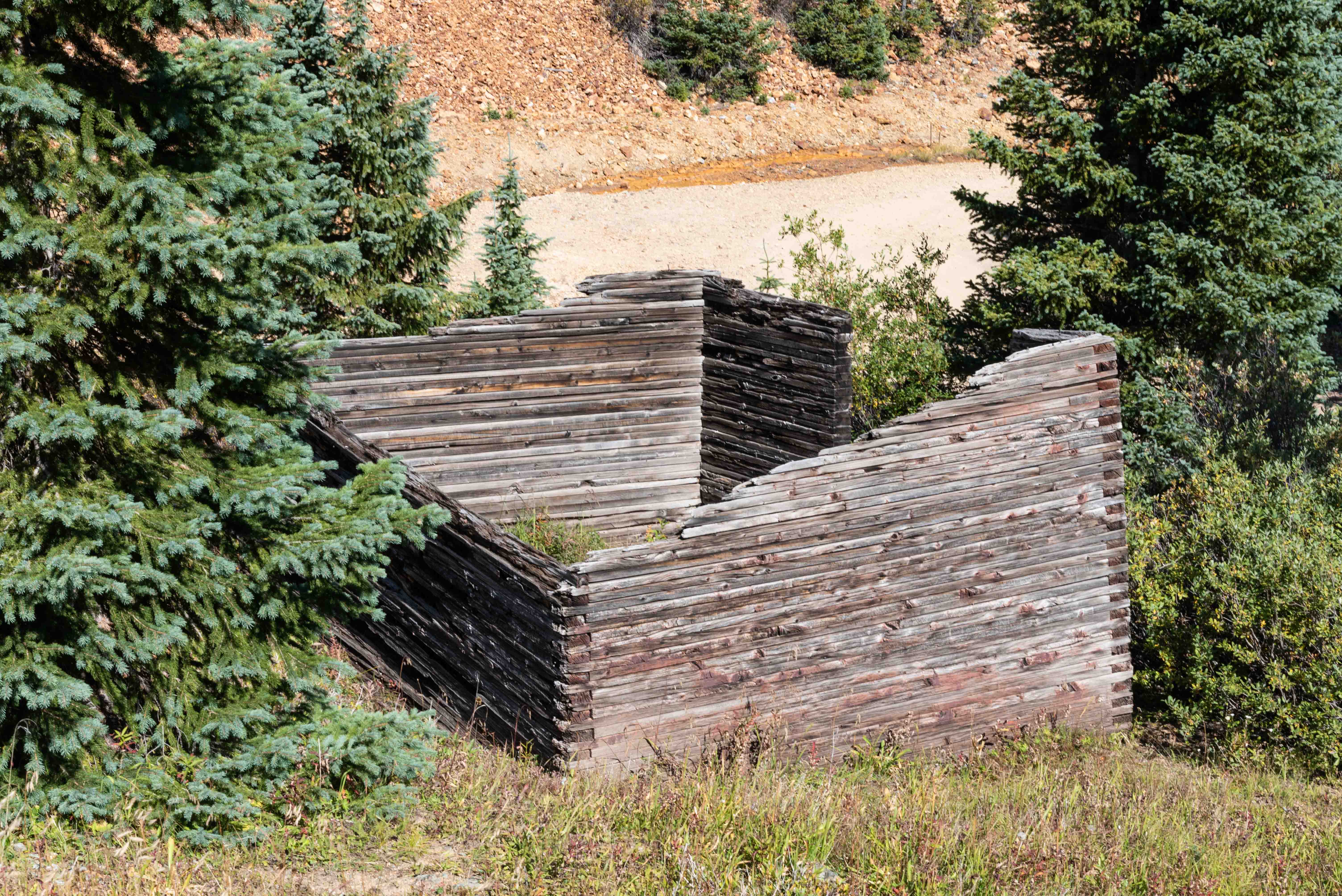
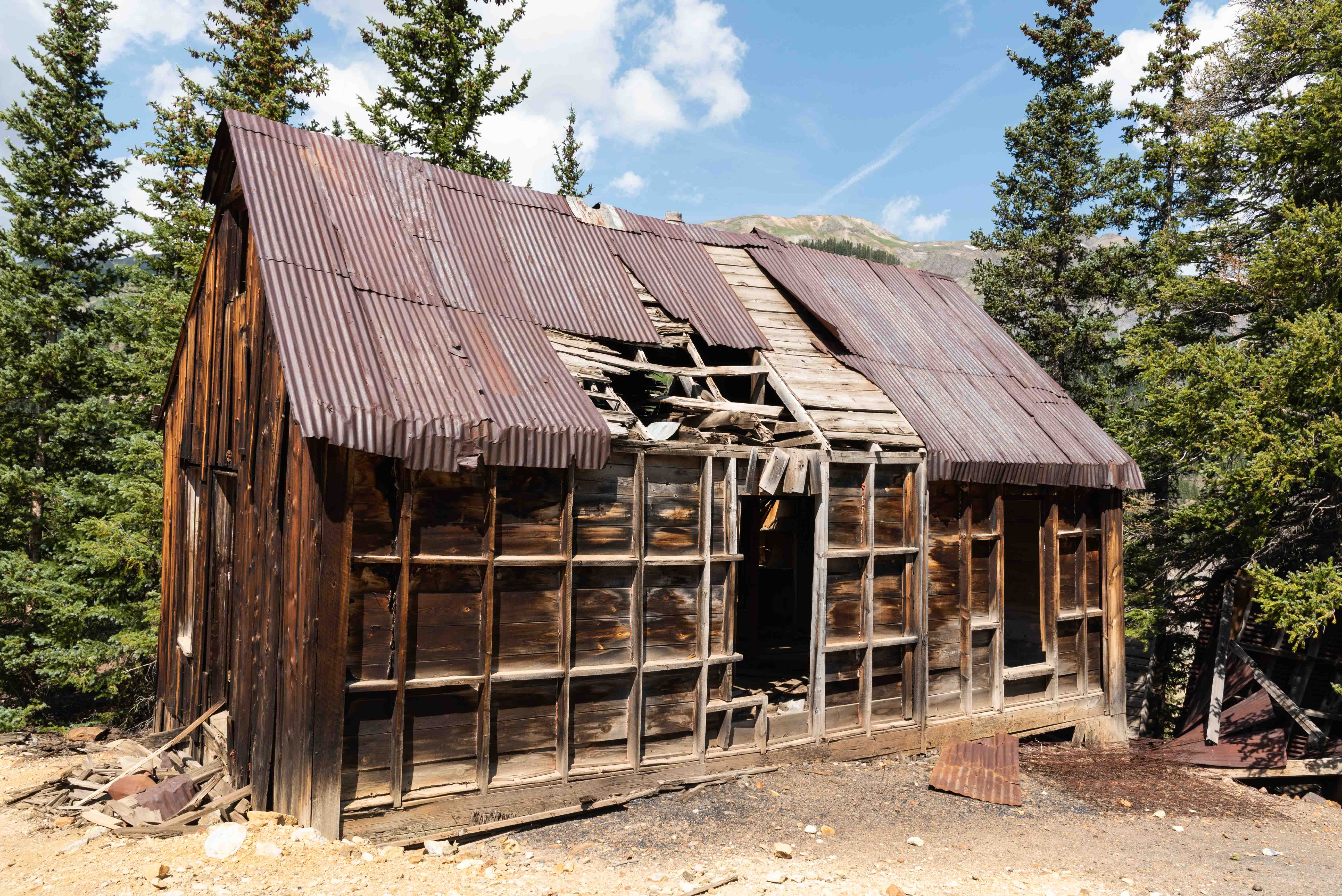
Red Mountain town jail
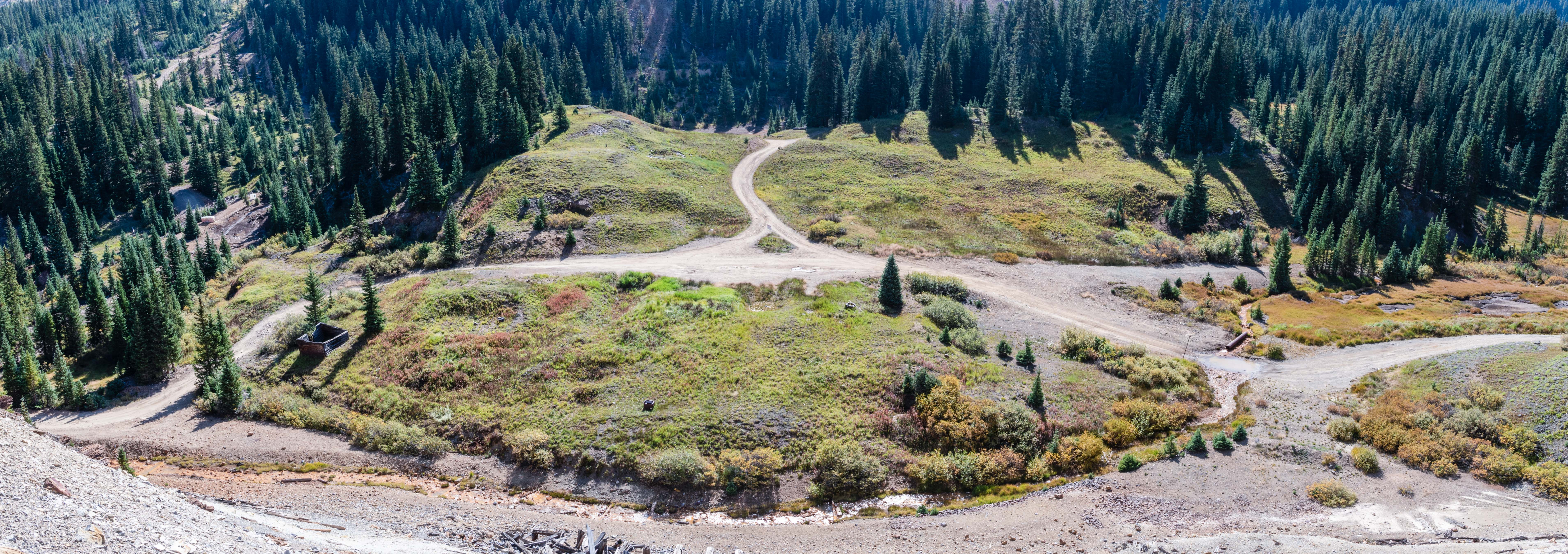
Red Mountain Town townsite
Boarding house? - National Belle Mine
Background info: legendsofamerica.com, reporterherald.com, hmdb.org, Mountains of Silver by P. David Smith
Use the form on the Home Page to submit comments, questions, or suggestions. TD Productions Copyright © 2022