Sky Pond Hike - Rocky Mountain National Park
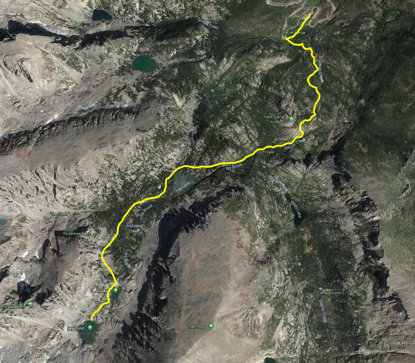
The last time I took this hike was several years ago, but it's still one of my favorites. The hike is 9 miles round
trip and total elevation gain is about 1800 feet. I've roughed in the trail on a Google Earth
satellite view, and if you click on the map you'll be able to see it a little better. The hike starts at the Glacier Gorge trailhead.
After about a quarter mile you will come to Glacier Creek junction; take the left fork away from Glacier Creek Trail. About 8/10 mile
along the trail is Alberta Falls, a very popular hiking destination. Keep right at the next trail junction (North Longs Peak junction) .
At the junction with Glacier Gorge Trail (Mills junction) continue straight onto Loch Vale Trail. The trail gets steeper after
this junction and Loch Vale or "The Loch" is reached at the 2.8 mile mark. Continue past the Loch to the next destination, Lake of Glass
(Glass Lake) where Loch Trail turns into Sky Pond Trail. The last quarter mile to Sky Pond is moderately difficult but not exactly "technical". A little scrambling using both
hands and feet will get you there. This section is not recommended for people with medical problems or who are out of shape. Also not recommended if precipation in any form is present, although
lots of hikers have done this in the snow (crazy). That's it. Enjoy the scenery, have a snack, and retrace your route to the Glacier Gorge trailhead.
Sky Pond Trail
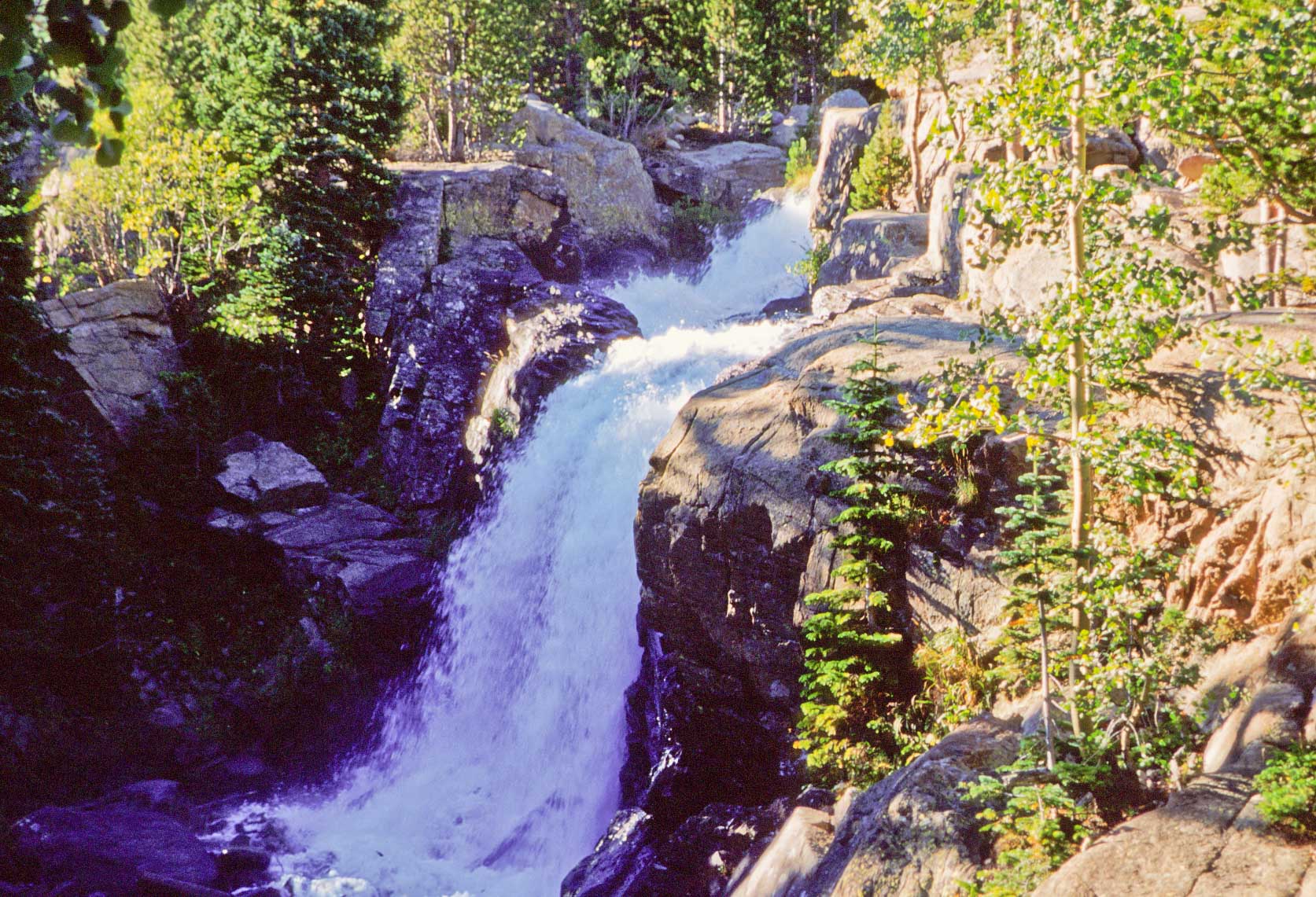
Alberta Falls
Alberta Falls (right) is a 30 foot waterfall located about 0.6 mile from the
Glacier Gorge trailhead. It was named after Alberta Sprague, one of the earliest
residents of Aspen Park. The trail winds through aspen forests on the way to the Falls,
very nice in the fall.
The photo on the right is part of the trail between Alberta Falls and the Loch.
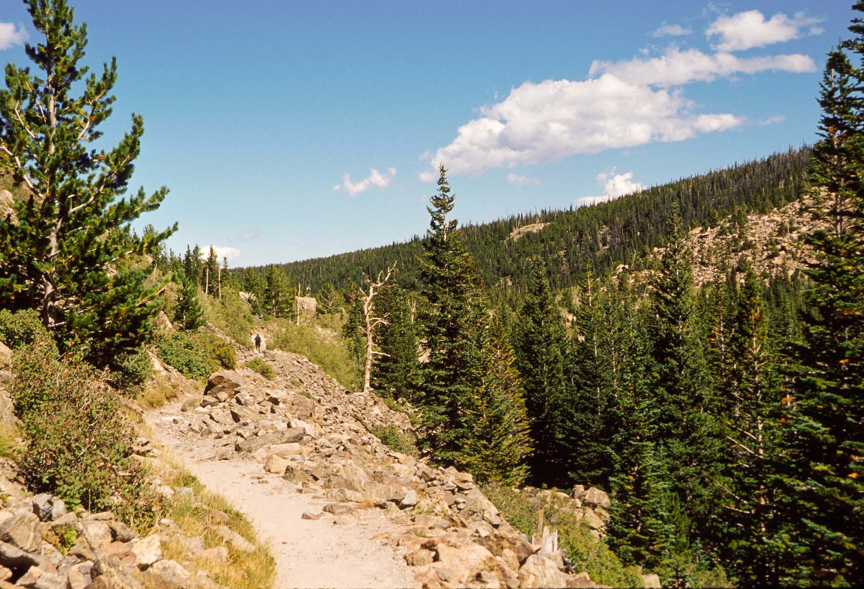
Sky Pond Trail
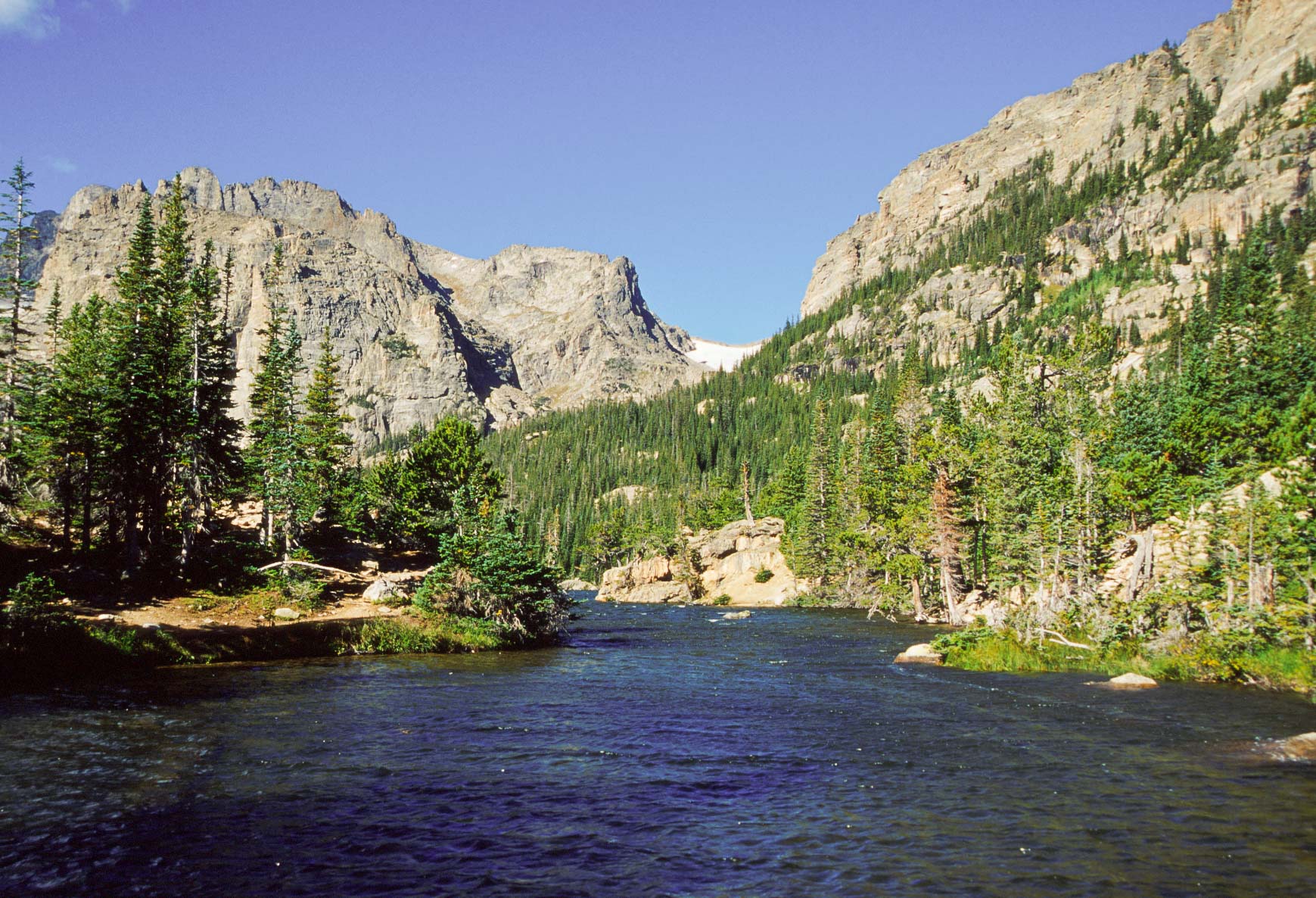
The Loch - Taylor Peak and Taylor Glacier in the background
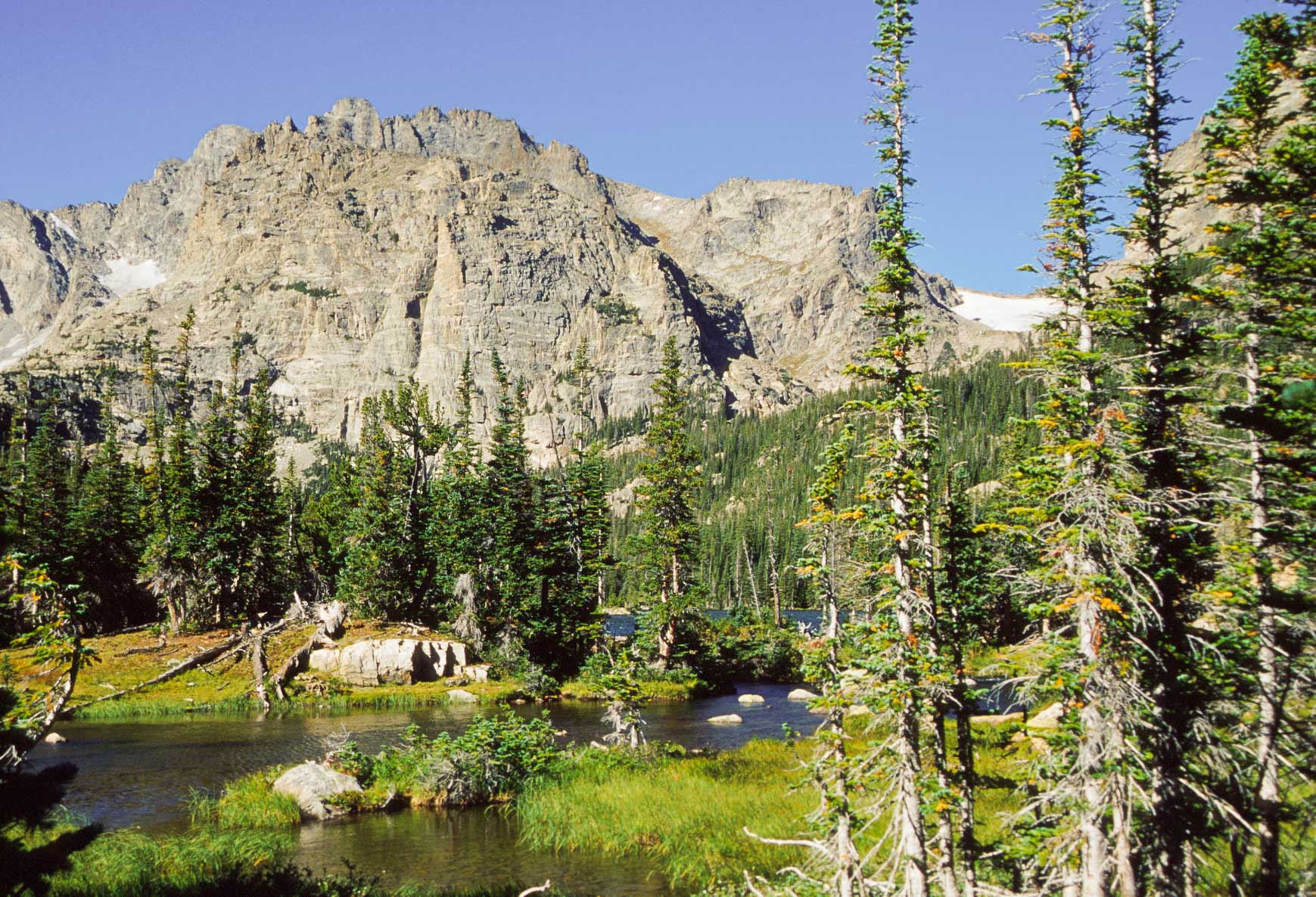
The Loch
Loch Vale, commonly know as "The Loch" is a sub-alpine lake and the first one encountered on the
way to Sky Pond. The Loch is the largest of the three lakes on this hike and to my mind the prettiest
(but not the most dramatic). Taylor Peak (13,153 feet) and Taylor Glacier are directly across from the
foot of the lake. Thatchtop Mountain (12,668 feet) is to the south and The Sharkstooth (12,829 feet) is
to the southwest.
Just below Lake of Glass there is a waterfall that is not marked on many maps.
It also happens to be marmot country.
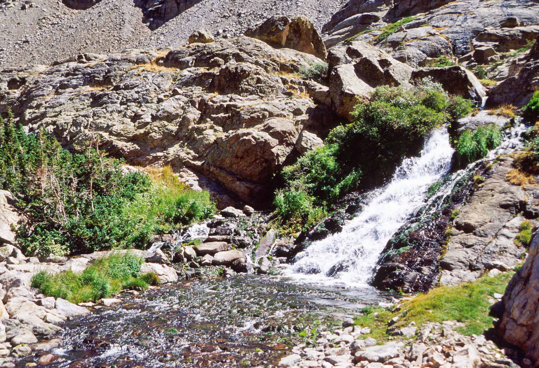
Waterfall below Lake of Glass
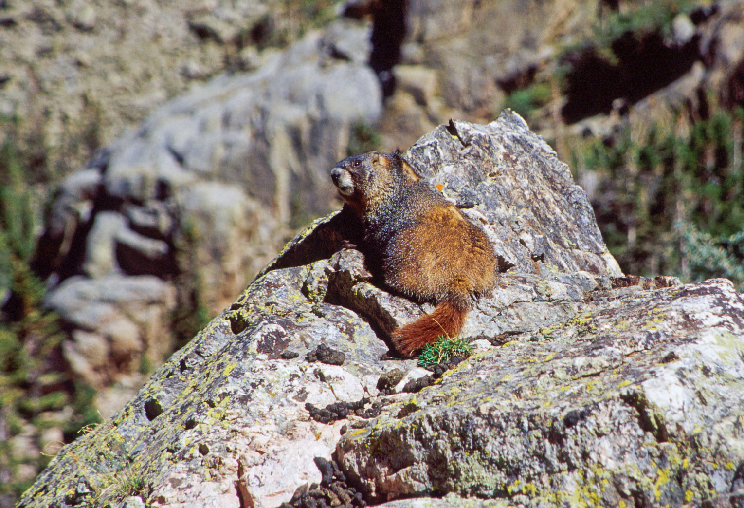
Marmot Varmint
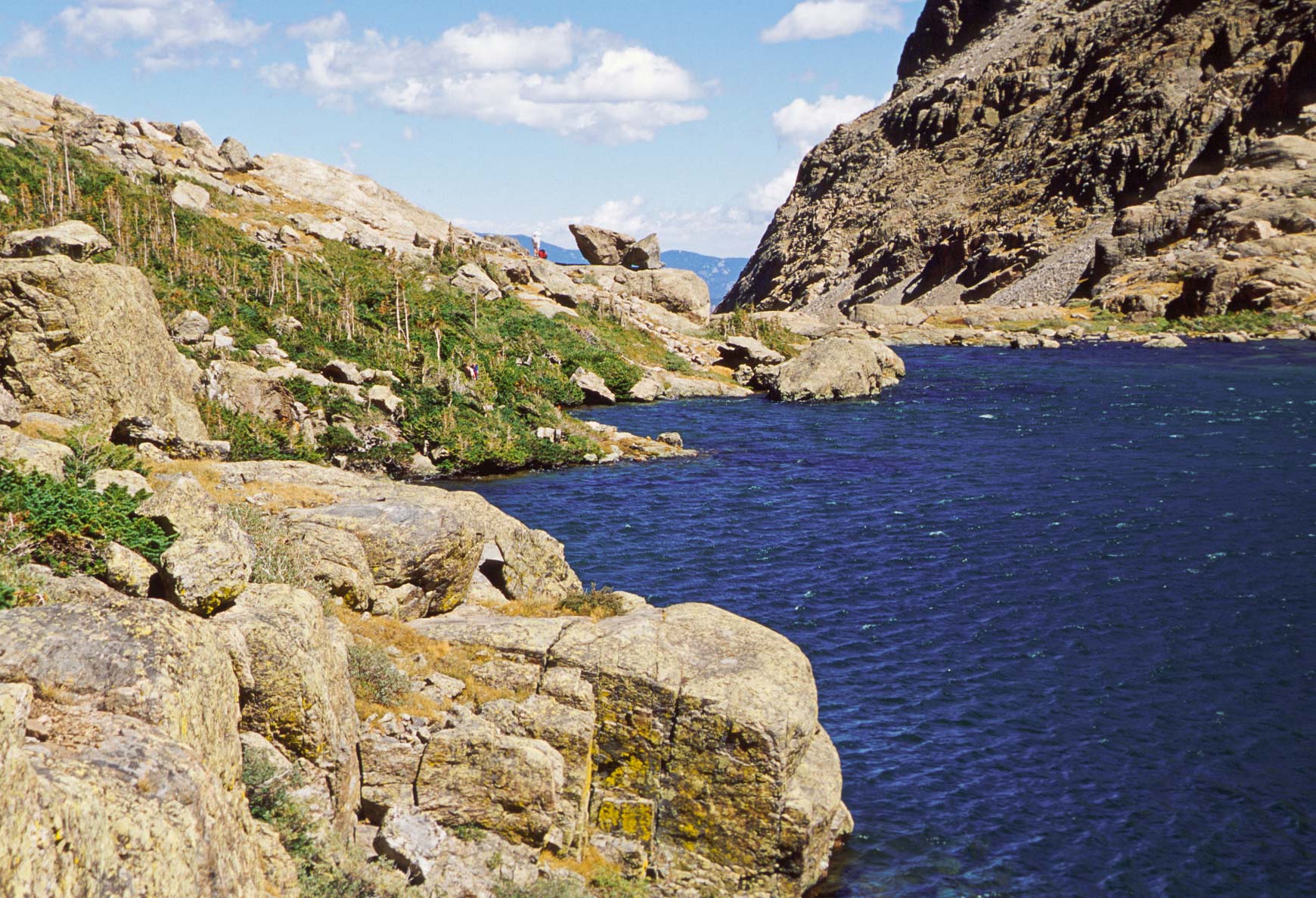
Lake of Glass

Lake of Glass viewed from Sky Pond
Lake of Glass, commonly called Glass Lake. This is the second lake on the trail and the smallest
of the three.
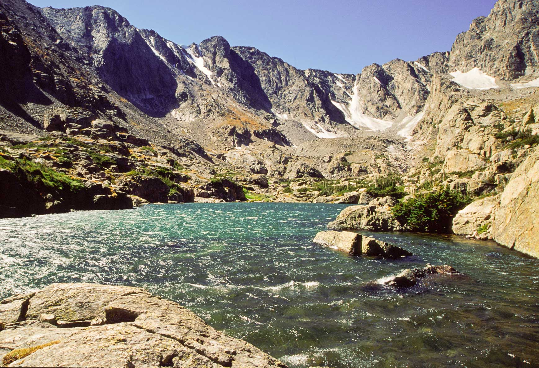
Finally, we've reached the end of the trail, Sky Pond. Sky Pond is an alpine lake that sits in a cirque at 10,900 feet. It is surrounded
on three sides by sheer cliffs which makes for a spectacular view, especially when the wind is creating whitecaps on the lake. It
is above the treeline, with the only vegitation being krummholtz. Taylor Peak's eastern face is at the head of the cirque. The Sharkstooth spires rise to
the right and Powell Peak (13,208 feet) is to the south.
Sky Pond
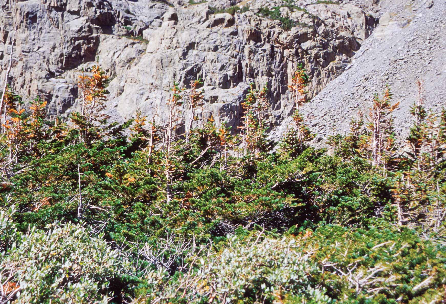
Krummholtz around Sky Pond
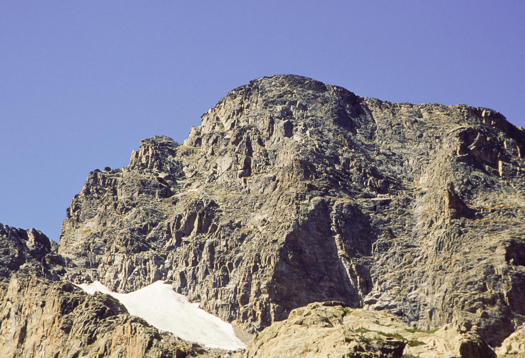
Taylor Peak

The Sharkstooth
Use the form on the Home Page to submit comments, questions, or suggestions. TD Productions Copyright © 2019