Mesa Verde National Park Volume 1
Cliff Palace was "discovered" by the Wetherill boys in December of 1888, although
thousands of people knew about the cliff dwelling before that. They just weren't Anglos. In the
following years the Wetherills explored close to 200 Mesa Verde structures, removing and selling artifacts
to museums and private collectors. In 1891, Gustaf Nordenskiöld was the first to excavate several
sites in a quasi-scientific manner, although he too amassed a sizeable collection of artifacts that
now resides in the National Museum in Helsinki, Finland. Artifact collecting (looting) and cliff dwelling
vandalism became an American pastime as the cliff dwellings became more publicized. Finally Congress
and President Teddy Roosevelt put a stop to it by making Mesa Verde a National Park in 1906. Since then
the Park has become a cultural icon, with visitation in the millions per annum. To date, close to 4,000 sites
and over 600 cliff dwellings have been found in the Park.
I used to live about 40 miles from Mesa Verde and have visited there often, usually when chauffeuring
friends and family around. The Park offers hundreds of Kodak moments, so naturally I have hundreds of photos.
It took me a while, but I've maneuvered some of them into what I consider to be a pretty comprehensive tour of
Mesa Verde National Park. I've divided this tour into 4 volumes. This is Volume 1 and covers noteworthy features
from the Park entrance to the Far View Area. Volume 2 is all about Chapin Mesa, while Volumes 3 and 4 cover the
major cliff dwellings in the cliffs of Chapin Mesa and Wetherill Mesa.
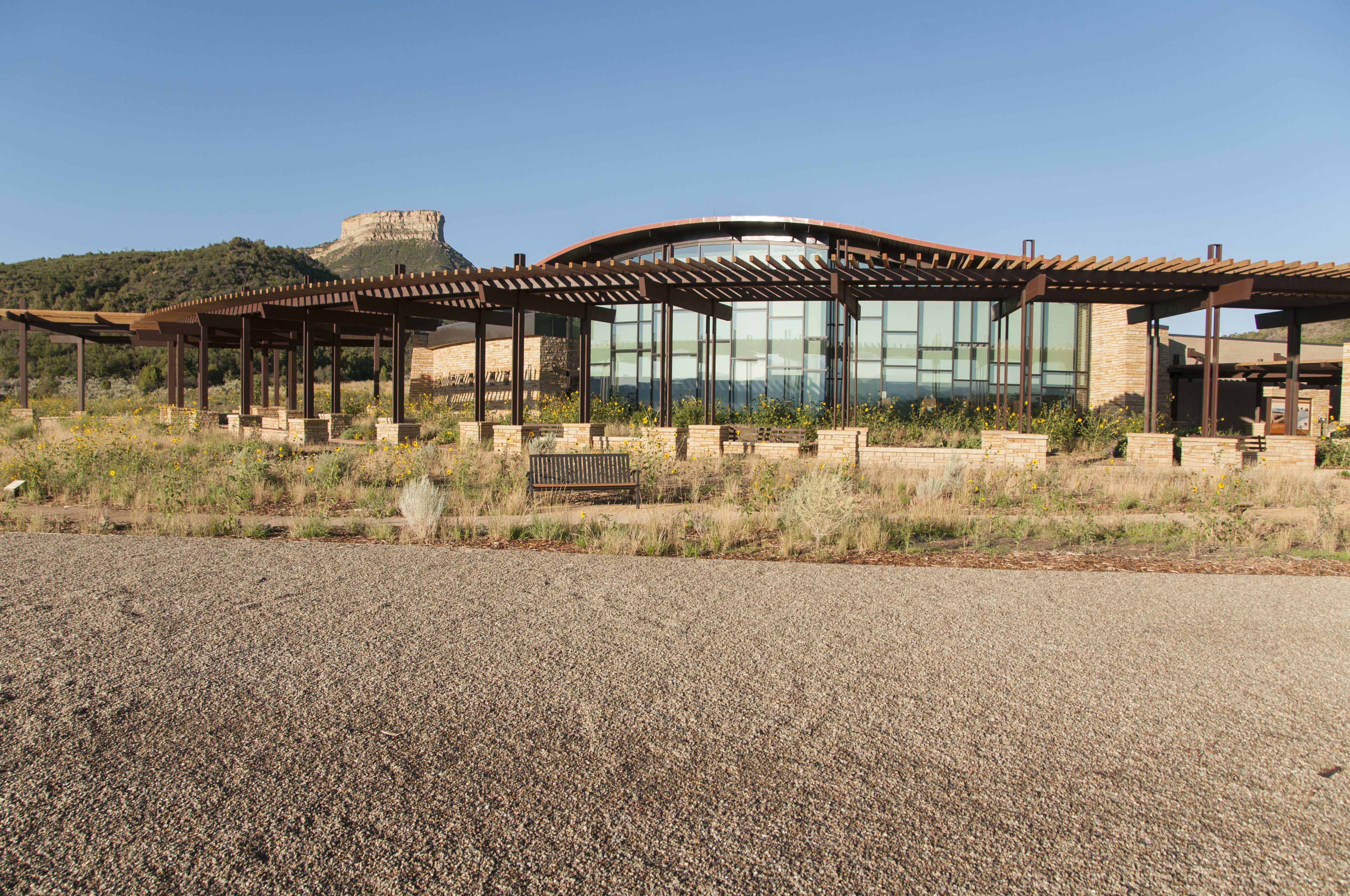
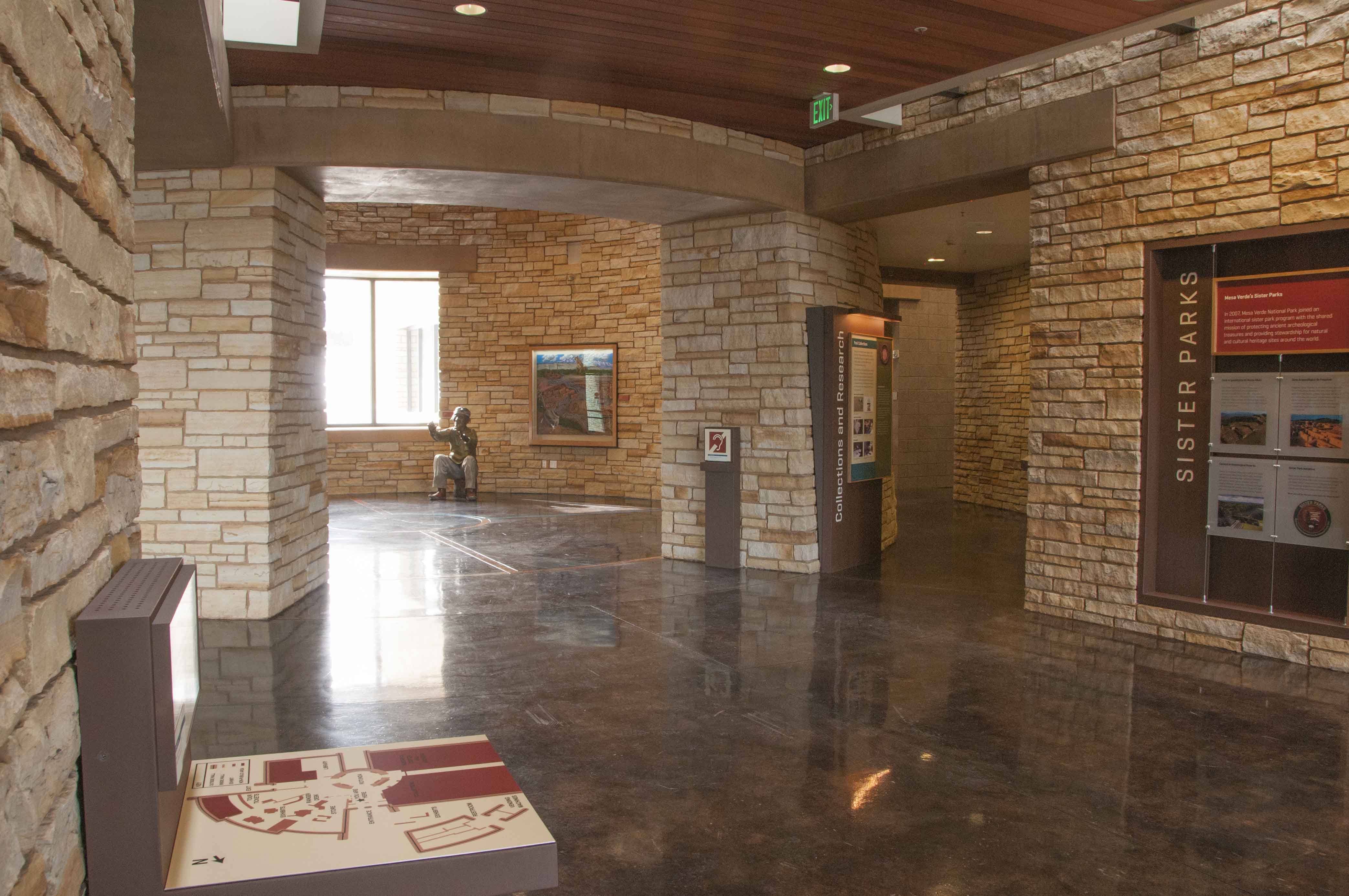
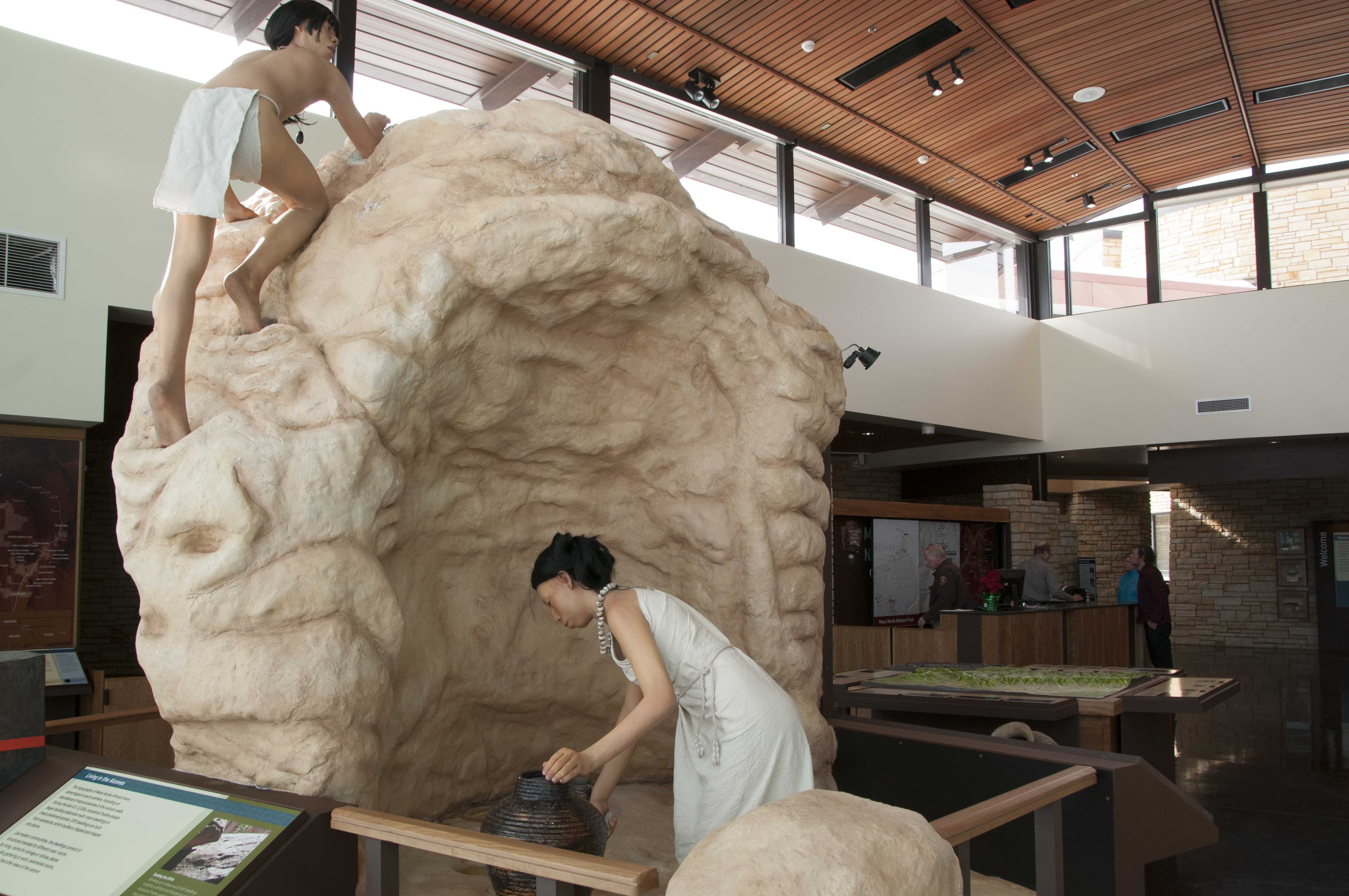
Mesa Verde National Park Visitor and Research Center
The new Visitor and Research Center, located at the park entrance, opened in December of 2012. It houses
storage and research facilities for the park's archives and museum collection, as well as diplays and an information
desk for visitor orientation and tour tickets. It replaced the old Far View Visitor Center.
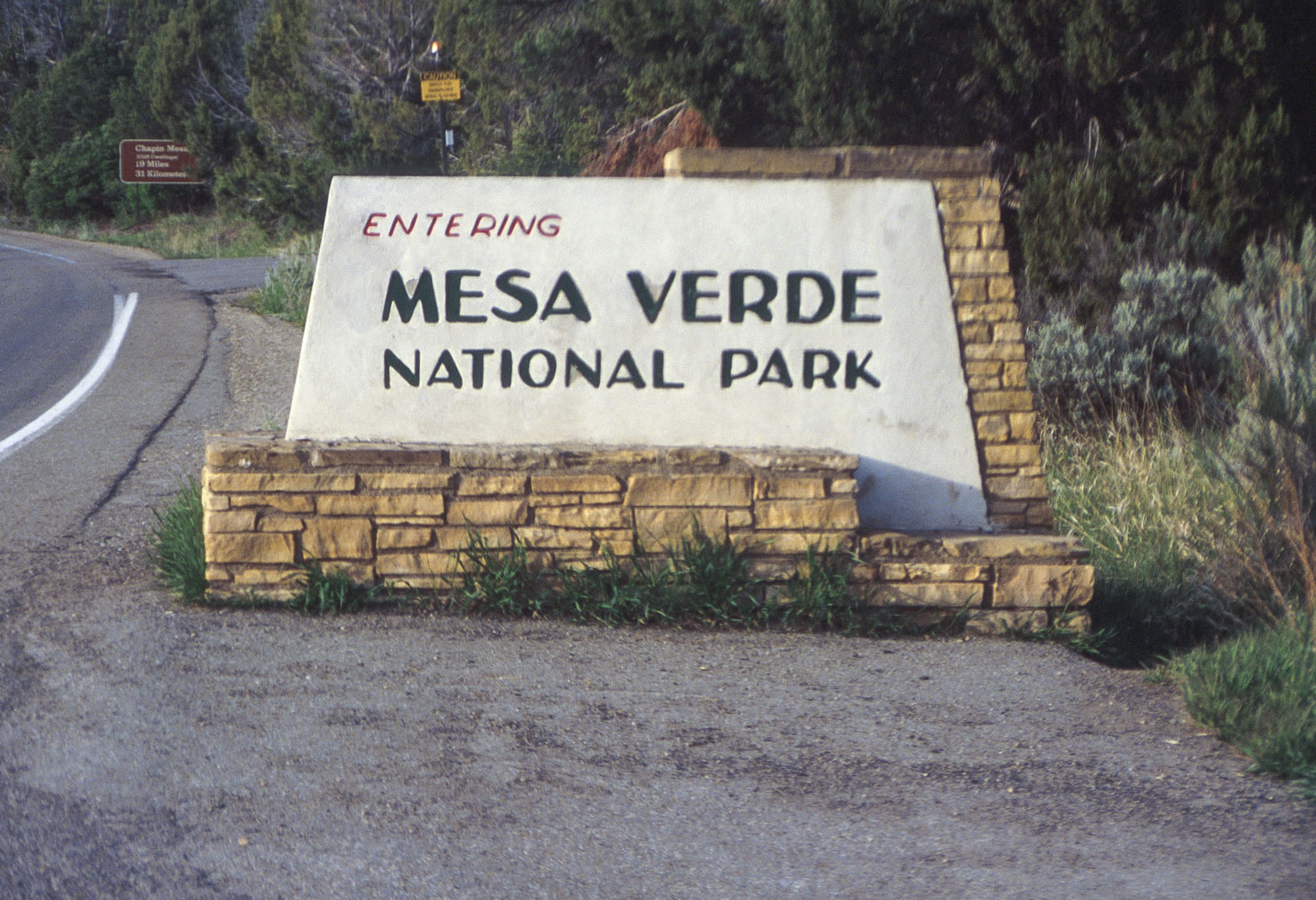
Park sign (1995)
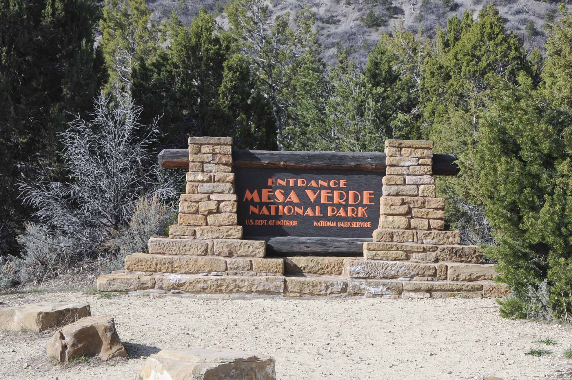
Park sign (2008)
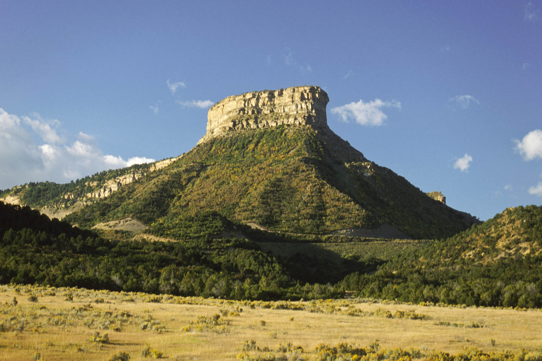
Point Lookout
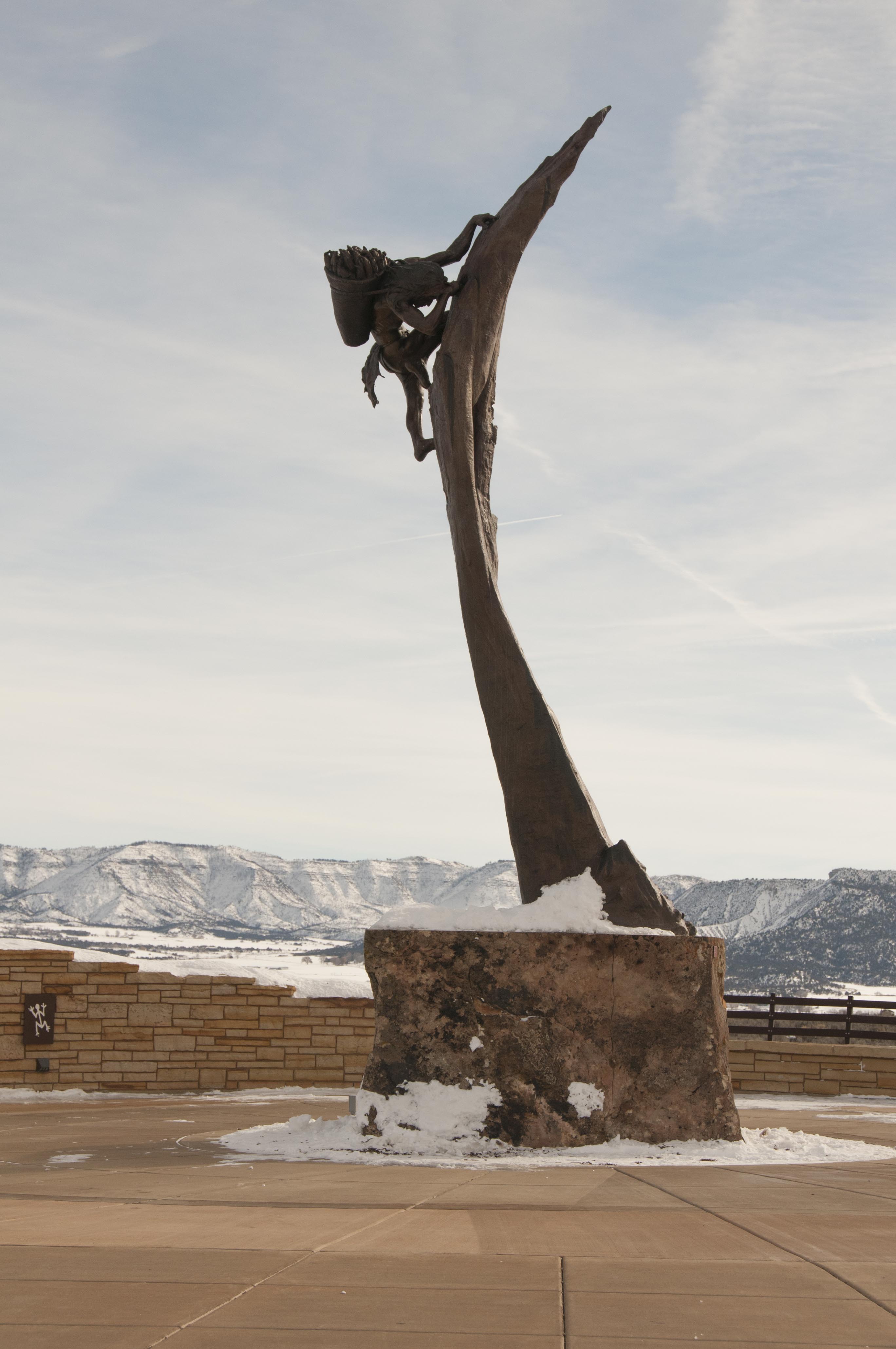
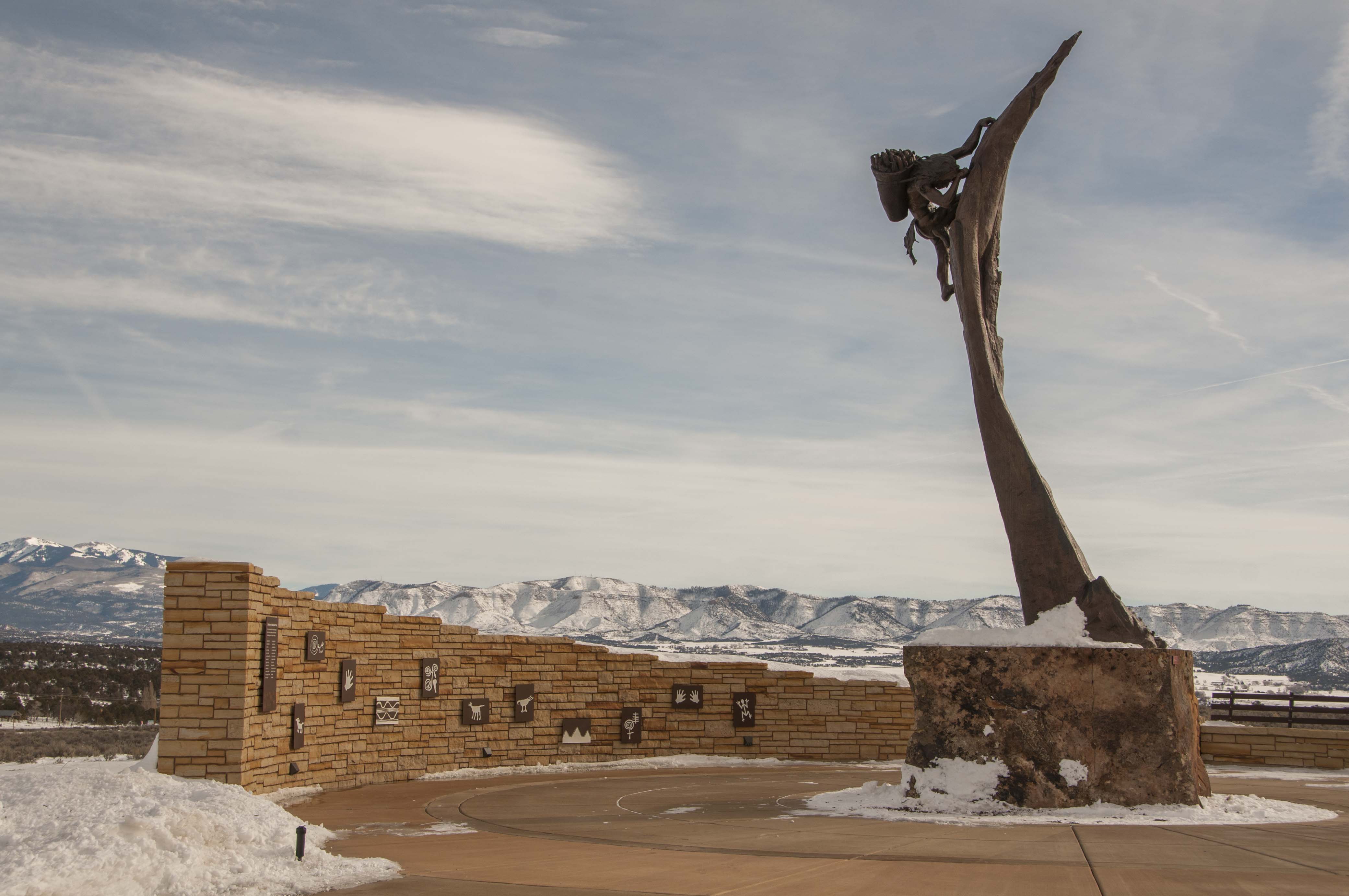
"The Ancient Ones"
by Edward J. Fraughton
"The Ancient Ones"
by Edward J. Fraughton
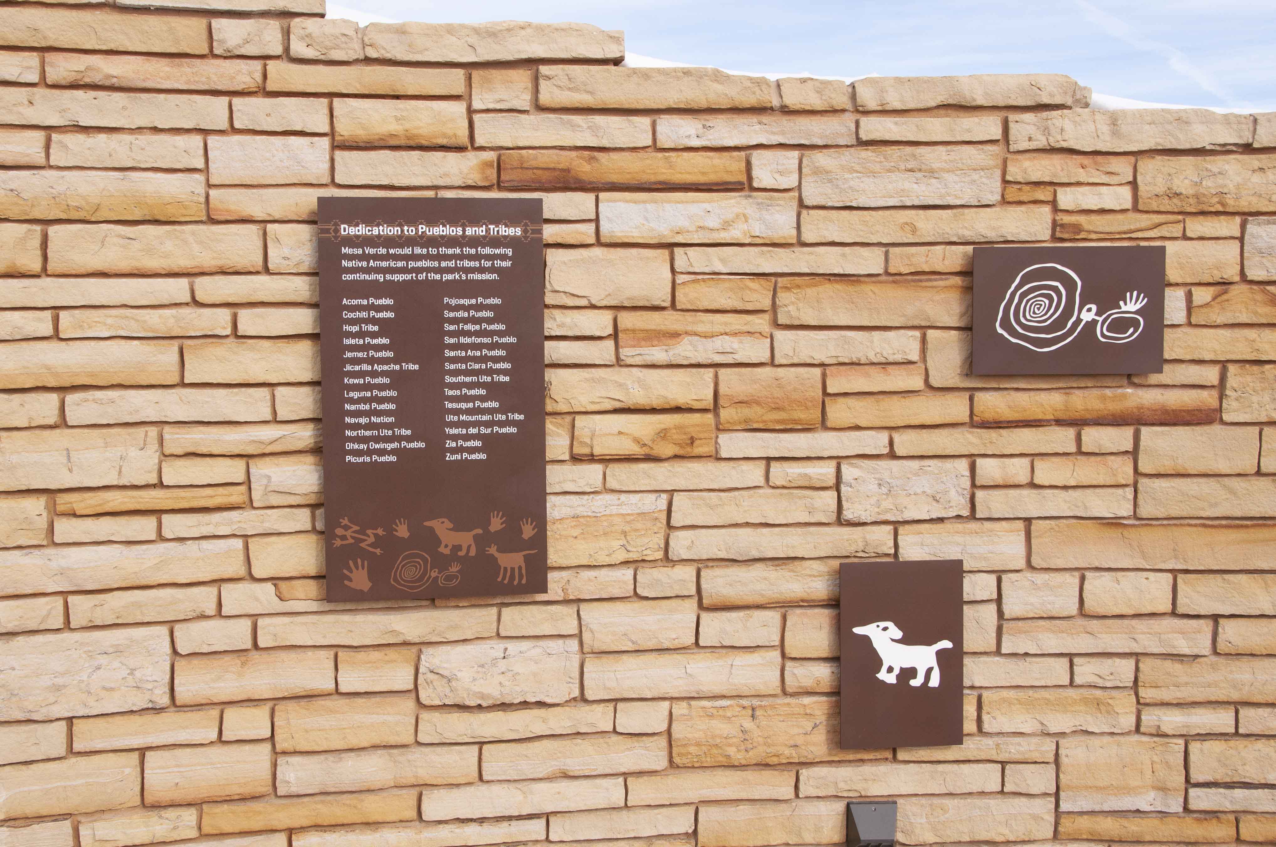
Dedication wall
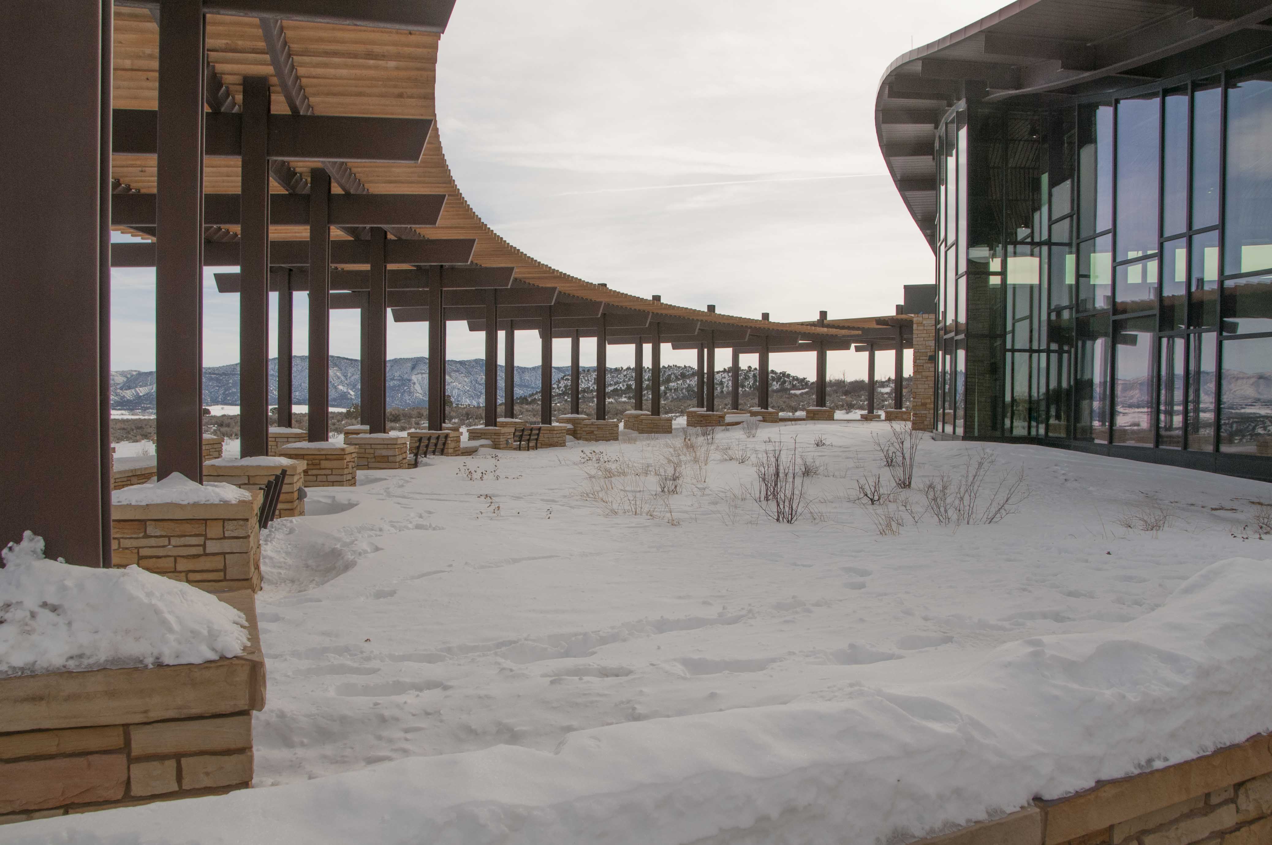
Visitor Center colonnade (Jan 2013)
Visitor Center colonnade (Aug 2013)

Visitor Center entrance

Mesa Verde National Park
Visitor and Research Center
Foyer and rotunda
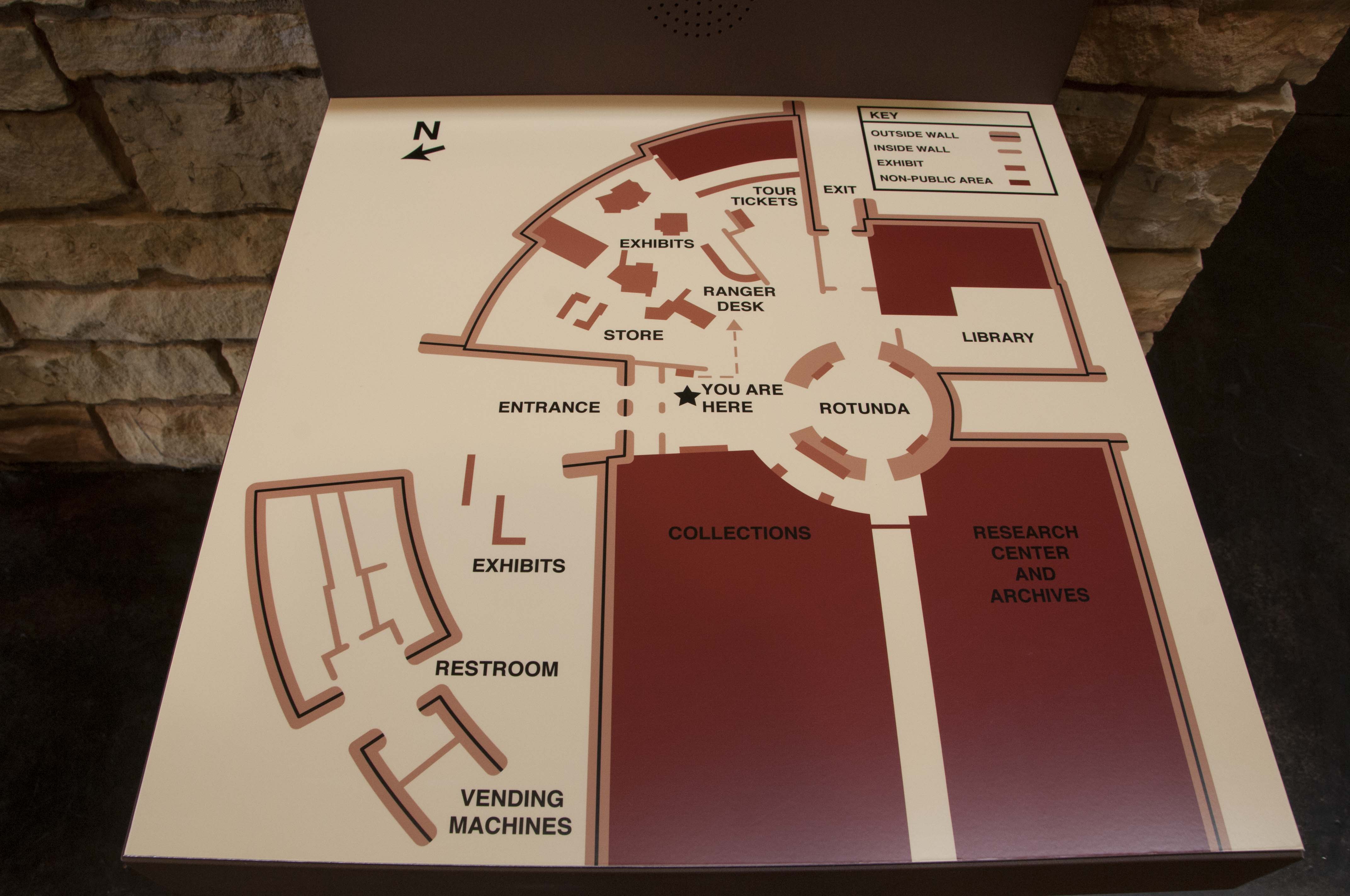
Visitor Center map
Visitor Center display

Visitor Center display
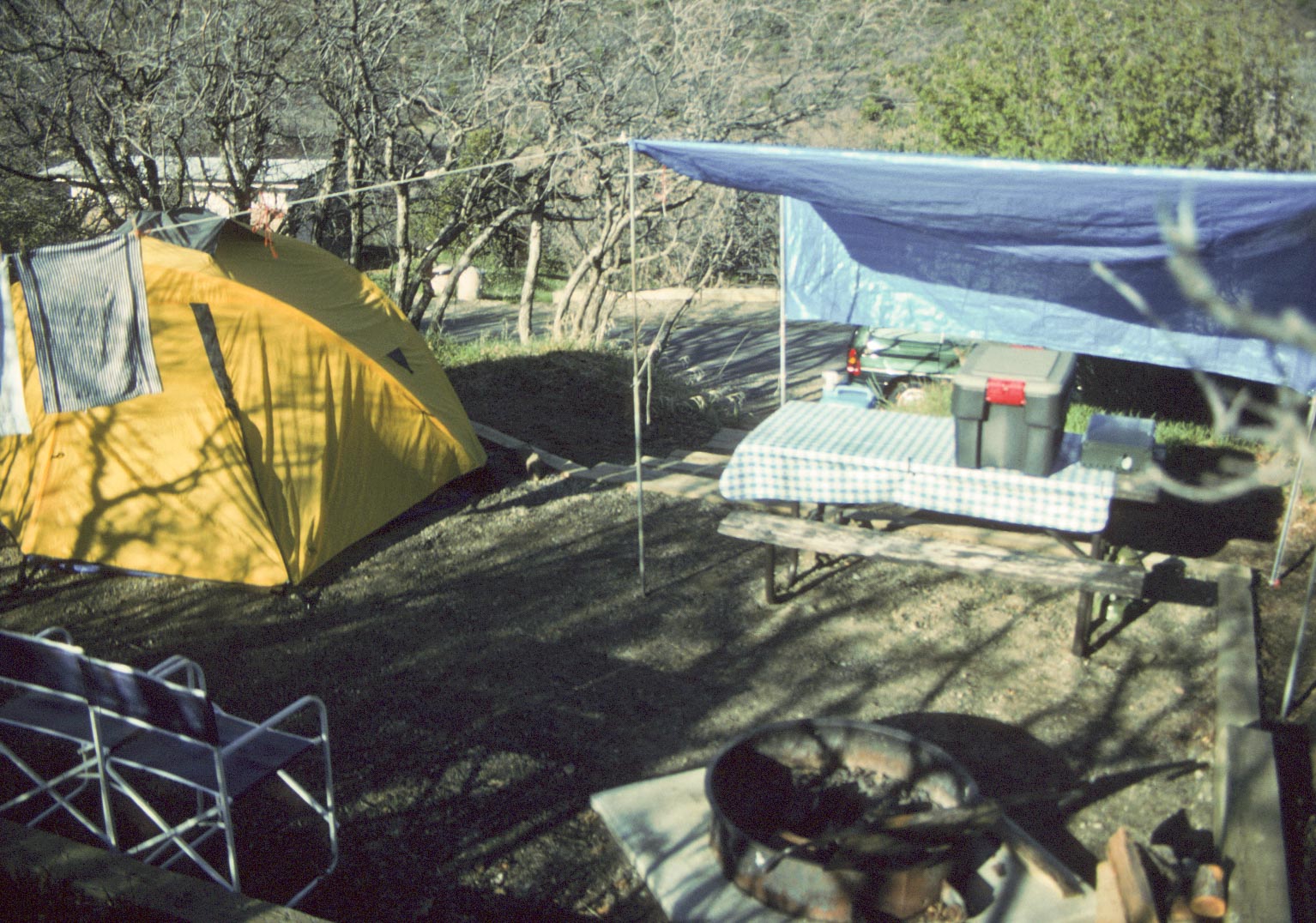
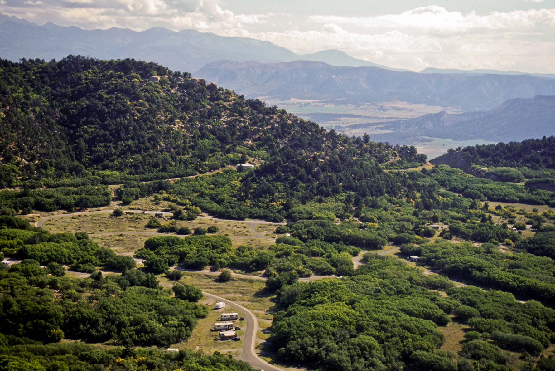
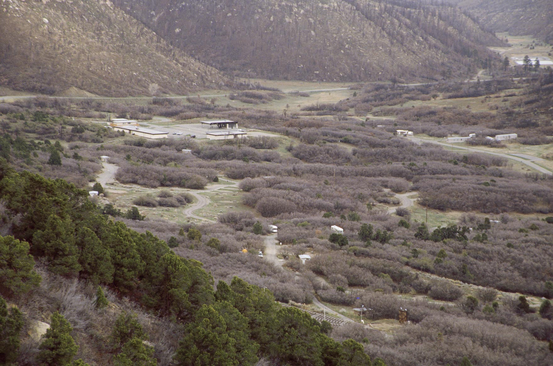
Morefield Campground and Village
Morefield Campground is the only campground in the park, open from the middle of April through
the middle of October. There are 267 campsites avilable on a first-come first-served basis.
Morefield Village has a restaurant (the Knife Edge Cafe) and a camp store (camping supplies,
sundries, groceries, and gifts). You can board your pets at the Morefield Village Kennel.
There are 3 trails from the campground, Point Lookout (4.4 miles out and back), Knife
Edge (4 miles out and back), and Prater Ridge (7.8 mile loop).
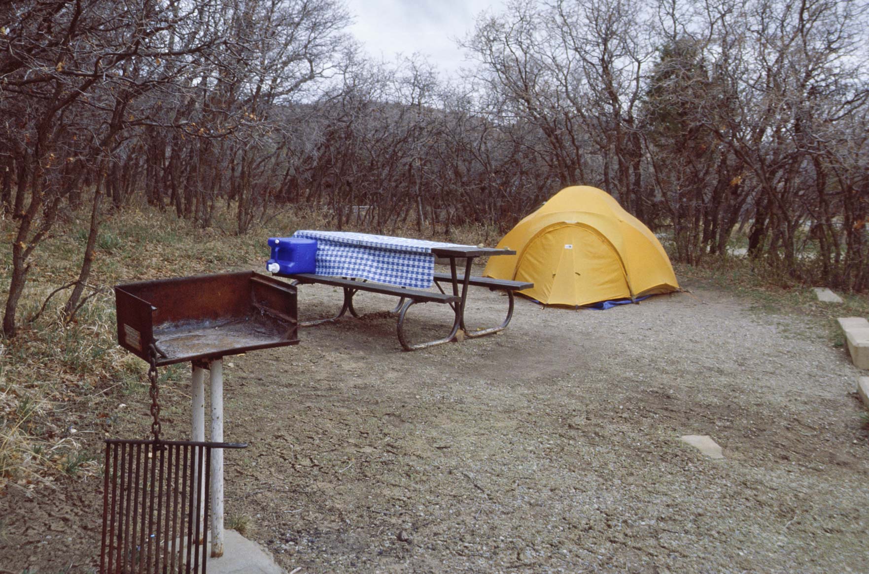
Campsite #88 Zuni Loop
Morefield Campground (1995)
Morefield Campground
View from Prater Ridge Trail
San Juan Mountains
View north from Prater Ridge Trail
Sleeping Ute Mountain
View west from Parter Ridge Trail
View south from Prater Ridge Trail

Park Road (junction with US Hwy 550 in distance)
View from Point Lookout Trail
Morefield Campground
View from Point Lookout Trail
Campsite #189 Ute Loop
Morefield Campground (2002)
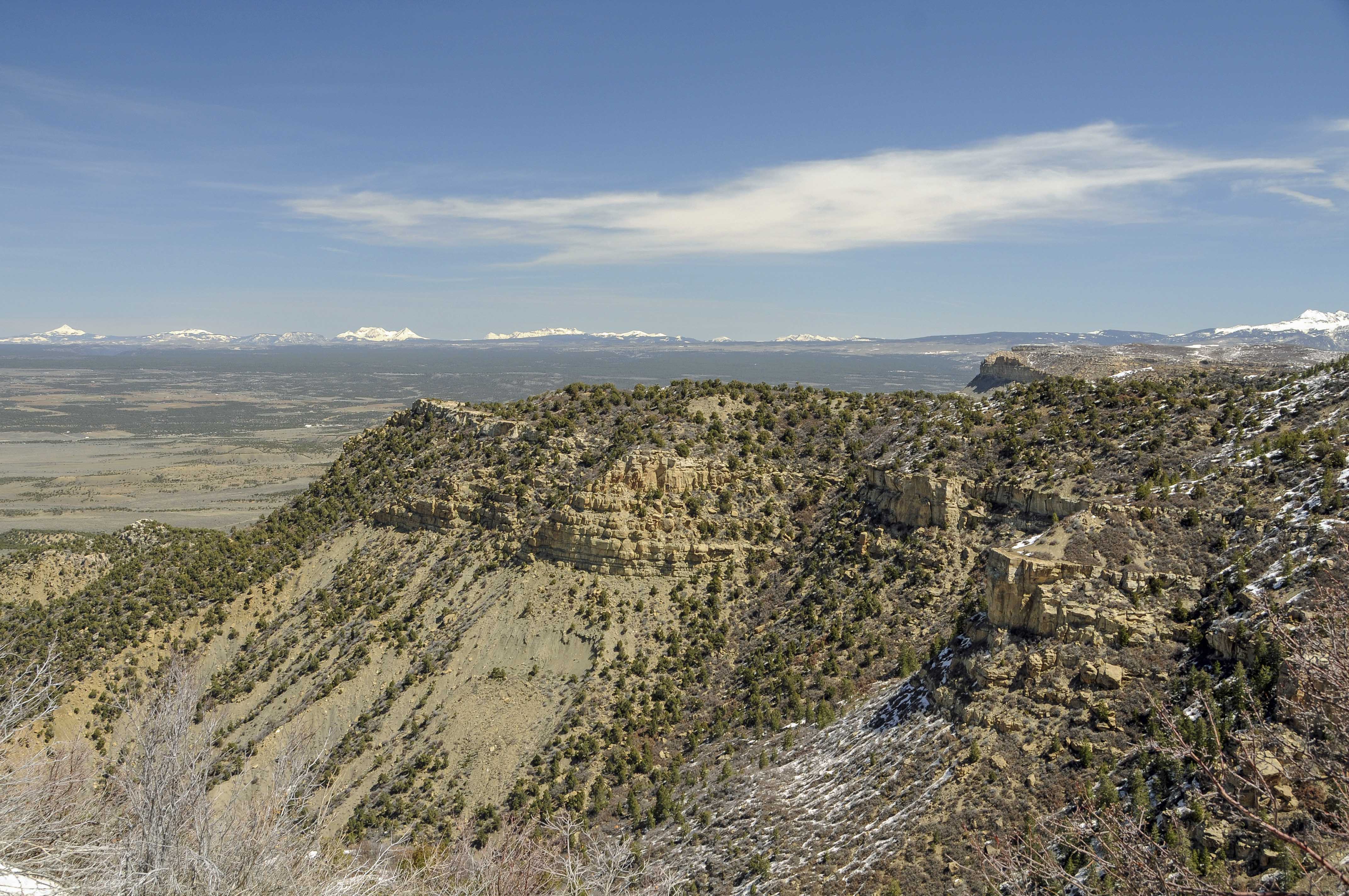
Drive to Far View Area
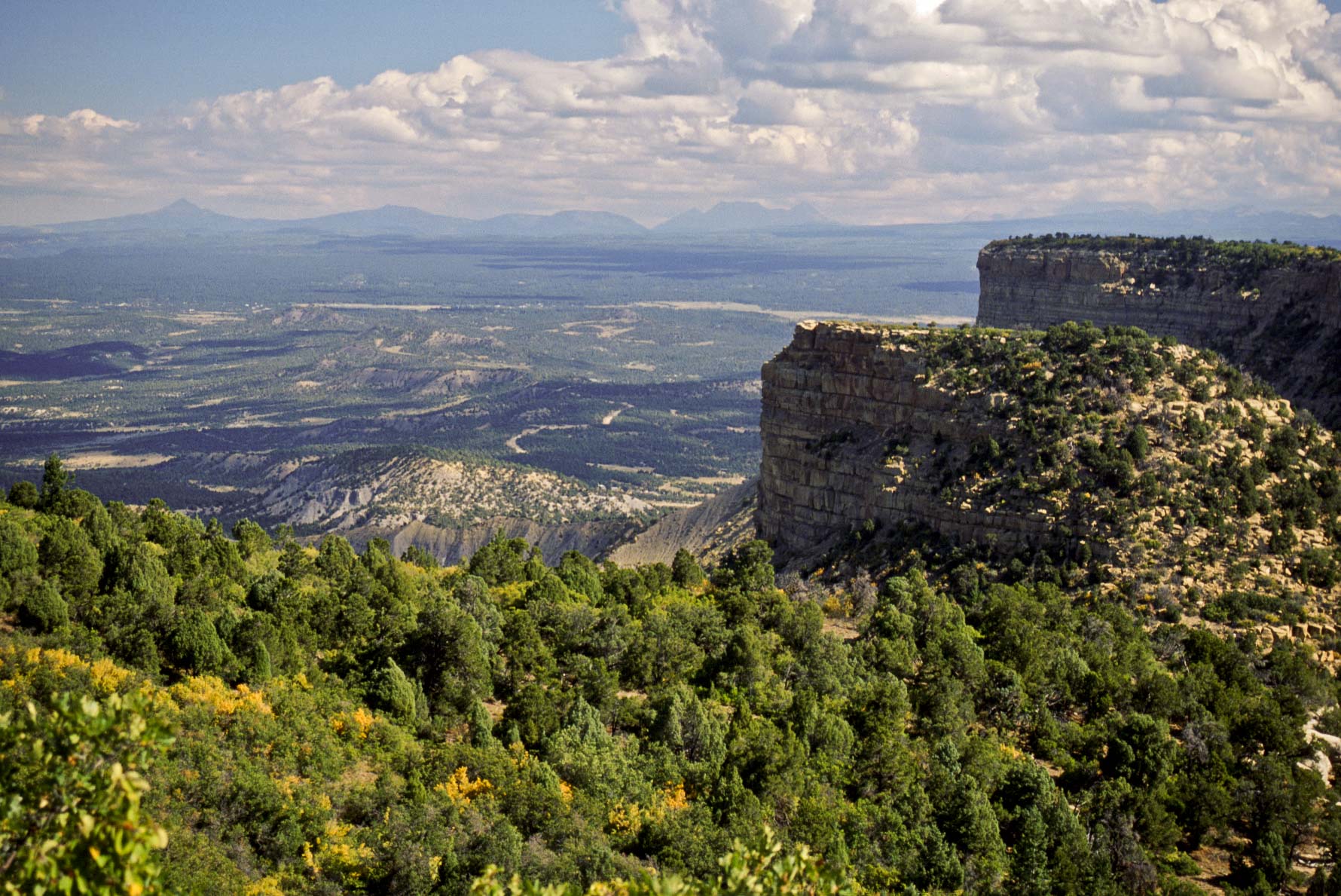
The park road from Morefield Campground to the Far View Area is a tortuous affair
that twists and turns along the north rim of Mesa Verde for several miles (I'm
guessing maybe 8 or 9). There are 3 overlooks along the way, Montezuma Valley,
Park Point, and Geologic. I generally only stop at Park Point. The Far View Area includes
the old Far View Visitor Center (now closed), Far View Lodge, and Far View Terrace.
I stayed at Far View Lodge once. It was nice (kind of 60s-ish with a southwestern flavor).
The Metate Room restaurant in the lodge was excellent (*****). Far View Terrace
has gift shops and a cafeteria.

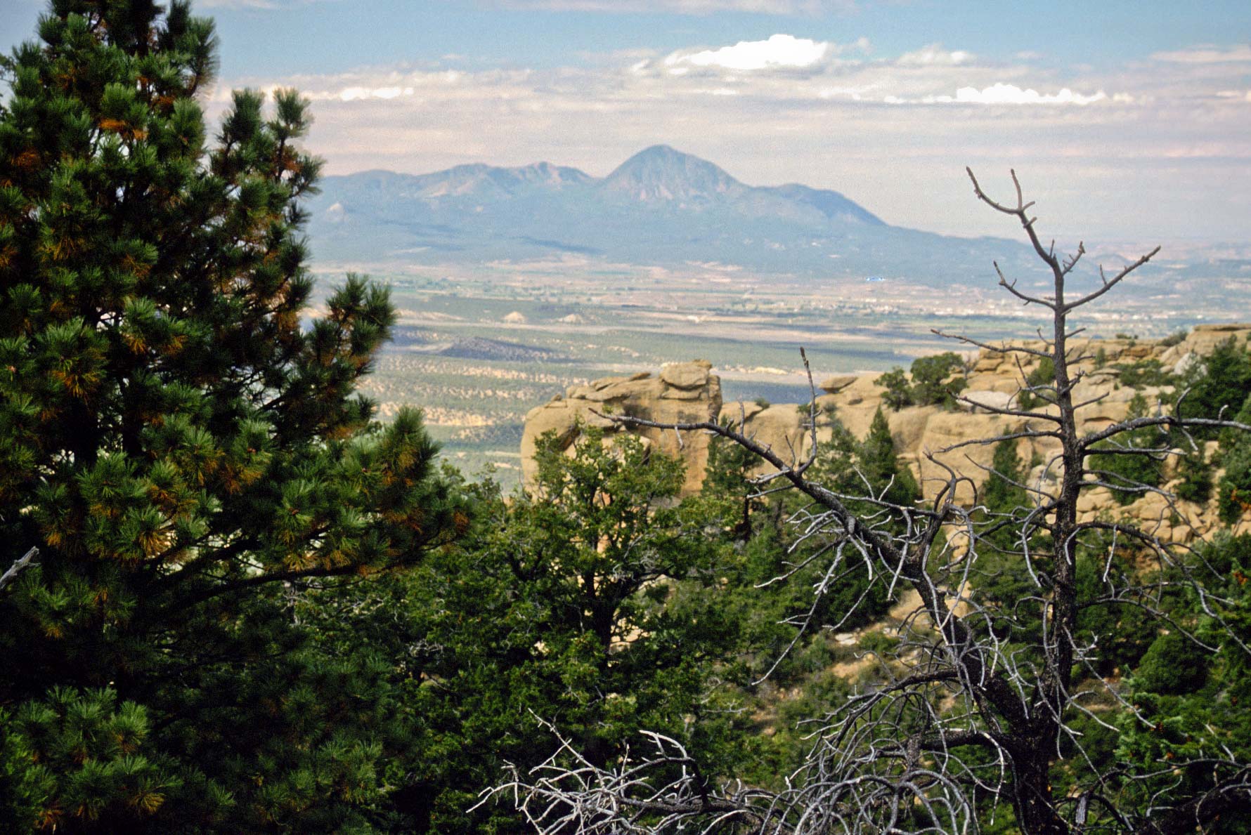
Park Point view N-NE La Plata Mountains to the right and San Juan Mountains to the left
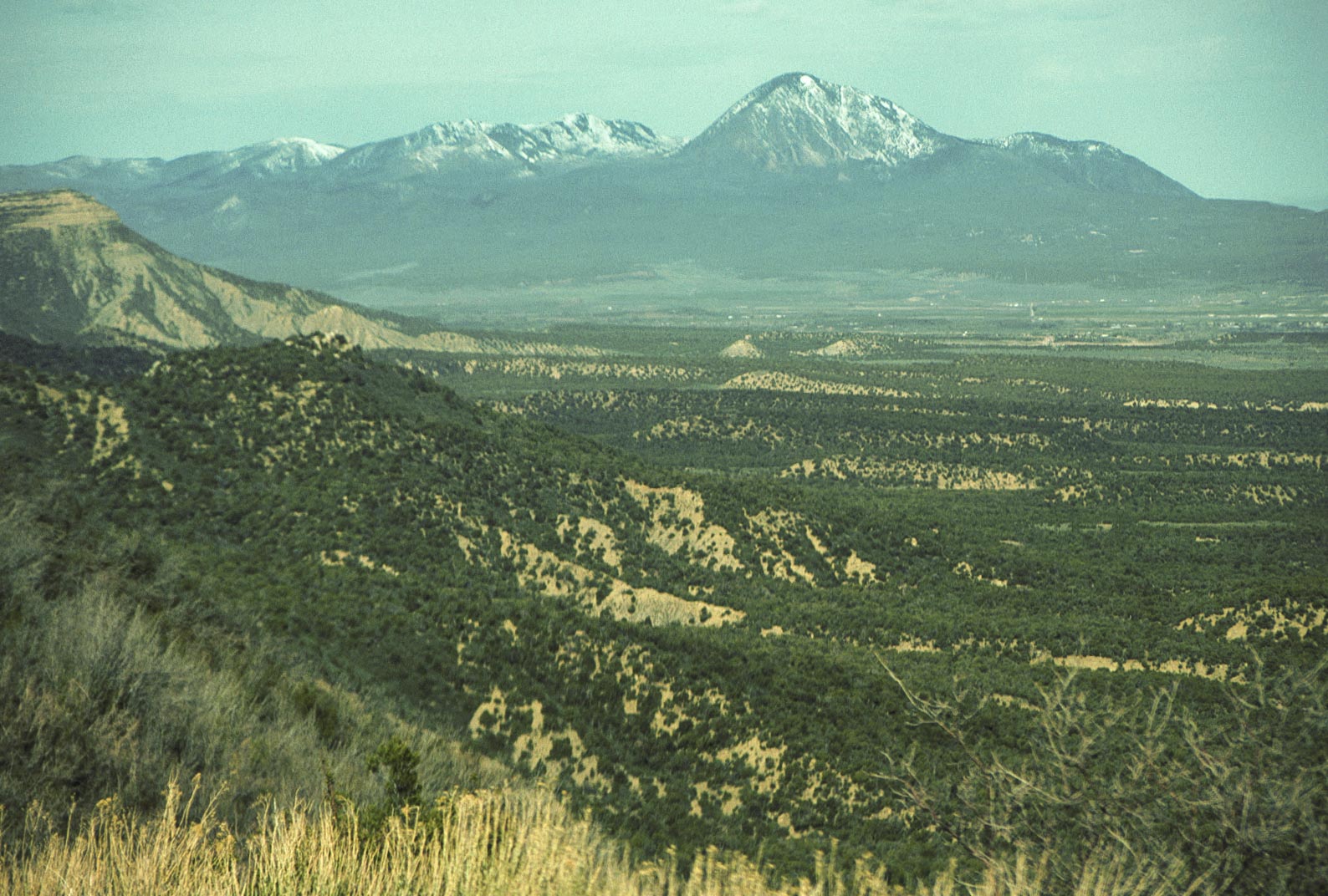
Sleeping Ute Mountain
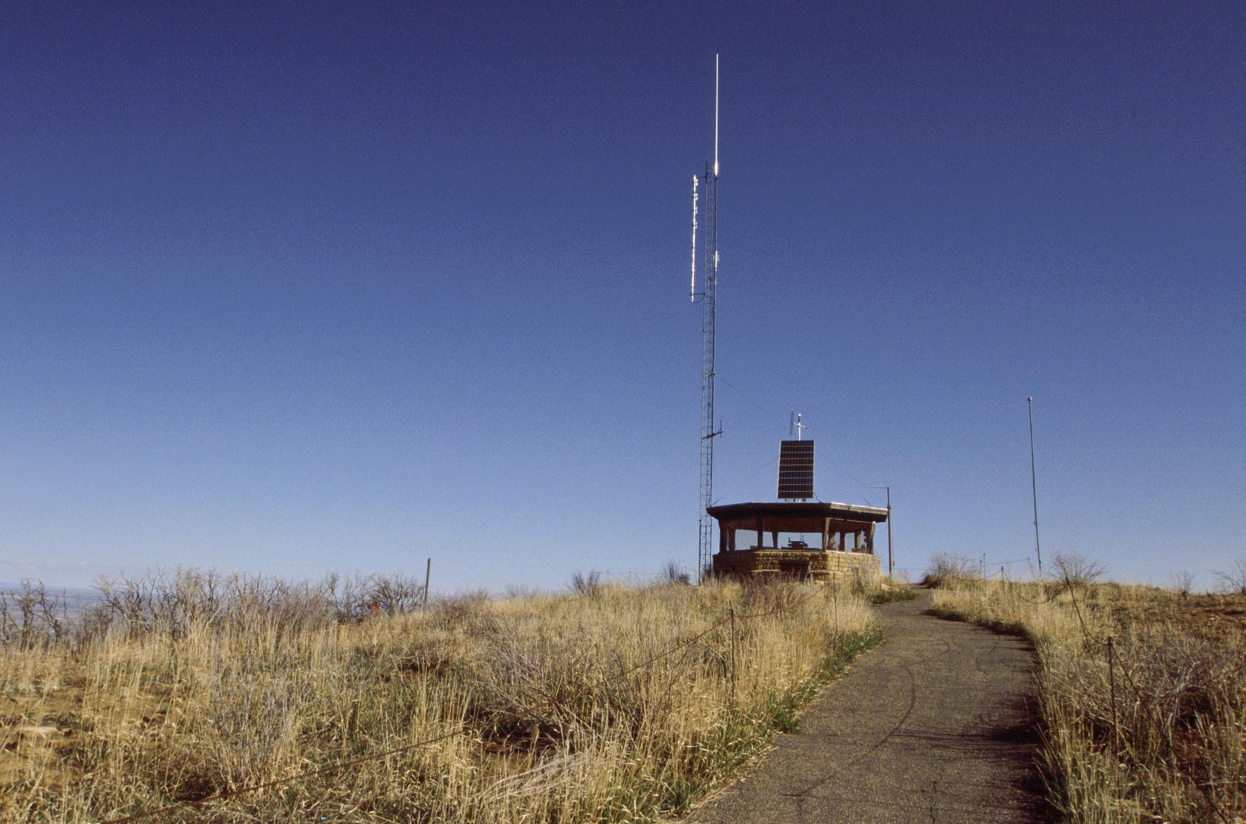
Park Point fire lookout (2002)

Burned vegetation at Park Point
Sleeping Ute Mountain in background

Park Point Fire Lookout (2012)
San Juan Mountains
View from Park Point
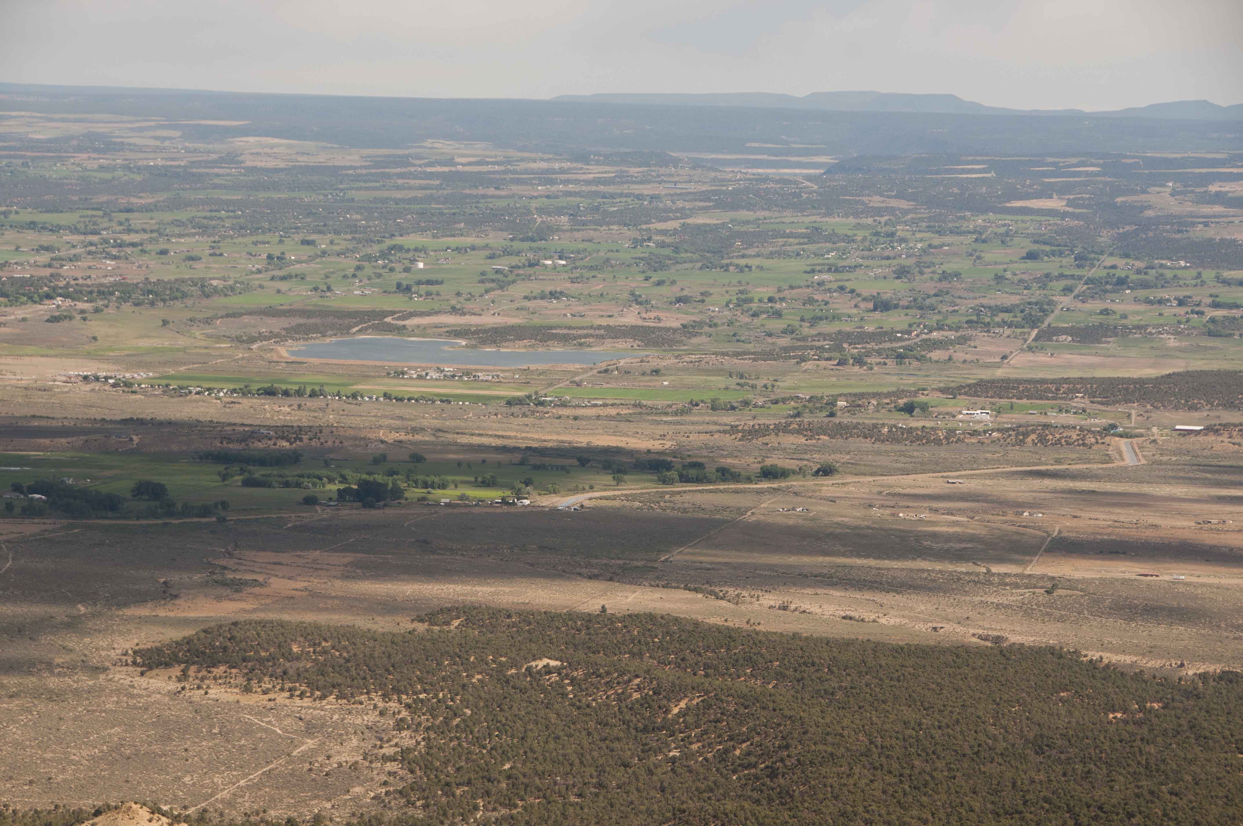
Montezuma Valley

Far View Visitor Center (1995)
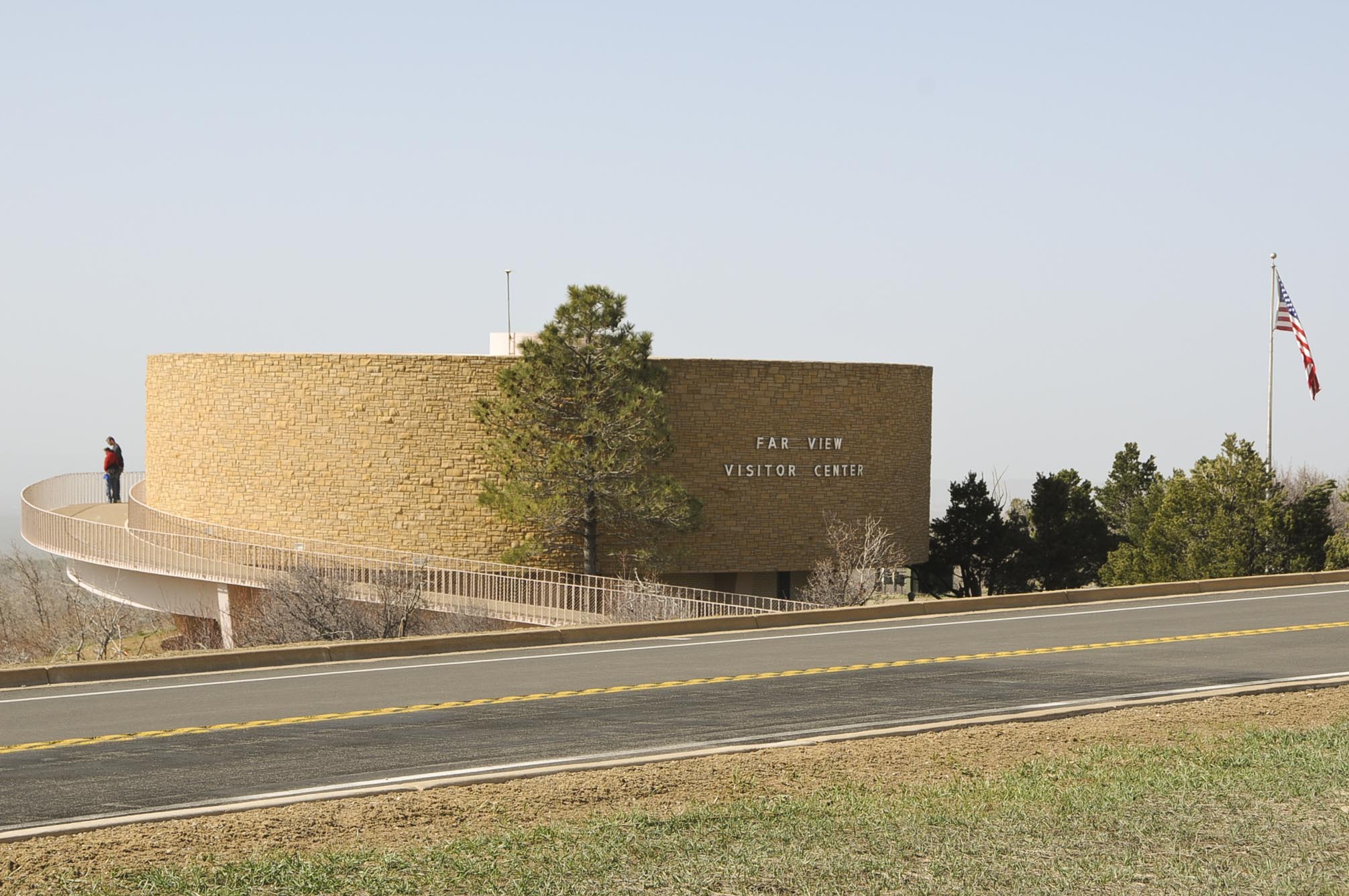
Far View Visitor Center (2008)
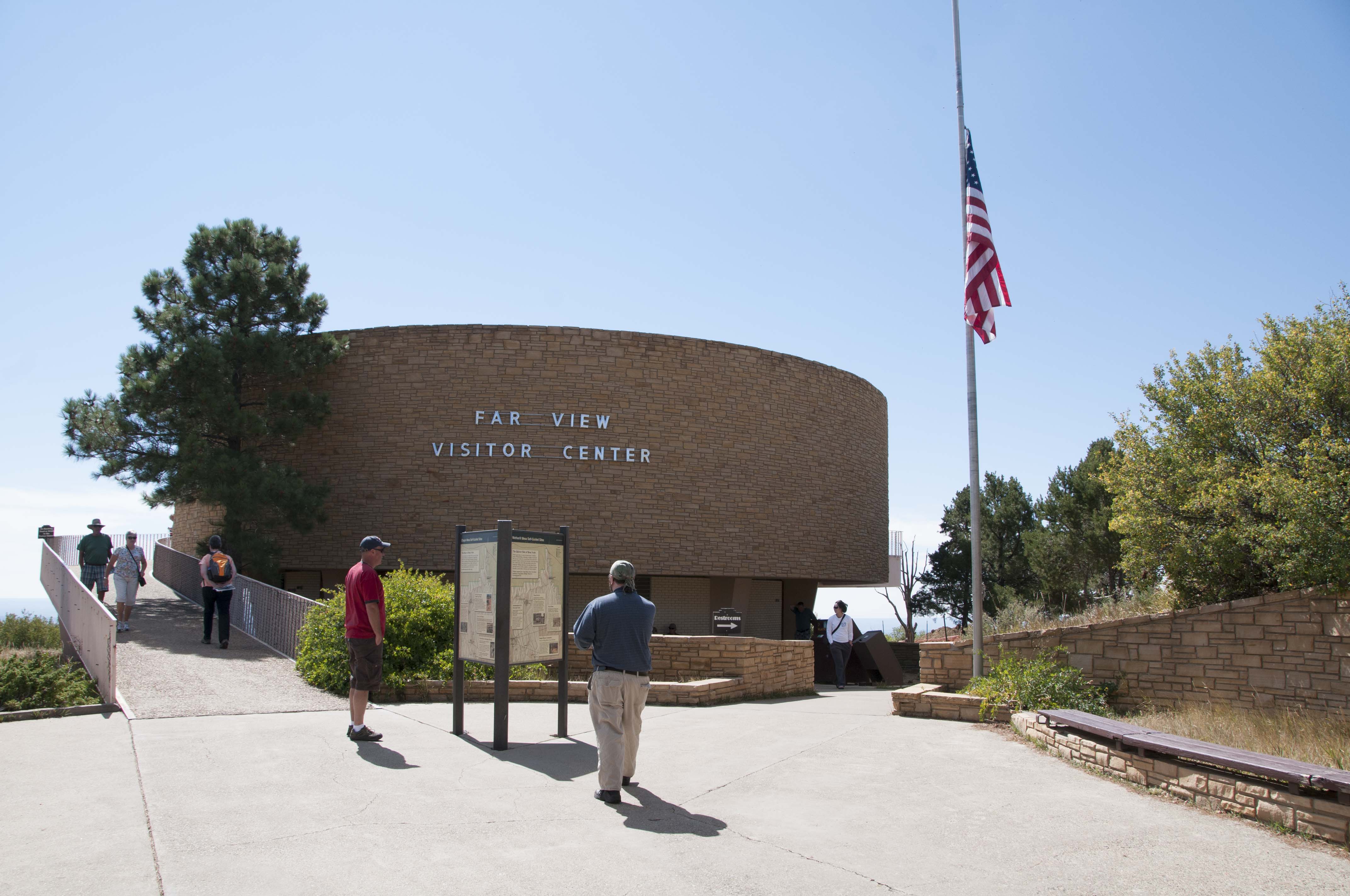
Far View Visitor Center (Sept 2012)
Visitor Center display
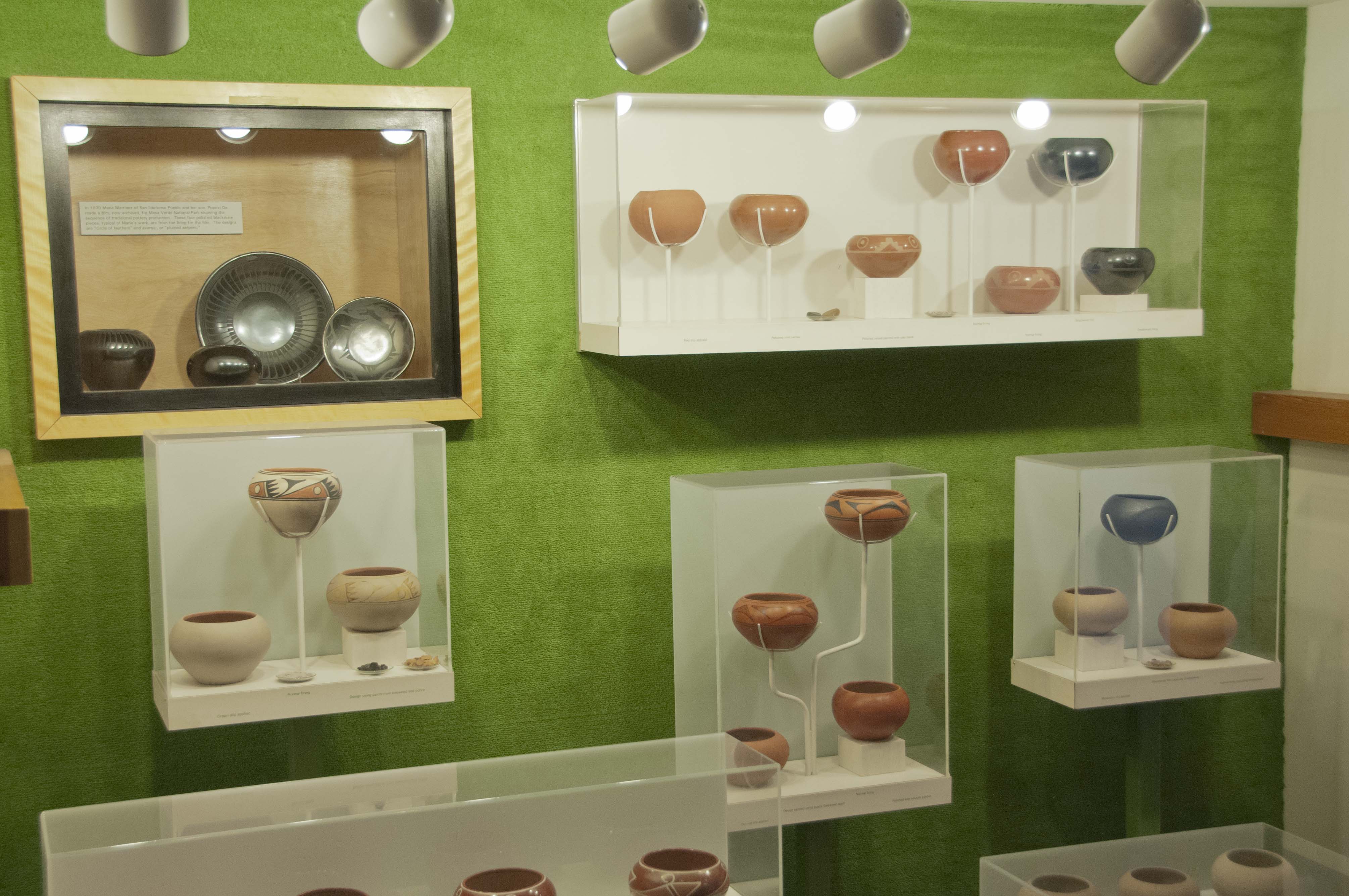
Visitor Center display
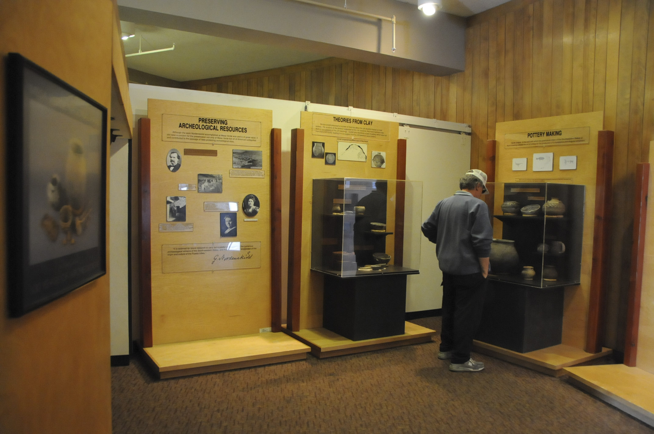
Visitor Center display

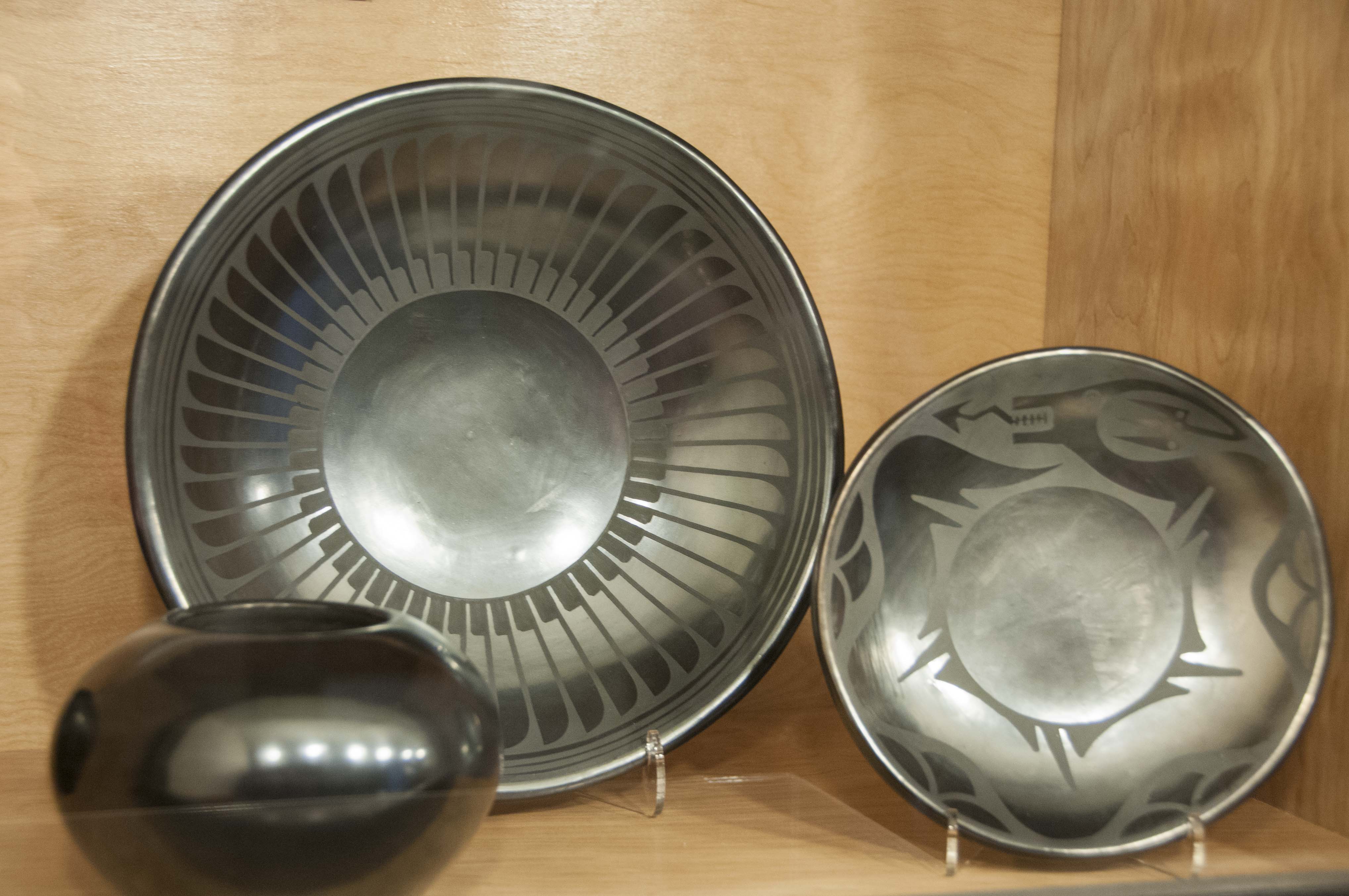
Pottery display
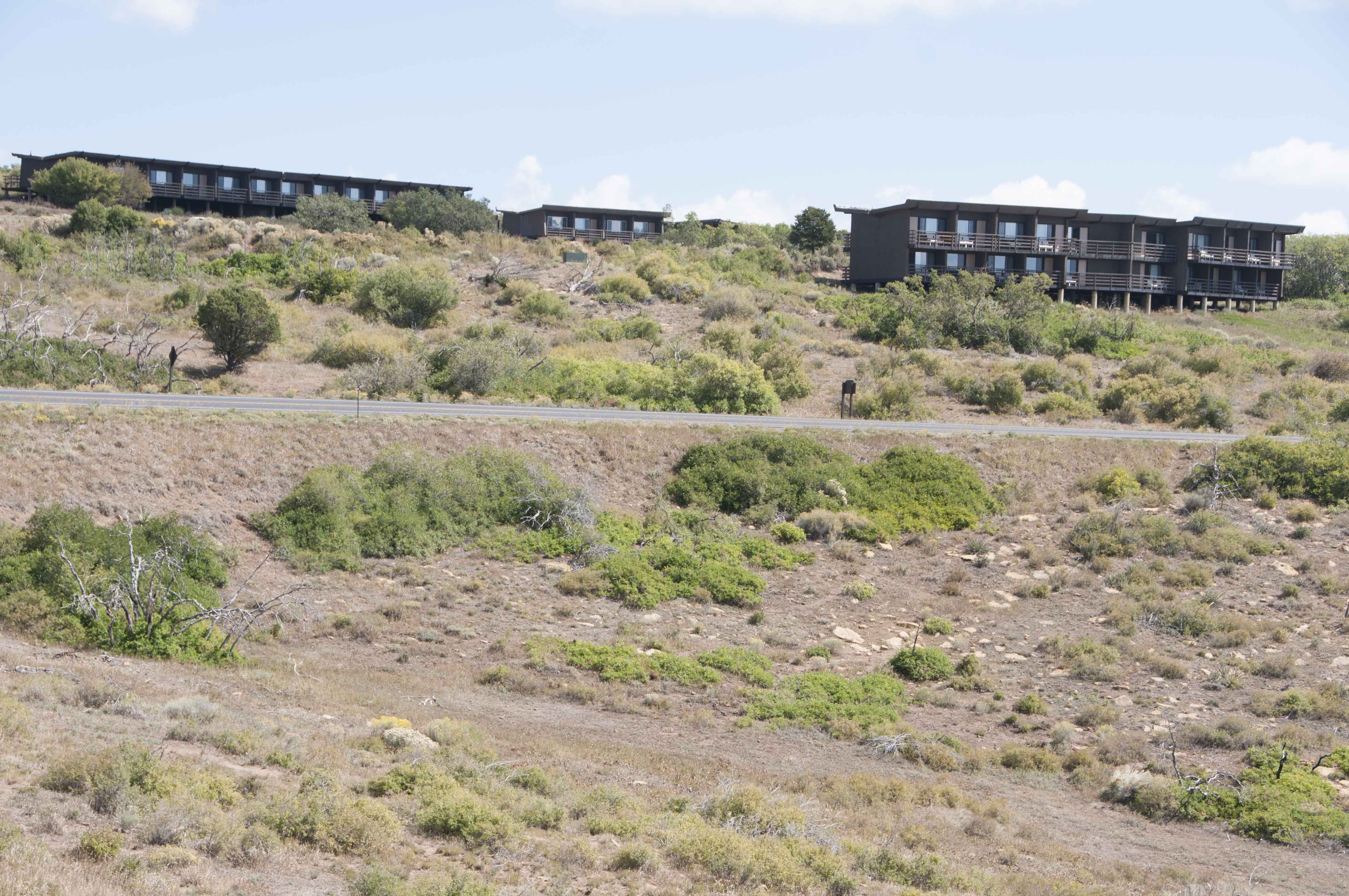
Far View Lodge
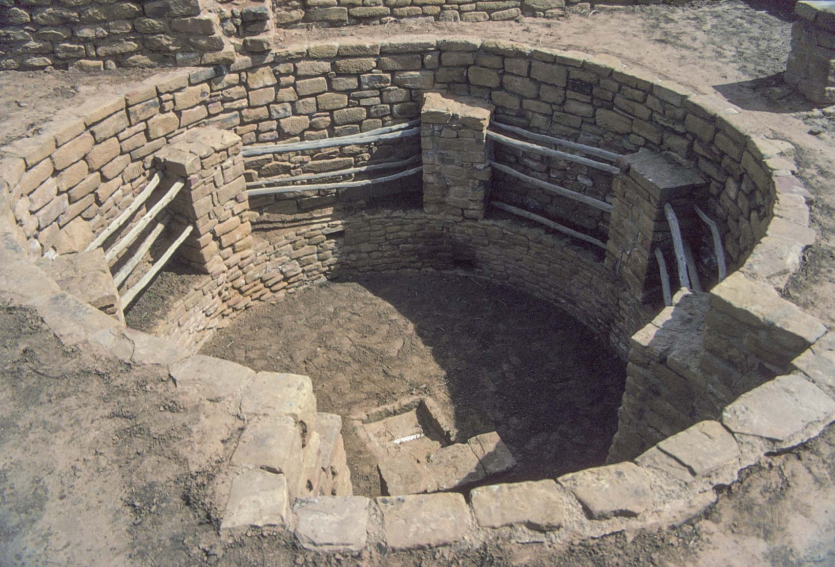
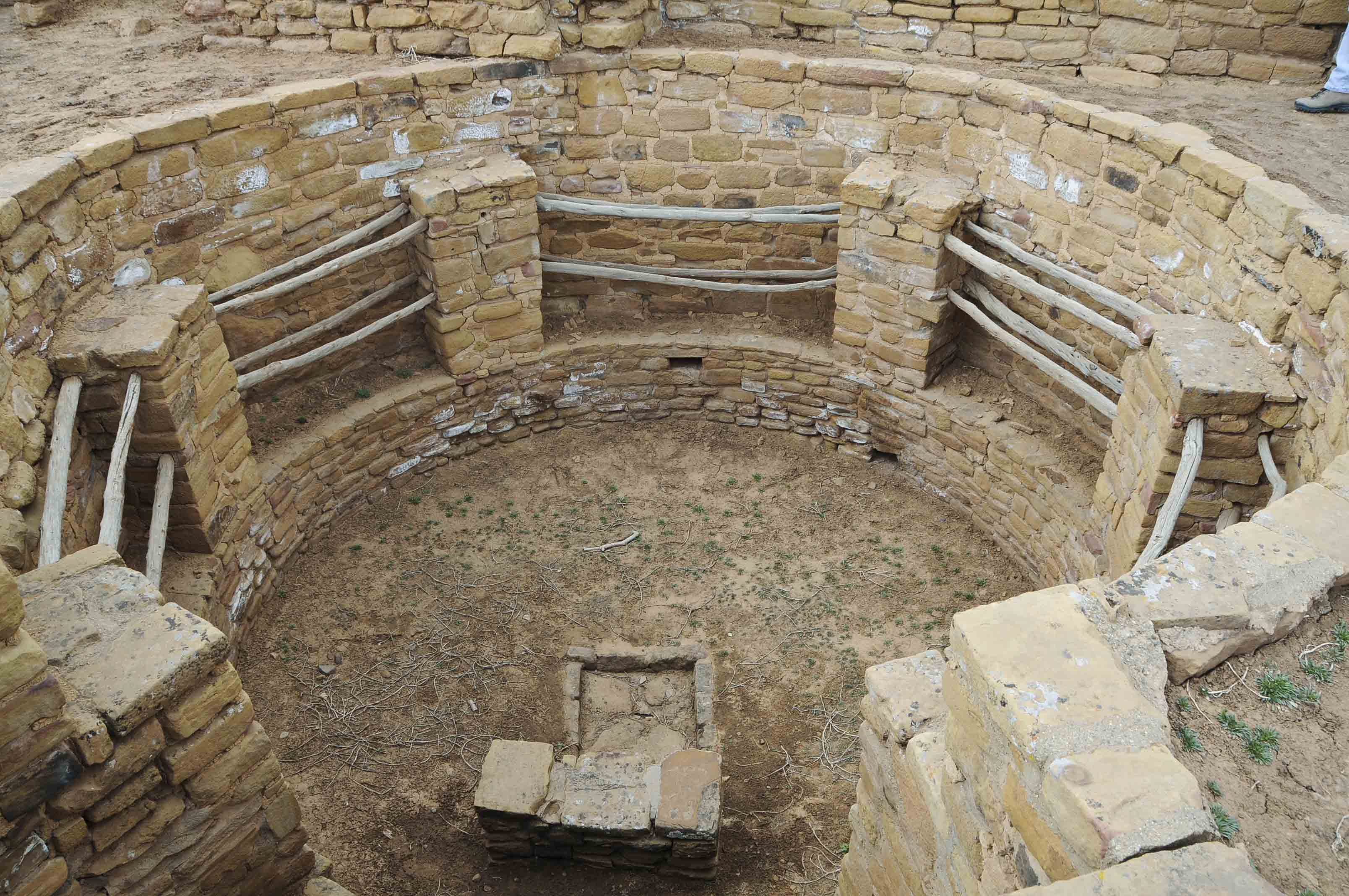
Concerning Kivas
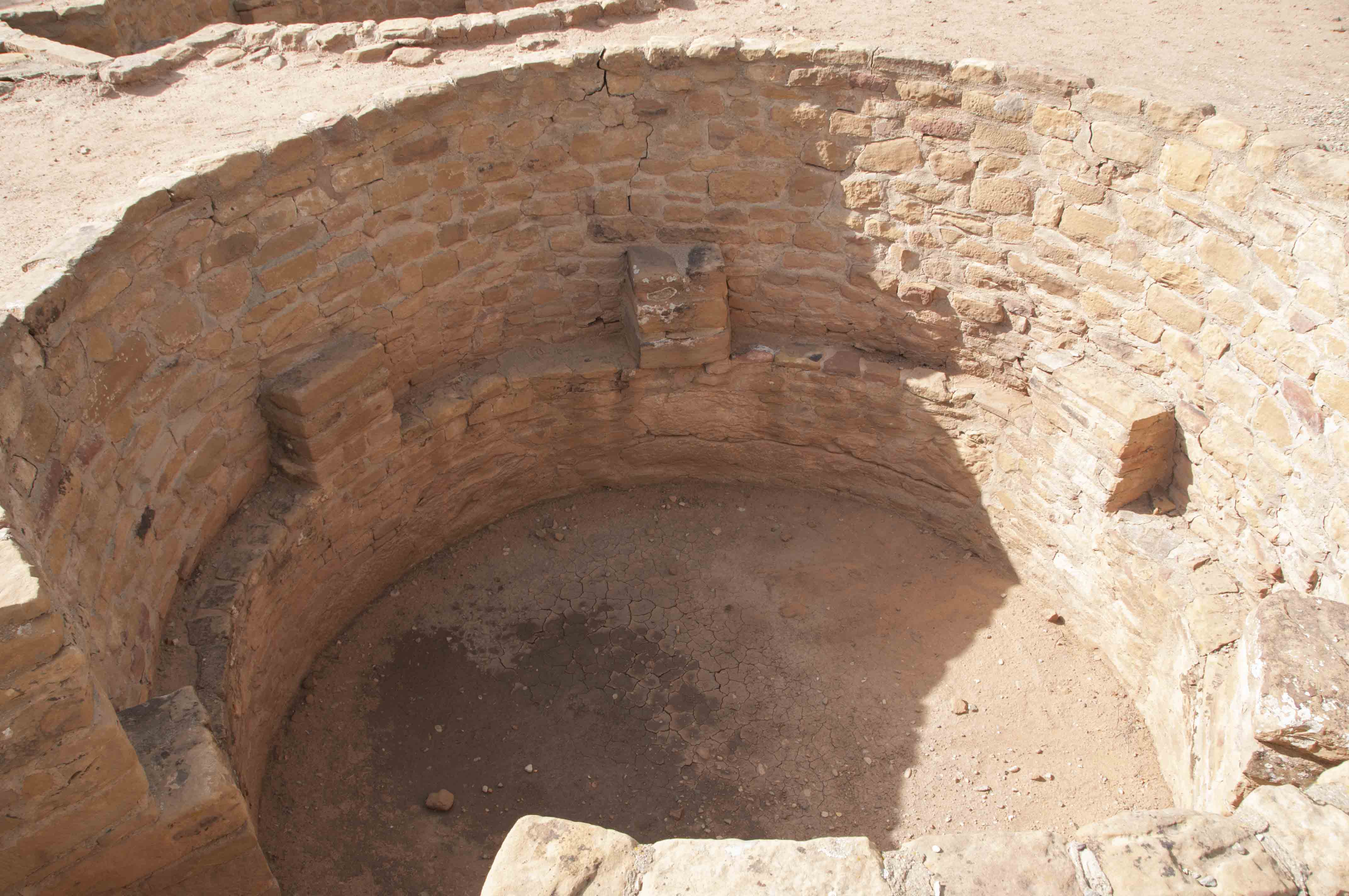
The kiva is a unique architectural form that evolved from the pithouses of the Basketmaker Periods.
It's a subterranean and/or above ground room used for a number of functions.
The most common type of kiva was the kin or clan kiva.
This type was generally subterranean and incorporated into room blocks. Roof poles were
set on pilasters encircling the room, and entry was through an opening in the roof. It was used by
extended families or clans for domestic functions, social gatherings, and religious ceremonies.
A variant of the kin kiva was the tower kiva, extending two, and sometimes three stories above
the ground, thought to be used for ceremonial functions. A third type was the great kiva, much larger
than other kivas, and separated from other structures. The great kiva was used for religious ceremonies,
and maybe town hall meetings. While most great kivas are found at Chacoan Pueblo sites, a few are found
at Mesa Verde. Fire Temple and the great kiva at Long House are rectangular, while most Chacoan great kivas
are circular. Features common in most kin kivas included a firepit and draft deflector, ventilation shaft,
storage niches, banquette, roof pilasters, and sipapu. The sipapu is a small round hole in the floor
representing a portal through which ancestral puebloans believed their ancesters first emerged into the world.
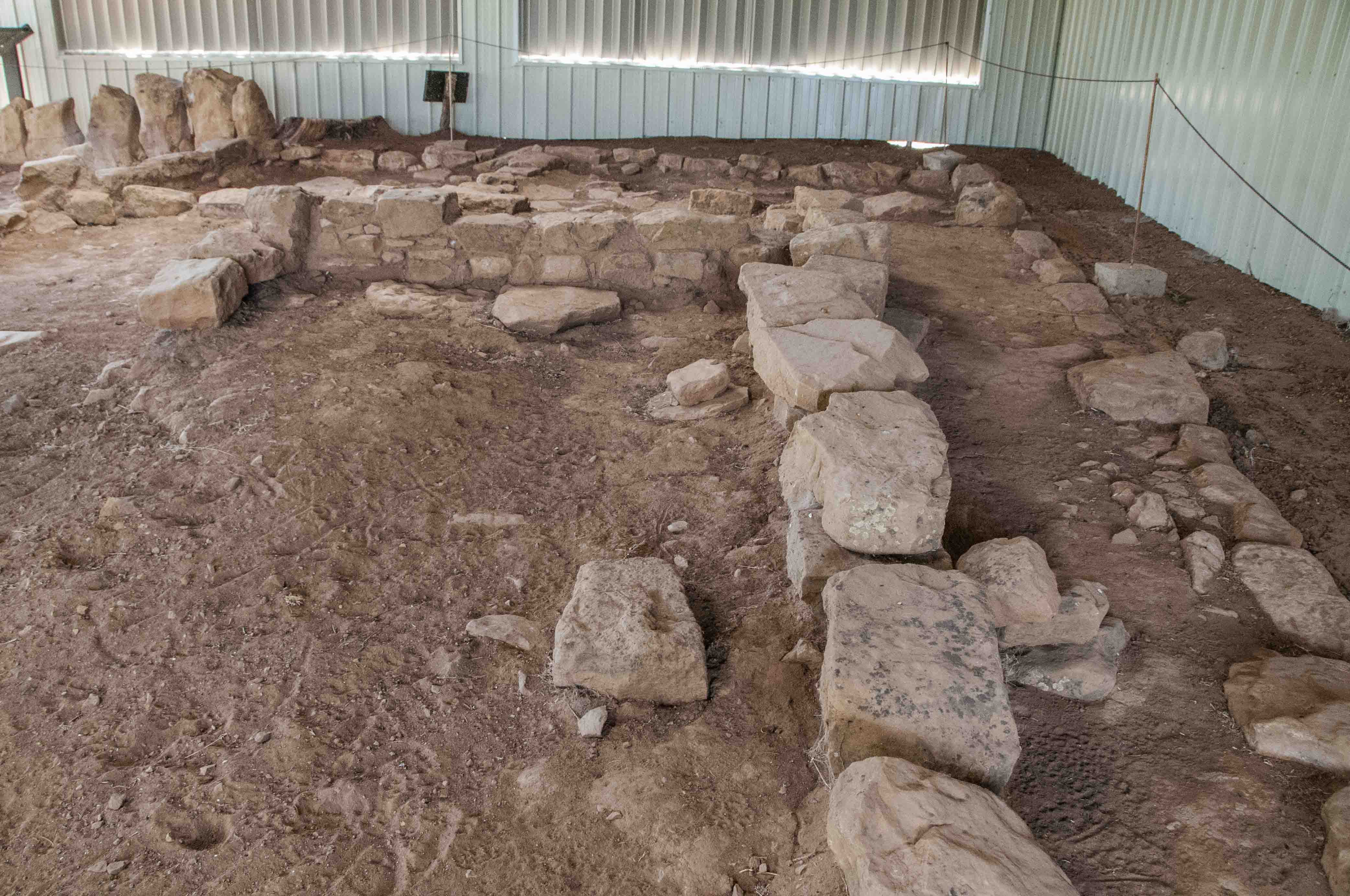
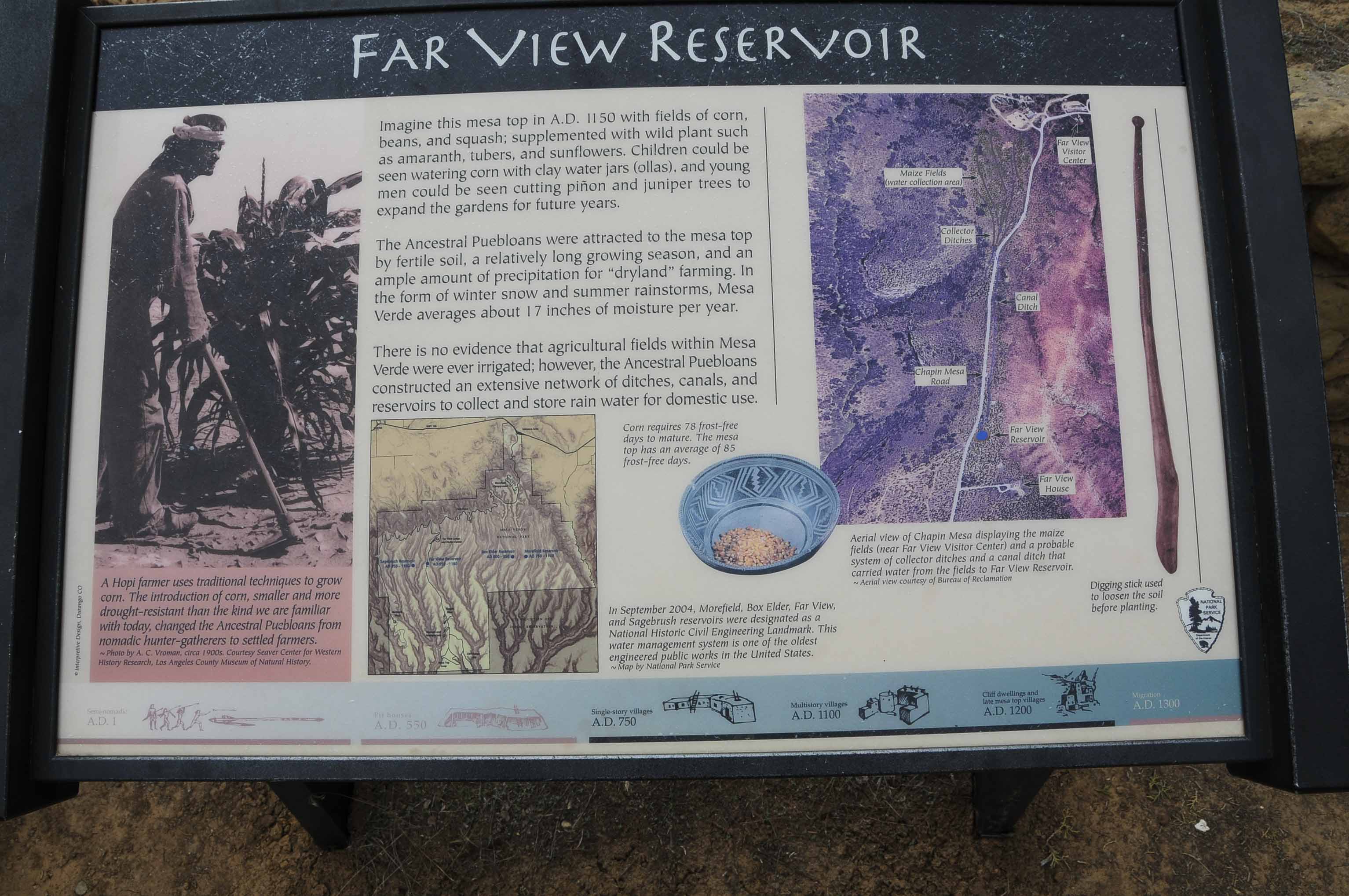
Far View Community
The Far View Community began as a farming community on the northern part of Chapin Mesa in the 900s (Early Pueblo II).
The residents of the area built dams and ditches to funnel water into Far View Reservoir and to irrigate their fields.
Over time the Pueblo II unit pueblo villages were replaced by larger, more sophisticated Pueblo III structures.
The ruins in the Far View Area include the Pueblo II Megalithic House, Far View Reservoir, and the Pueblo III
sites of Far View House, Pipe Shrine House, Site 820 (Coyote Village), Site 857, and Far View Tower. I have no photos of Site 857.
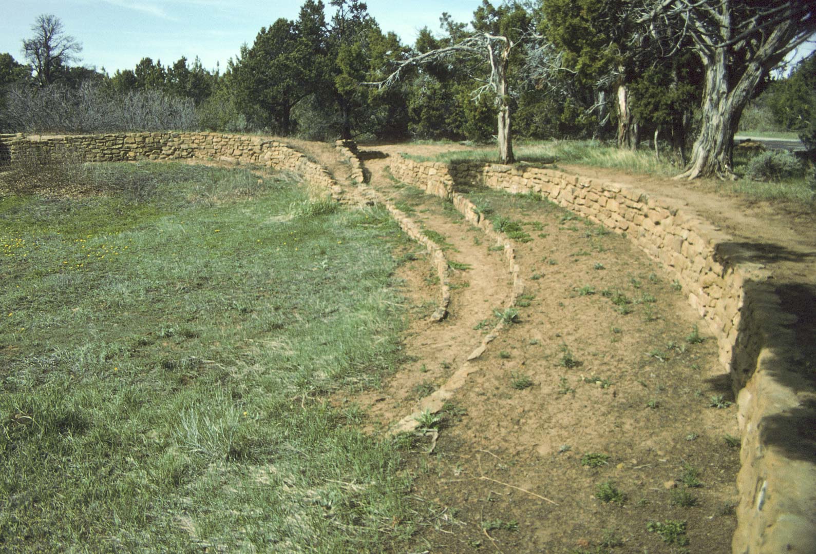
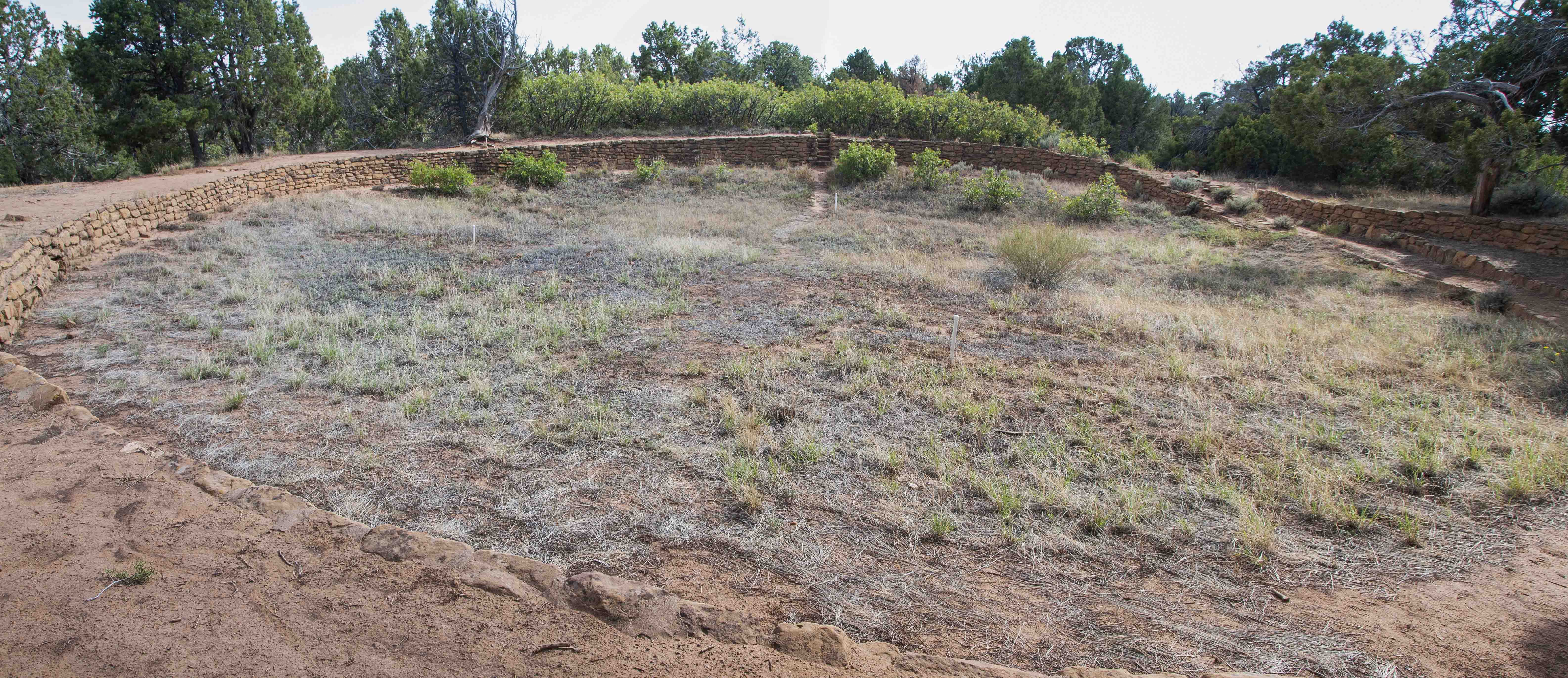
Megalithic House is one of the oldest structures in the Far View Community (AD 900 to 1100). It's comprised of about 16 rooms arranged in a stubby L-shape around a kiva. A few of the walls of the room block had rows of large flat rocks (megaliths), giving the site its name.

Megalithic House

Interpretive sign (1995)
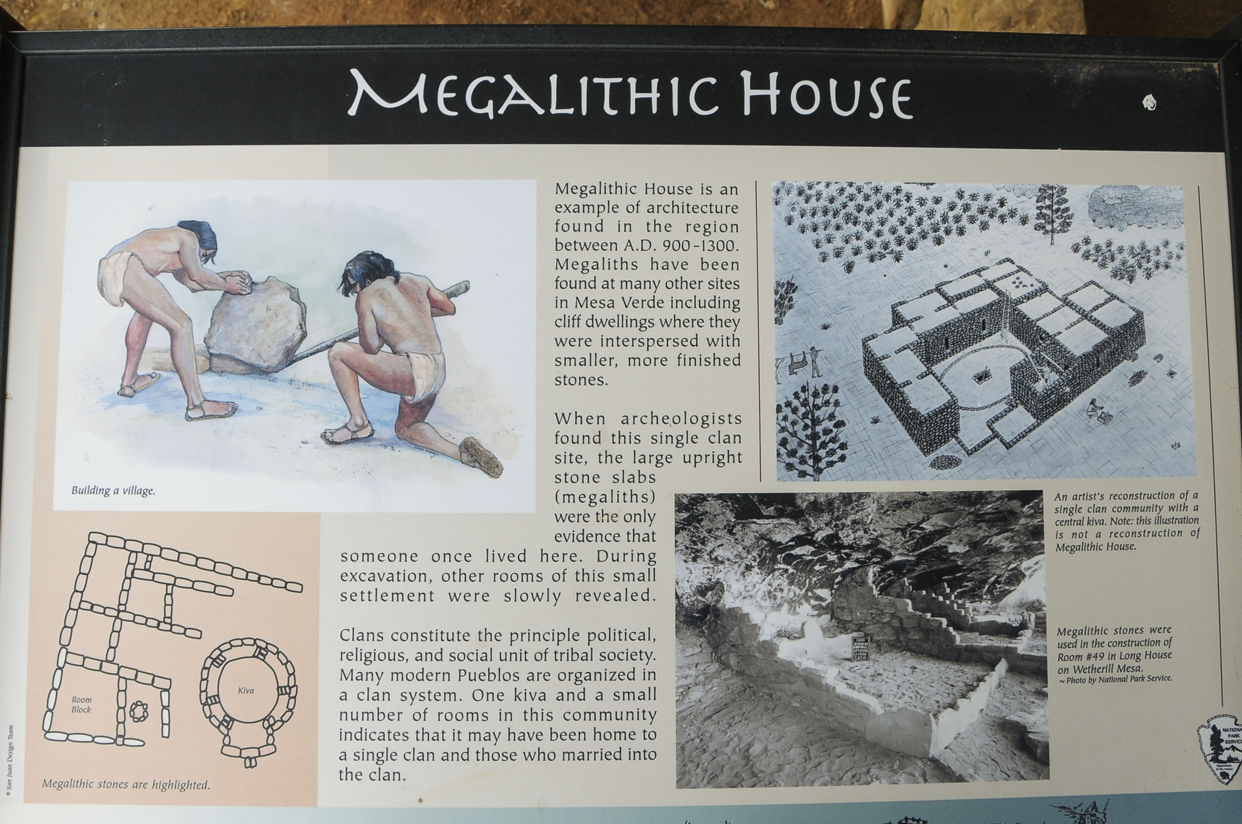
Interpretive sign (2008)
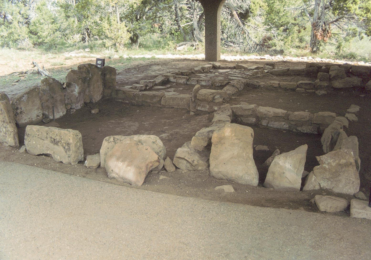
Room block with megaliths (1995)
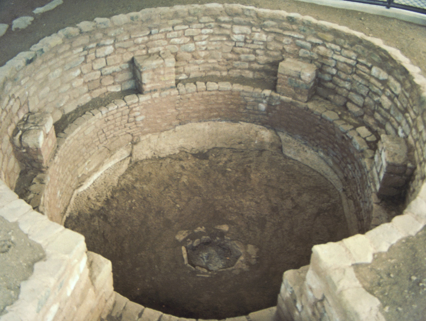
Kiva (1995 - film)
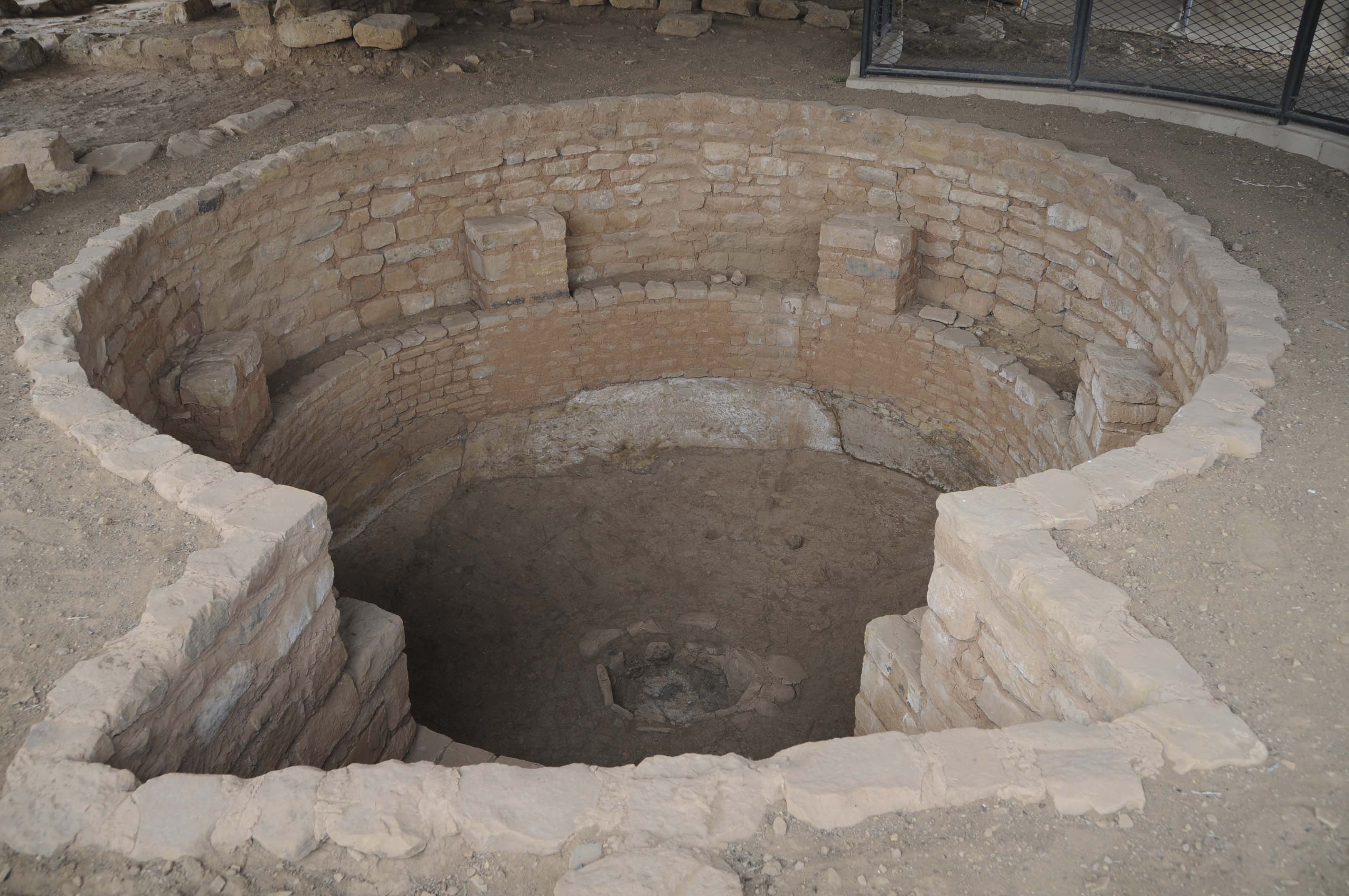
Kiva (2008 - digital)
Megaliths in rows (2008)
Kiva and room block
Room block
Megaliths (upper left)
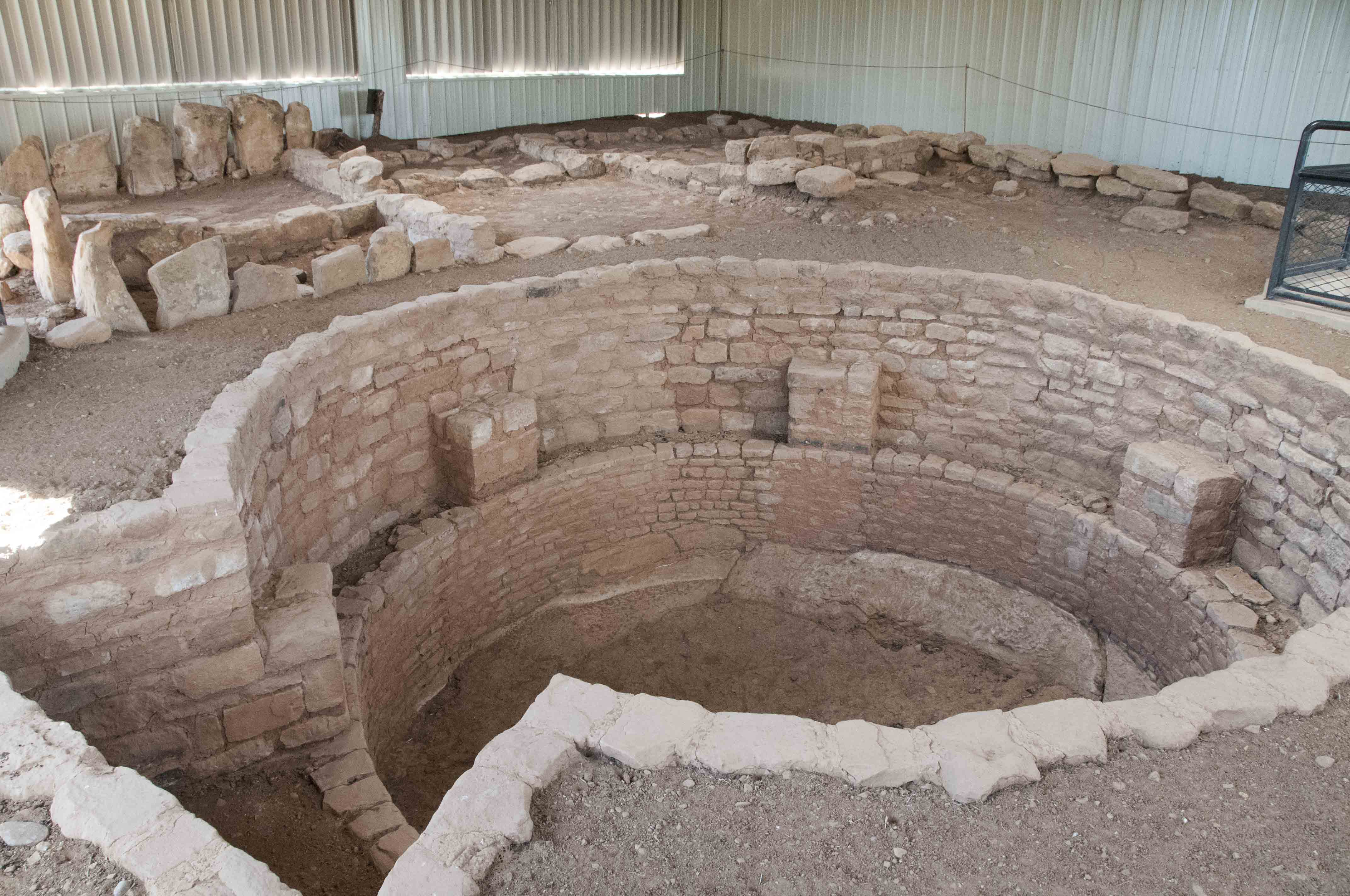
Far View Reservoir (formerly known as Mummy Lake) was built around
AD 900, and expanded at least twice after that. The reservoir stored up to half a million gallons
of water for domestic use by the residents of Far View Community. The steps in the south wall were
used for access when filling water vessels.
Interpretive sign
Far View Reservoir (1995 - film)
(aka Mummy Lake)
Far View Reservoir (2012 - digital)
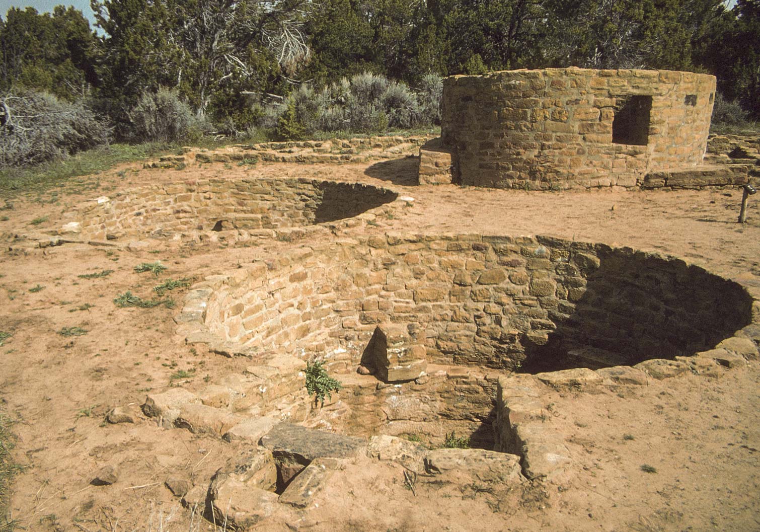
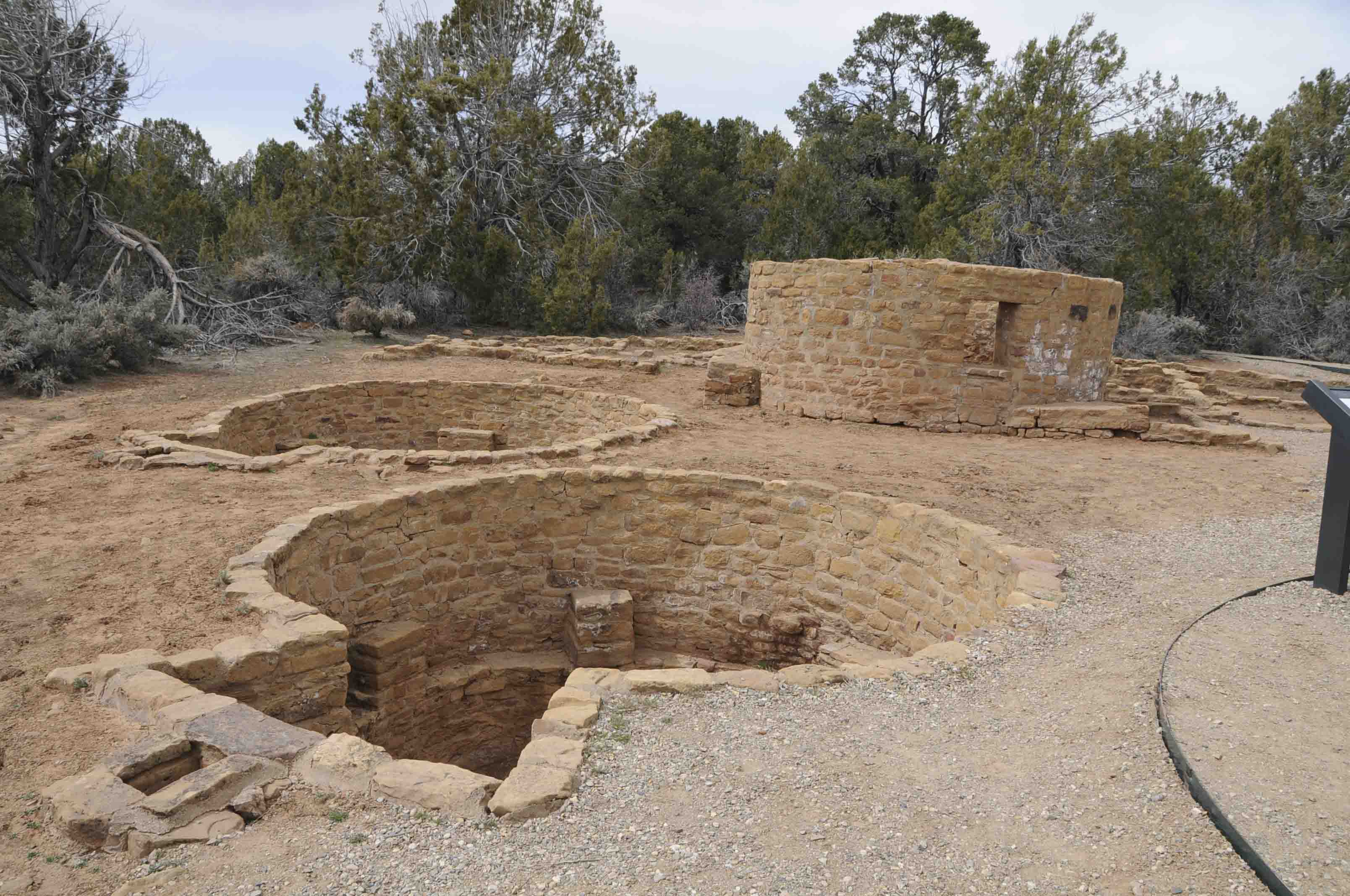
Far View Tower is an early Pueblo III ceremonial
structure that was built on the ruins of an earlier Pueblo II house.
It consists of a circular tower and 2 kivas. One of the kivas is a
remodeled kiva from the earlier Pueblo II house.
Far View Tower complex (1995)
Far View Tower complex (2008)
Tower and room block
Far View Tower

Tower and Pueblo II room block
Far View Tower (2008)
Tower and Pueblo II room block
Far View Tower (2012)
Kiva
Far View Tower
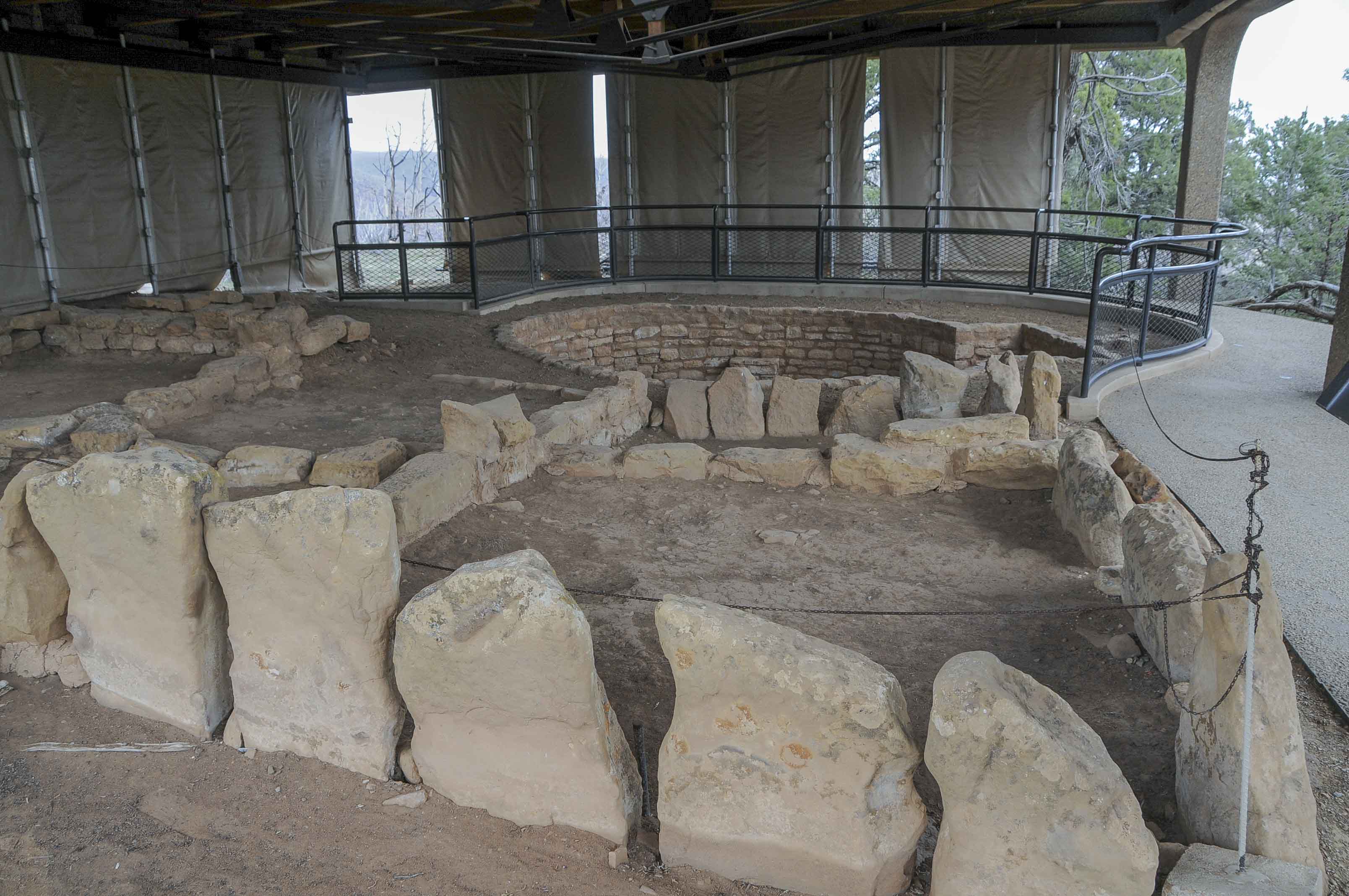
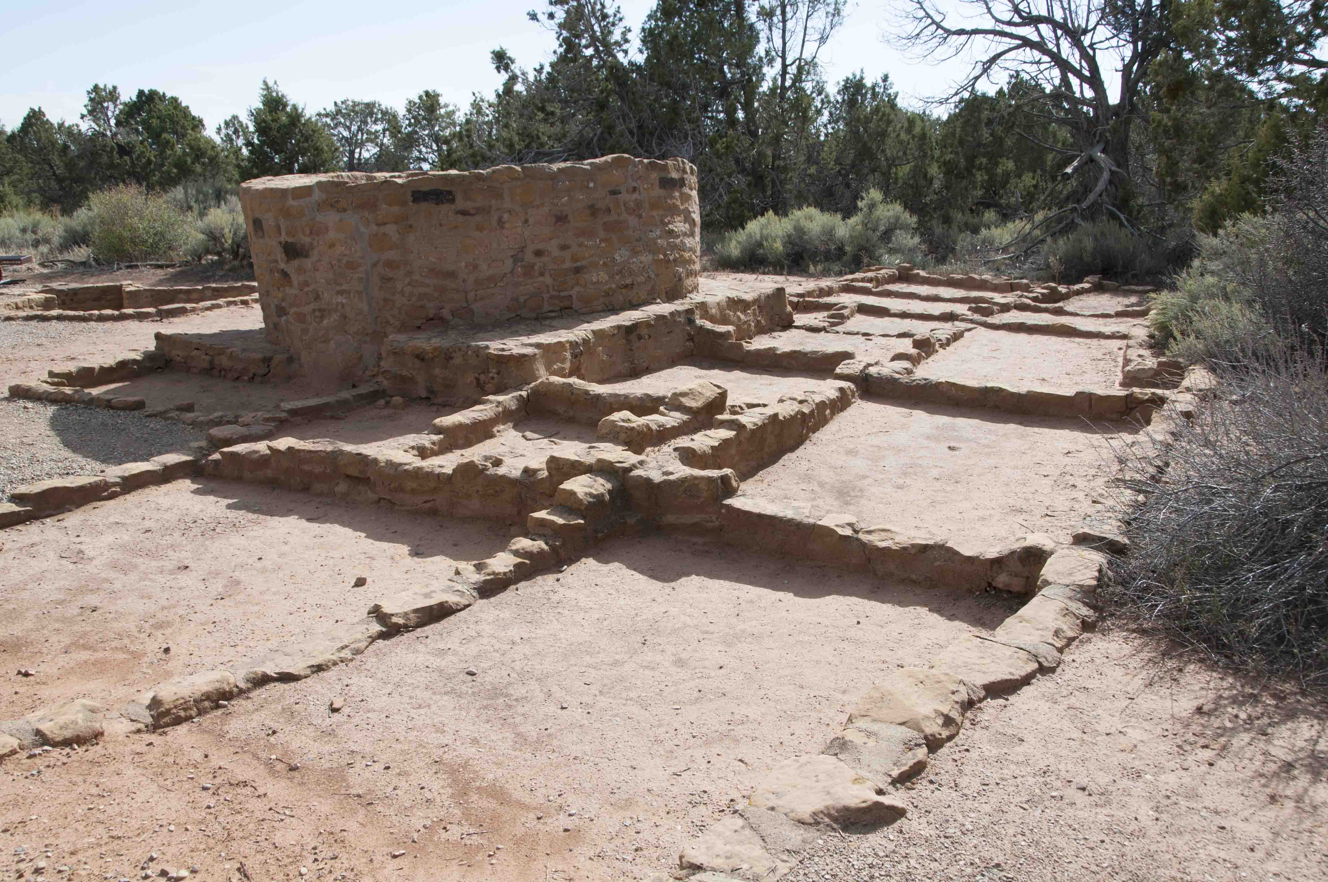
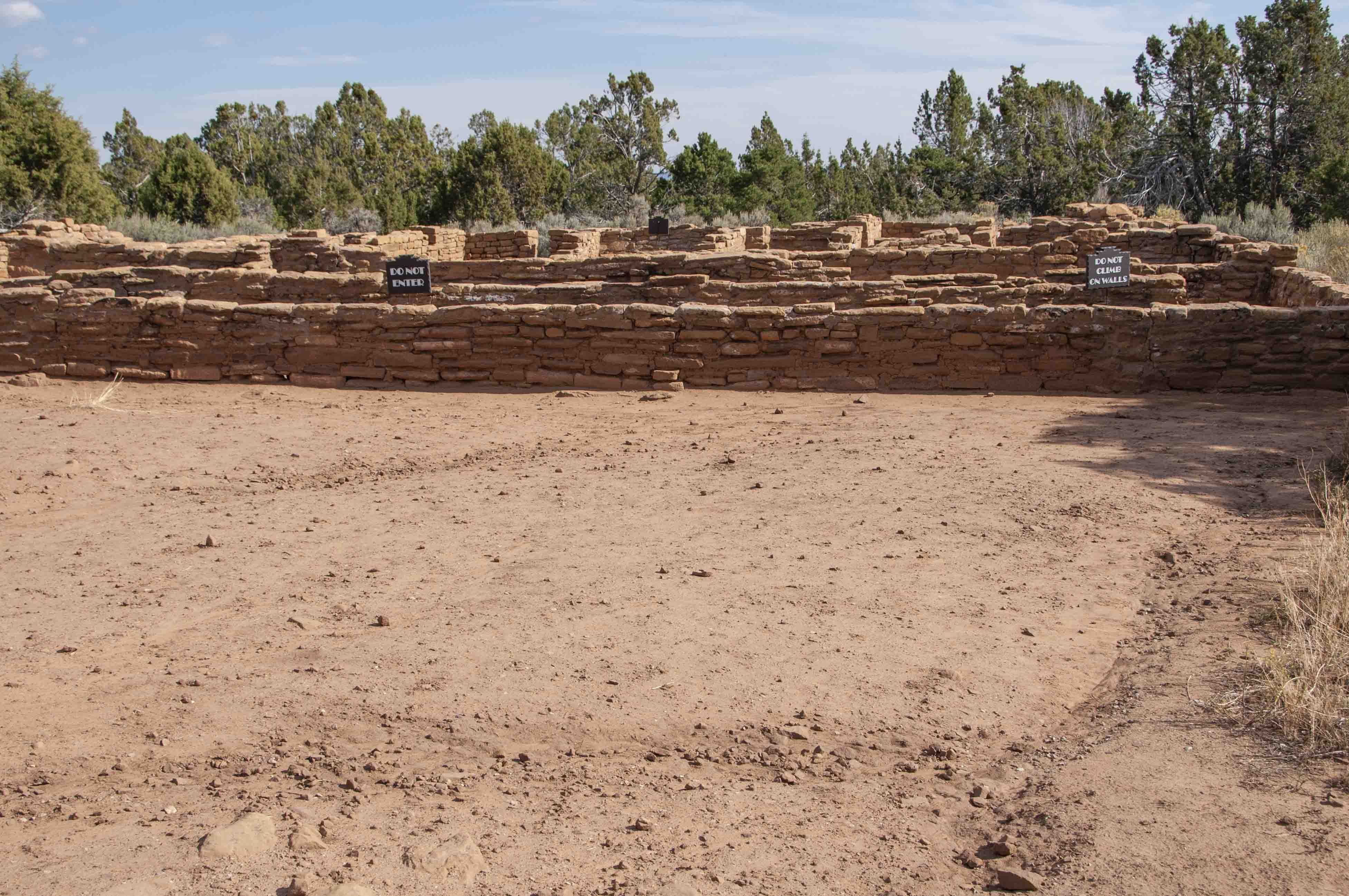
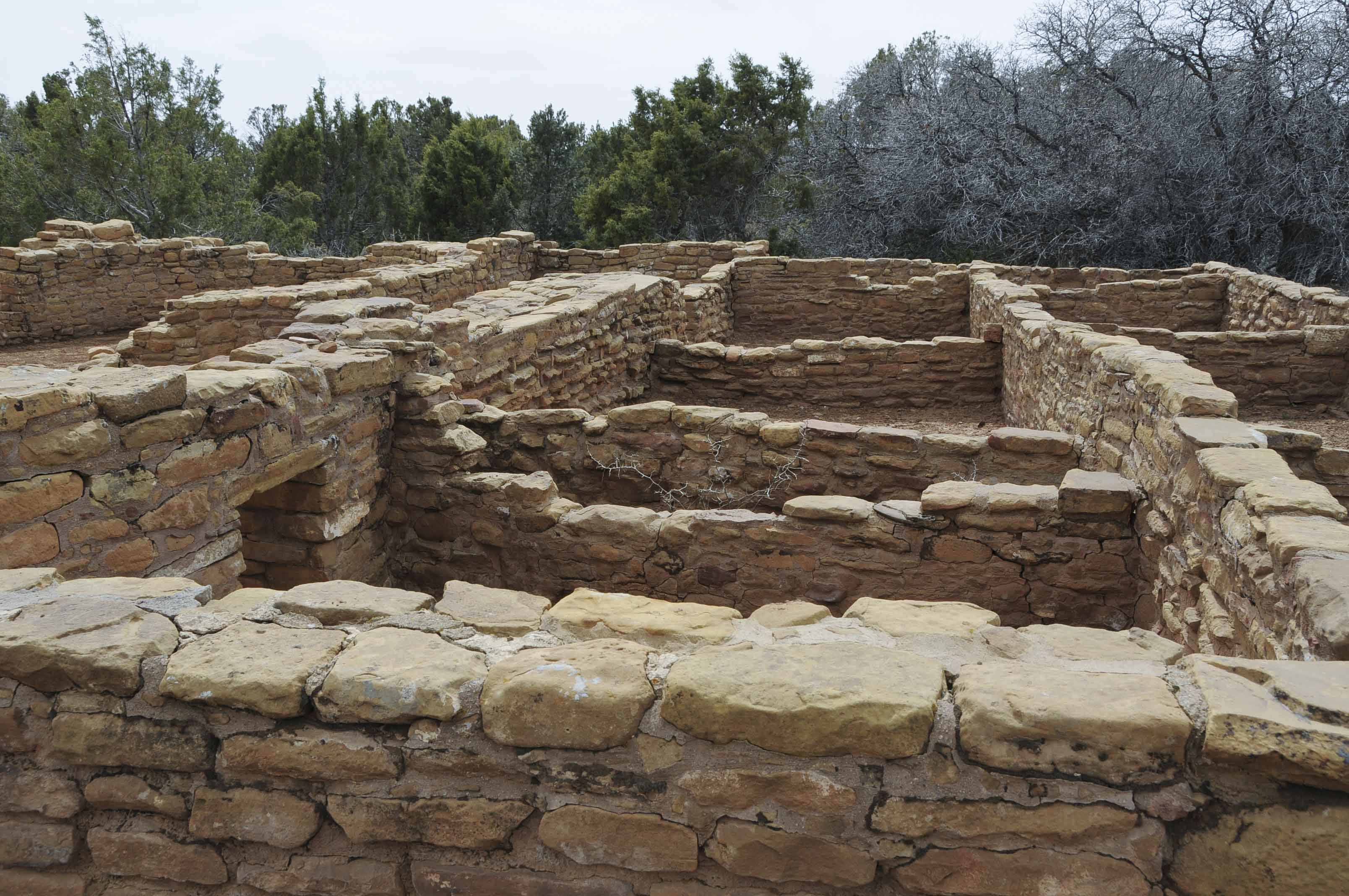
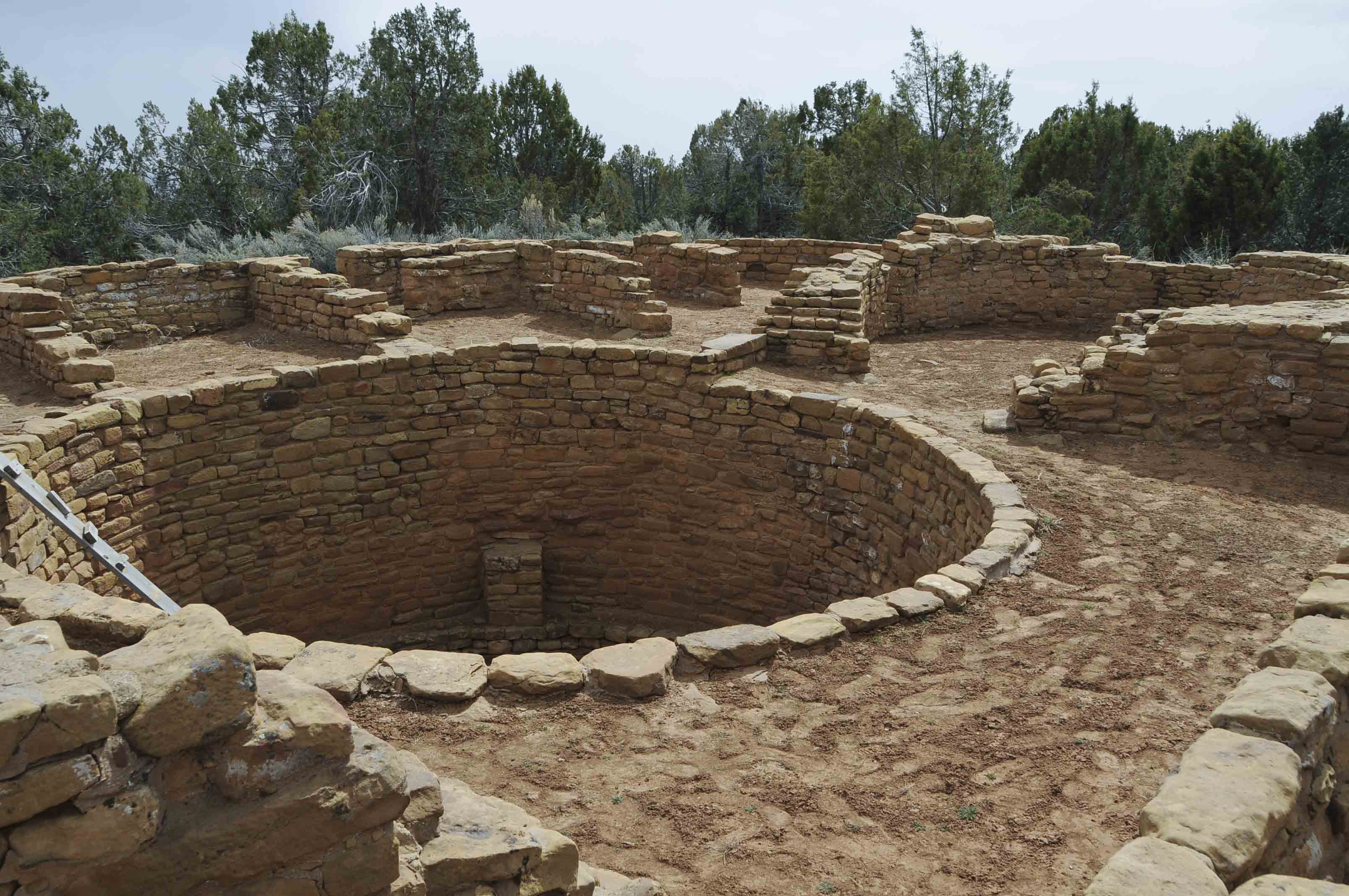
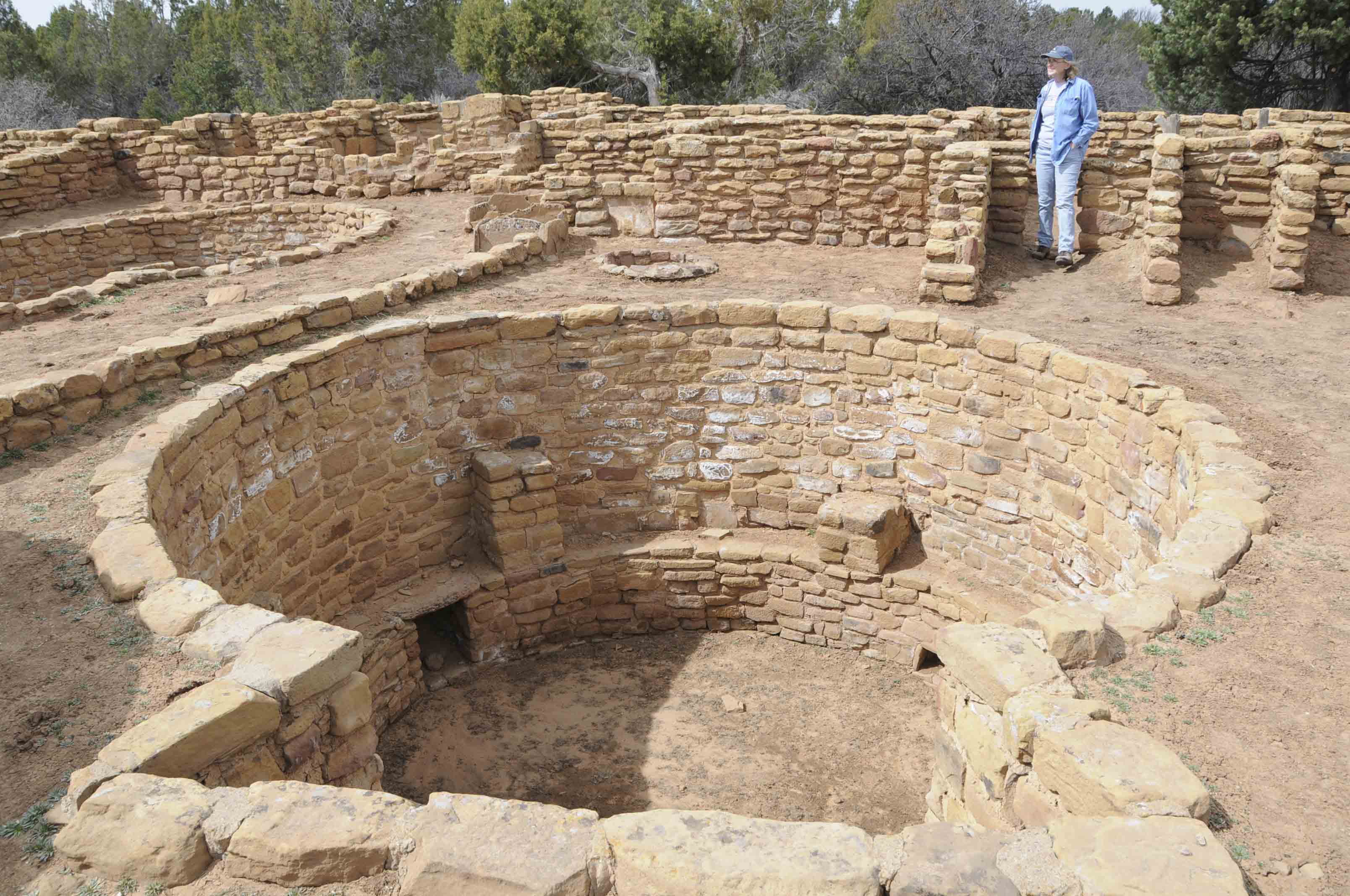
Far View House had about 50 rooms and 5 kivas. Four of
the kivas were incorporated into the room block, while the fifth was
built just outside the south wall of the room block. The central room
block kiva was large with 8 roof pilasters and 2 floor vaults.
Far View House
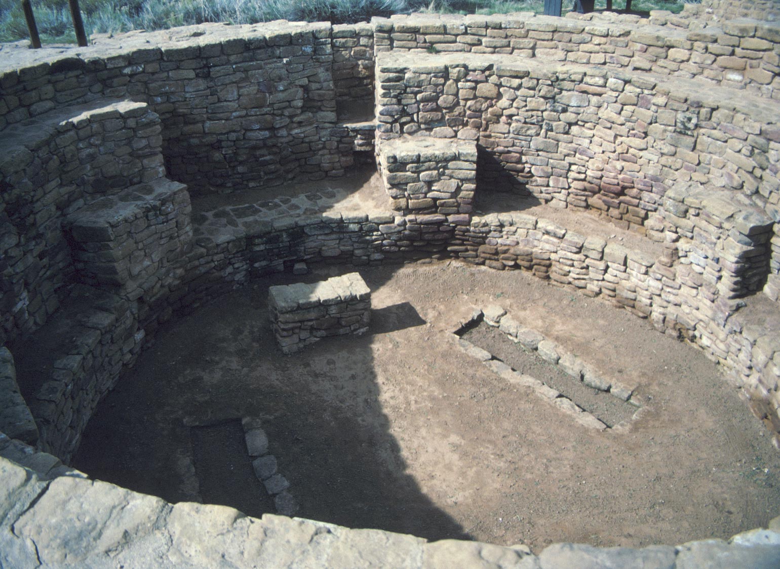
Central kiva
Far View House
Masonry detail
Far View House
Far View House
Far View House
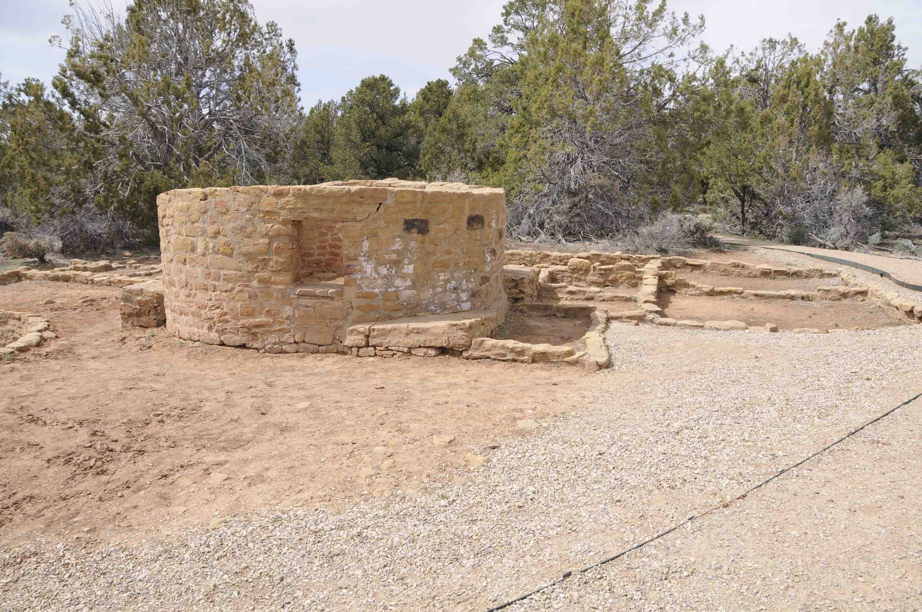
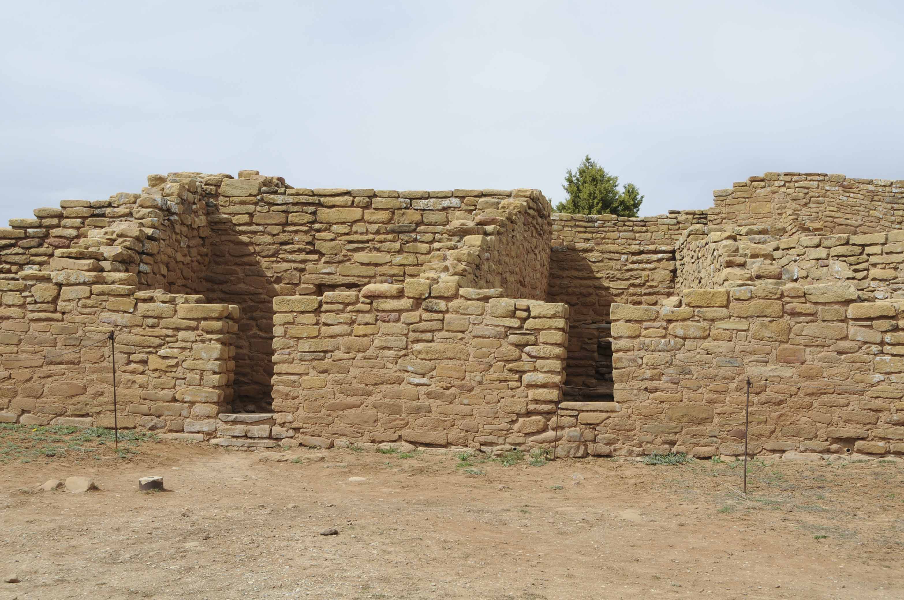
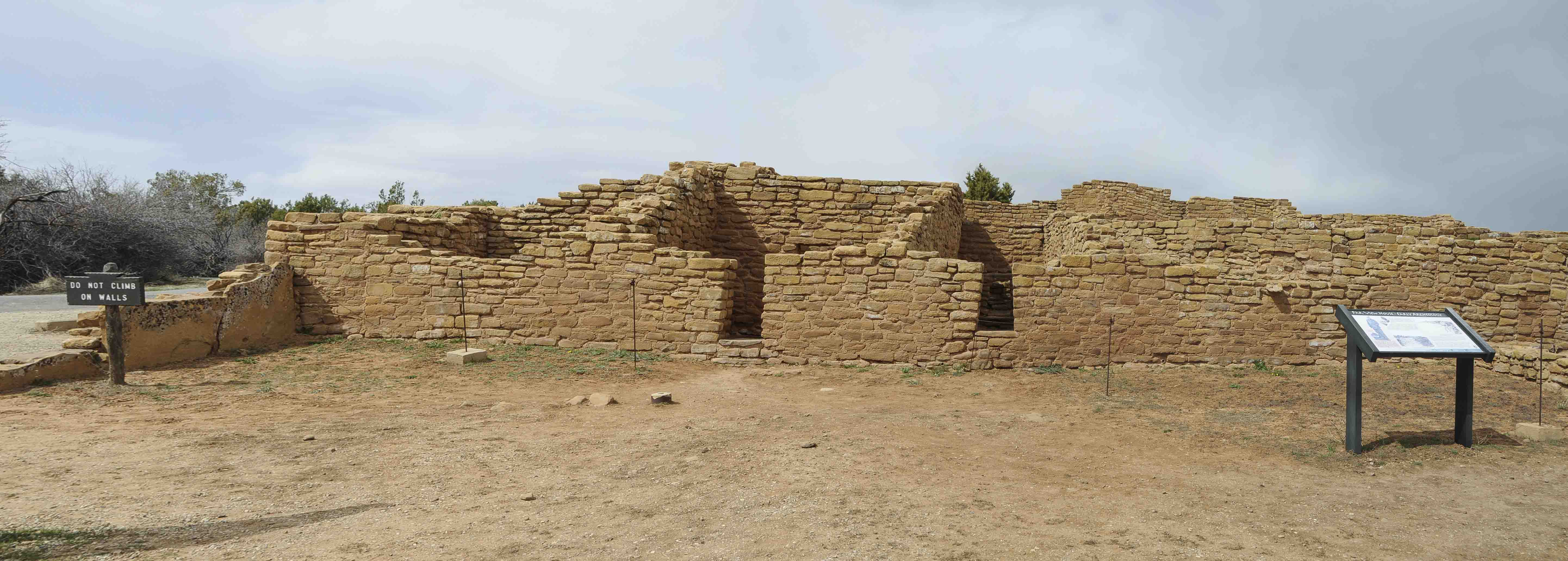
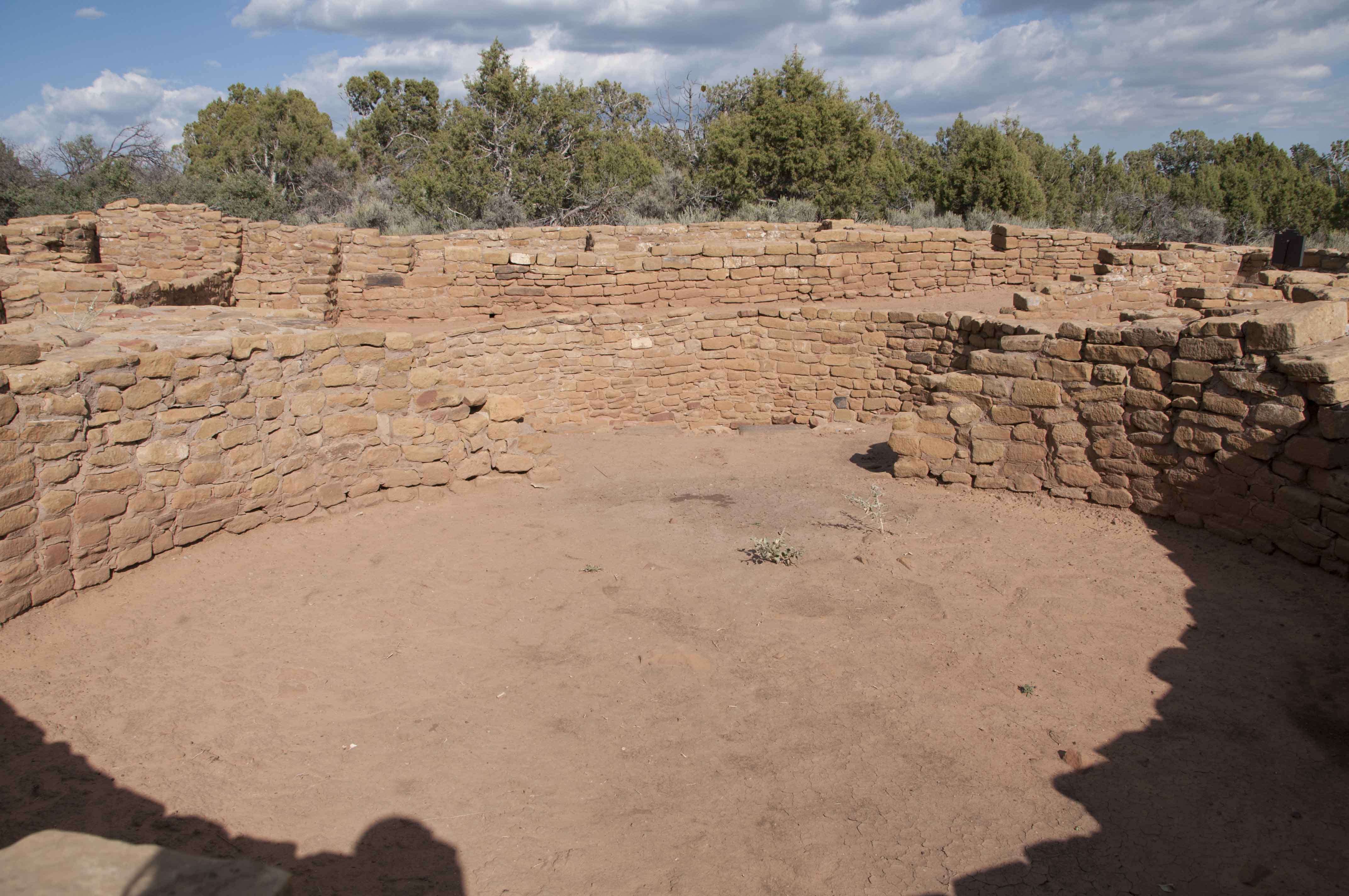
Pipe Shrine House contains 22 rooms, one kiva, and one tower.
A portion of the construction is late Pueblo II with walls of only one row
of rounded rectangular stones. The remainder of the walls are Pueblo III walls made of two or more
rows of sandstone blocks. The site got its name from a cache of smoking pipes
found in a small shrine just to the south of the pueblo.

Pipe Shrine House (2008)
Pipe Shrine House (2012)
Notice the additional signs

Pipe Shrine House

East-west view of some of the Pueblo II room block (1995)
East-west view of some of the Pueblo II room block (2008)
Large central kiva
Pipe Shrine House
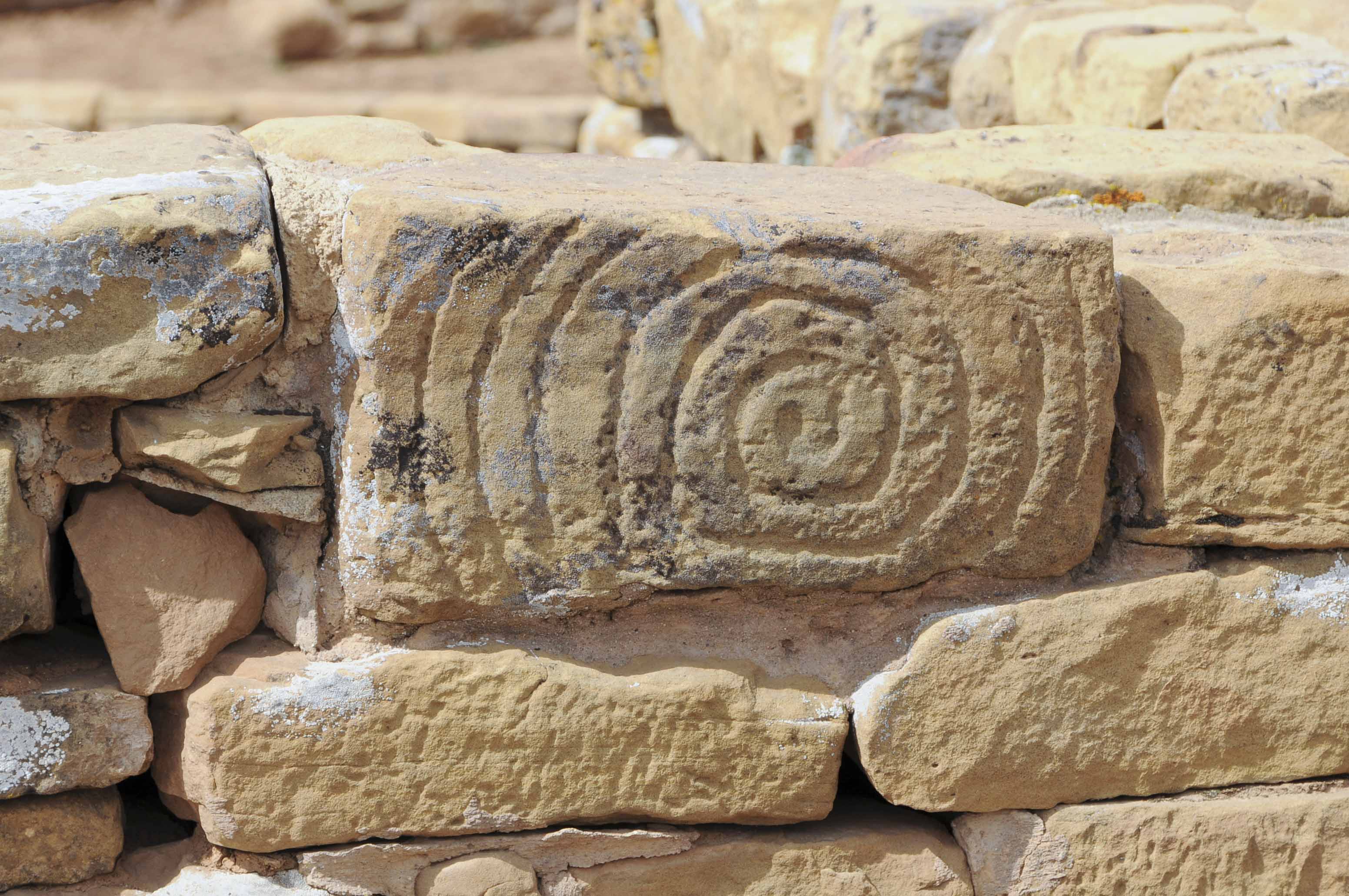
Spiral Petroglyph
Pipe Shrine House

Pipe Shrine House
Far View House in Background
Tower
Pipe Shrine House
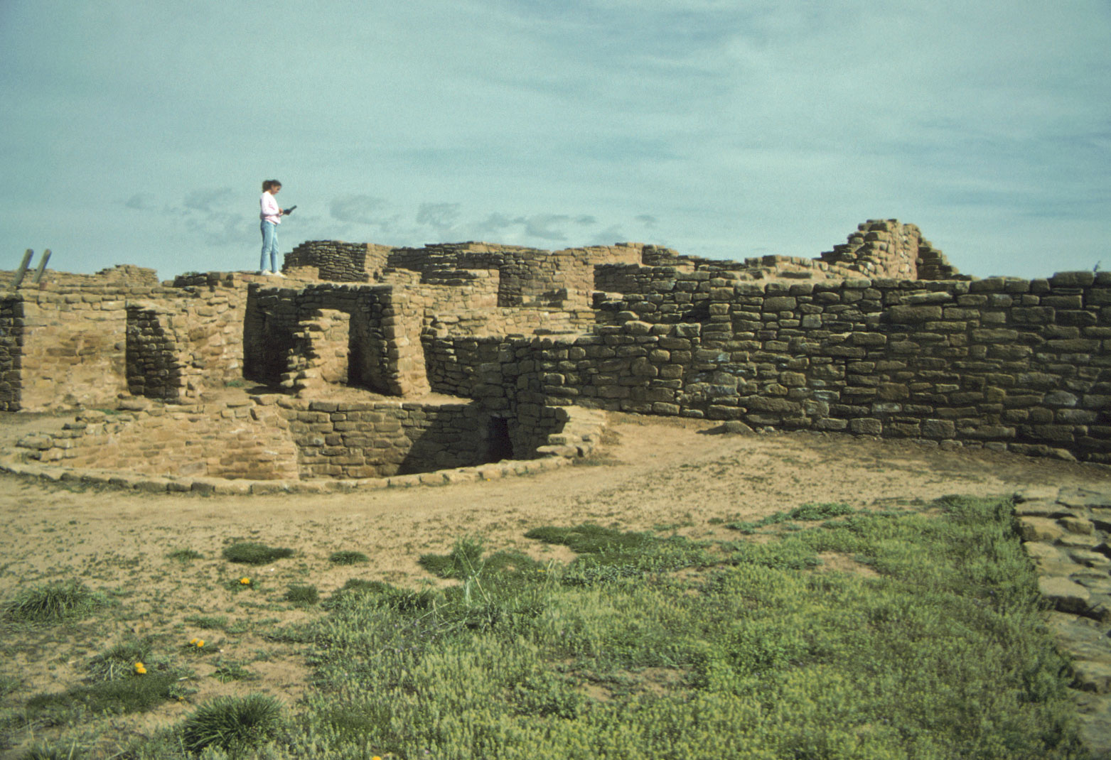
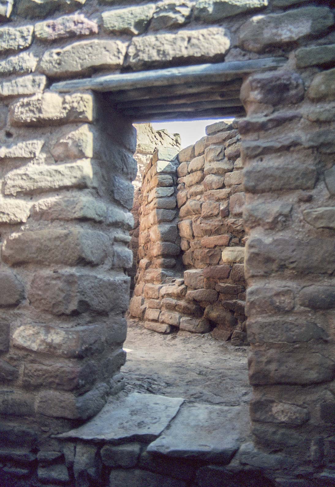
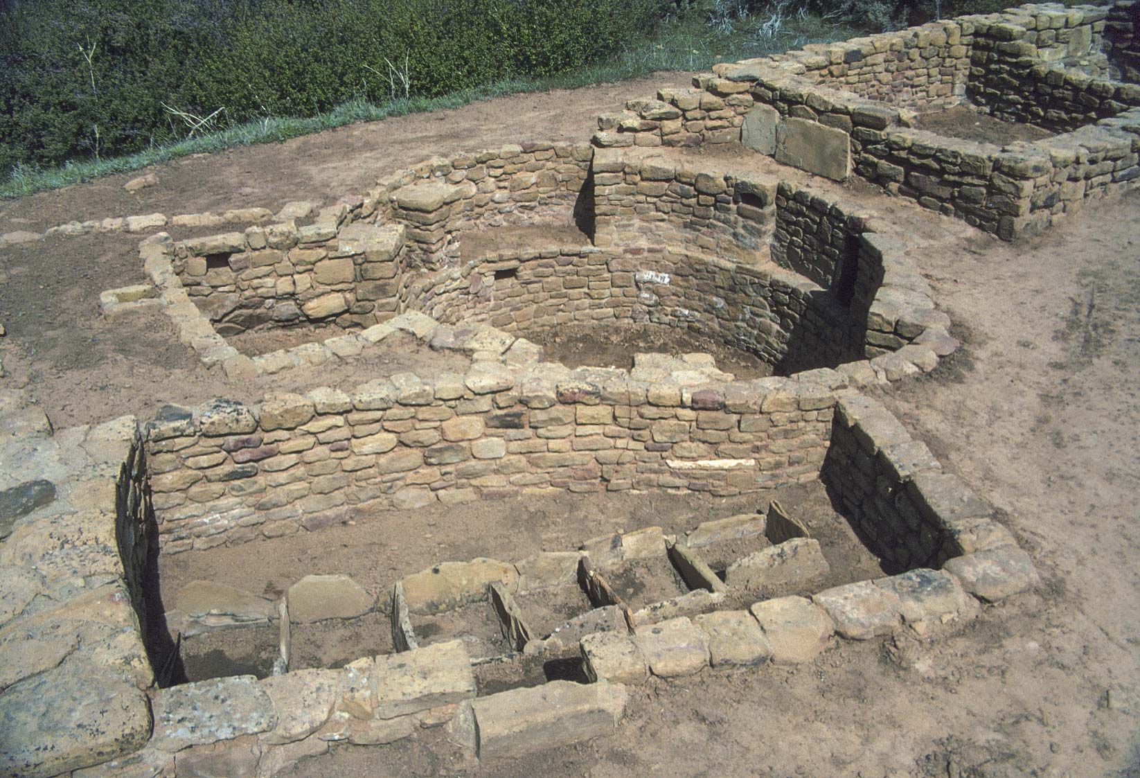
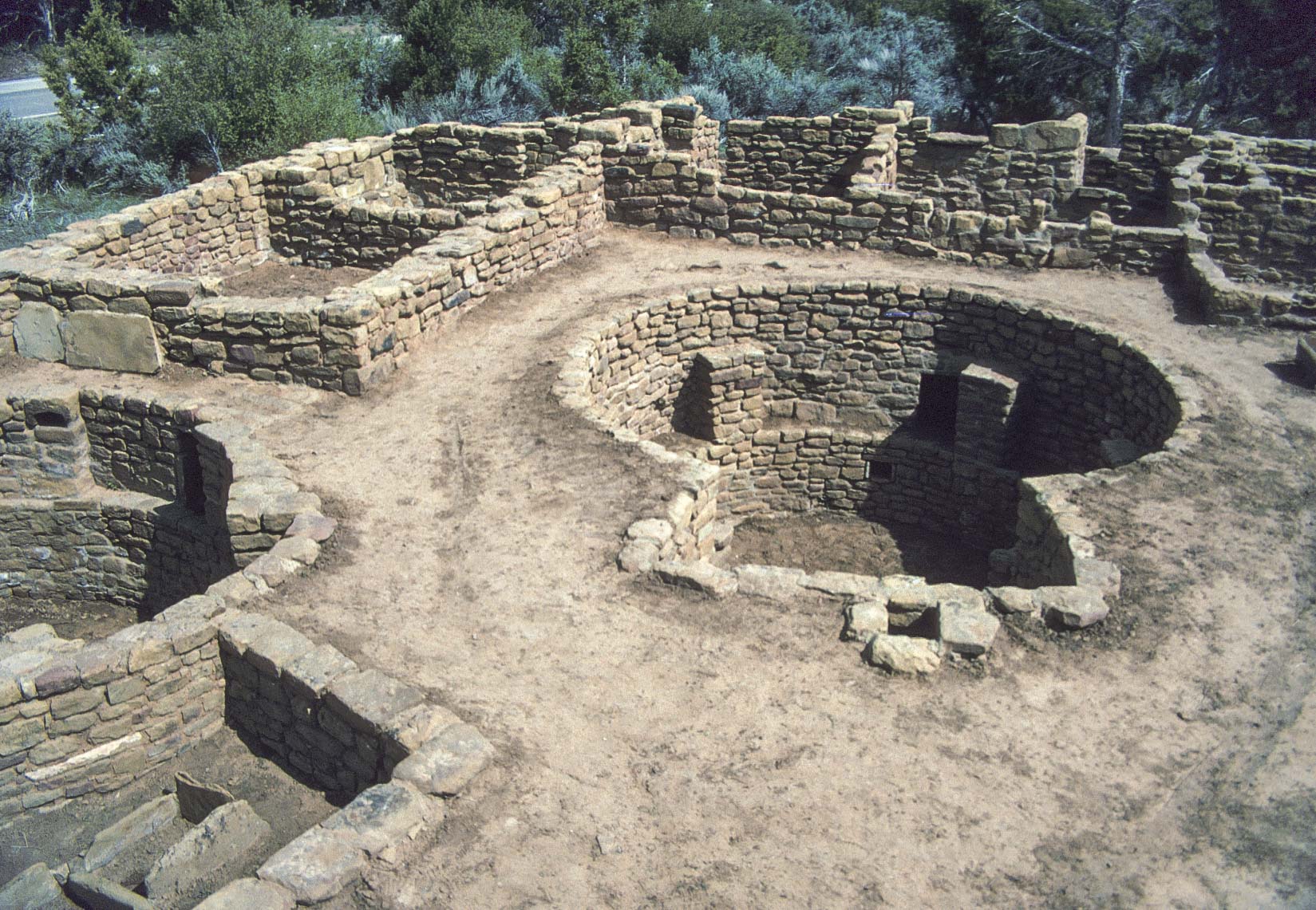
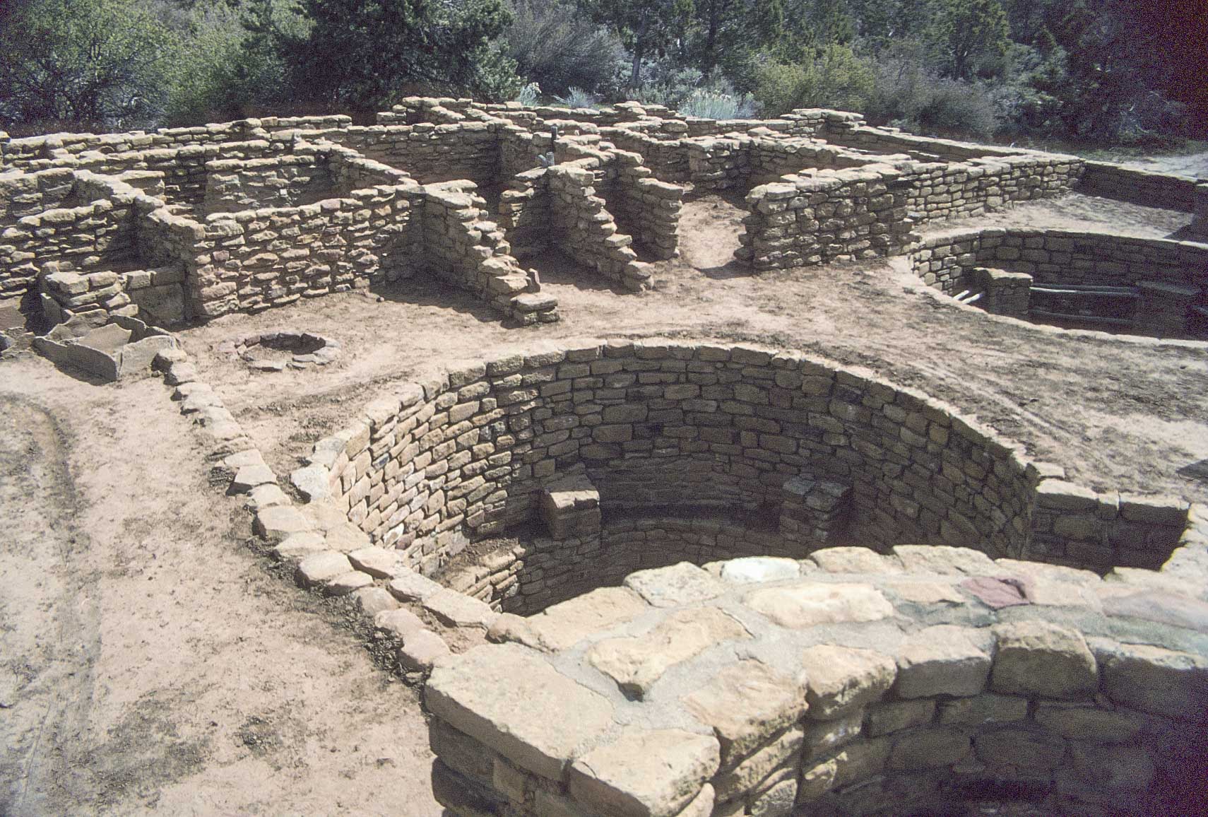
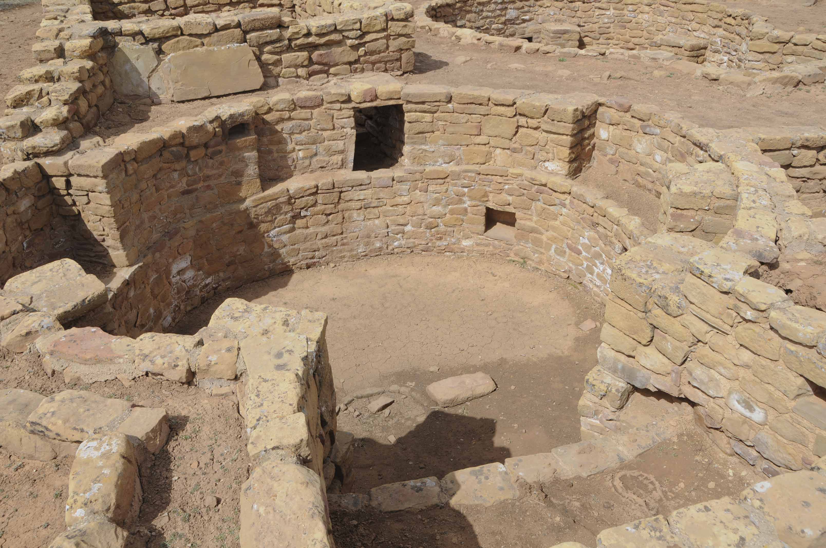
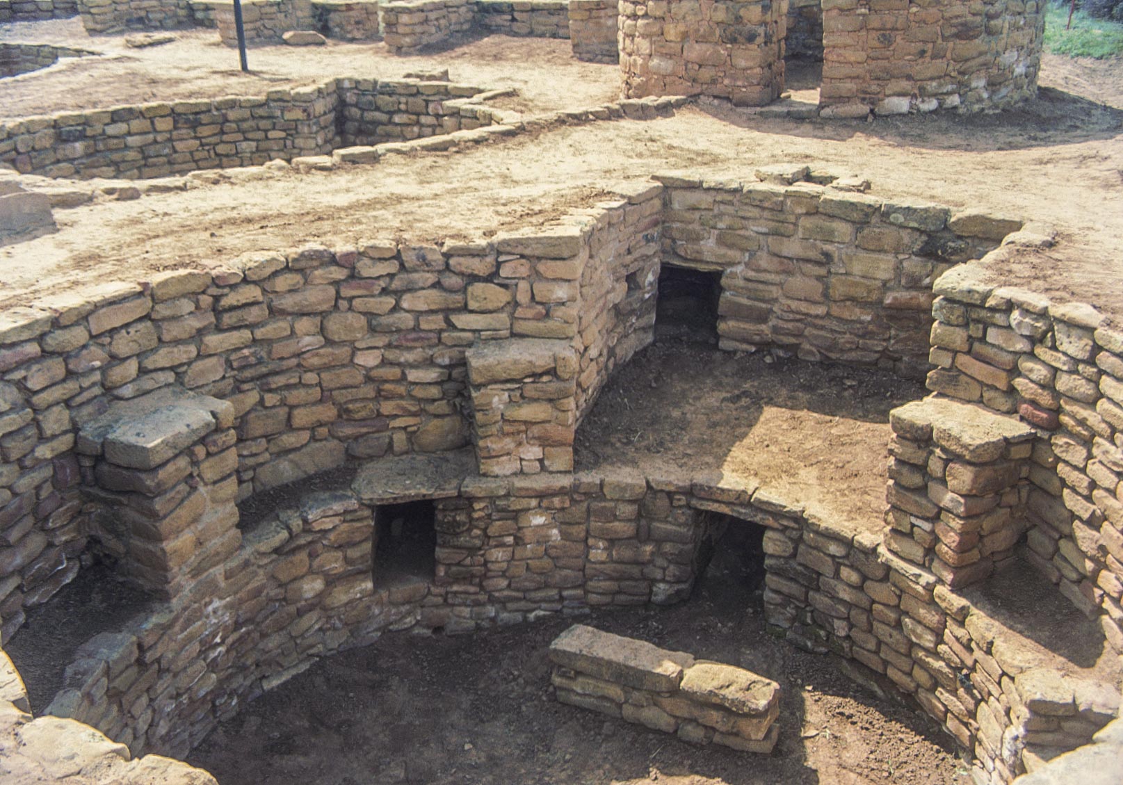
Coyote Village (Site 820) is a Pueblo III structure with 5 kivas, 1 tower,
and ~ 30 ground floor rooms. Four of the kivas have the typical Mesa Verde keyhole shape.
One kiva (south-east) has horizontal poles between each pair of pilasters. Don't know why
- maybe to hang or support objects. The north-west kiva is connected to the tower and a
kiva on each side by tunnels. Tunnels, especially those connecting kiva and tower, are
often found in Mesa Verde but are rarely found at other Ancestral Pueblo sites.
This is my favorite Far View site. I think it's certainly the most interesting.
I have LOTS of photos from trips in 1995 and 2008.
Kiva and food prep room (1995)
SW corner of Coyote Village

Corn grinding bins in food prep room(2008)
SW corner of Coyote Village
North-west section of Coyote Village
View to the north-east from tower
south-central and south-east kivas visible
South-west Kiva
Coyote Village
NW kiva with tunnels connecting to tower and kiva in back (opening on floor goes to ventilator)
South-central kiva next to tower
Tunnel entrance is visible
South-east kiva (1995 film)
Coyote Village
South-east Kiva (2008 - digital)
Coyote Village

Large north-east kiva
Coyote Village

Grinding bins in north-central section
North-west kiva just visible (left)

Stephanie and tower
View to the south-east
Source material obtained from Anasazi Ruins of the Southwest in Color by Ferguson and Rohn, Wikipedia, and National Park Service sources.
Use the form on the Home Page to submit comments, questions, or suggestions. TD Productions Copyright © 2019