Capitol Reef Loop the Fold Tour
If you're ever at Capitol Reef National Park and have the time you should definitely take the
Loop the Fold Tour. It's a 125 mile drive that circumnavigates much of the southern Waterpocket Fold.
The tour starts at the Capitol Reef Visitor Center, and I recommend doing it in a clockwise direction.
Take UT SR 24 east, then the Notom-Bullfrog Road south along the eastern edge of the Waterpocket Fold,
then west on Burr Trail Road across both Capitol Reef NP and Grand Staircase-Escalante NM, then north
on Utah Highway 12 (the "All American Road"), then east on UT SR 24 back to Capital Reef Visitor Center.
The Capitol Reef Natural History Association publishes the Loop the Fold Road Guide (available at the
Visitor Center) that includes numbered stops of interest with the mileage from the Visitor Center for each stop.
I have used the same numbers for the stops I made. I made the tour in 6 hours, but it can be done in 4 if you're
in a hurry.
The two stops to the right are buildings in the Fruita Historic District
not far from the Visitor Center. Both are located along Utah SR 24.
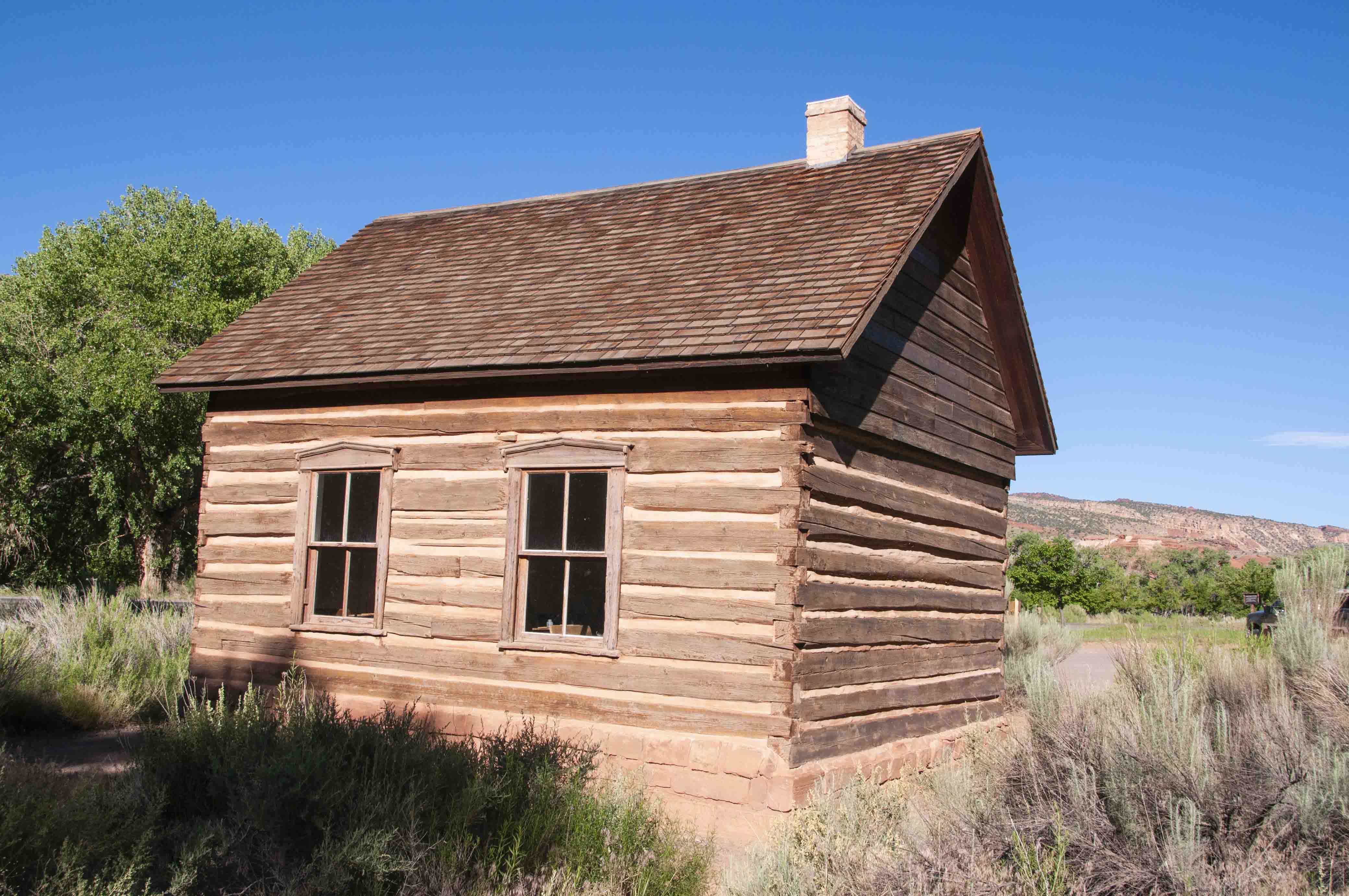
Historic Fuita Schoolhouse
Stop 1, mile 0.8
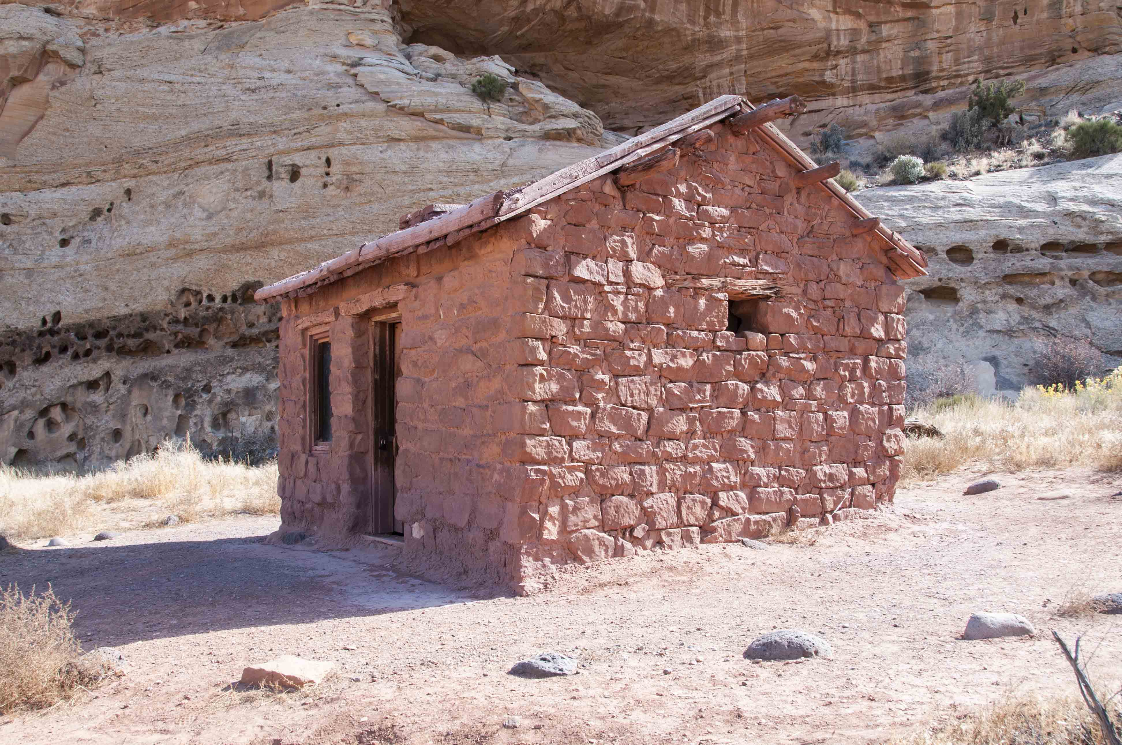
Behunin Cabin
Stop 6, mile 6.0
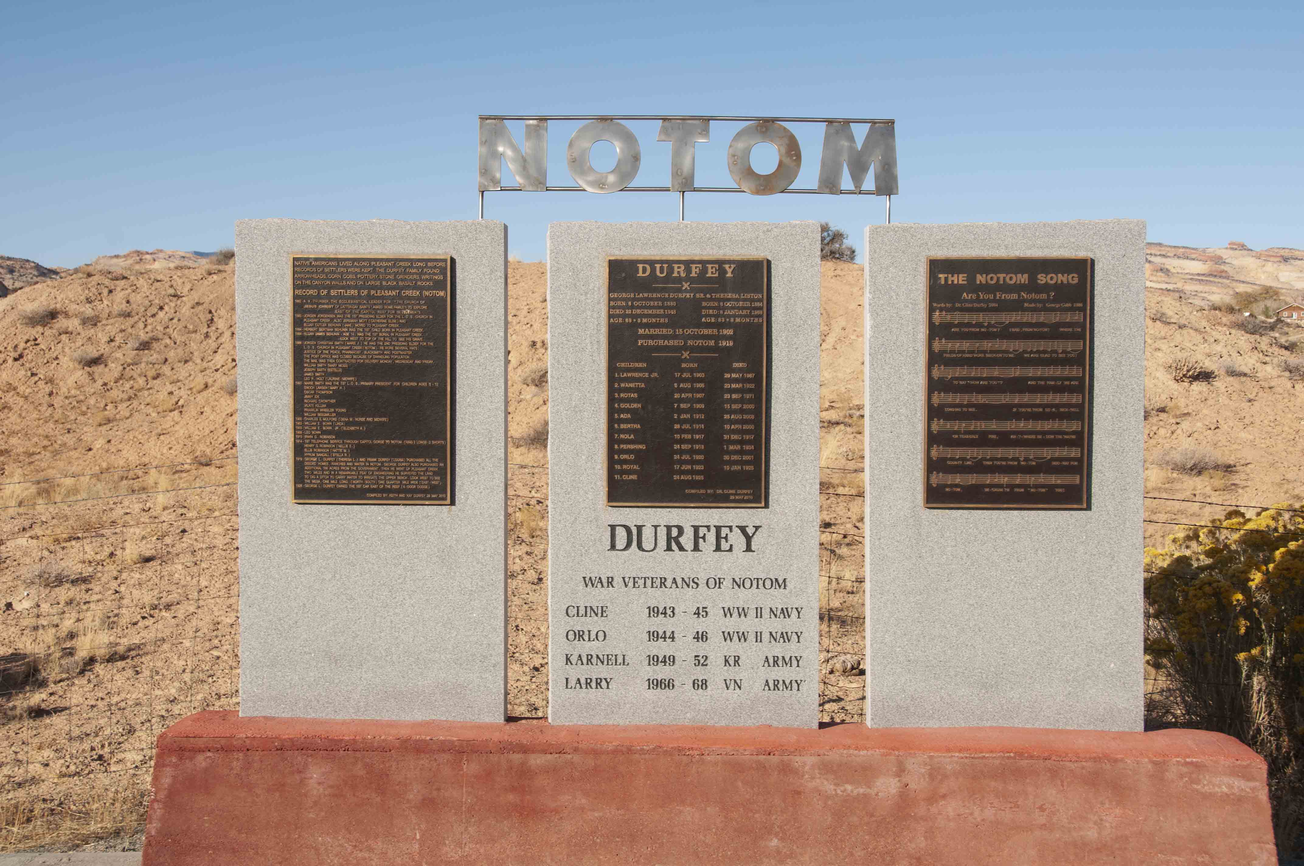
Notom Historical Marker
The settlement of Notom is featured at Stop 8, mile 14.
The historical marker in the photo on the left provides a brief history of
Notom and information about the Durfey family, who purchased Notom in 1919.
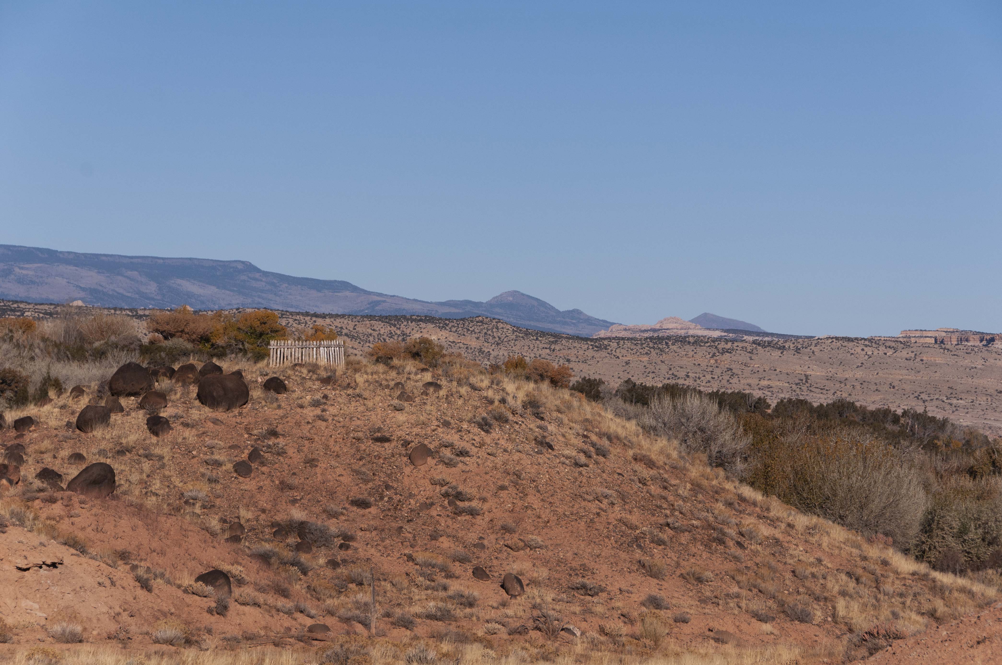
The picket fence in the right-hand photo marks the grave of one of Elijah
Behunin's sons. The Golden Throne can be seen in the distance.
View northwest at Stop 8
Stop 14, mile 24. The Henry Mountains are to the east
and the alfalfa fields of Sandy Ranch are immediately to the west along the road. The Henrys are
home to one of only four genetically-pure bison herds left in the U.S.

Henry Mountains

Sandy Ranch alfalfa field
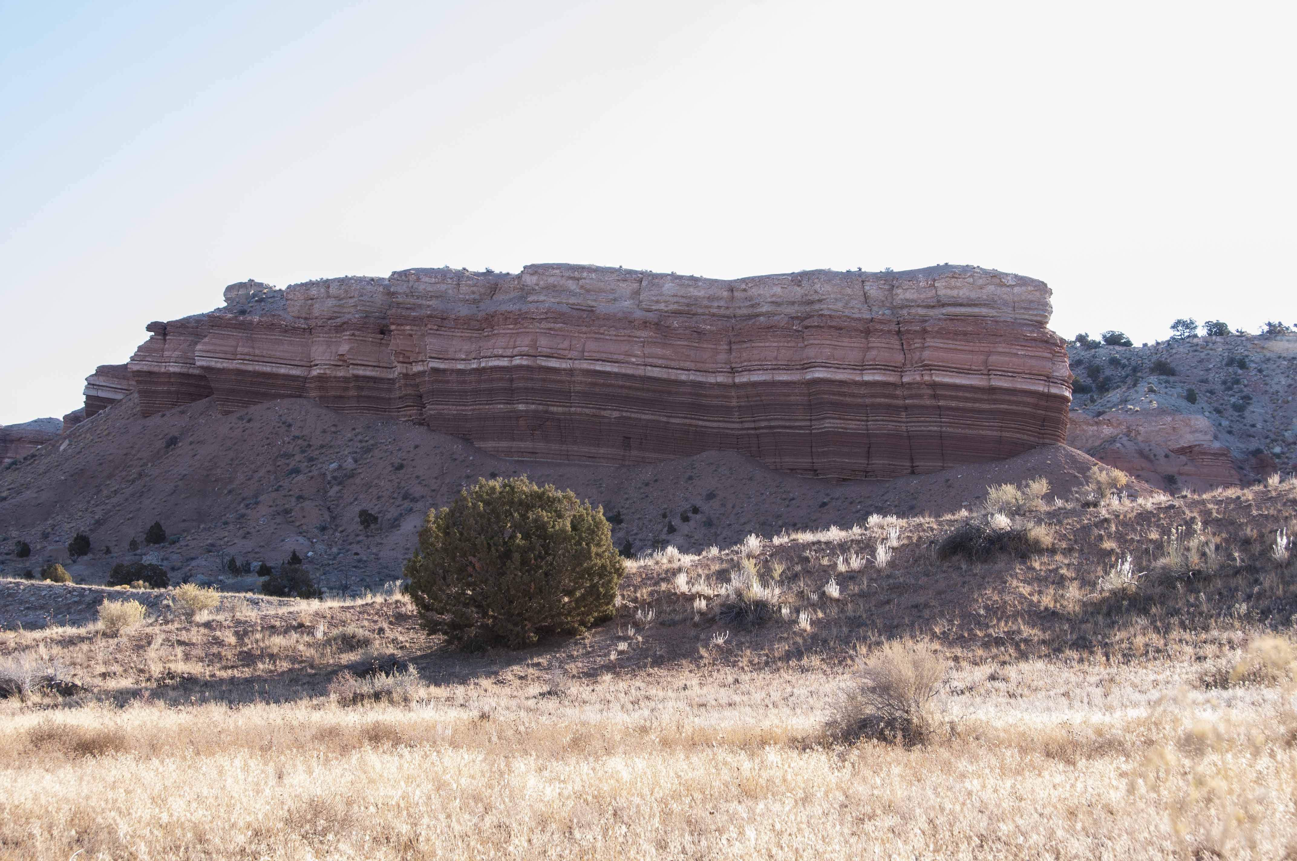
Summerville Formation
Stop 15, mile 28.1. The Summerville Formation
is located to the east. This is a sedimentary rock formation with many narrow bands of
mudstone, siltstone, sandstone, and gypsum.
Stop 16, mile 30.6. The turnoff for
Cedar Mesa Campground is located at this stop. This is a primitive campground
with five sites that have picnic tables at fire rings. There is a vault toilet.
No water or trash cans, so bring water and pack out your trash. Bring your telescope too, because
there is no light pollution at Cedar Mesa. Red Canyon Trail leaves from the campground.
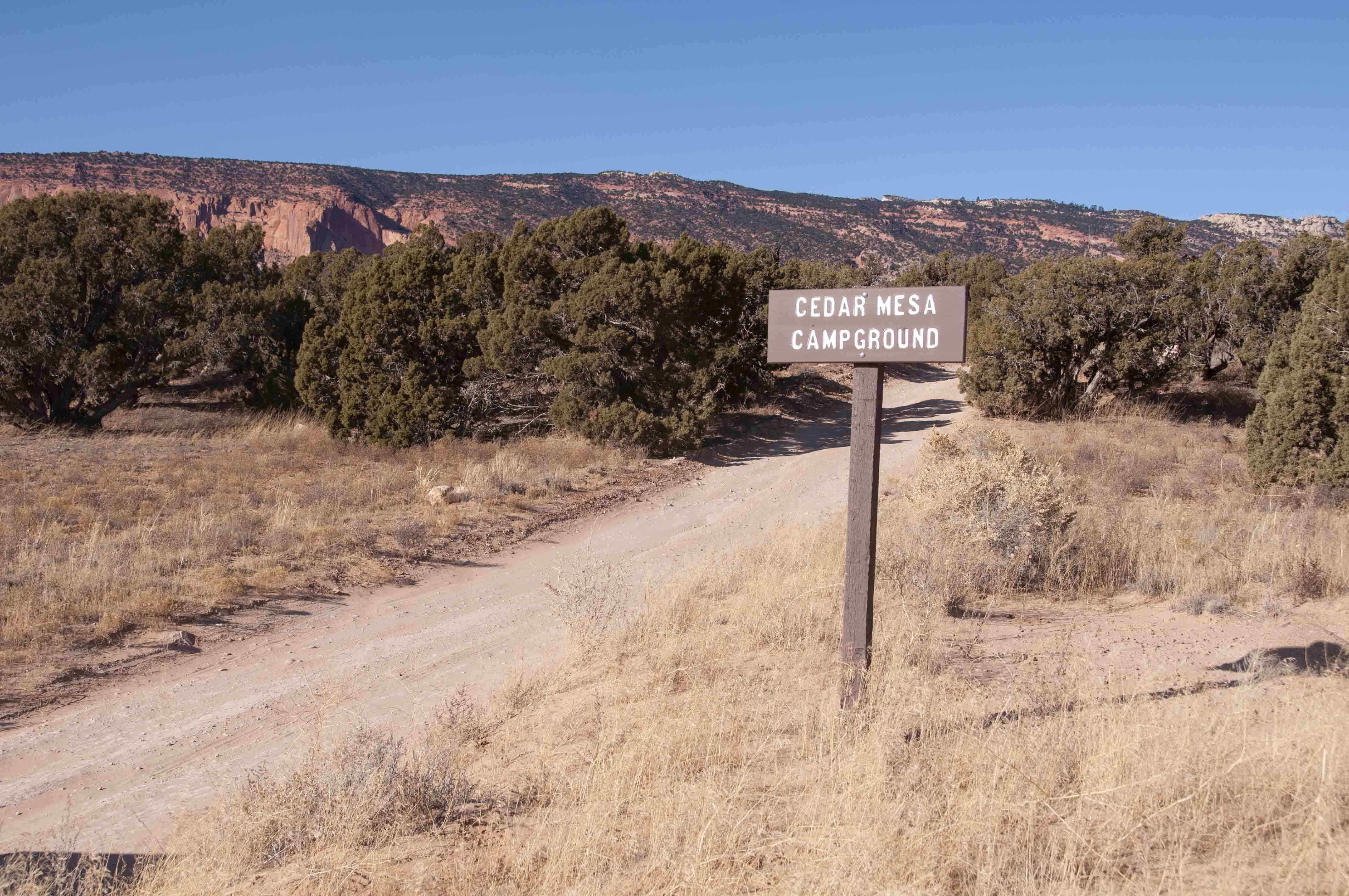
Cedar Mesa Campground

Cedar Mesa campsite
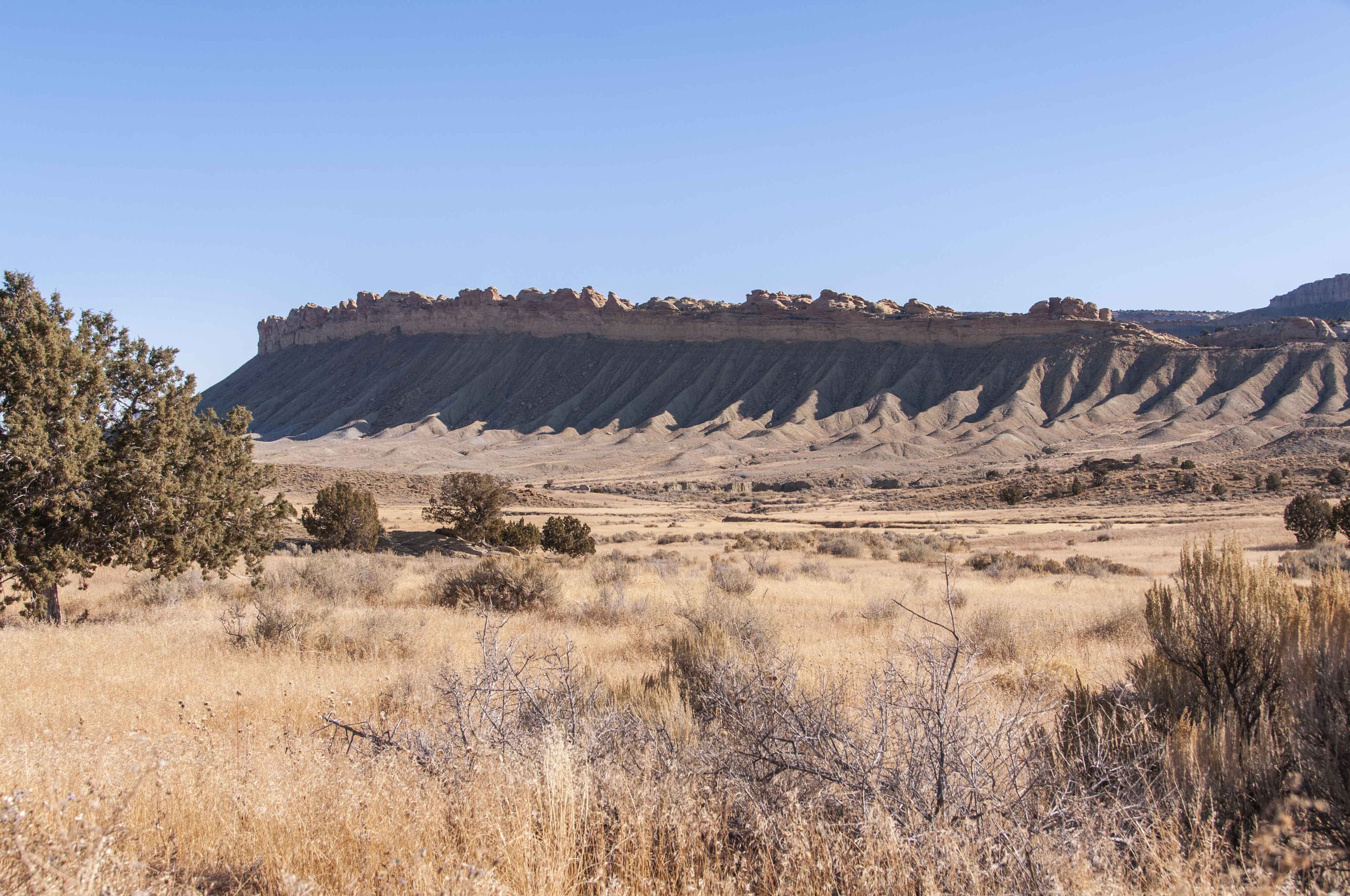
Oyster Shell Reef
Stop 17, mile 32.3. Oyster Shell Reef runs parallel
to the east side of the road at this stop. This ridge is an outcrop of
95 million year old Dakota Sandstone.
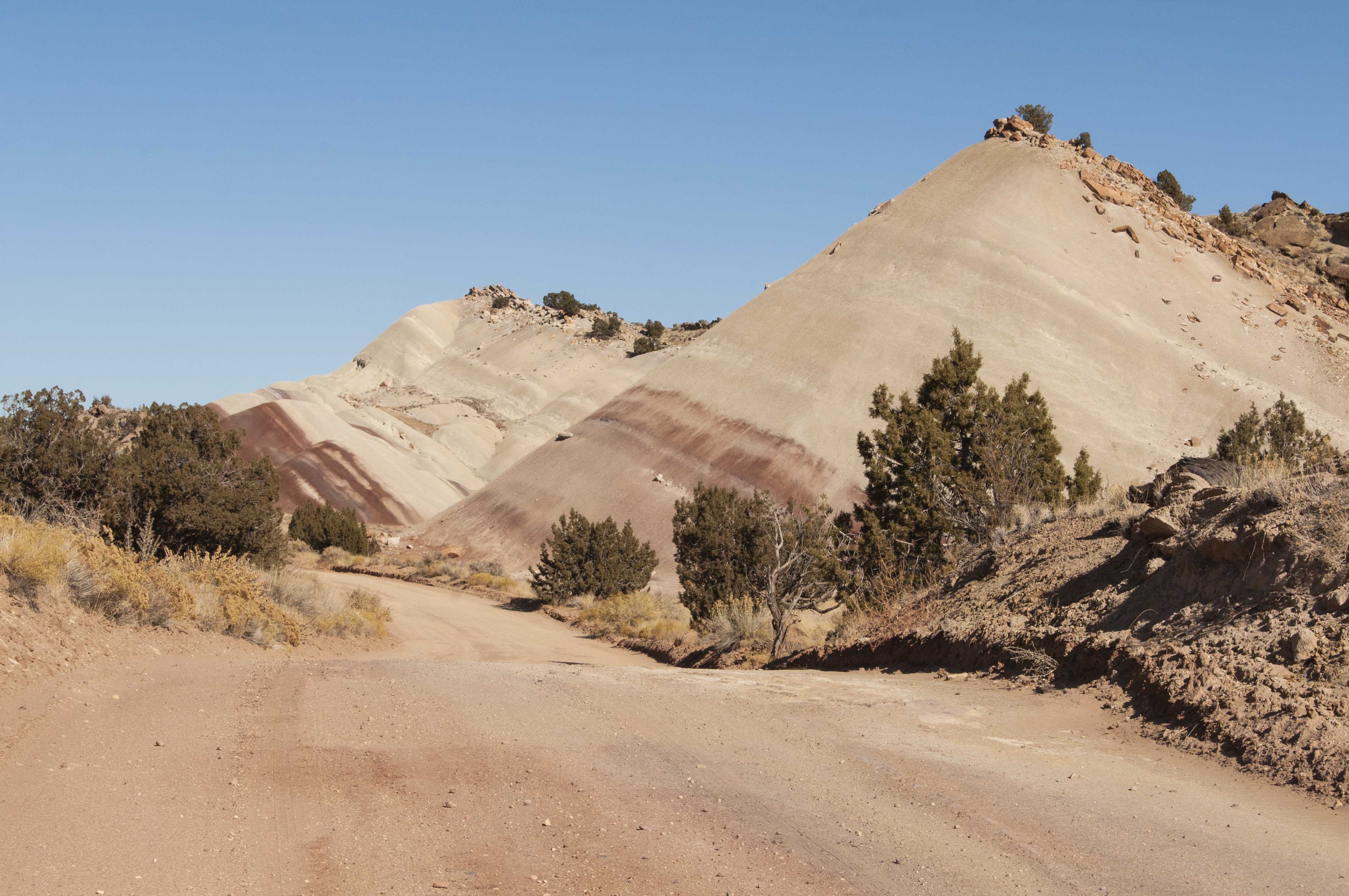
Morrison Formation Salt Wash Layer
Stop 18, mile 39.0-39.6. At this point the road
passes between two layers of the 150 million year old Morrison Formation.
The Salt Wash Layer of tan sandstone is on the west side (left
photo) and the multi-colored claystone hills of the Brushy Basin Layer
are on the east side (right photo). The layers of the Waterpocket Fold are
the most steeply tilted in this part of the park.
Morrison Formation Brushy Basin Layer
Stop 19, mile 39.8. This stop provides a good view
of the steeply-tilted eastern face of the Waterpocket Fold. There is a sharp
delineation between the red Carmel Layer and the white Navajo sandsone.
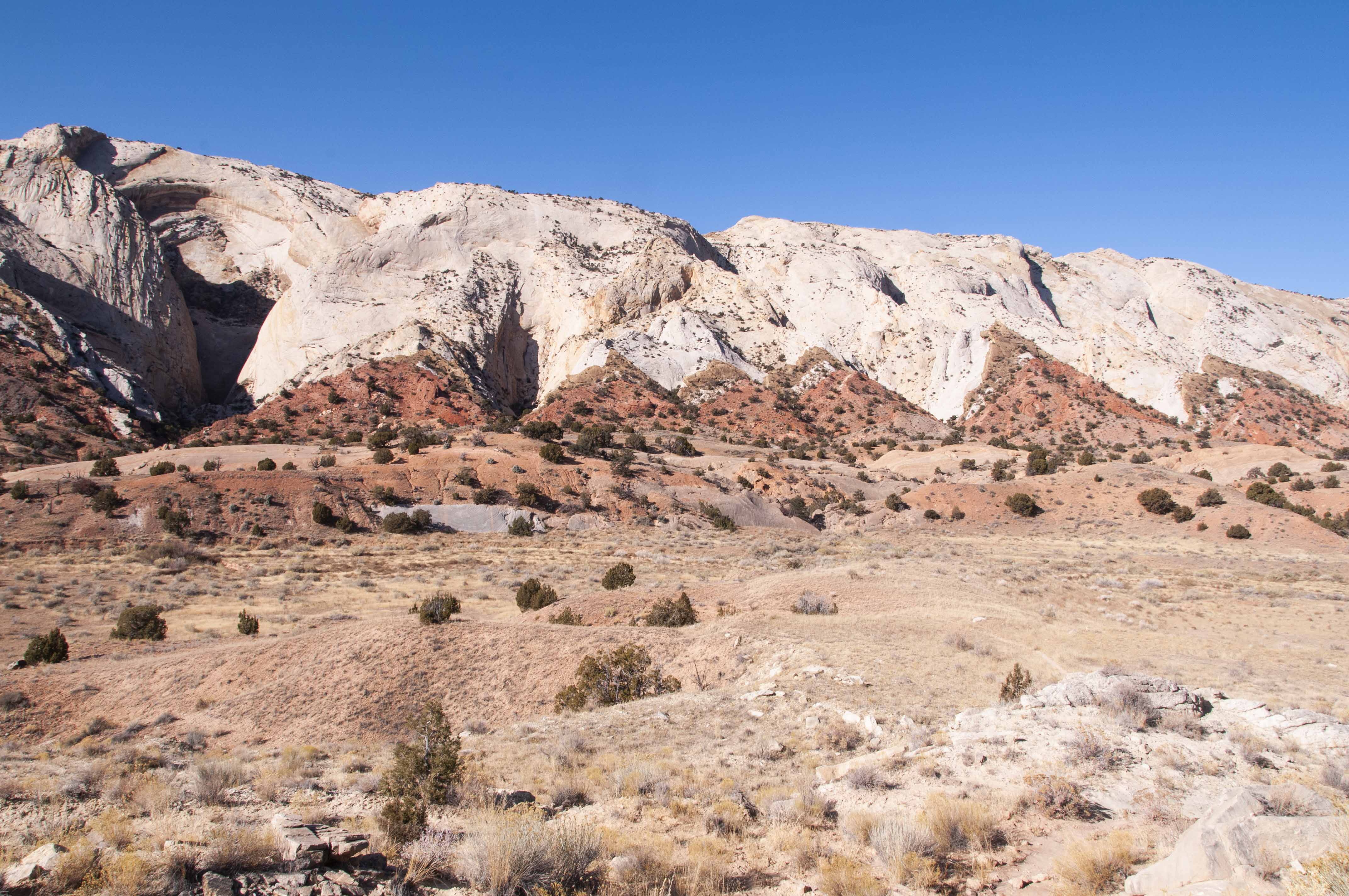
White Navajo Sandstone above, red Carmel Layer below
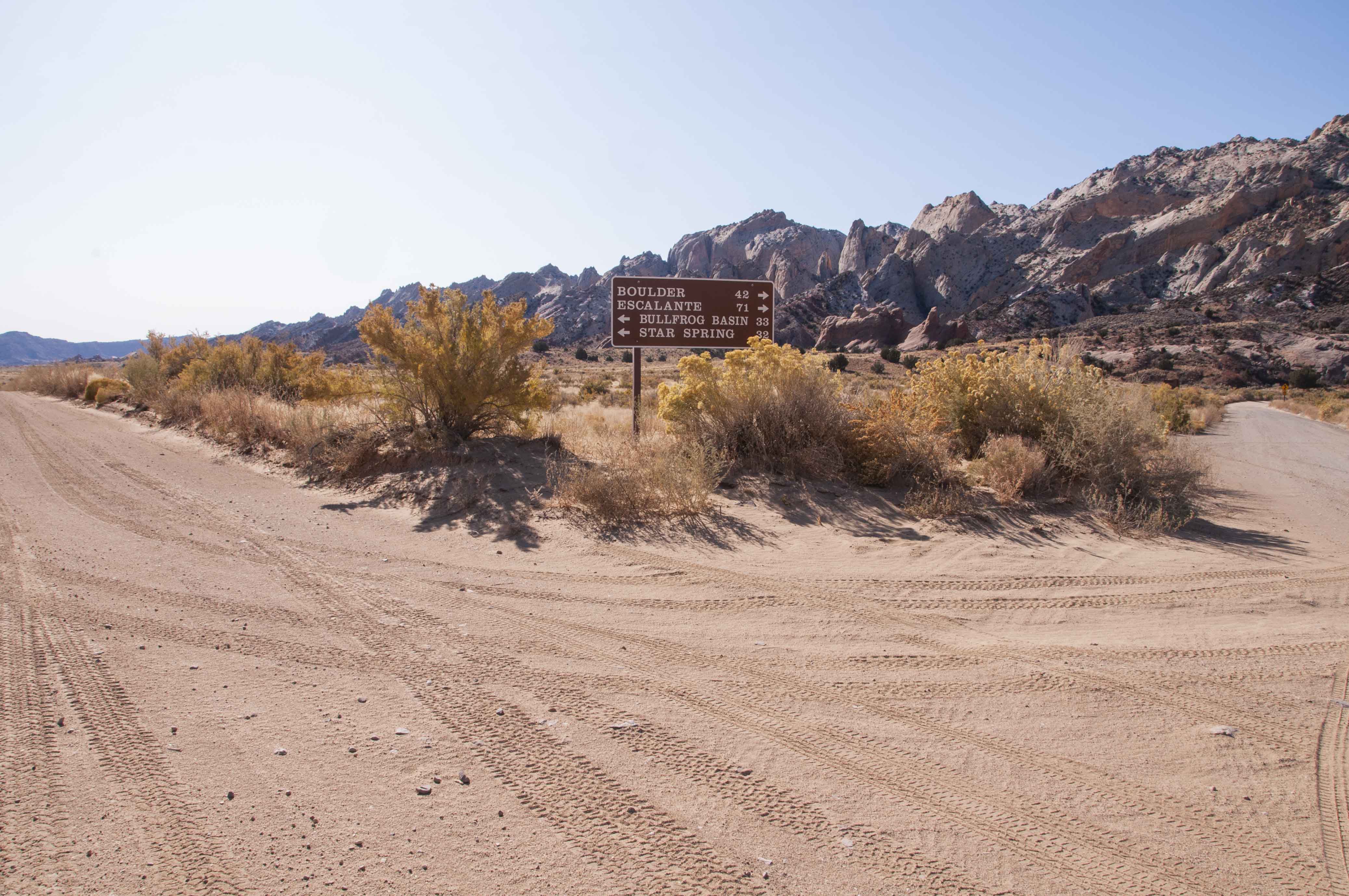
Junction of Notom-Bullfrog and Burr Trail Roads
Stop 20, mile 42.1. The Notam-Bullfrog and
Bur Trail Roads intersect at this point. Take the fork to the right onto Burr
Trail Road to continue the Loop-the-Fold tour.
Stop 22, mile 42.9. The Burr Trail switchbacks
are part of a rough trail built by John Atlantic Burr to move his cattle between
summer and winter grazing ranges. The switchbacks were graded for vehicles during
the Cold War uranium boom.
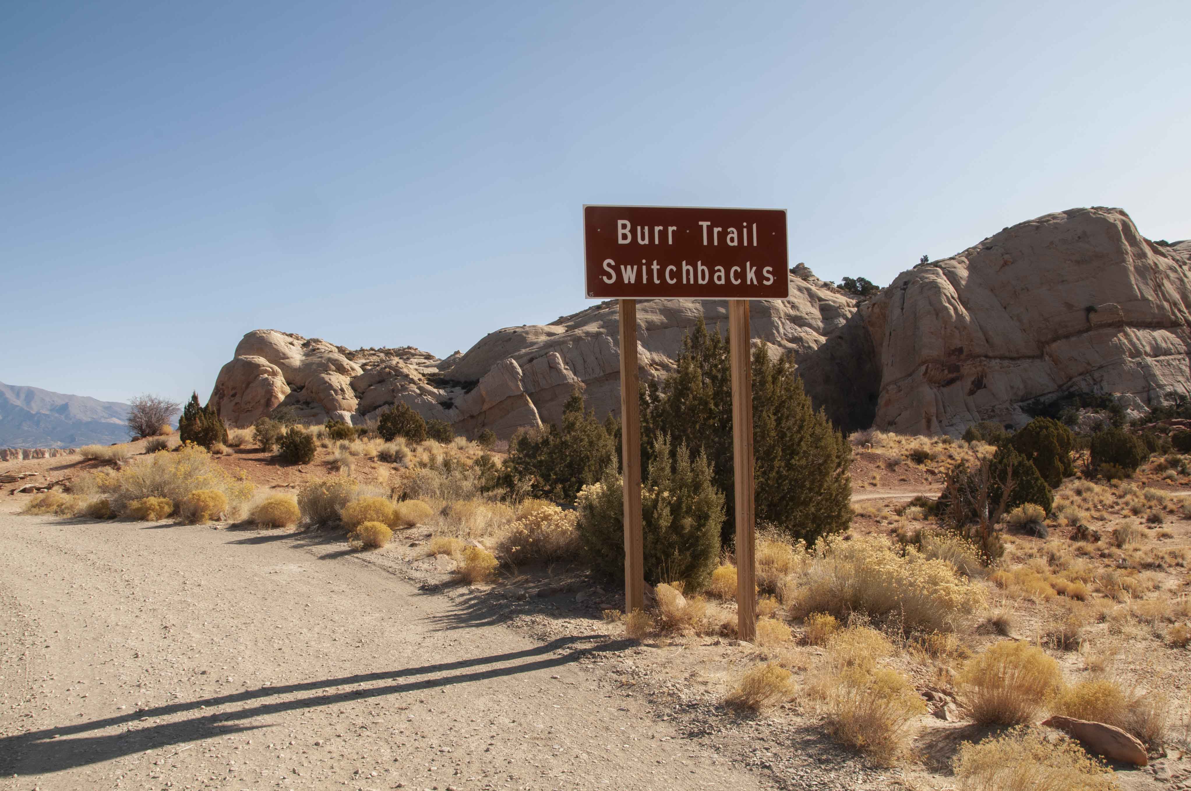
Burr Trail Switchbacks
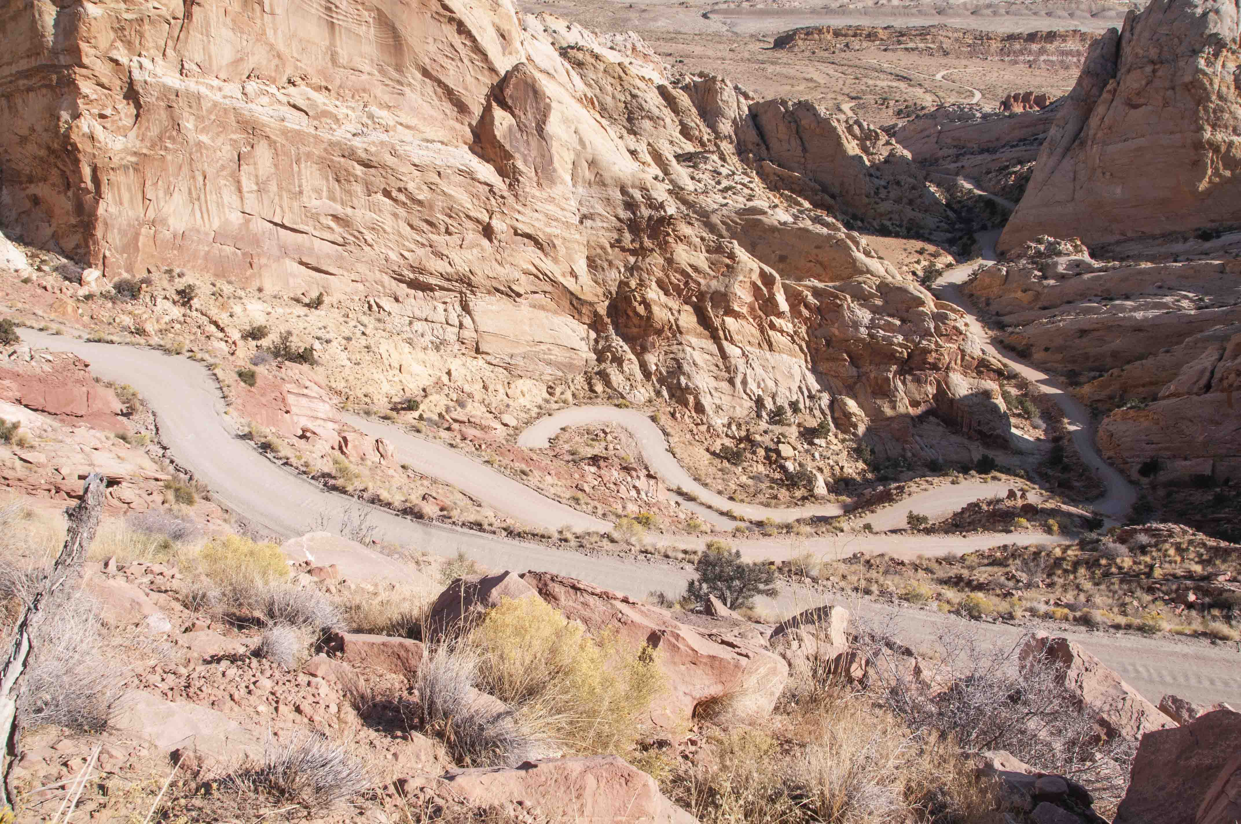
Burr Trail Switchbacks
Burr Trail Road crosses into Grand Staircase-Escalante National
Monument at mile 47.5 where it turns to pavement.
Stop 25, mile 61.6
There is a generous pullout at this stop which marks the upper end of Long Canyon. The panoramic
view from here includes the multi-colored hills of the Chinle Formation, the Circle Cliffs, and the
Henry Mountains. We had lunch at this stop - very picturesque. The Burr Trail Road continues through
Long Canyon for 6 miles after this stop.

Grand Staircase-Escalante National Monument
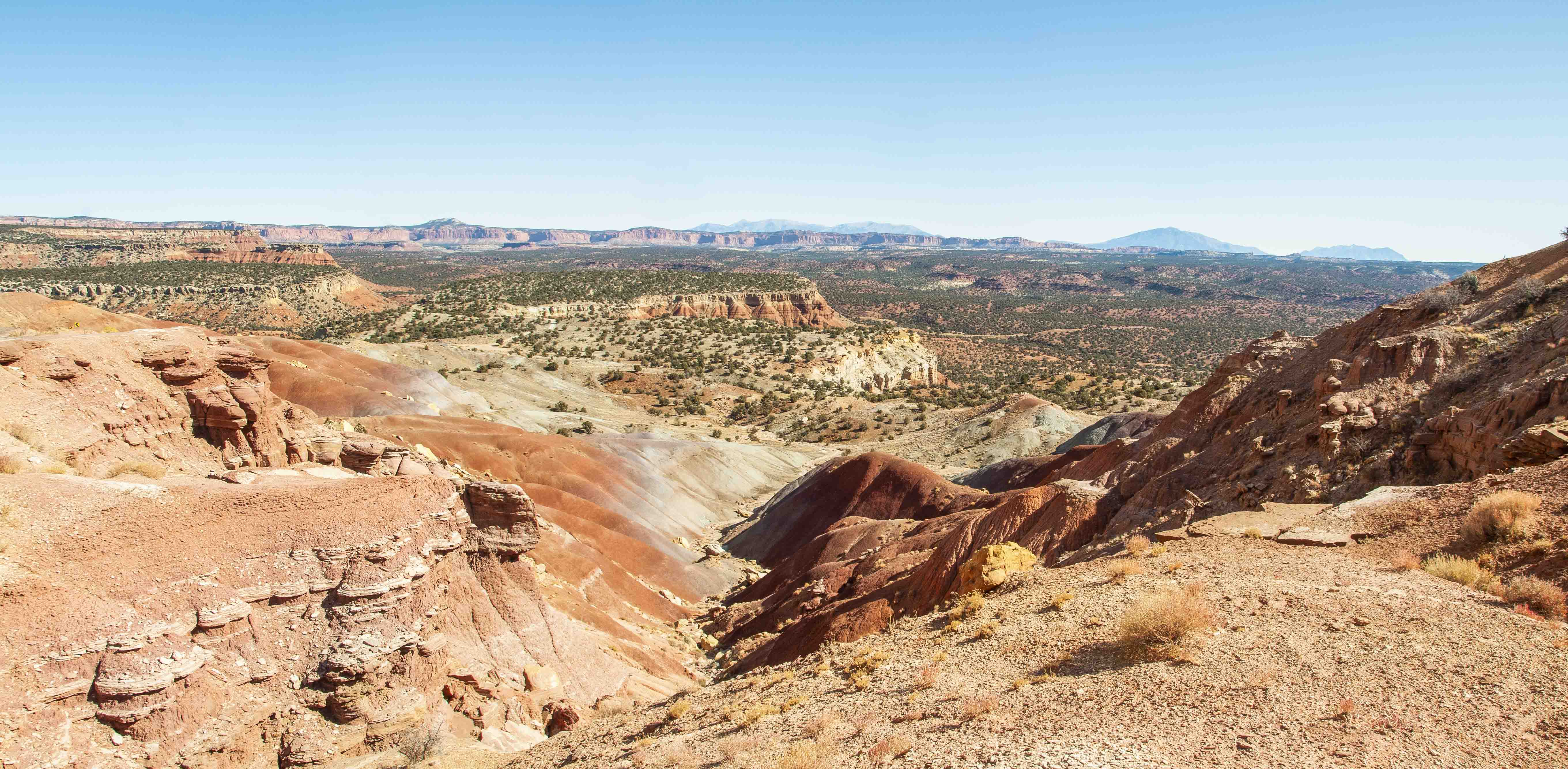
View from upper end of Long Canyon
Stop 26, mile 66.9. A short path leads into a deep
vertical crevice in the Wingate Sandstone cliff of Long Canyon.
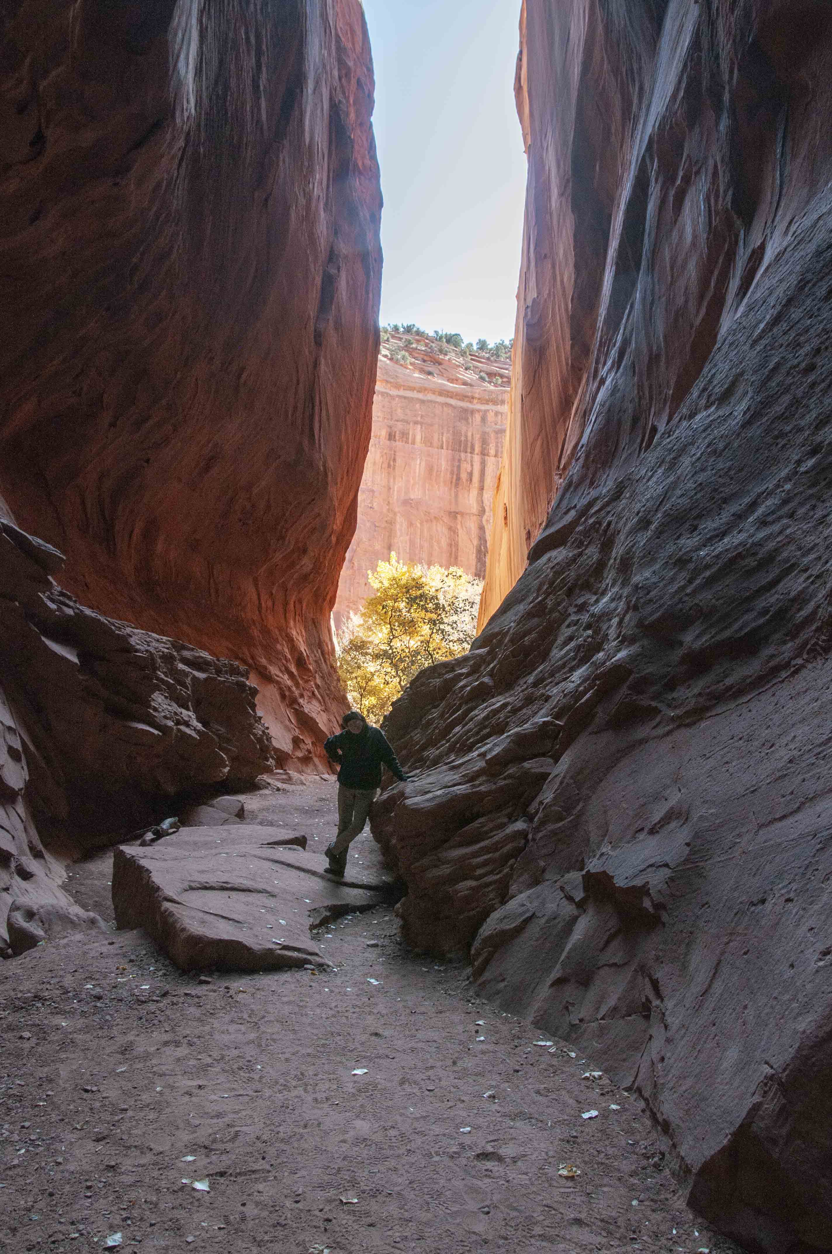
Crevice in the cliff
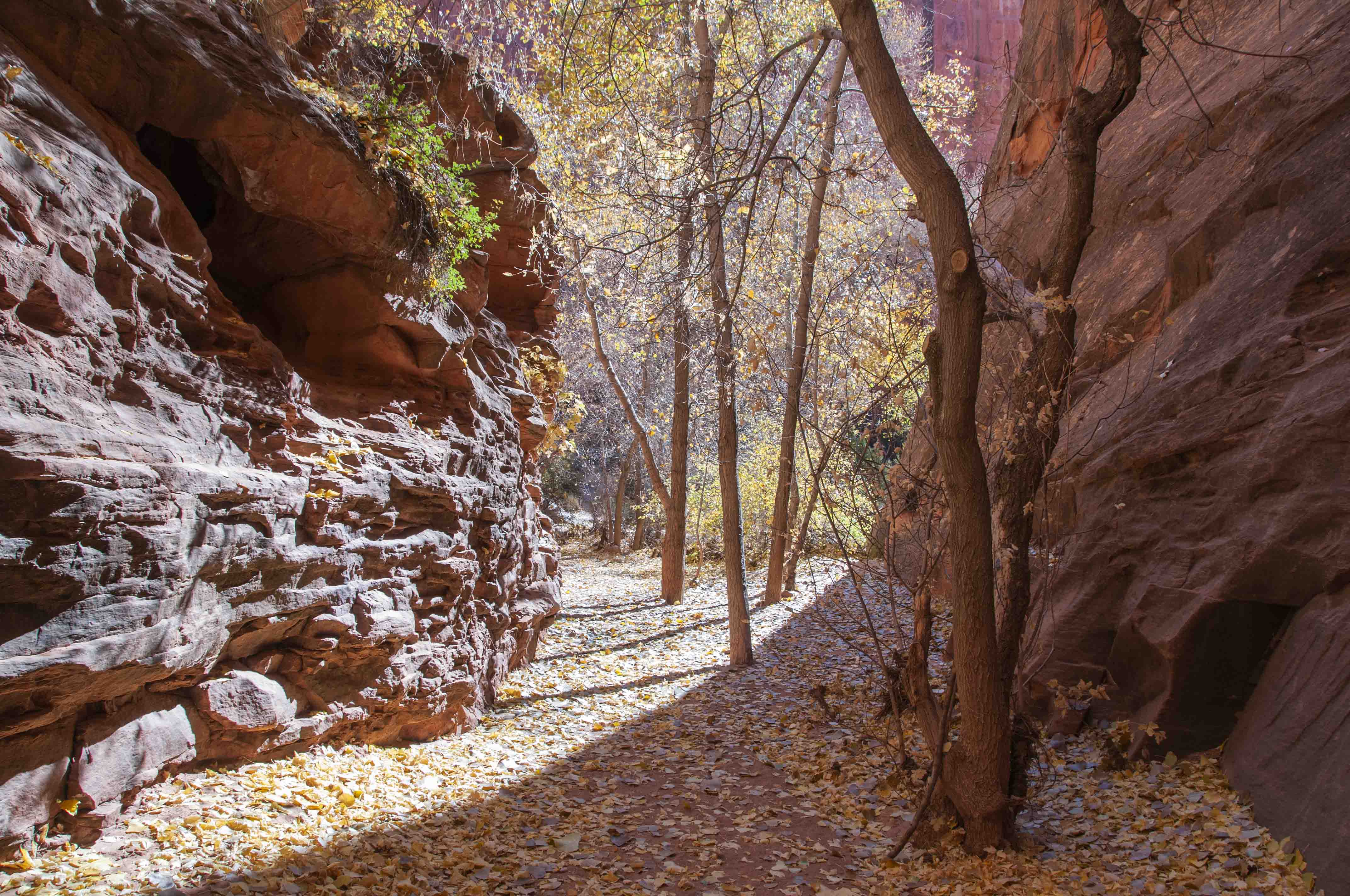
Box elders at the entrance to the cliff crevice
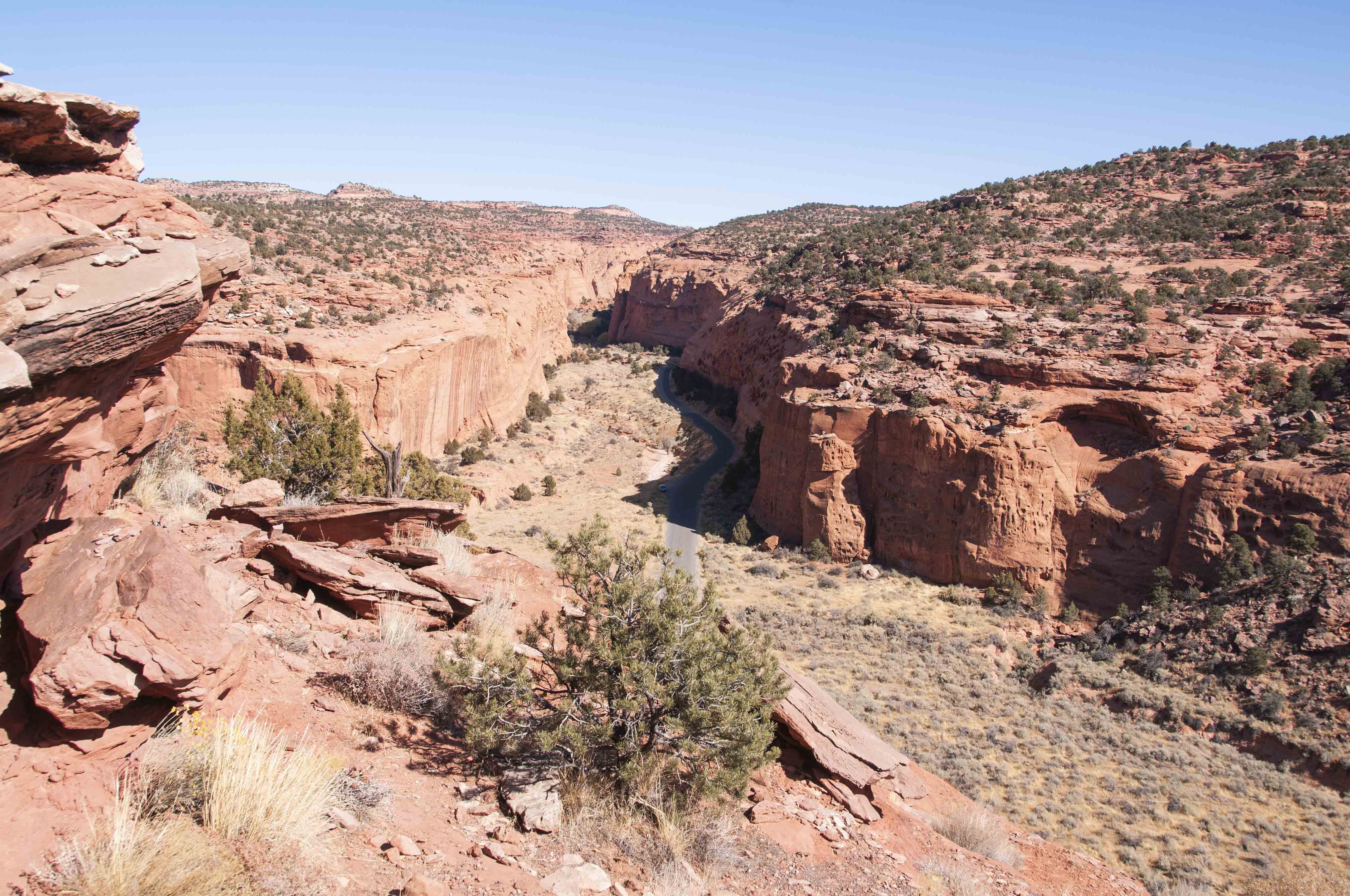
Long Canyon
Stop 28, mile 68.7. After a steep climb,
a small pullout on the east side of Burr Trail Road offers a good view of Long Canyon.
Stop 29, mile 76.5. At this stop Burr Trail Road passes
expanses of fractured Navajo Sandstone dotted with rounded boulders of
black lava. The boulders were originally fragments of 25 million year old lava flows
ground down by glacial action an subsequent floods that deposited them in the floodplains.
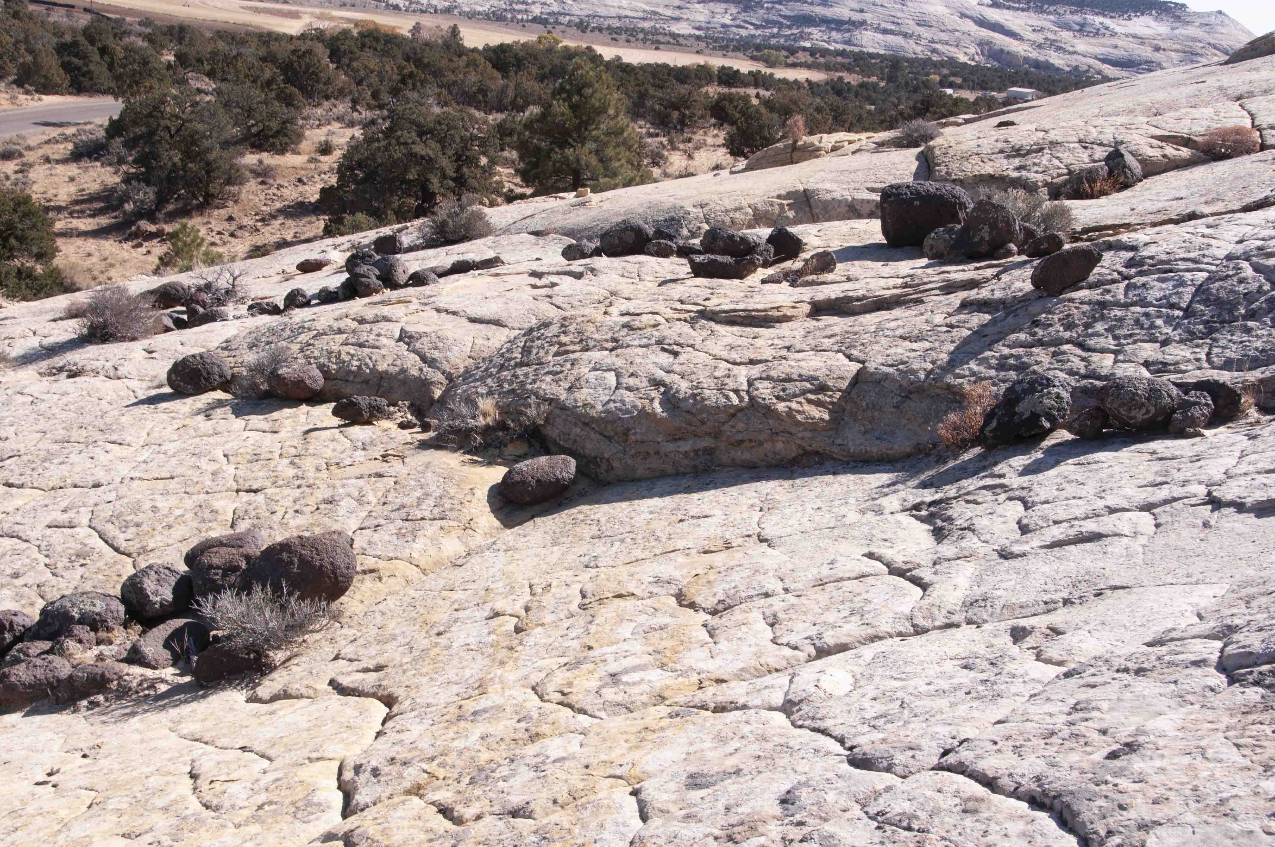
Navajo Sandstone strewn with black lava boulders
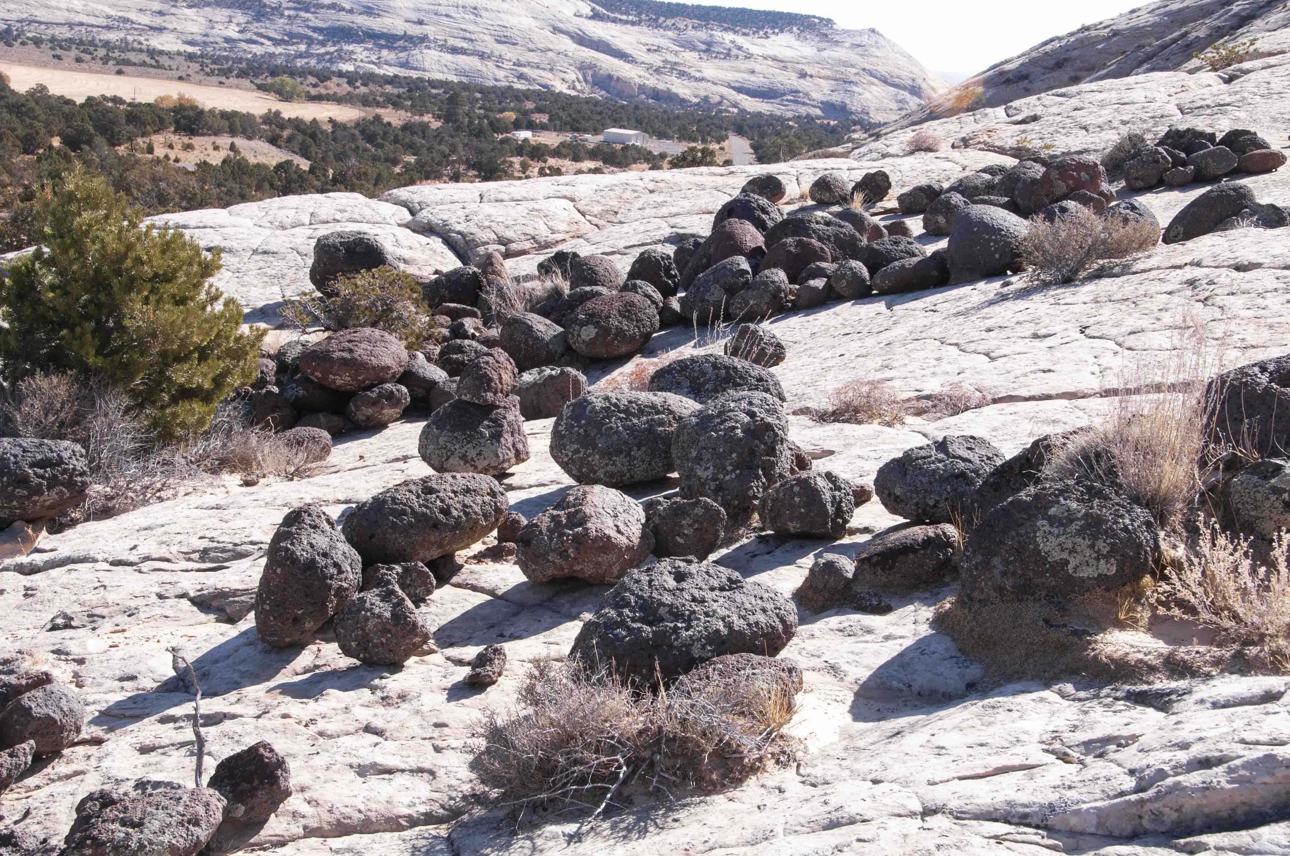
Navajo Sandstone strewn with black lava boulders
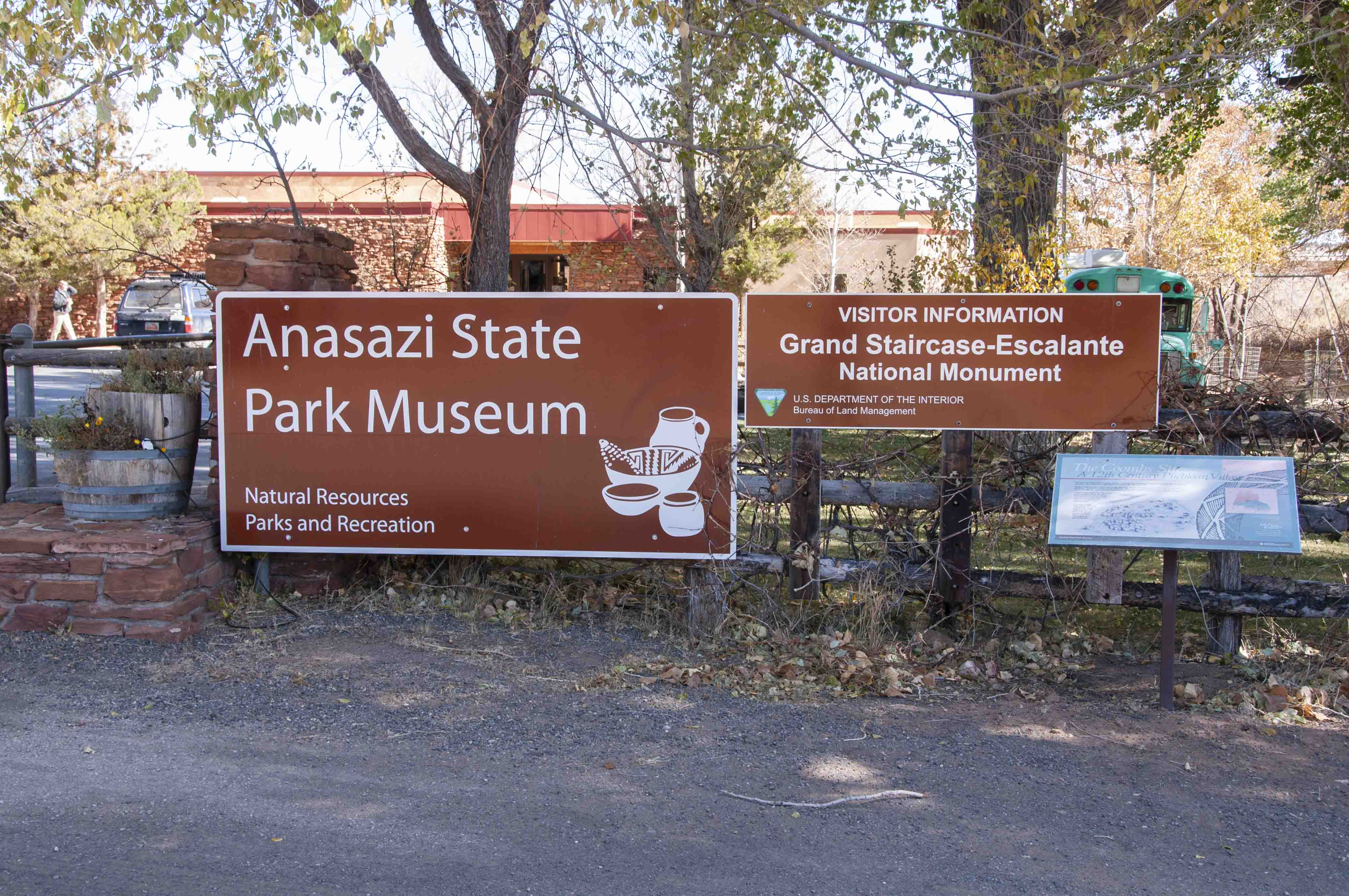
Burr Trail Road ends in the town of Boulder at the intersection
with Utah Highway 12 (Stop 30, mile 78.6). UT Hwy 12 is a scenic byway dubbed "The All
American Road", and it is scenic. Turn right (north) onto UT 12 and continue a little
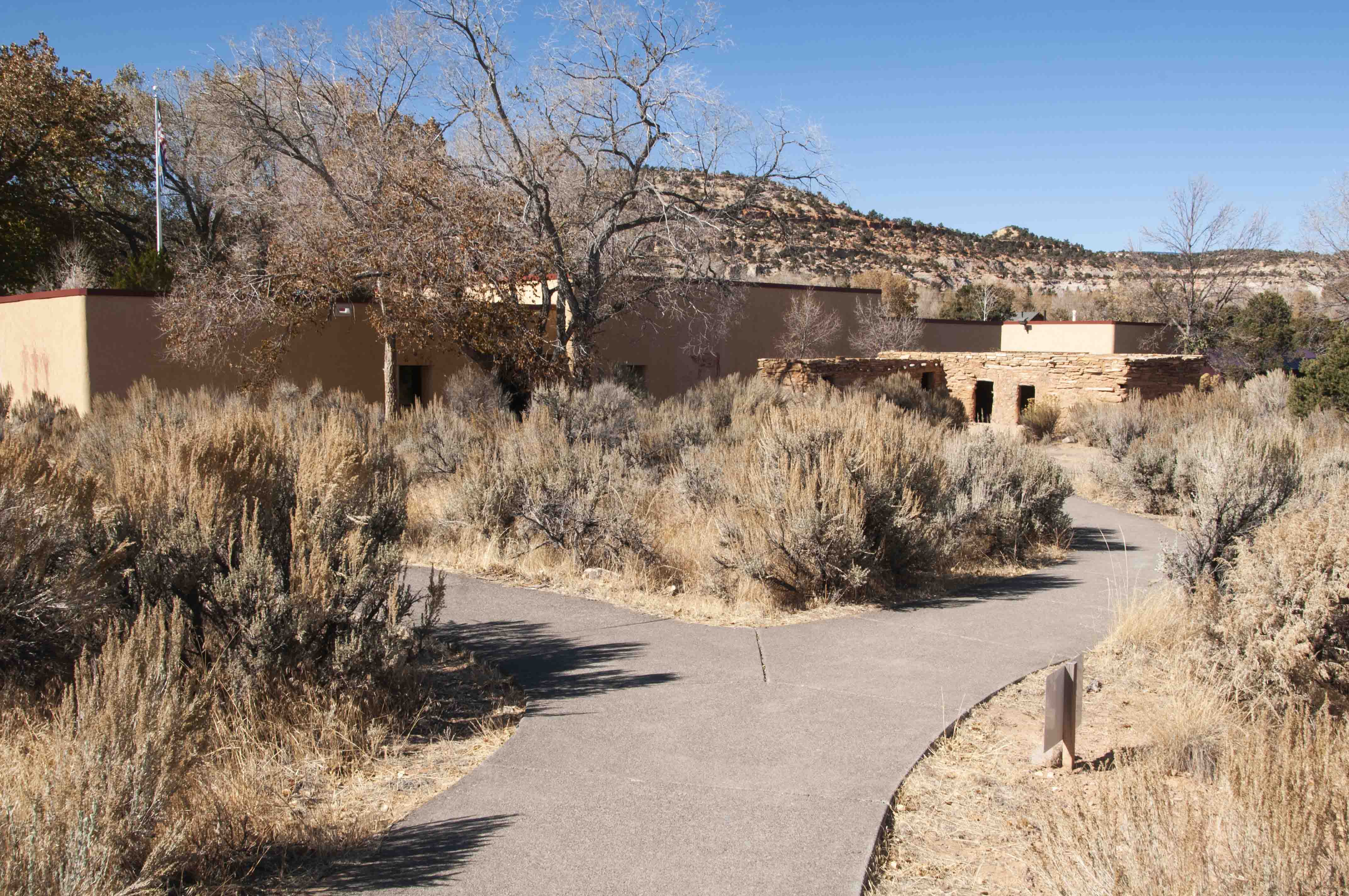
ways to Stop 31 at mile 79.3. This is Anasazi State Park. The park contains a
partially excavated Ancestral Puebloan village called the Coombs Site, a room block replica,
visitor center, and museum.
Anasazi State Park
Visitor Center and Room Block Replica
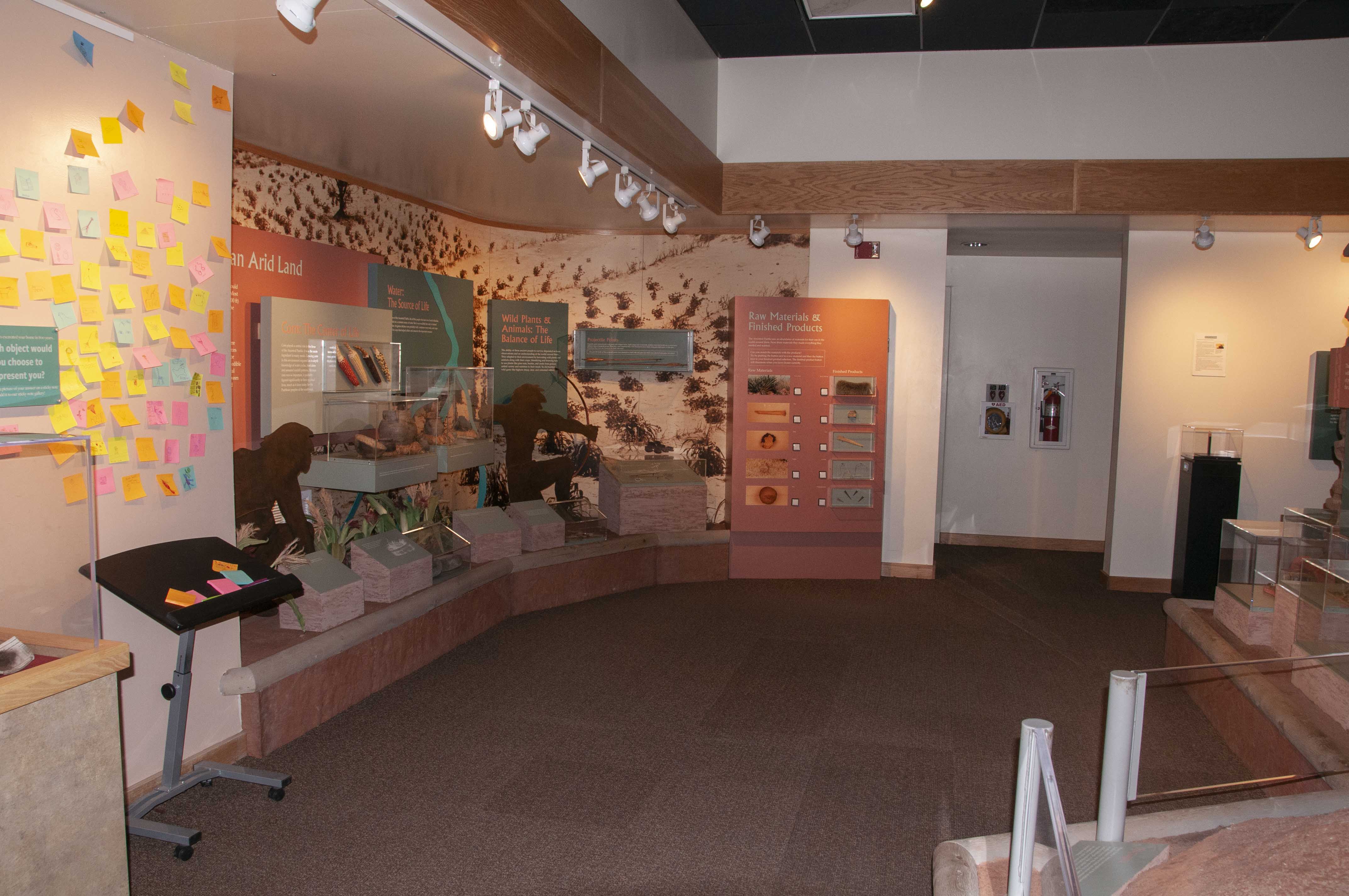
Museum Exhibits
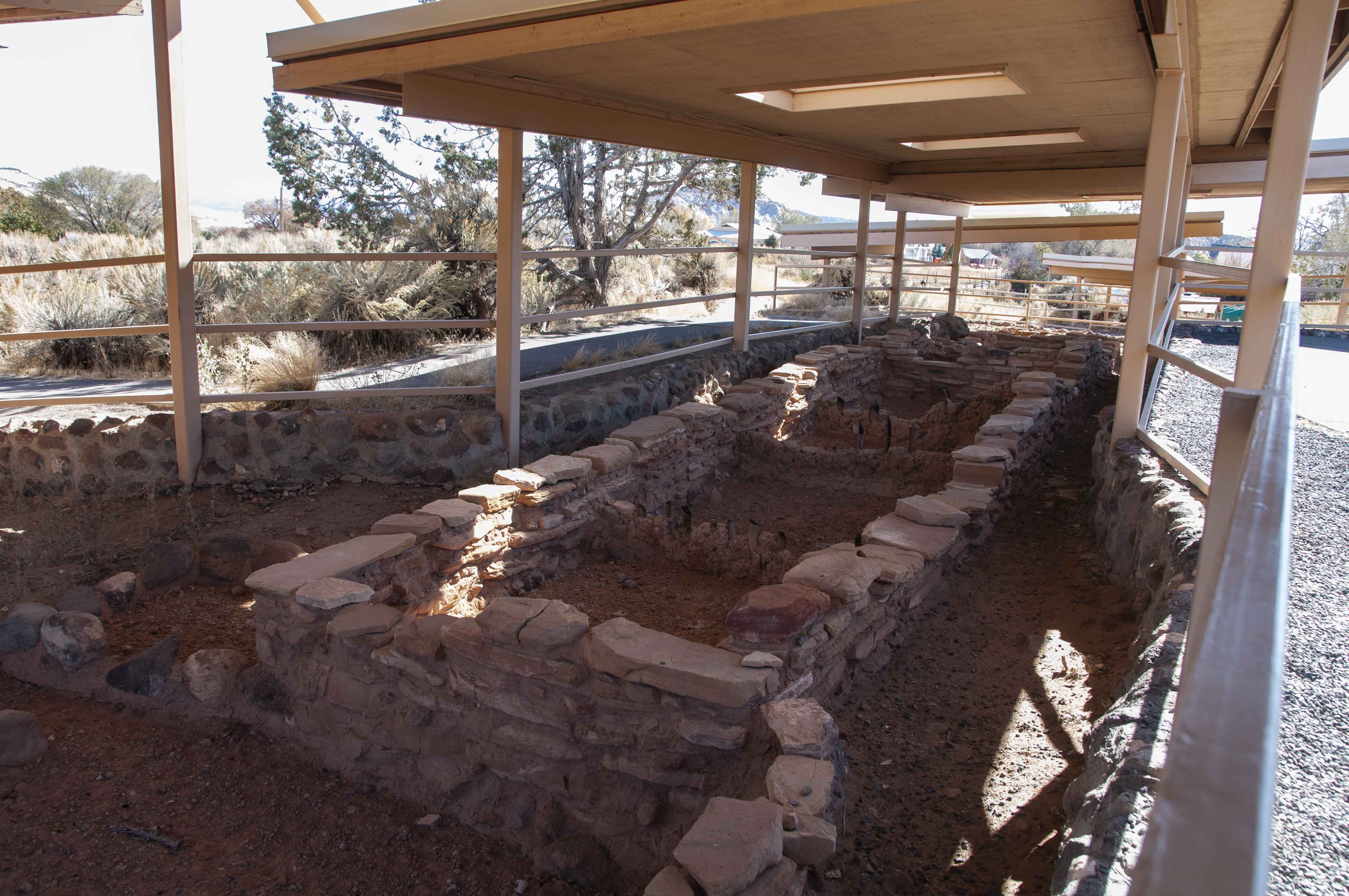
Excavated Room Block
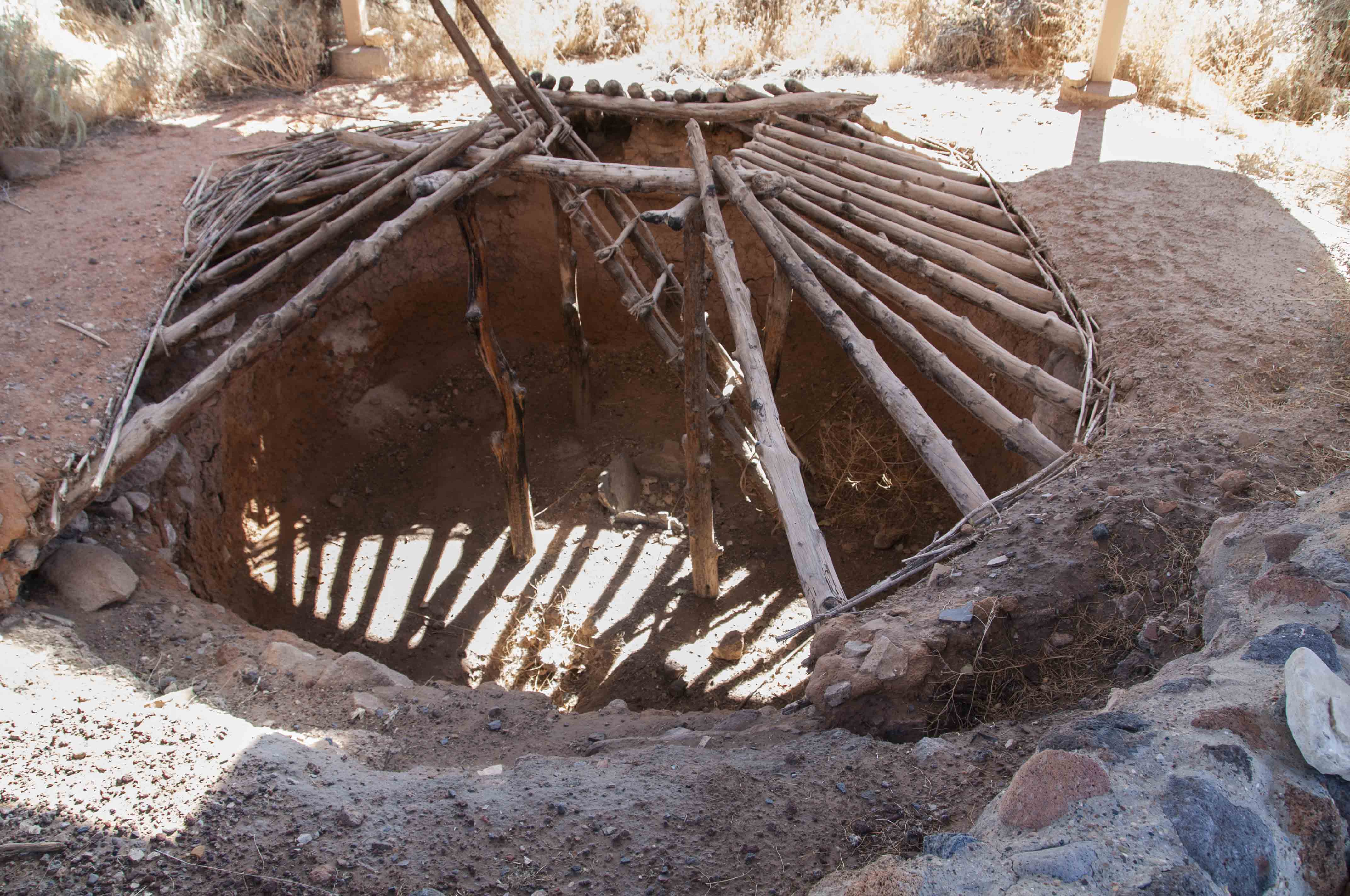
Pit House

View from Larb Hollow Overlook
Utah Highway 12 continues north through Dixie and Fishlake
National Forests, climbing around the east flank of Boulder Mountain. There are
several viewpoints along the way, and one of the best is Larb Hollow Overlook (Stop 34, mile 101.4).
This overlook offers a panorama of Capitol Reef, Factory Butte, the Henry Mountains,
and even the La Sal mountains on a clear day.
The last three stops on the tour are along UT SR 24 in Capitol
Reef National Park. These are Twin Rocks (Stop 36, mile 120.6), Chimney Rock
(Stop 37, mile 122.6), and Panorama Point (Stop 38, mile 123.3). I didn't actually
make these stops when I took the tour. The photos are from a previous trip to Capitol Reef.
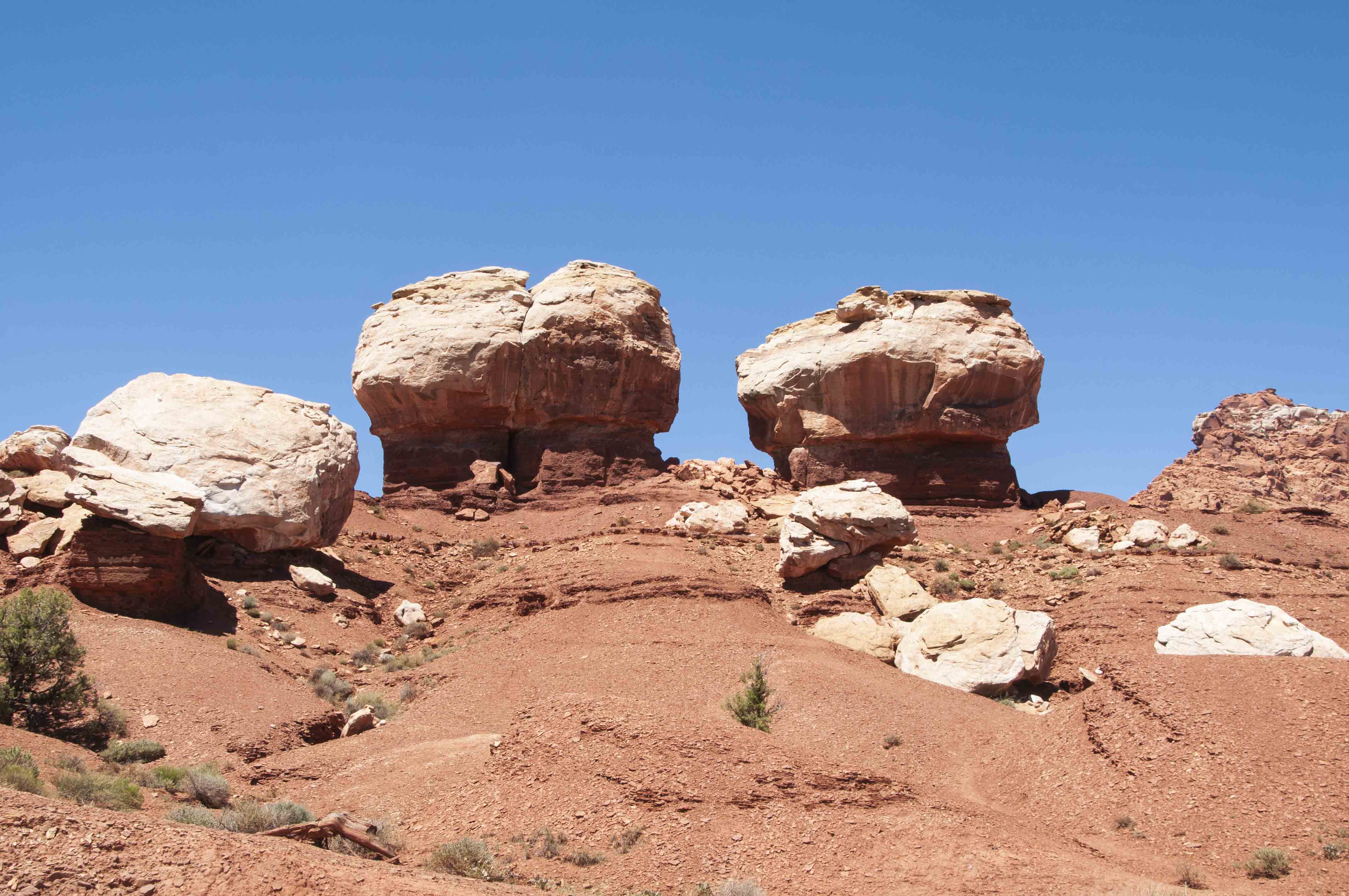
Twin Rocks
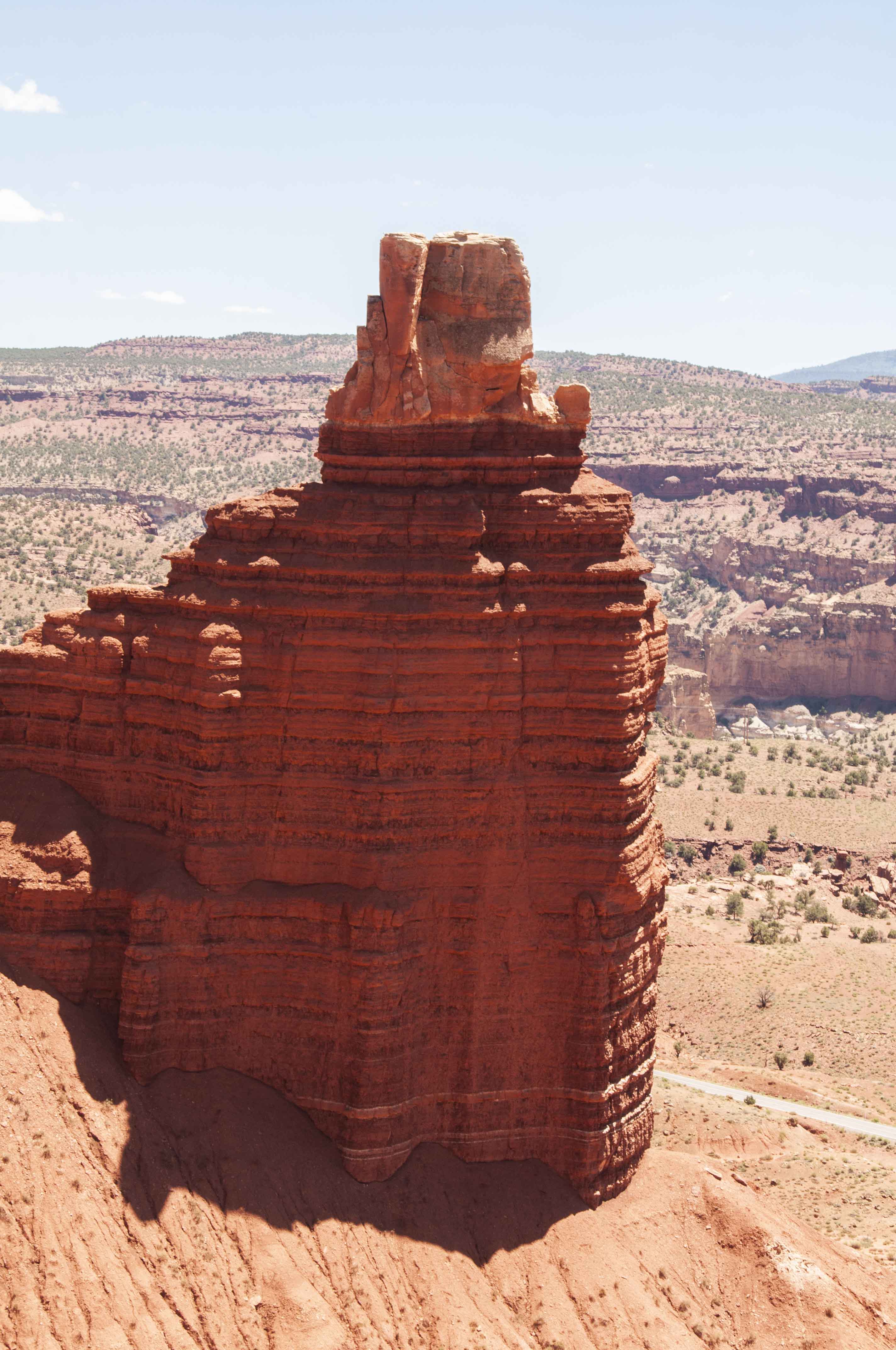
Chimney Rock
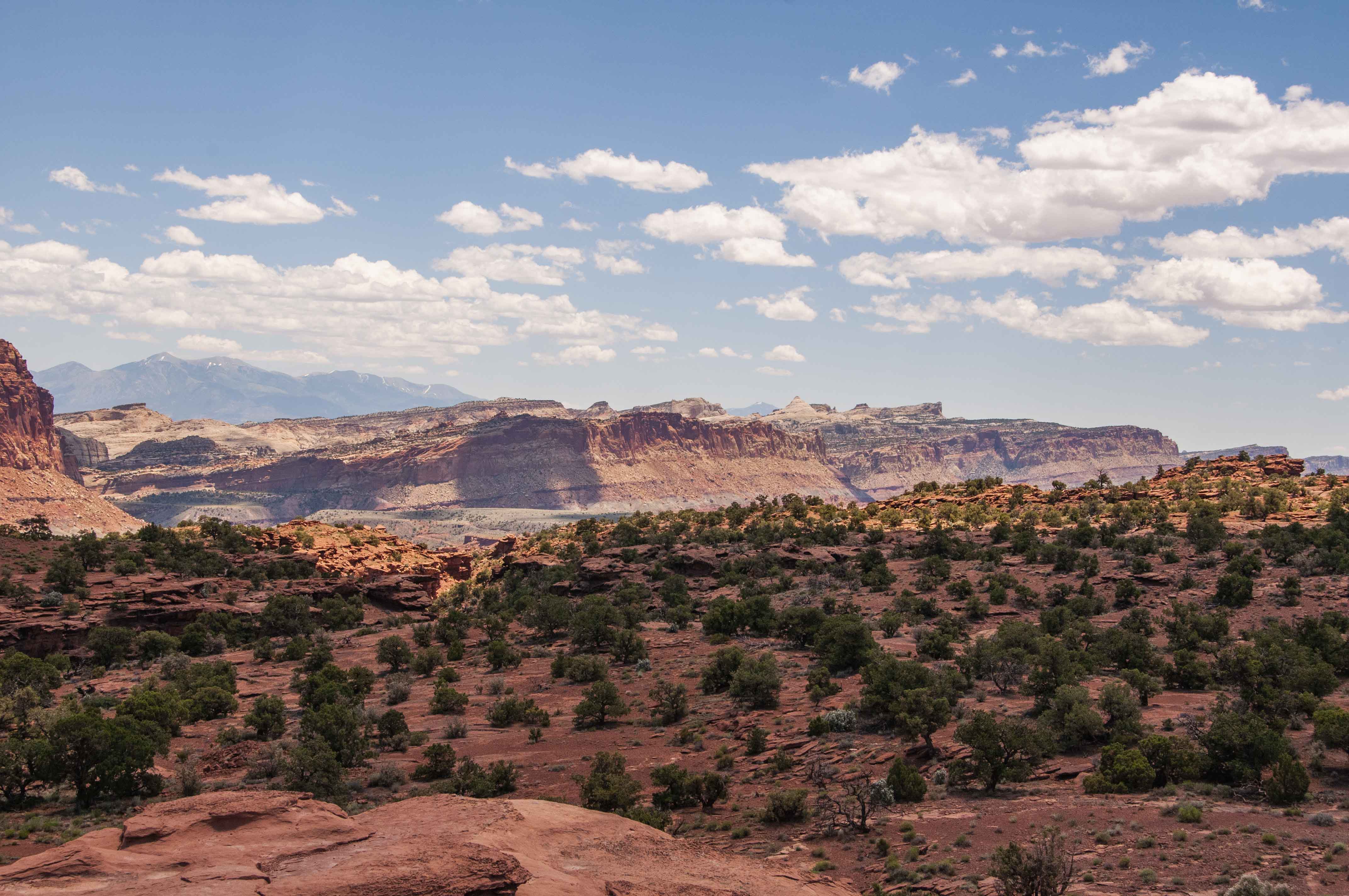
Panorama Point
Use the form on the Home Page to submit comments, questions, or suggestions. TD Productions Copyright © 2019