Bears Ears National Monument
Established on December 28, 2016, Bears Ears National Monument currently spans some 1.3 million acres in southeastern Utah. It's named after two distinctive buttes that resemble a pair of bear ears seen in the photo below. There is something for everyone in Bears Ears: camping, hiking, backpacking, birding, rock climbing, river rafting, and 4-wheeling. Indian Creek Corridor Scenic Byway along Utah SR-211 offers some of the best rock climbing in the country. The San Juan River accomodates boaters, river rafters, kayakers, and paddleboarders. Permits are required to float the San Juan River. Cedar Mesa and Comb Ridge in the southeastern part of the park are home to numerous archaeological sites that are the focus of this photoessay. I've made several forays to this part of Bears Ears spanning the years 2023 to 2025.
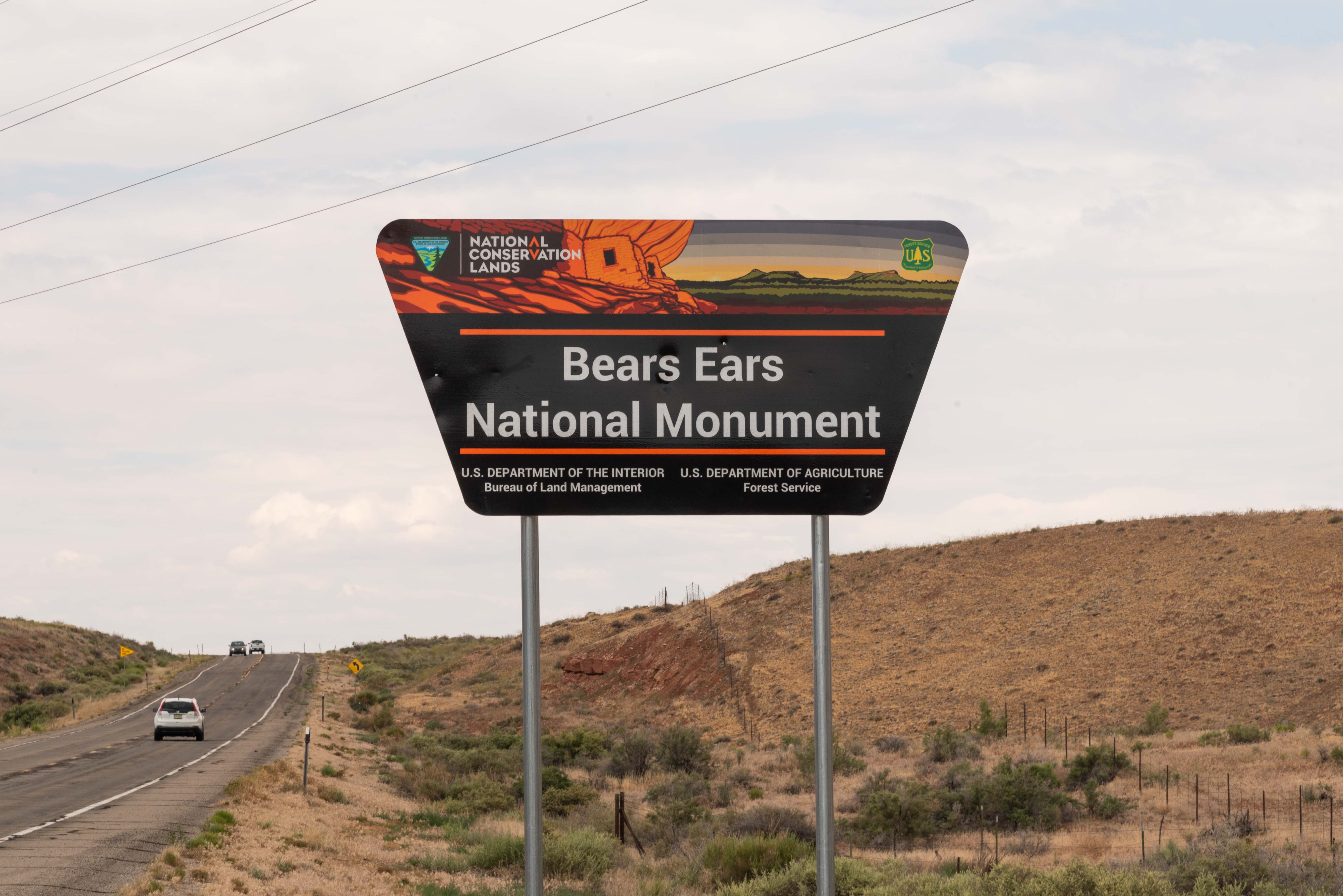
Bears Ears National Monument
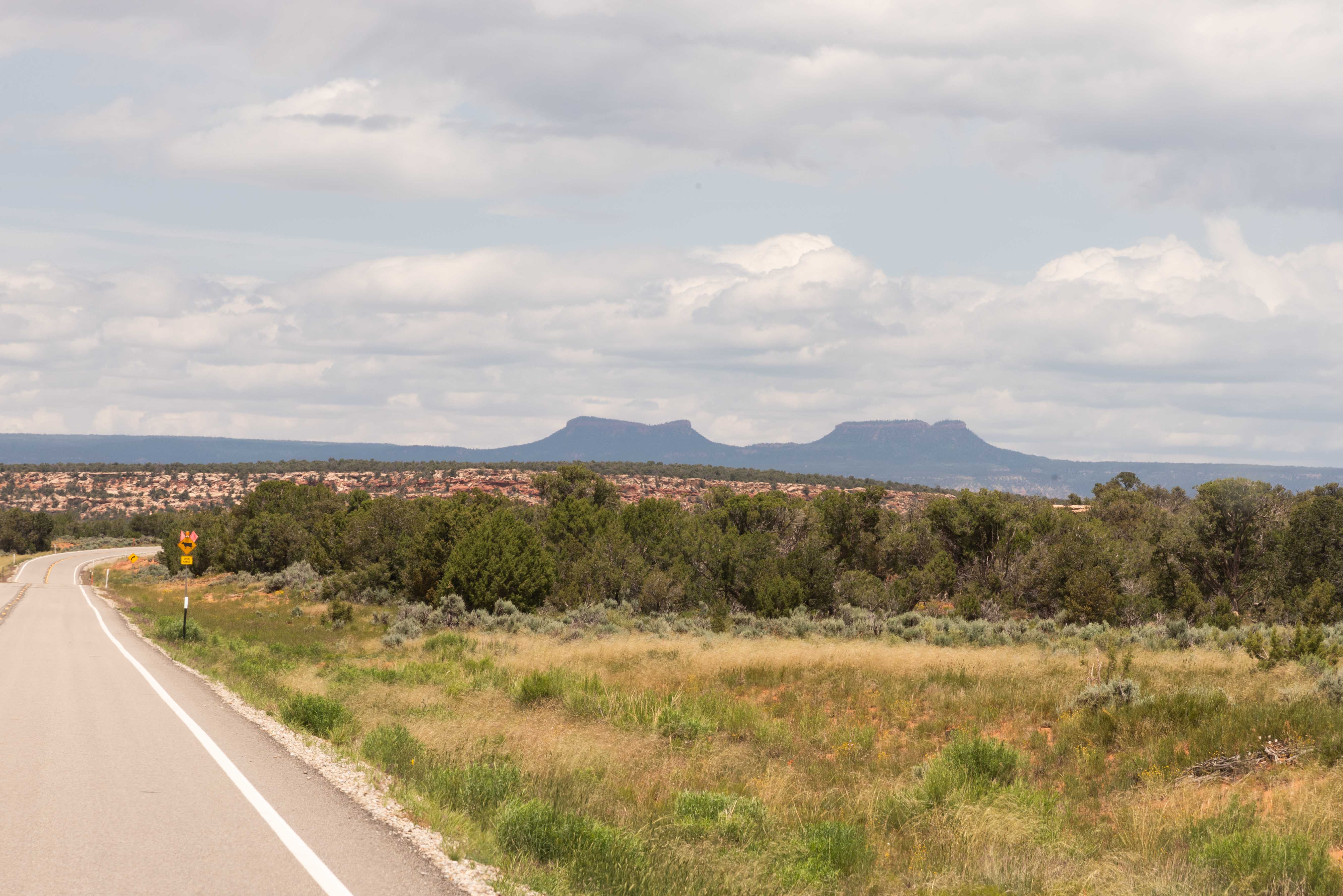
Bears Ears
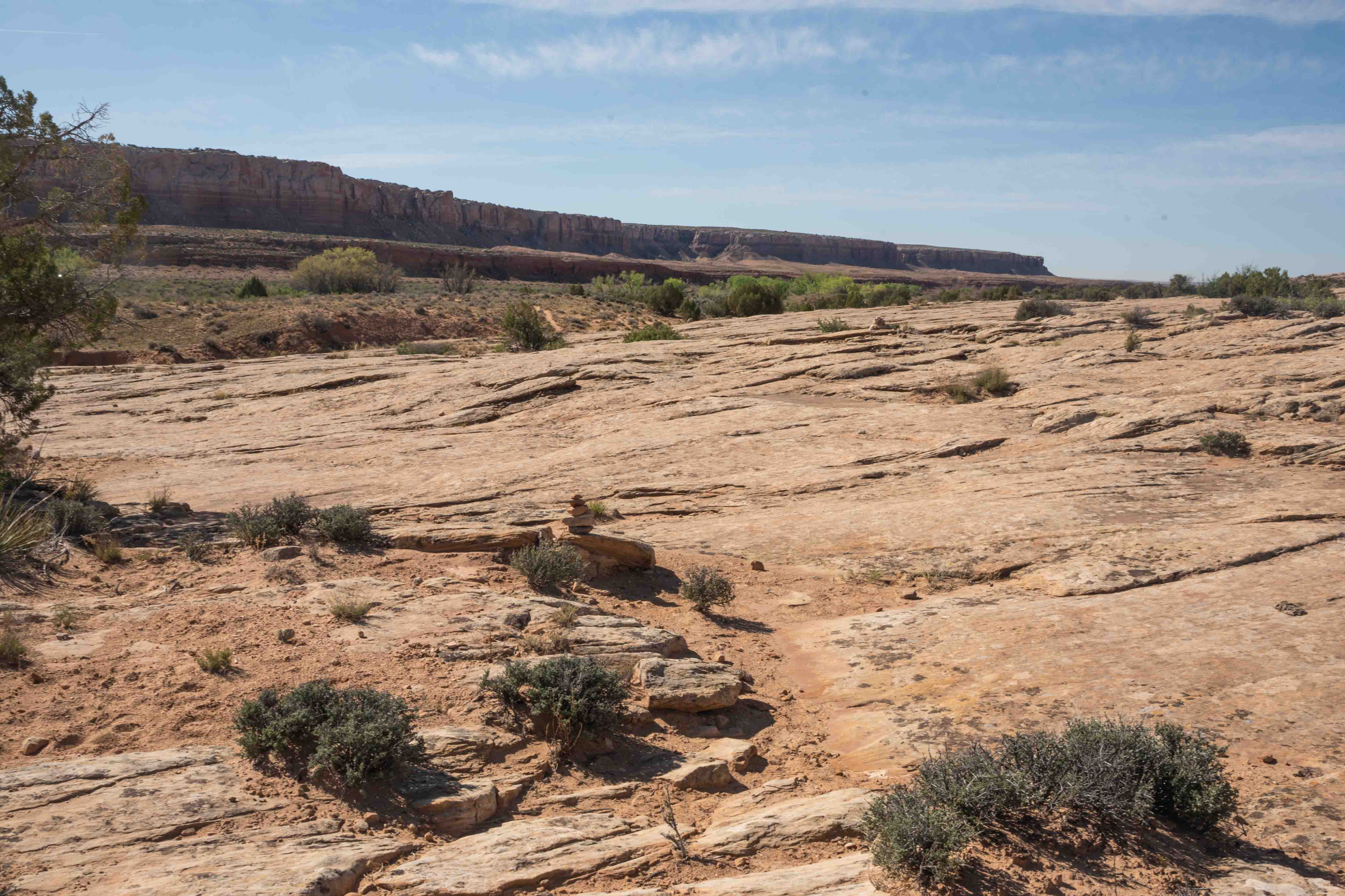
Butler Wash Road (County Road 262)
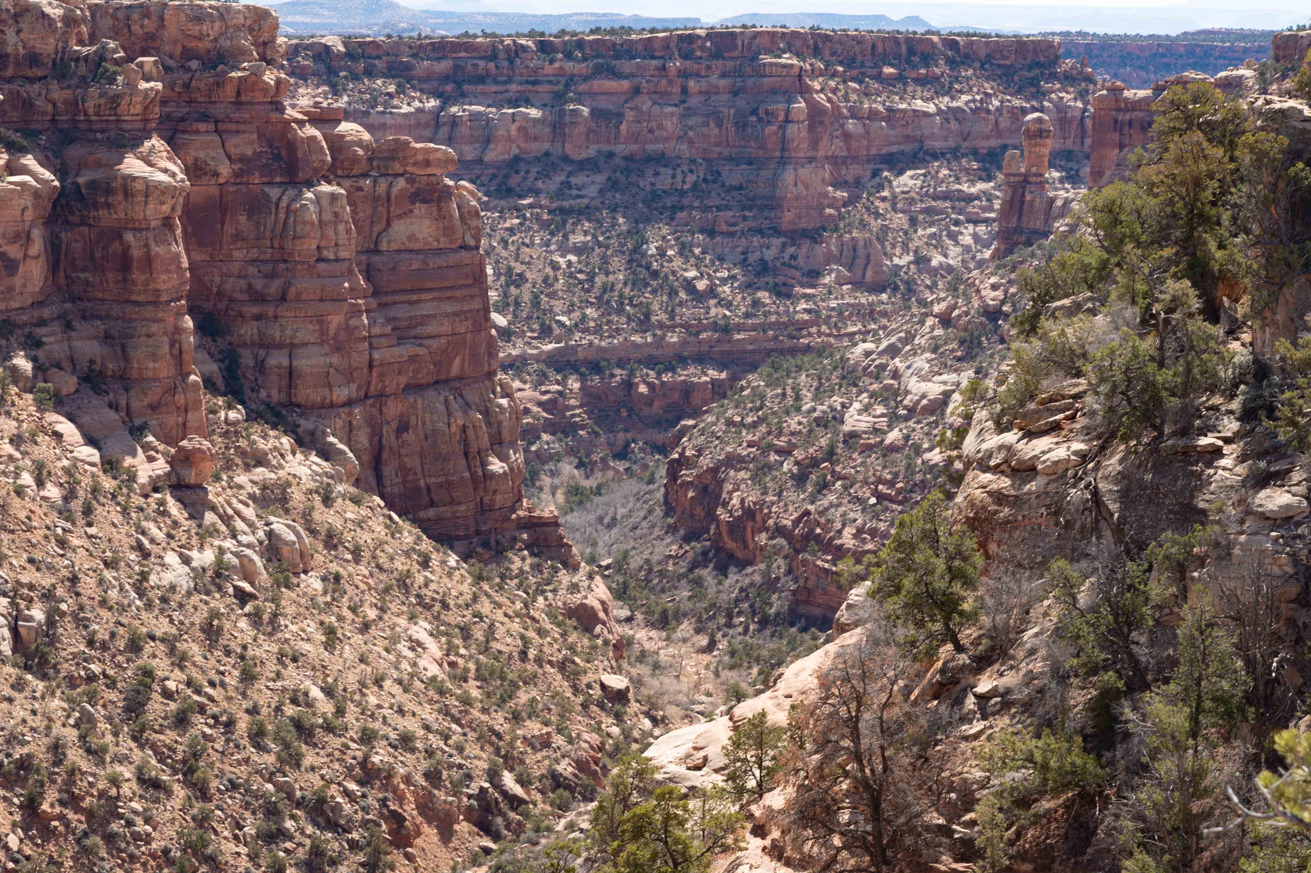
Butler Wash Road runs along the east side of Comb Ridge, which is a stunning sandstone monocline runing north-south for some 80 miles.
The ridge is cut by many small canyons and drainages containing numerous prehistoric sites.
The challenge is finding these sites along Butler Wash Road, as none of the turnouts to trailheads are marked.
Lower Butler Wash Road intersects US-162 between mile posts 40 and 41, just across from Bluff Airport Road (CR-269A).
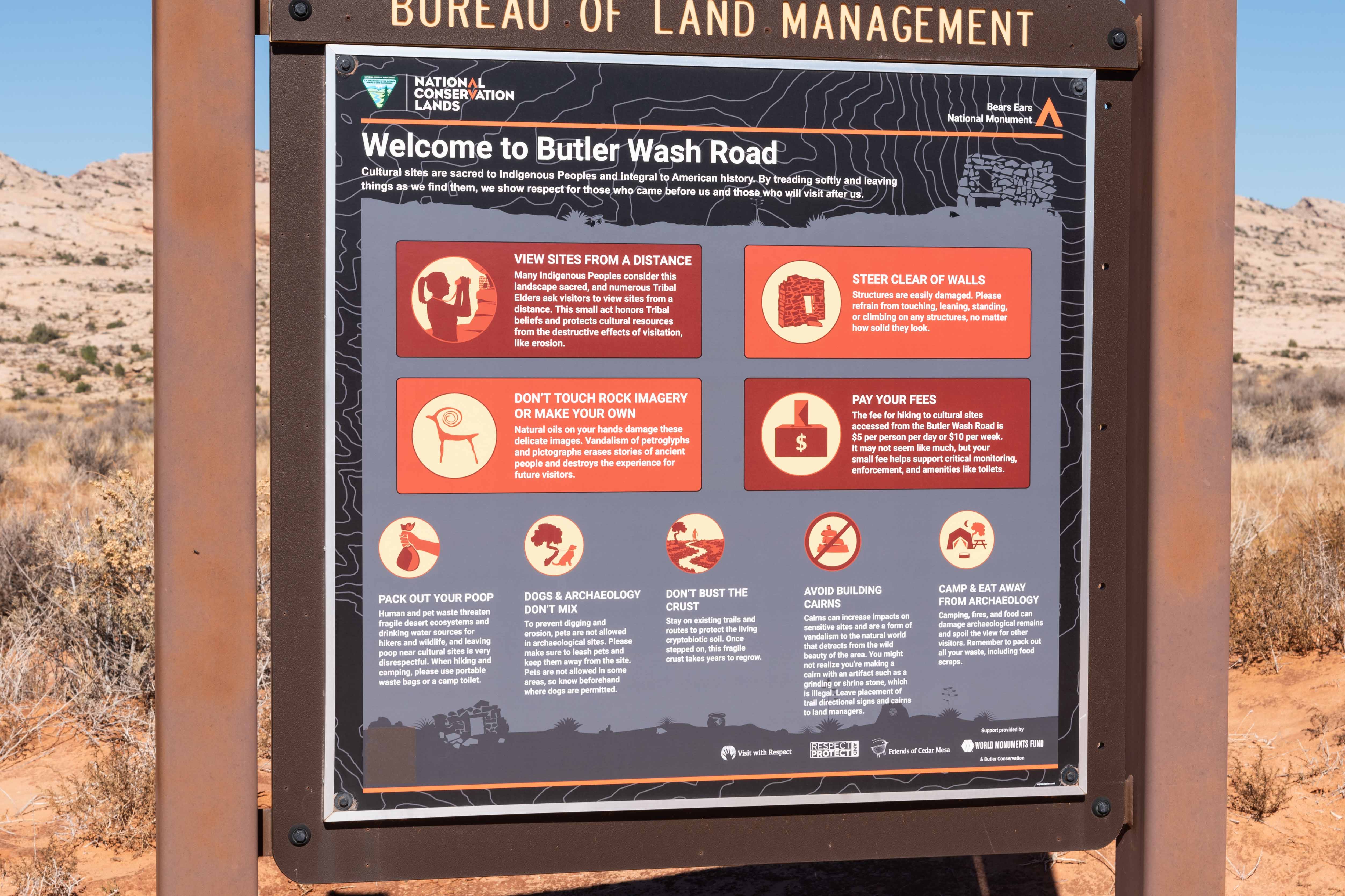
Welcome to Butler Wash Road - lots of regs
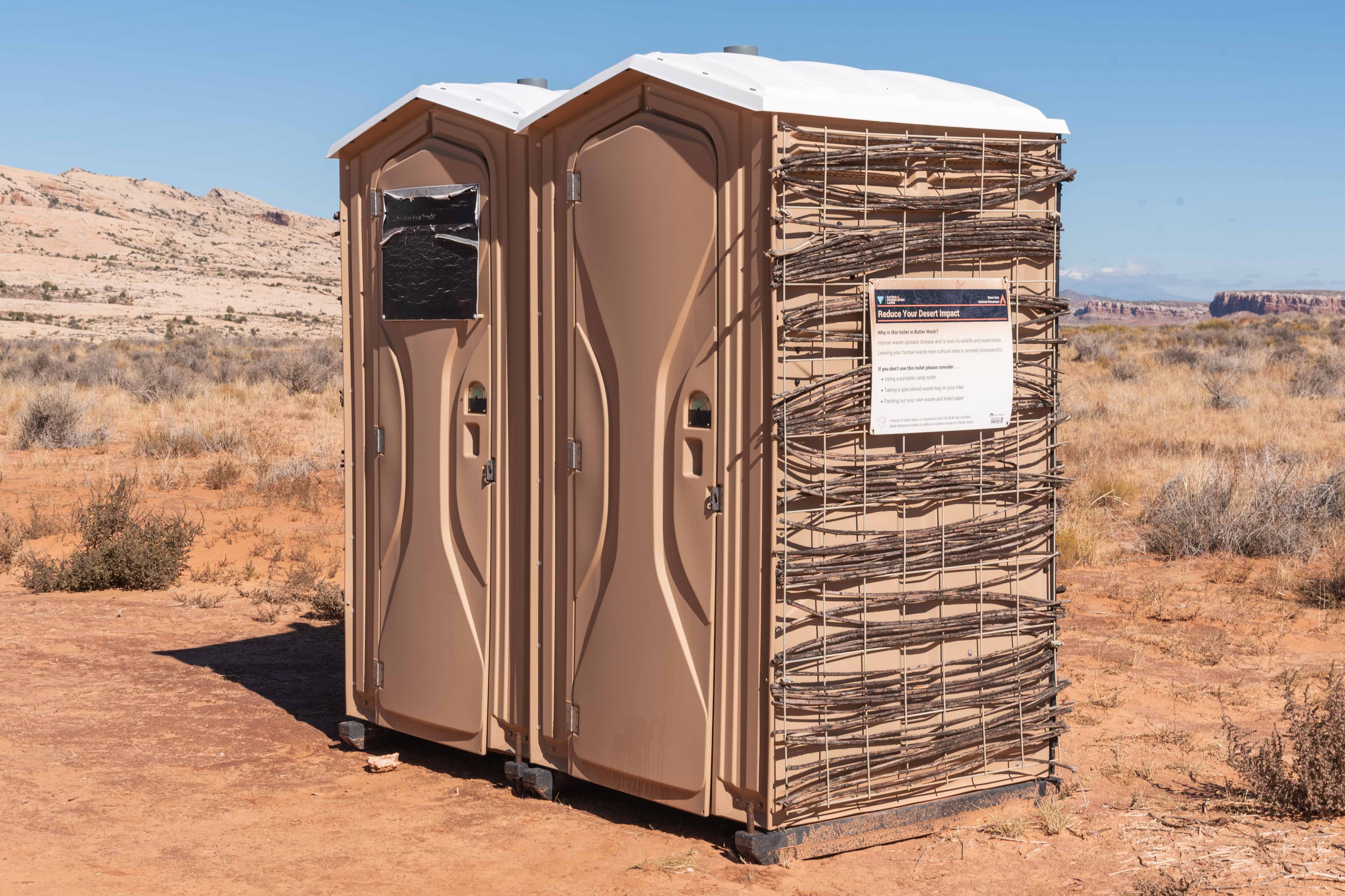
There are facilities
(but no water - be sure to bring your own)
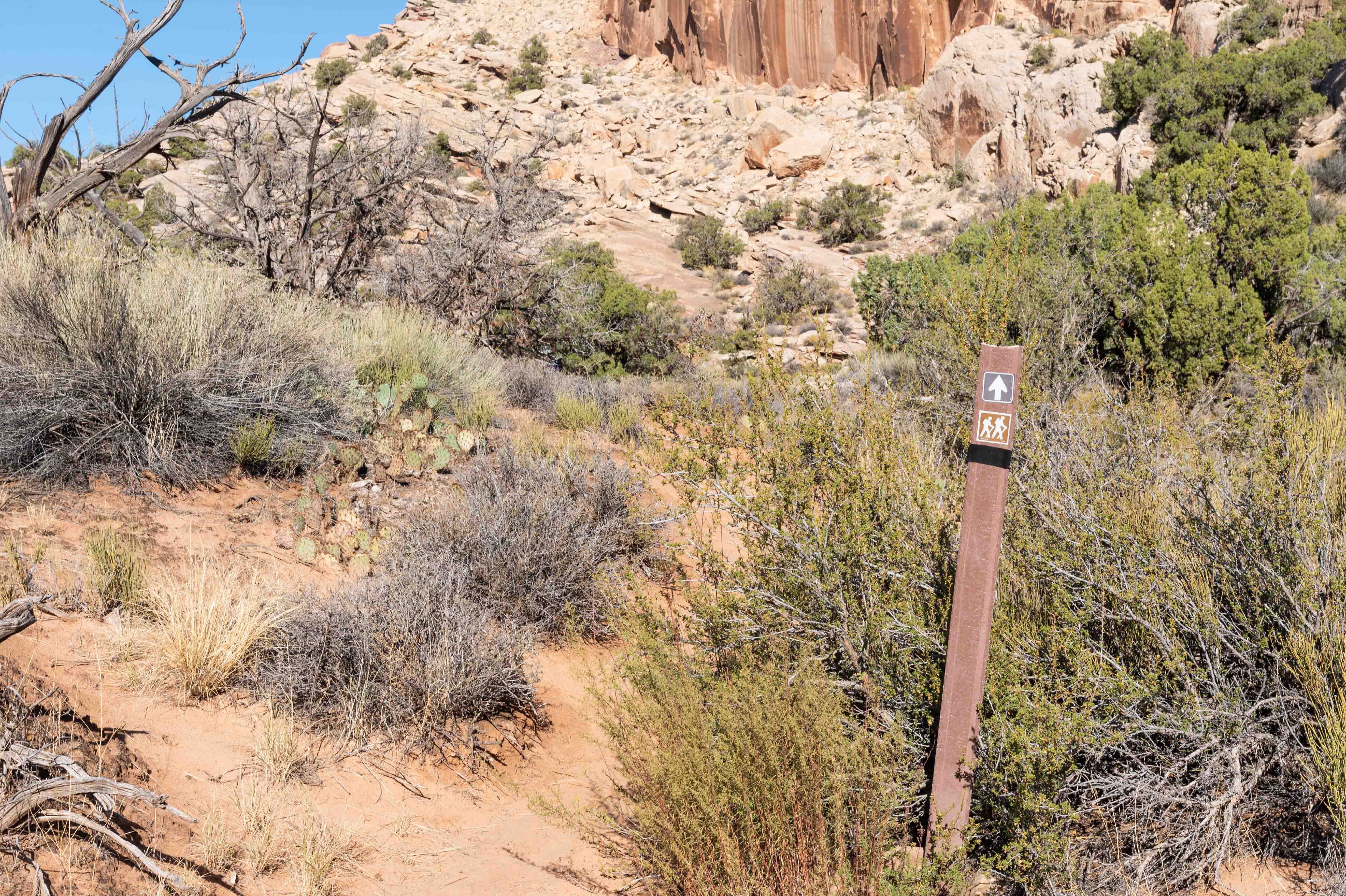
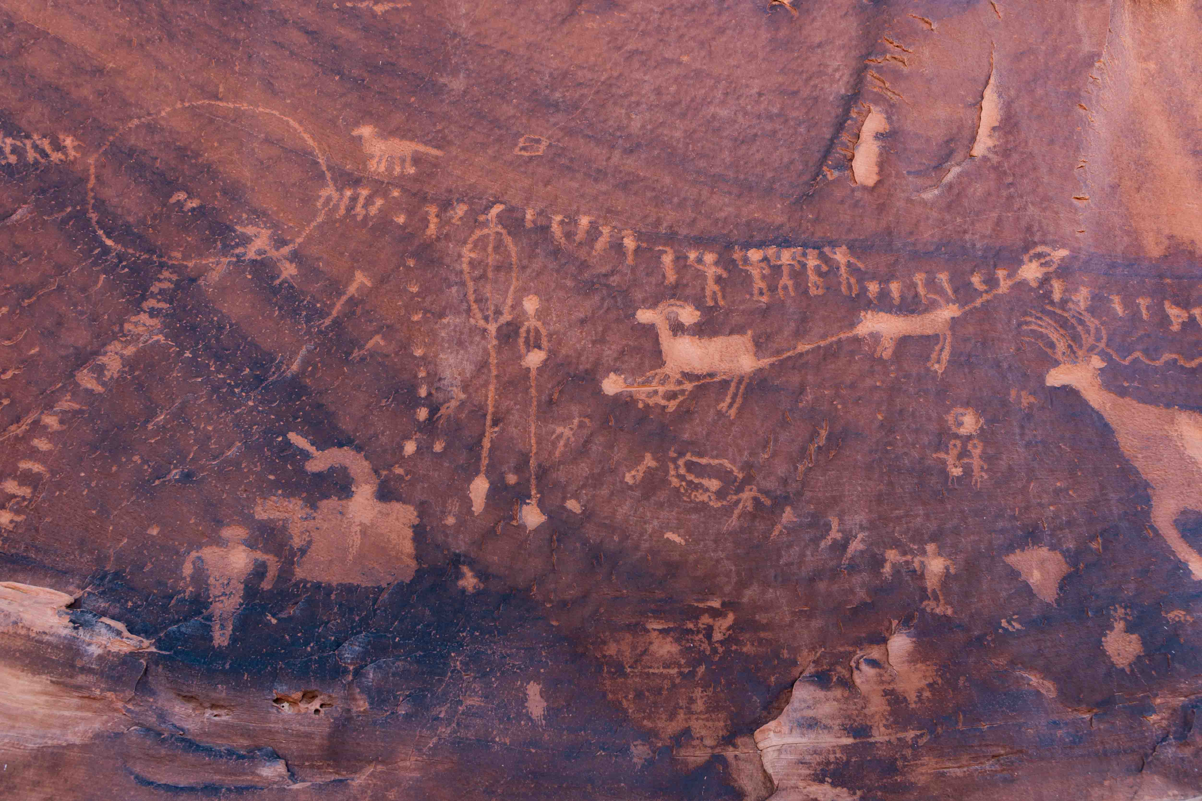
Wolfman Panel
Wolfman Panel is a series of petroglyphs located about
a mile up Butler Wash Road from US-162. The trailhead starts at a dirt parking lot with
portable toilets. Traveling Butler Wash Road requires a day pass (currently $5 per person)
and there is a fee station at the parking lot. The trail to Wolfman Panel is an easy 0.8
mile out-and-back hike. There is a boulder you have to squeeze around and a small ledge
you have to negotiate, just to make things interesting. Look for ruins along the west wall
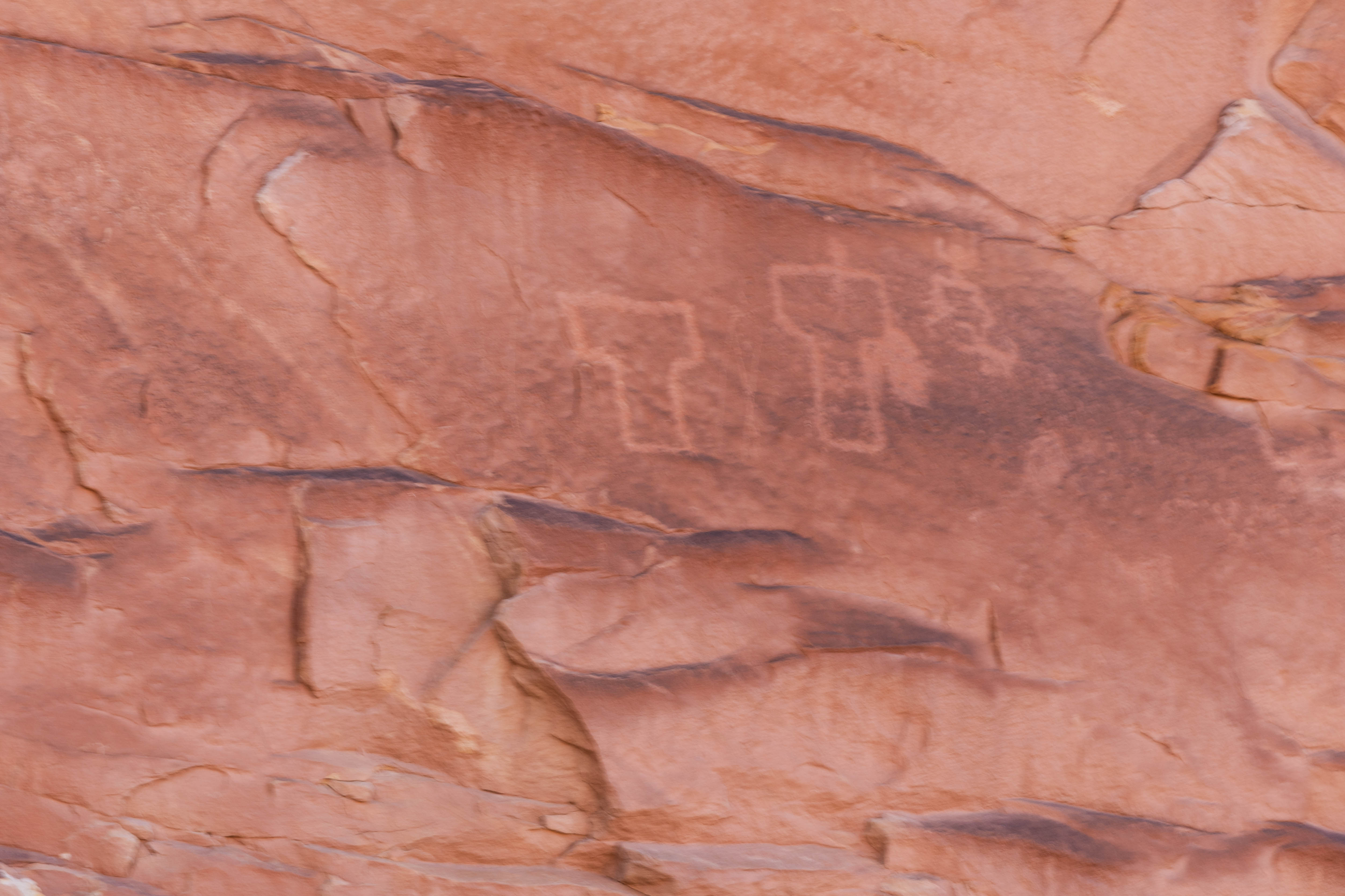
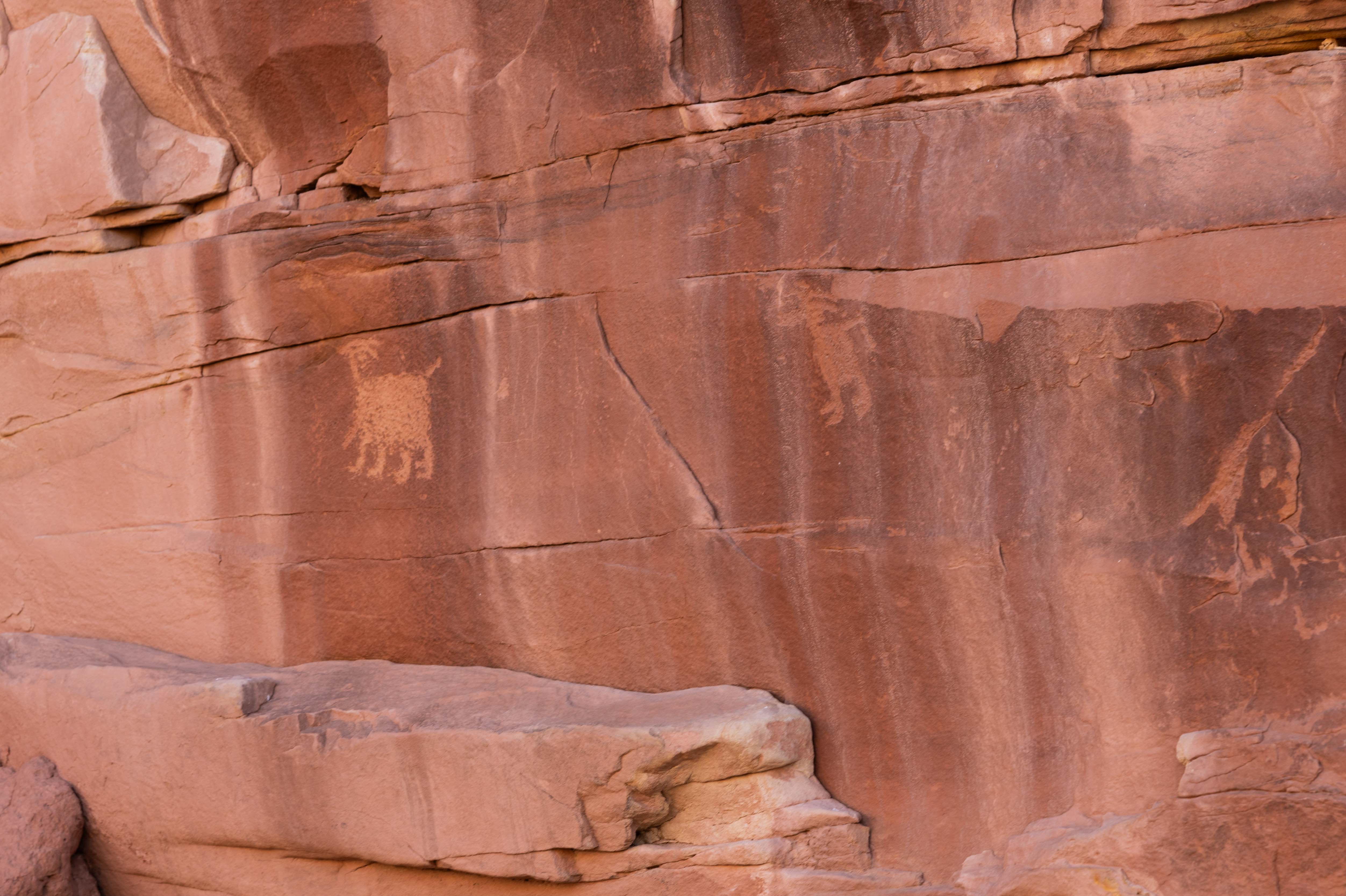
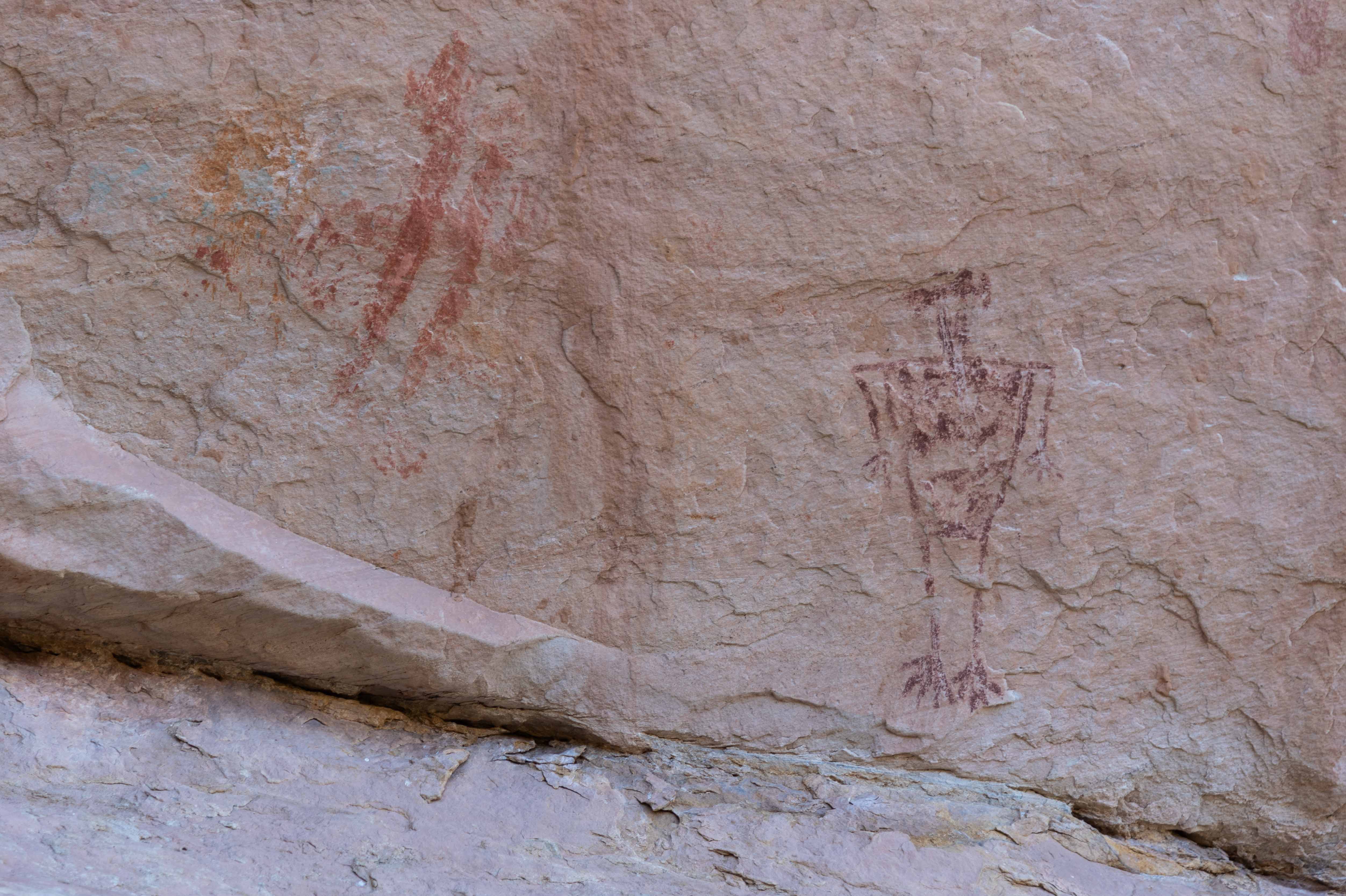
of Butler Wash during your hike. The petroglyphs of Wolfman Panel are finely chipped and
stand out well against the dark desert varnish. The panel includes anthropomorphs
(human-like figures), birds, big-horn sheep, a shield, and other petroplyphs that
require some imagination.
Wolfman Panel Petroglyphs
Wolfman Panel Petroglyphs
Wolfman Panel Petroglyphs
Notice the bullet holes around the shield
Wolfman Panel Petroglyphs

Petroglyph Panorama
Double Stack Ruin
The turnout to Double Stack trailhead is located about 3.9 miles from the intersection of
Lower Butler Wash Road and US-162. Turn left and keep right for ~ 0.1 mile to a parking area.
The trailhead to Double Stack is located at the north-west end of the parking area.
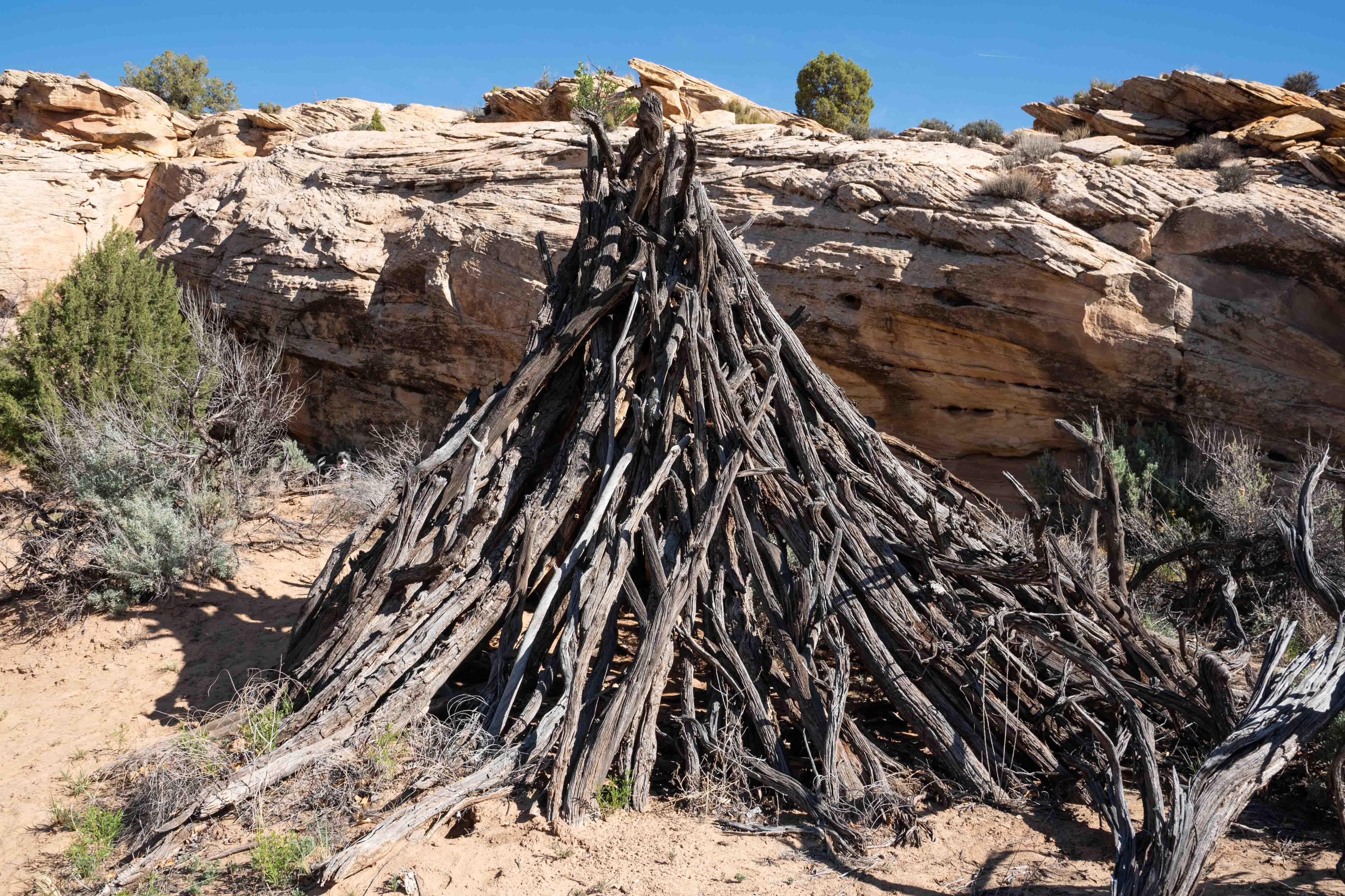
The hike to Double Stack is along a well-worn, easy 1.3 mile out-and-back trail. There
are 2 wikiups along the way - DON'T TOUCH. The upper level of Double Stack
Ruin will come into view first. It's located in a faily high alcove and is inaccessible. The
lower level is located a short distance further up the trail. It's fenced off but you can
still get fairly up-close and personal. I thought from the name, Double Stack, that the ruins
would be located one above the other, but I thought wrong.
Trail across slickrock
Notice the cairns
First Wikiup
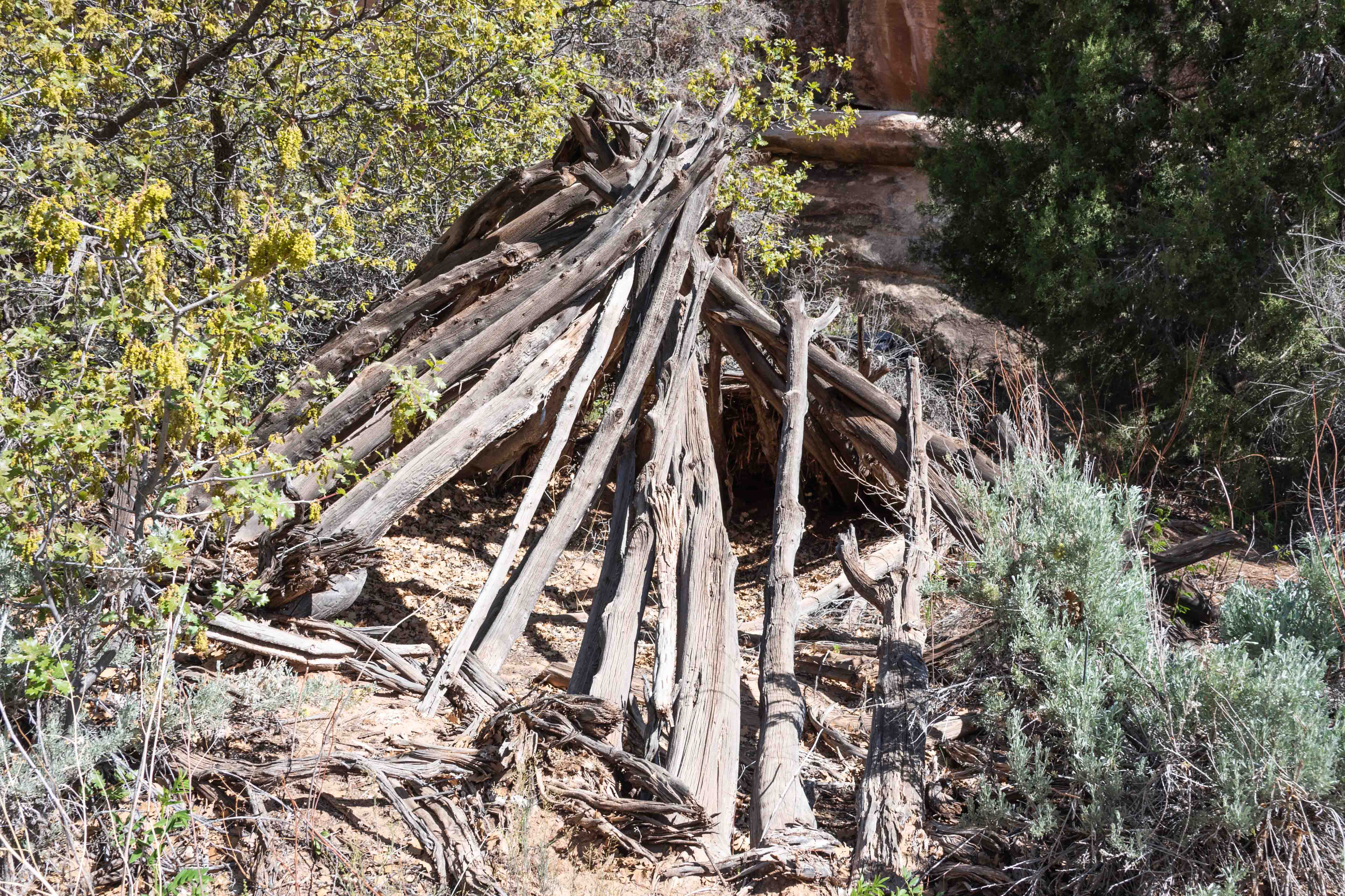
Second Wikiup
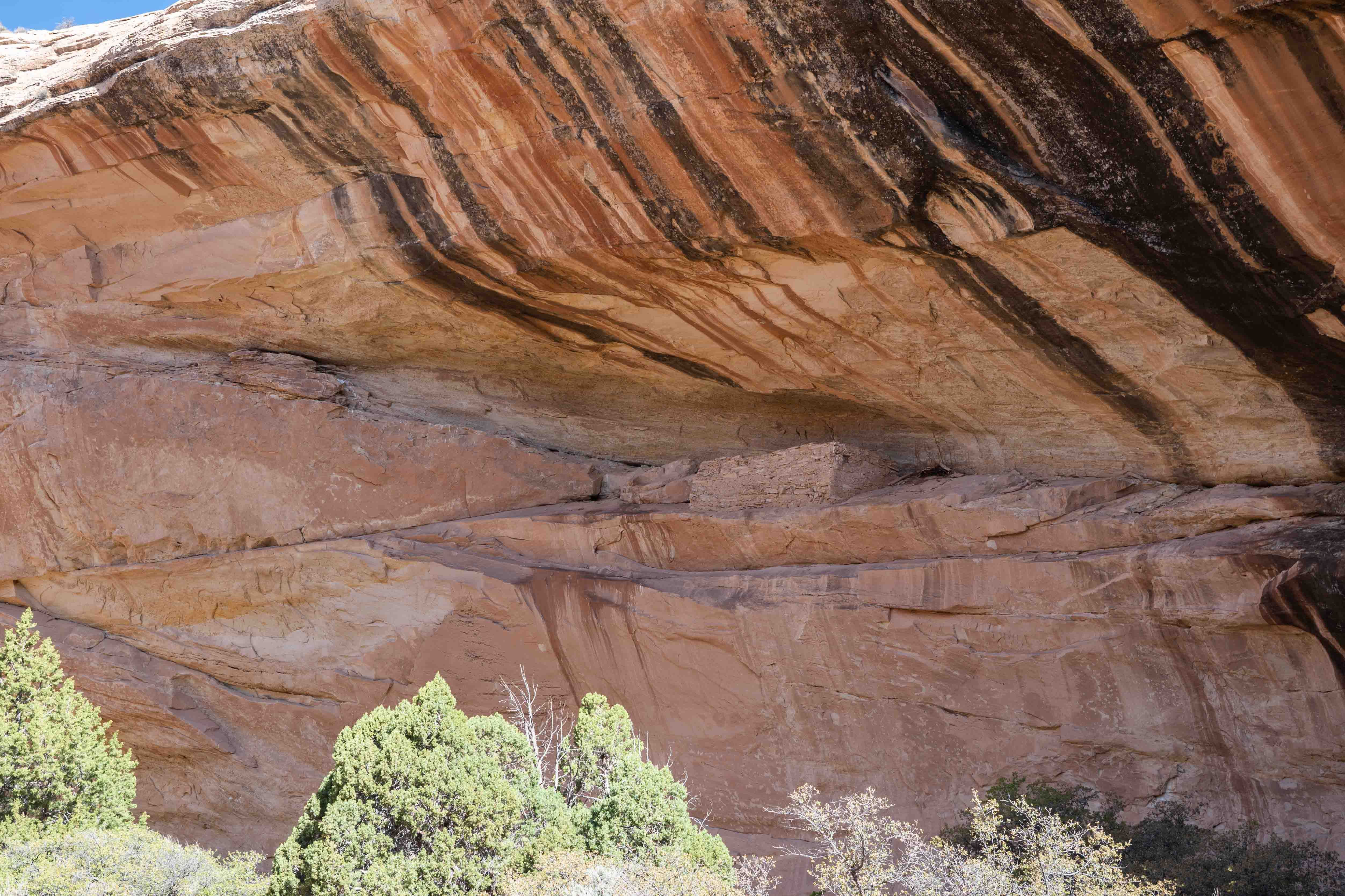
Upper Ruin
Upper Ruin
Lower Ruin fenced off
Lower Ruin
Monarch Cave
There are 2 turnouts that take you to Monarch Cave, one at 7.1 miles and the second
at 7.2 miles from the juction of Butler Wash Road (CR262) and US 162. Better to take
the second turnout. Turn left and drive a short distance to the parking lot and
trailhead. The trail to Monarch Cave is an easy 1.6-mile out-and-back hike along a
narrow canyon. Monarch Cave is situated in a deep alcove in the right canyon wall.
It's one of the better preserved ruins along Butler Wash. Look for grinding stones,
pottery sherds, and pictographs. There is a pond on the canyon floor beneath the alcove.
FYI dogs are not allowed on the trail.
Monarch Cave Ruin

A Closer Look
Pictographs
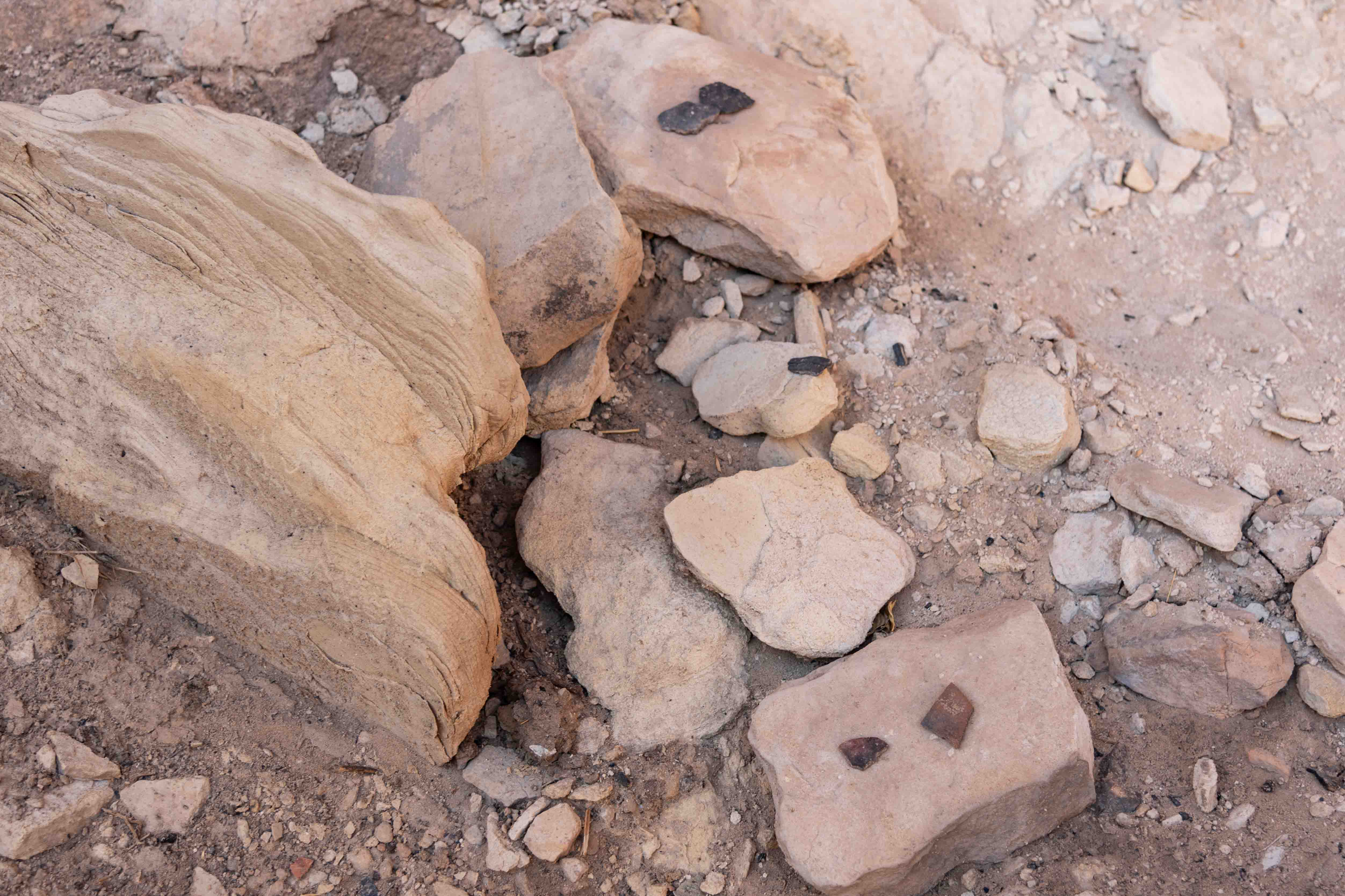
A Few Pottery Sherds
Wall Ruin
Monarch Ruin
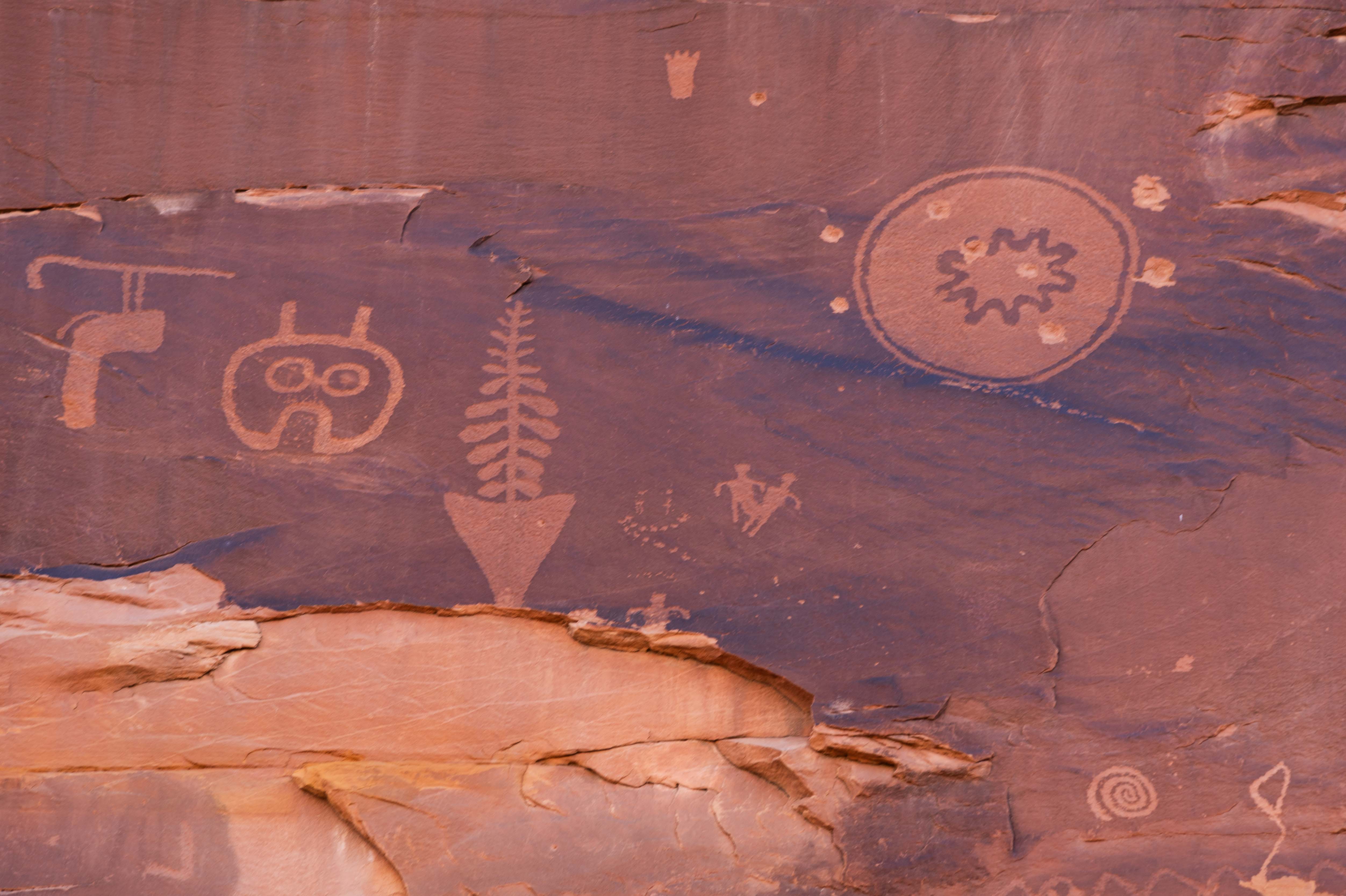
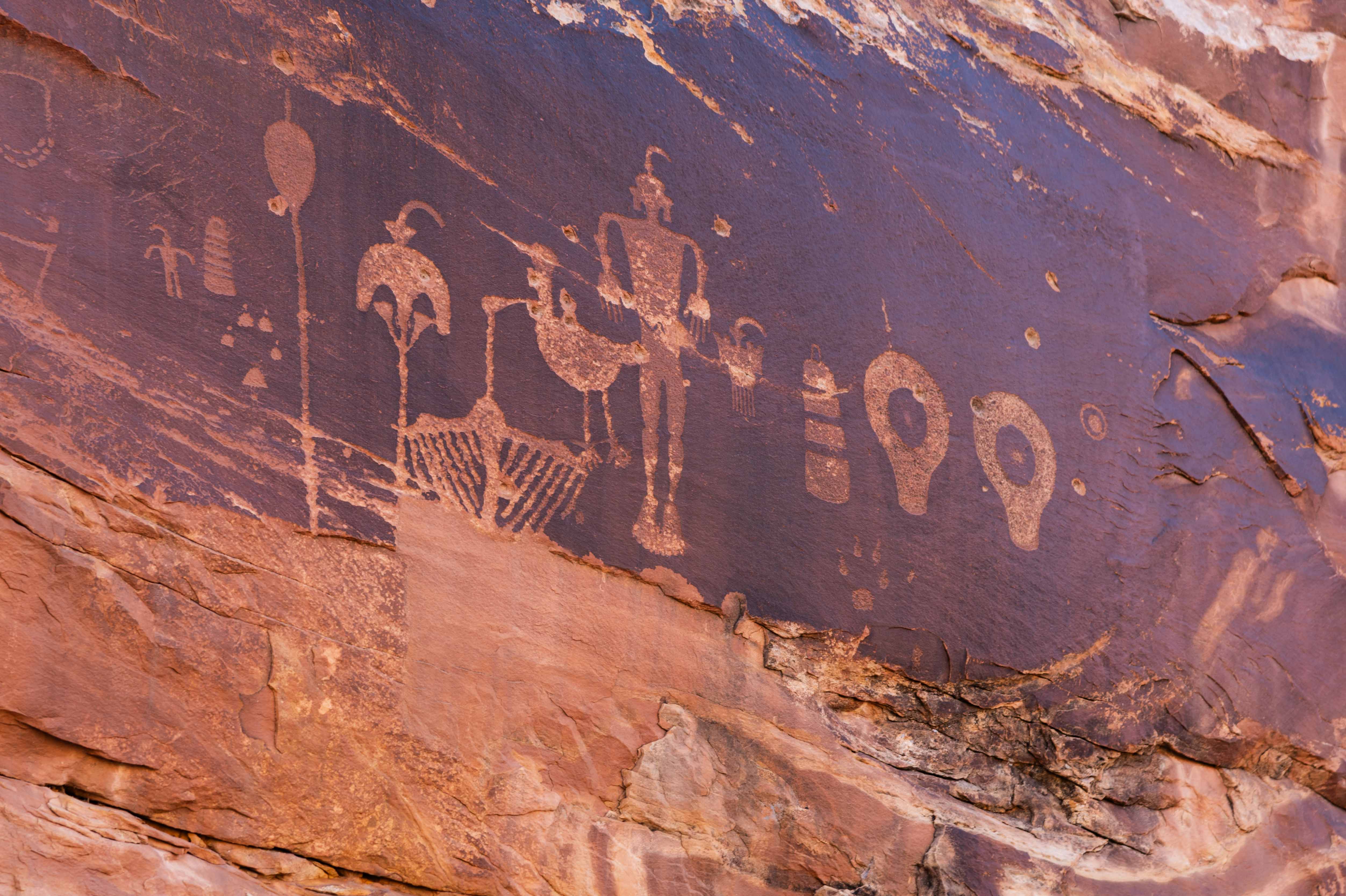
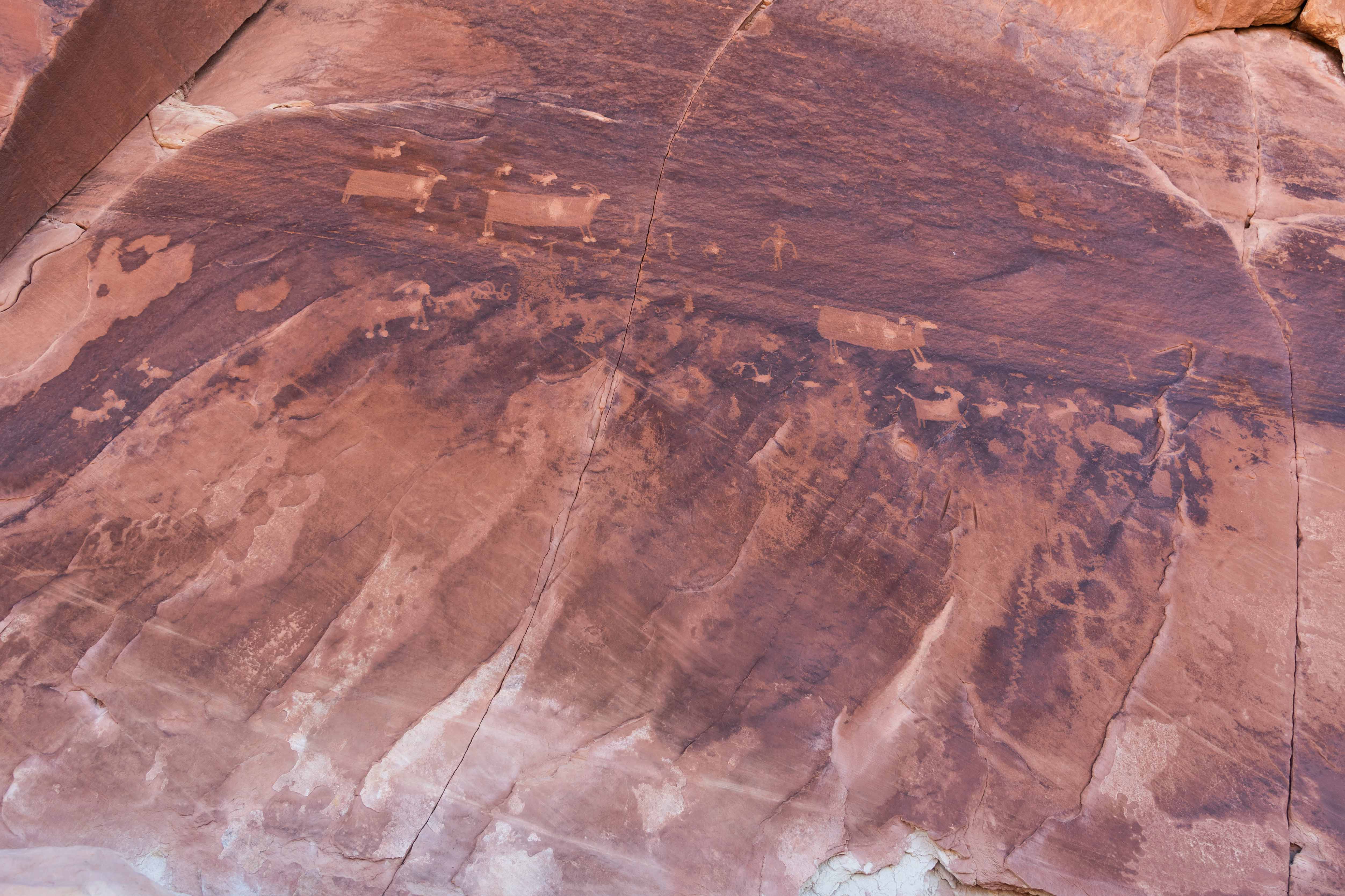
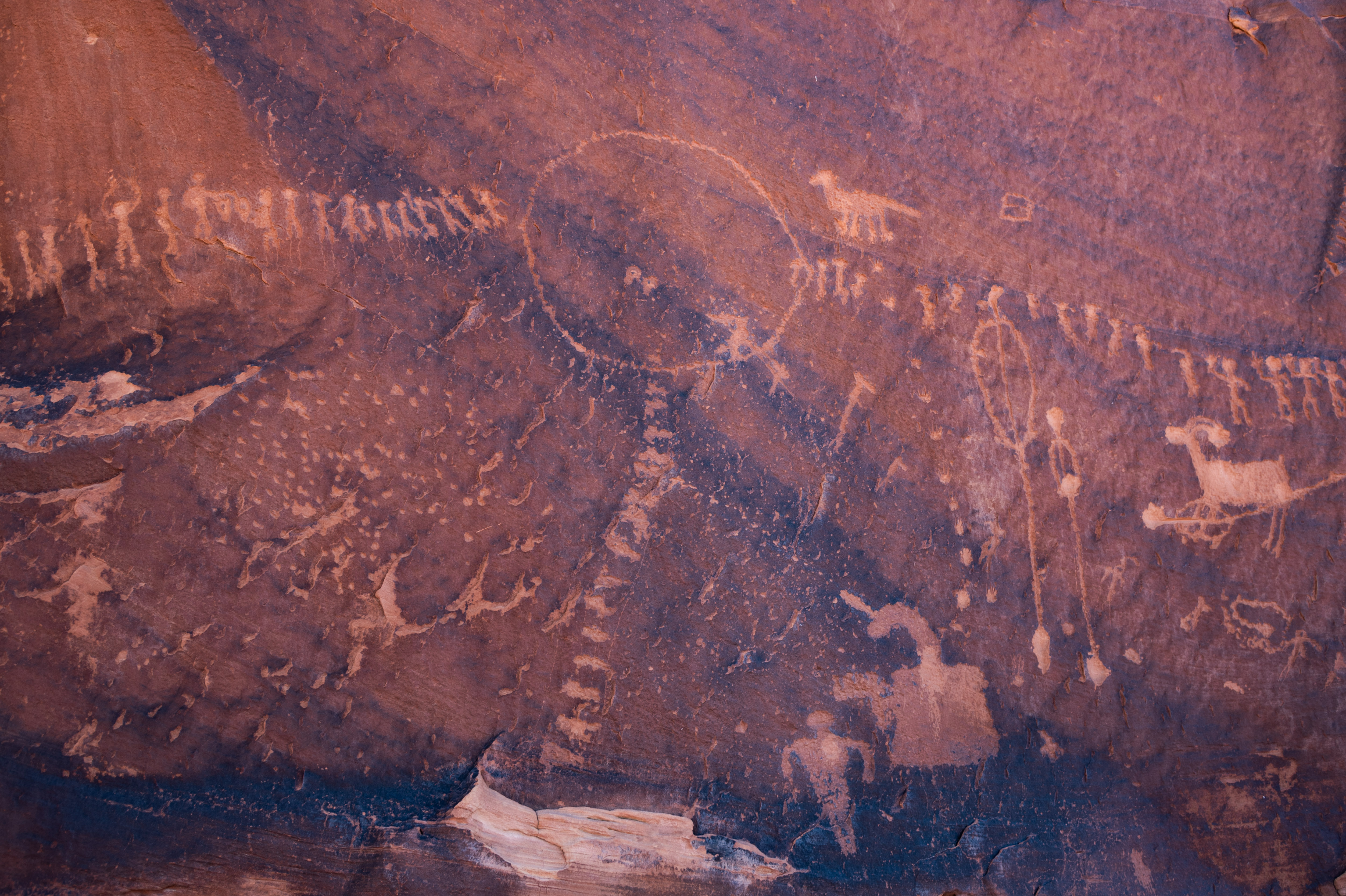
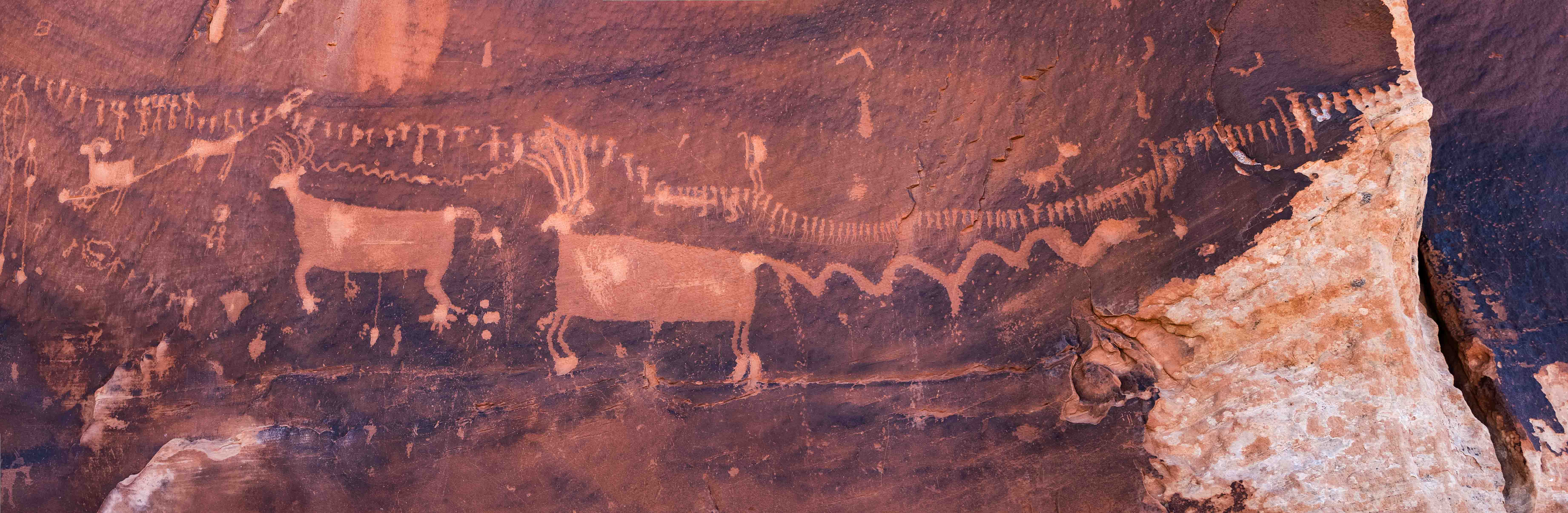
Procession Panel
Procession Panel is an amazing petroglyph with 179 anthropomorphs (human-like figures) in 3 lines converging
on a central circle. The panel also includes depictions of basket carriers, flute players, hunters, bighorn sheep, deer, and a snake.
The trail to Procession Panel is a moderate, 2.8 mile out-and-back hike that climbs up Comb Ridge (elevation gain ~ 500 feet).
Travel about 8 miles north on Butler Wash Road and look for a turnout to the left to the parking area and trailhead. Again, the turnout is
not marked.
Procession Panel Trail
Petroglyphs of deer and bighorn sheep
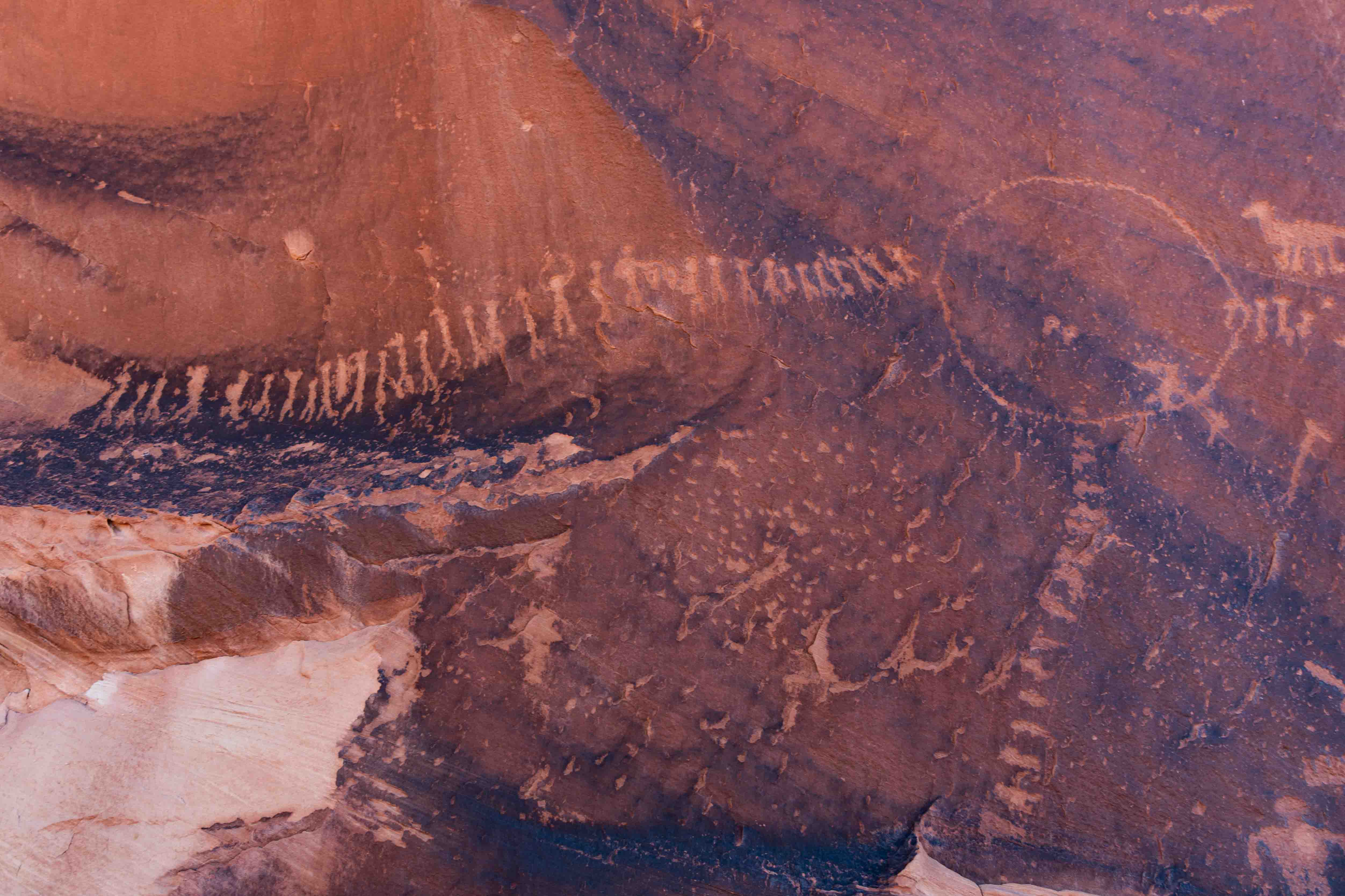
Figures to left of Circle
Figures Convering on Circle
Figures to right of circle
Procession Panel Panorama
Deer, Bighorn Sheep, Snake, and Figures with crooks (staffs curved at one end)
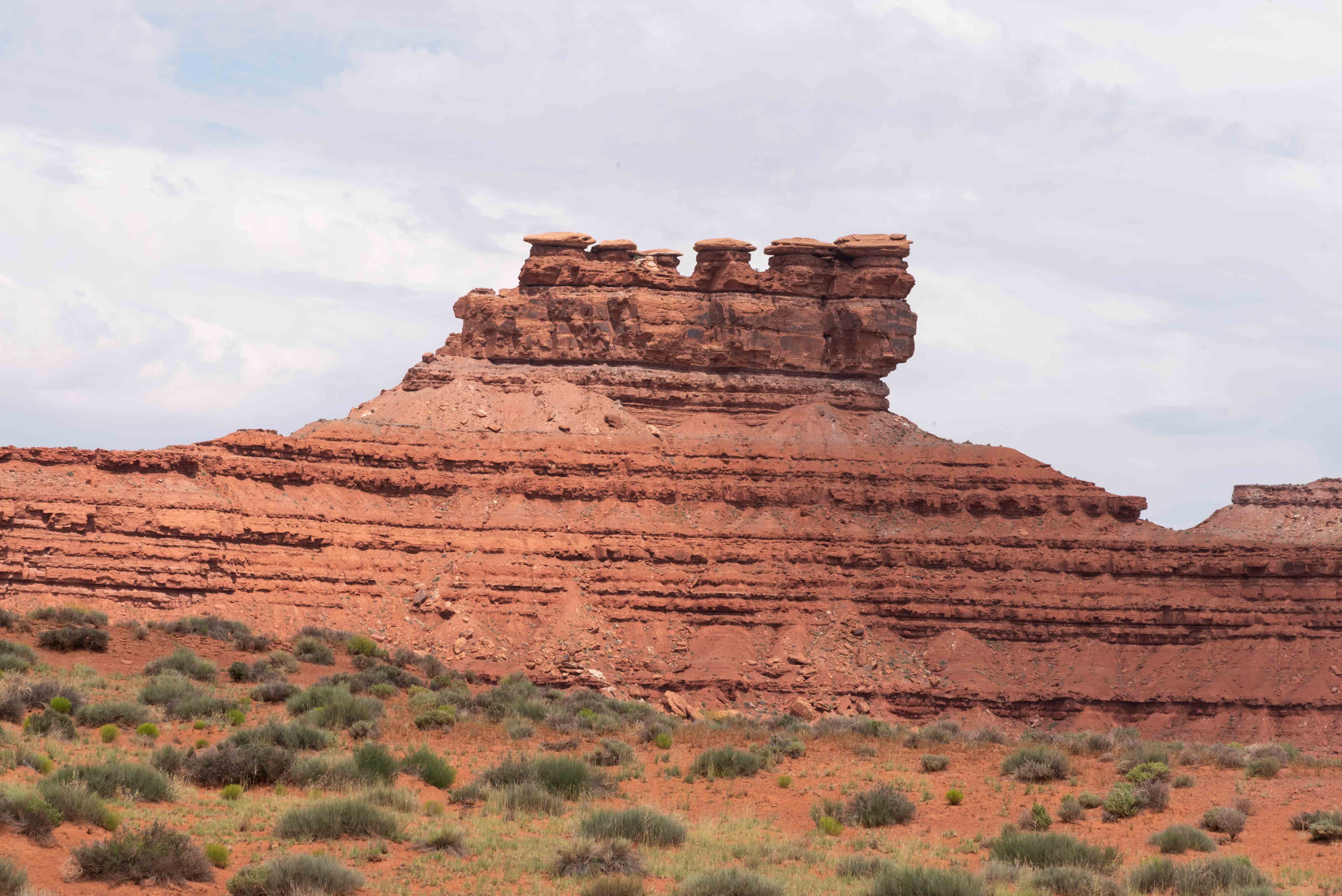
Valley of the Gods
The Valley of the Gods is part of Bears Ears National Monument. A 17-mile gravel road (San Juan County Road 242)
winds through the valley past mesas, tall buttes, and fantastic rock formations similar to those of Monument Valley.
The eastern end starts nine miles northeast of the town of Mexican Hat at an intersection with U.S. Highway 163,
while the western end joins Utah State Route 261 just south of Moki Dugway. Four-wheel drive is recommended,
but the road is usually passable by 2-wheel and all-wheel drive vehicles in dry weather.
Seven Sailors
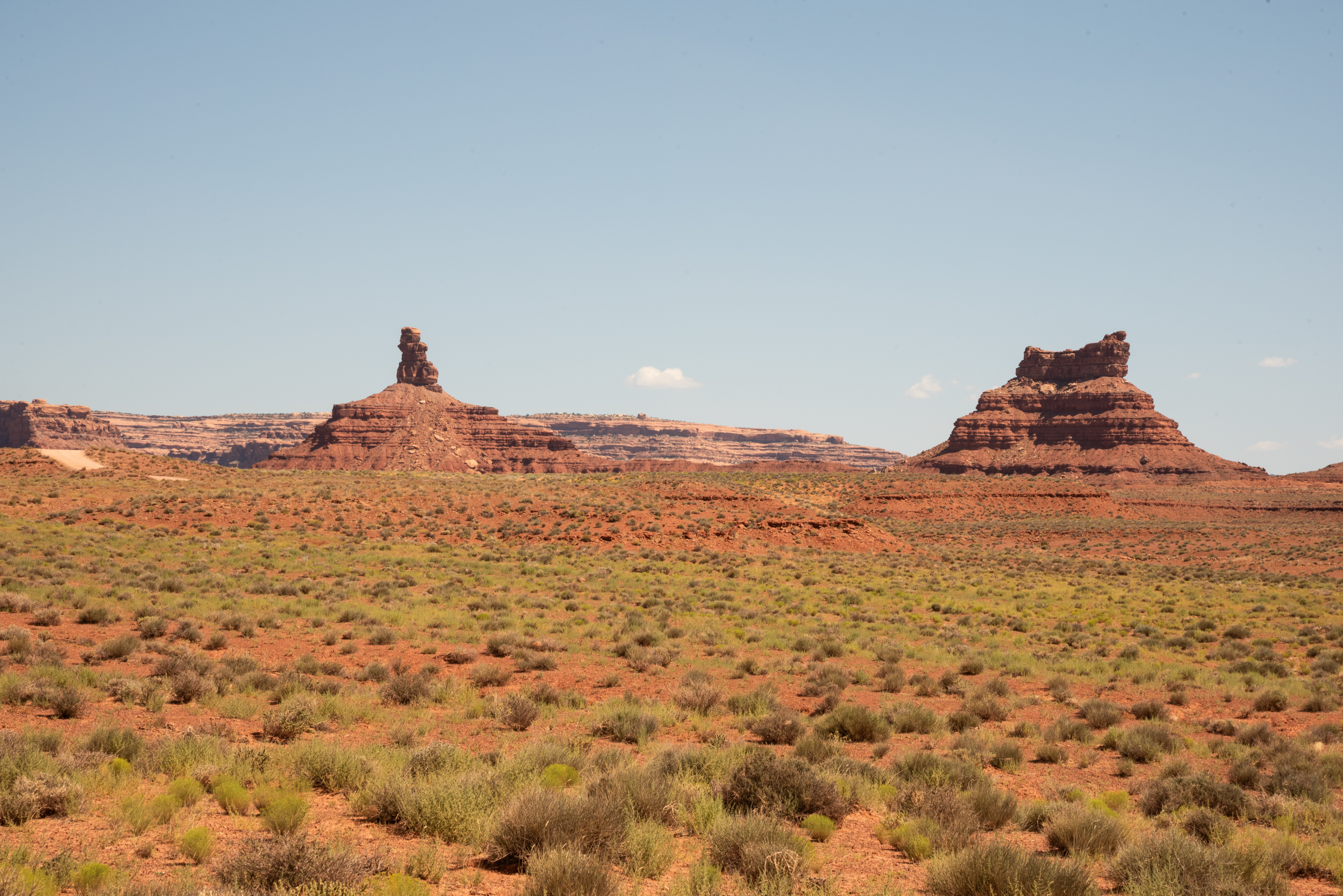
Rooster Butte (l) Setting Hen Butte (r)
Facilities
Valley of the Gods Panorama
Valley of the Gods Panorama
Rock Formations
Franklin Butte (l) Battleship Rock (r)
More Rock Formations
Valley of the Gods Bed and Breakfast
Valley of the Gods Bed and Breakfast
Moki Dugway
"Moki" is a local term for the ancient Puebloan people who inhabited the
Colorado Plateau hundreds of years ago. "Dugway" is a term used to describe
a roadway carved from a hillside. The Moki Dugway Scenic Backway is a stretch
of Utah State Route 261 where the asphalt turns into a dirt road that dramatically
switches back and forth down the side of a cliff at an 11% grade.
There are a couple of pullouts along the dugway with fantastic views of Valley
of the Gods.
Well plastered Dugway sign
Valley of the Gods viewed from Moki Dugway - Valley of the Gods B&B lower right foreground
Don't know the name of this formation
Valley of the Gods west entrance foreground
and Utah 261 meandering S-SE
Utah State Route 95
Utah State Route 95 more or less bisects Bears Ears running east to west. Its pases by Natural Bridges National Monument which is located within Bears Ears.
There are several easily accessible sites and hikes along the east end of UT-95 near Comb Ridge.
The ones presented here are, from east to west, Butler Wash Interpretive Trail, Butler Wash Dinosaur Tracks,
Mule Canyon Cave Towers, Mule Canyon Interpretive Site, and House on Fire.
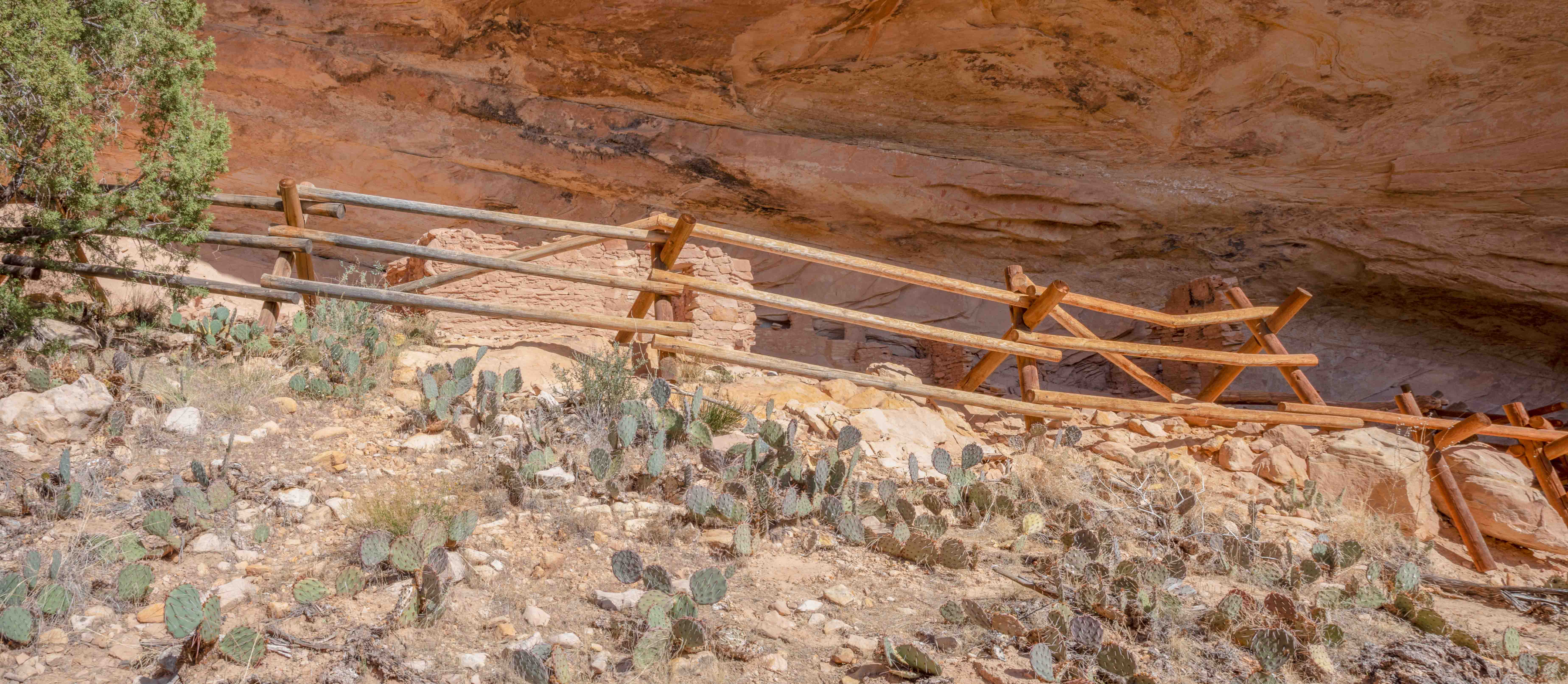
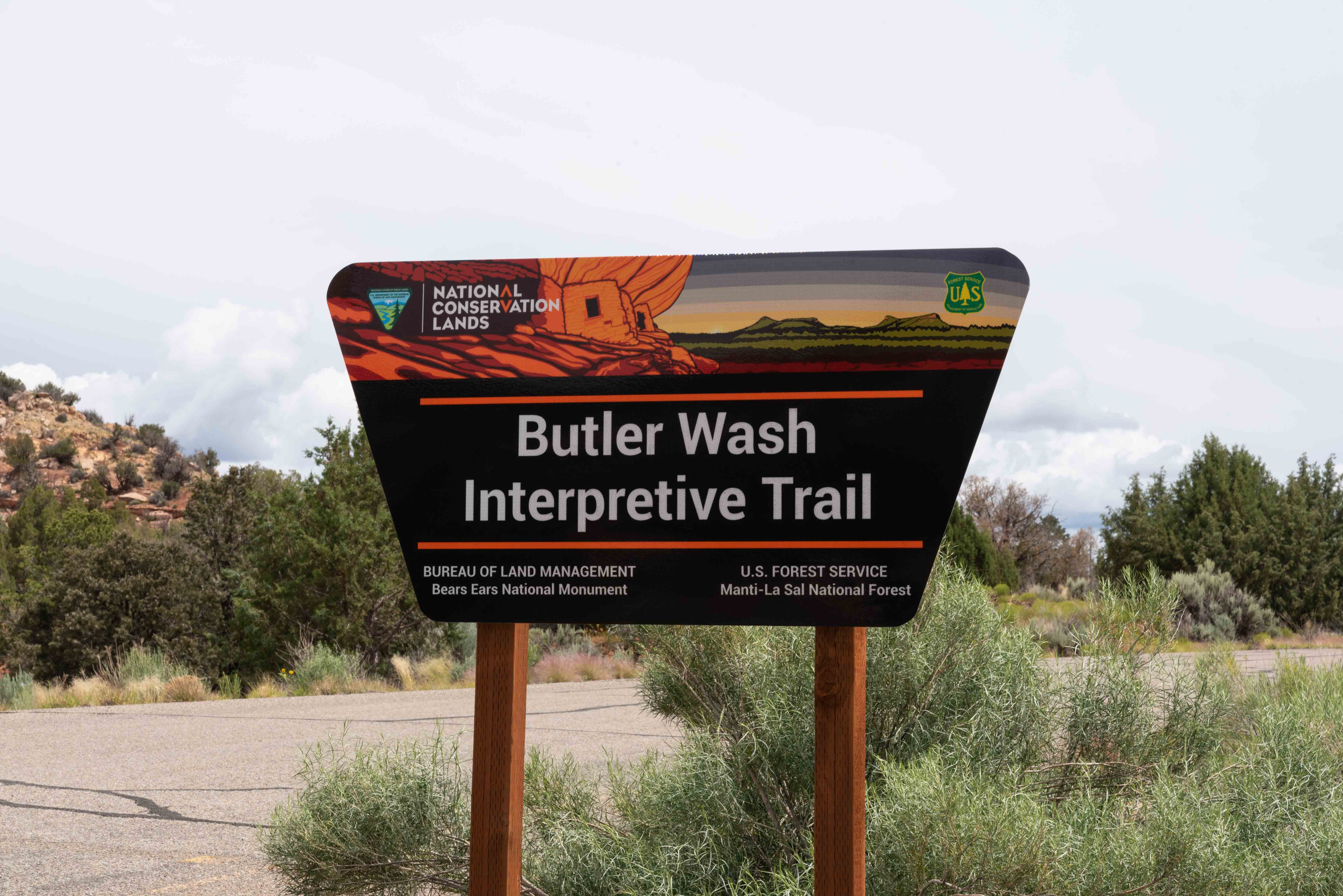
Butler Wash Interpretive Trail
The Butler Wash Interpretive Trail is an easy (or maybe moderate) 1-mile out and back hike over sand and slickrock.
It ends at an overlook with a view of puebloan ruins in alcoves on the opposite side of the canyon.
Butler Wash Interpretive Trail
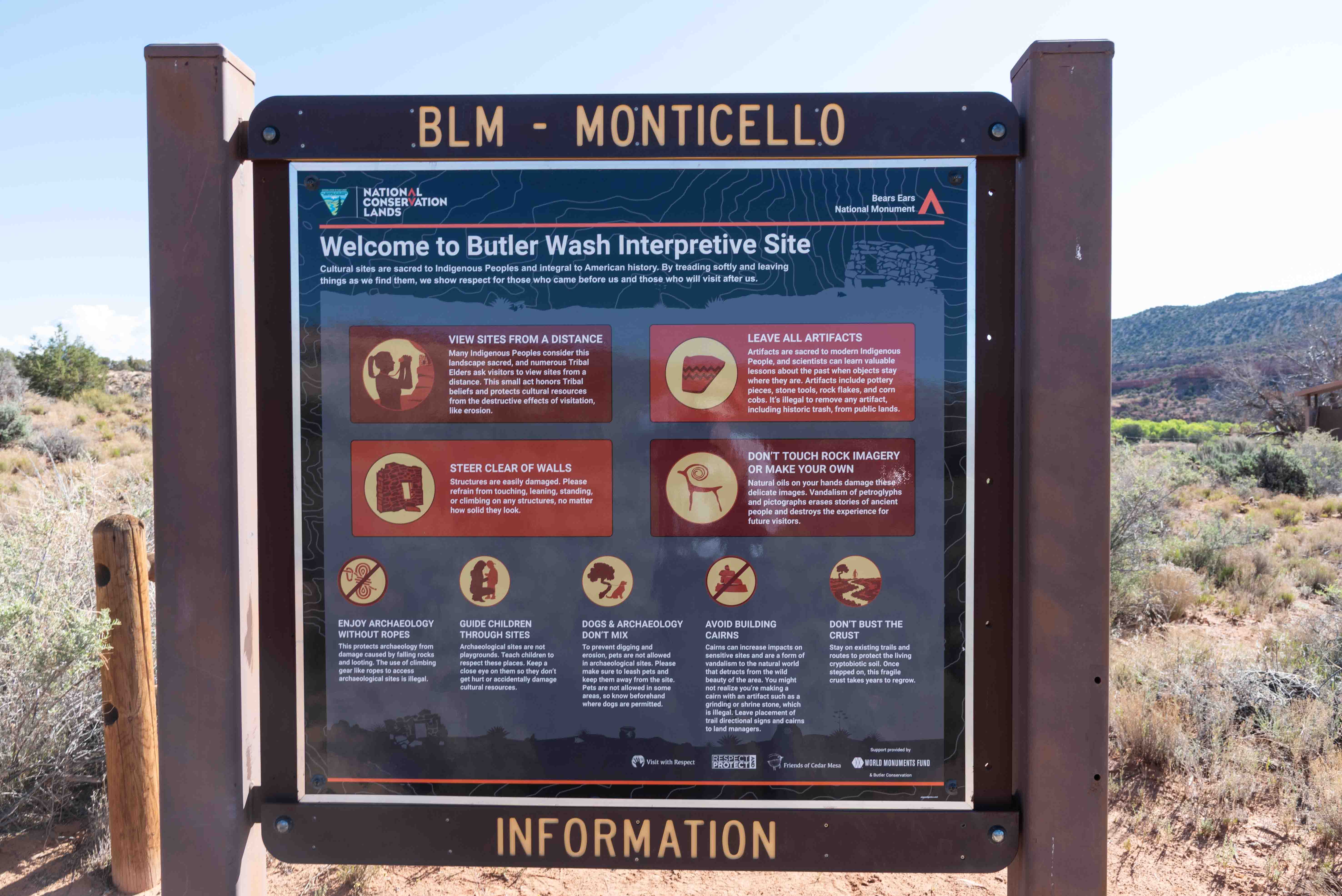
Lots of Dos and Don'ts
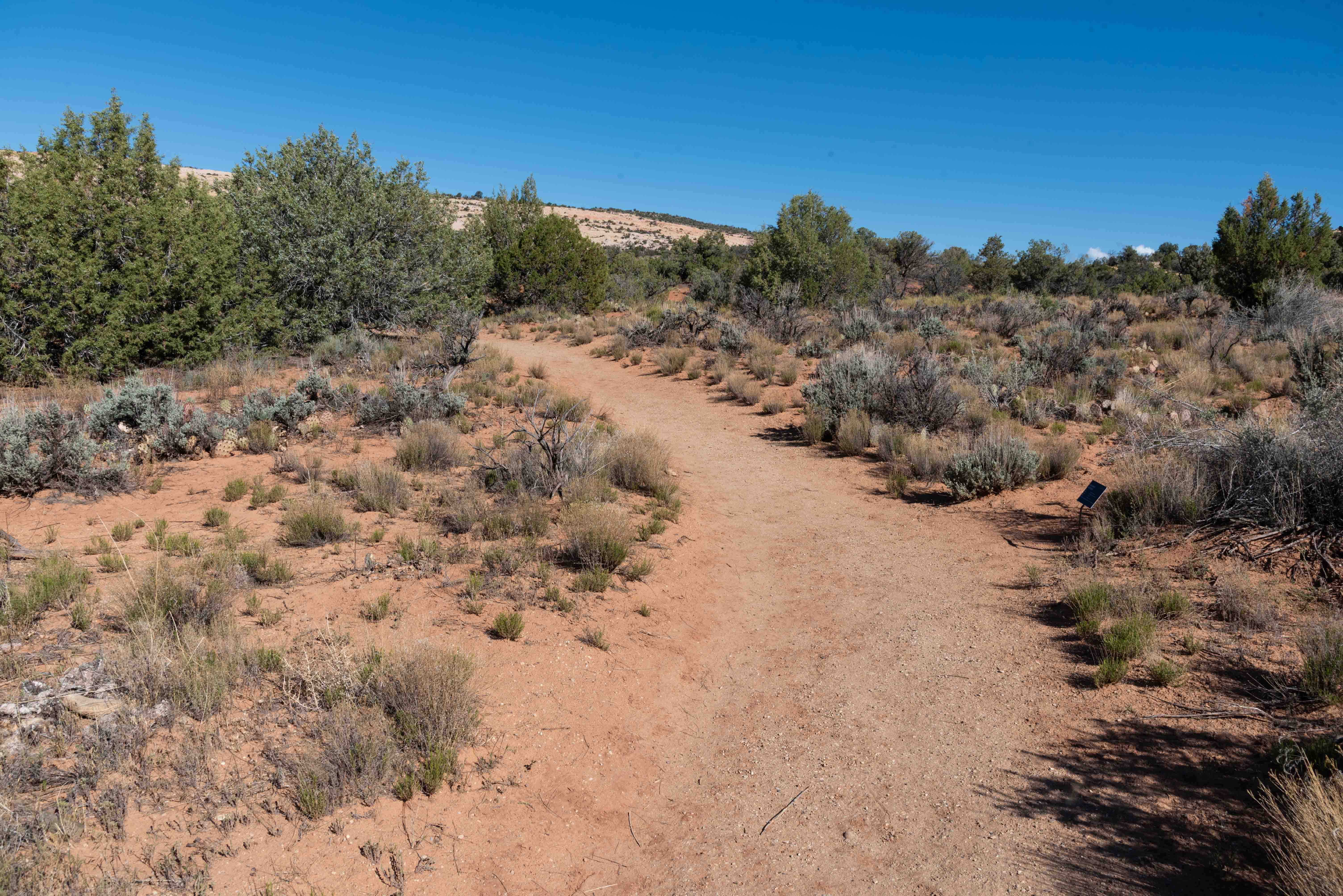
On the Trail
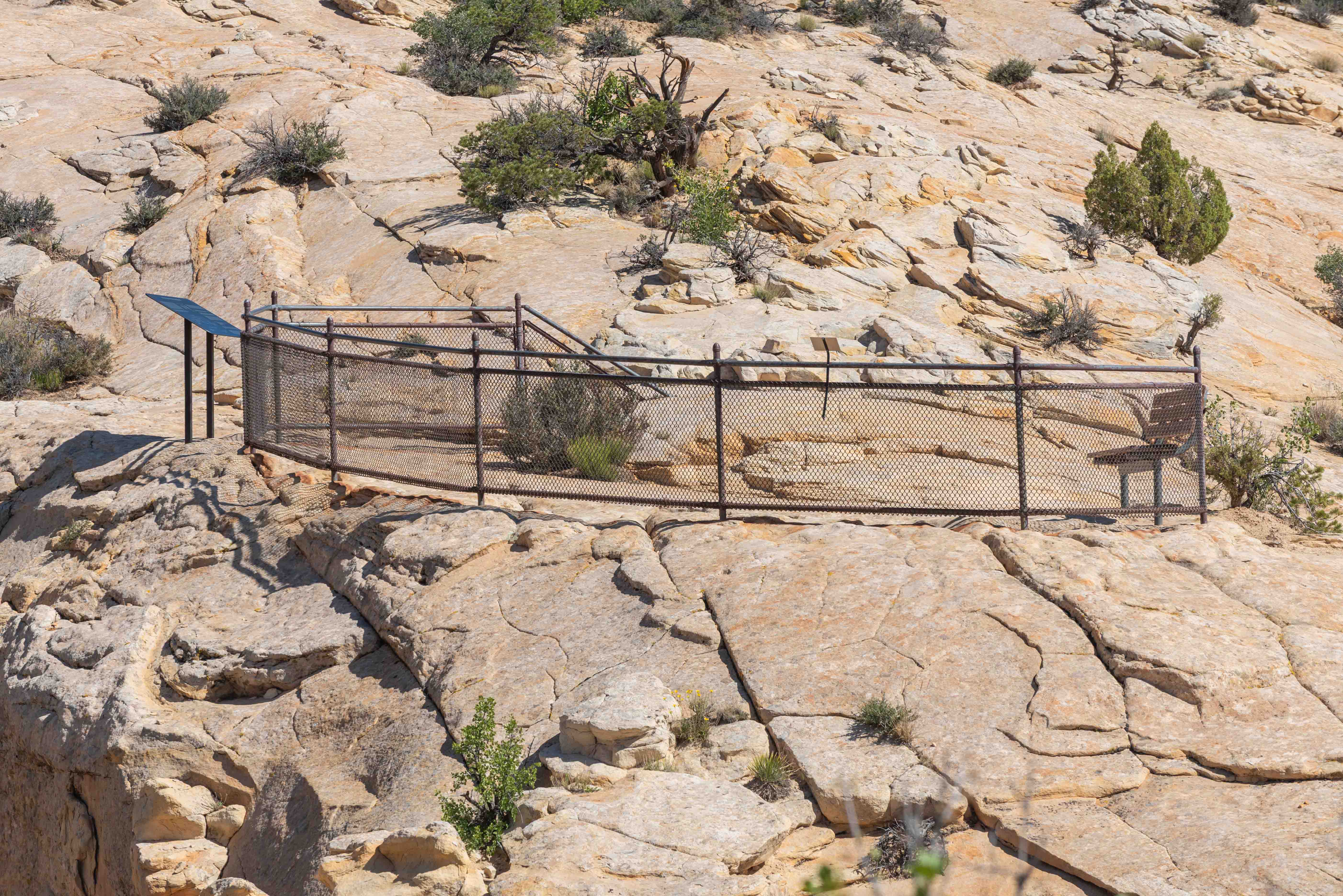
Overlook Fence, Sign, and Bench
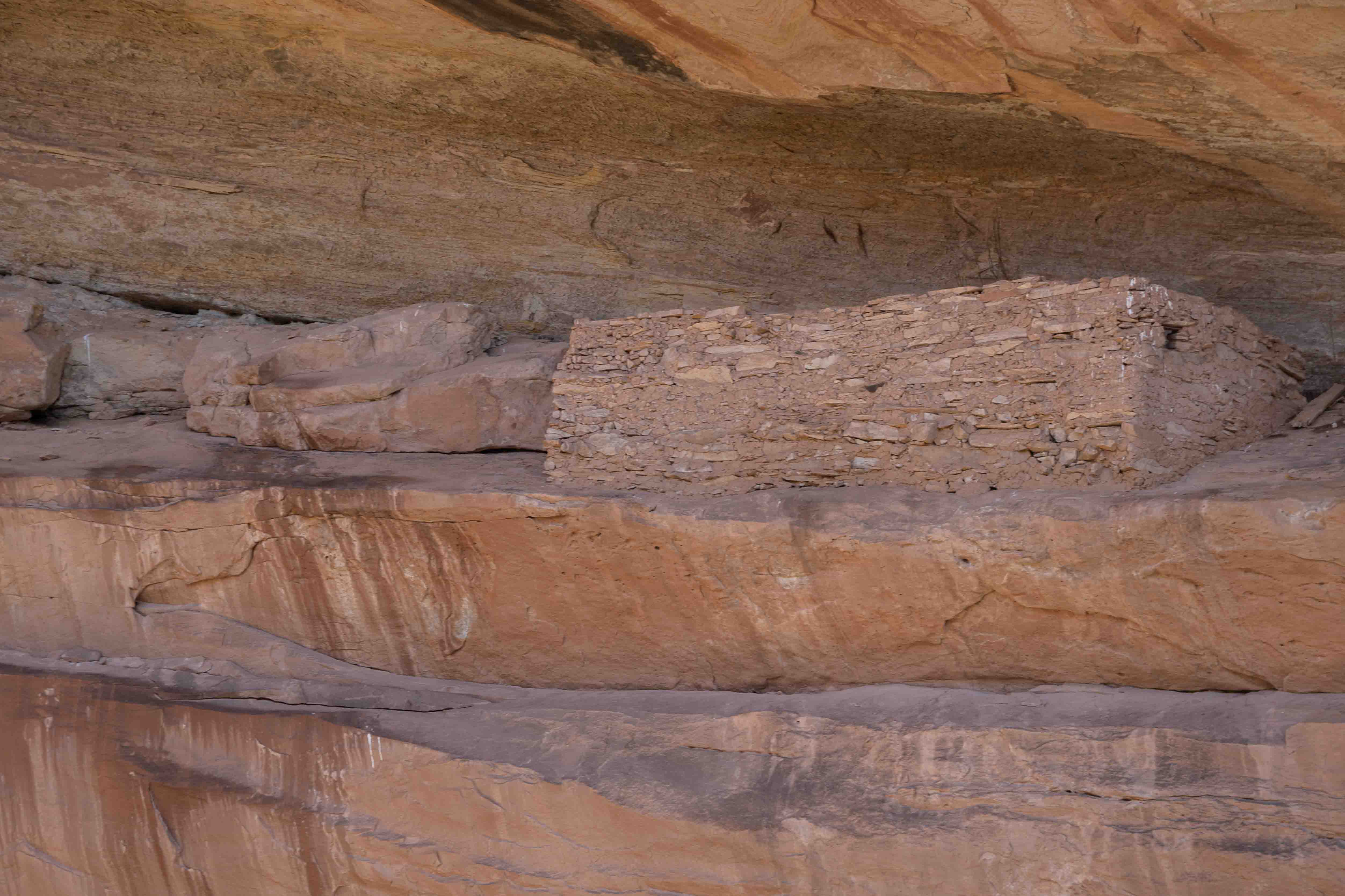
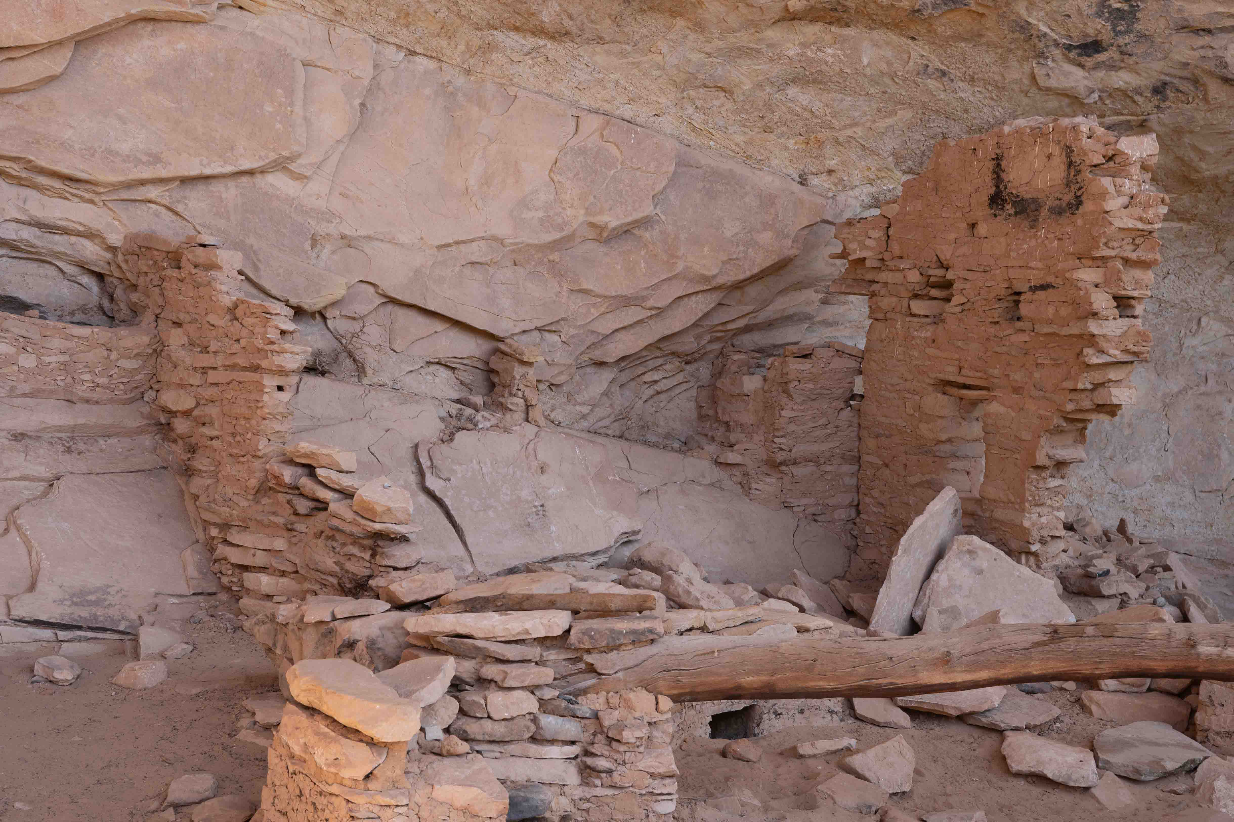
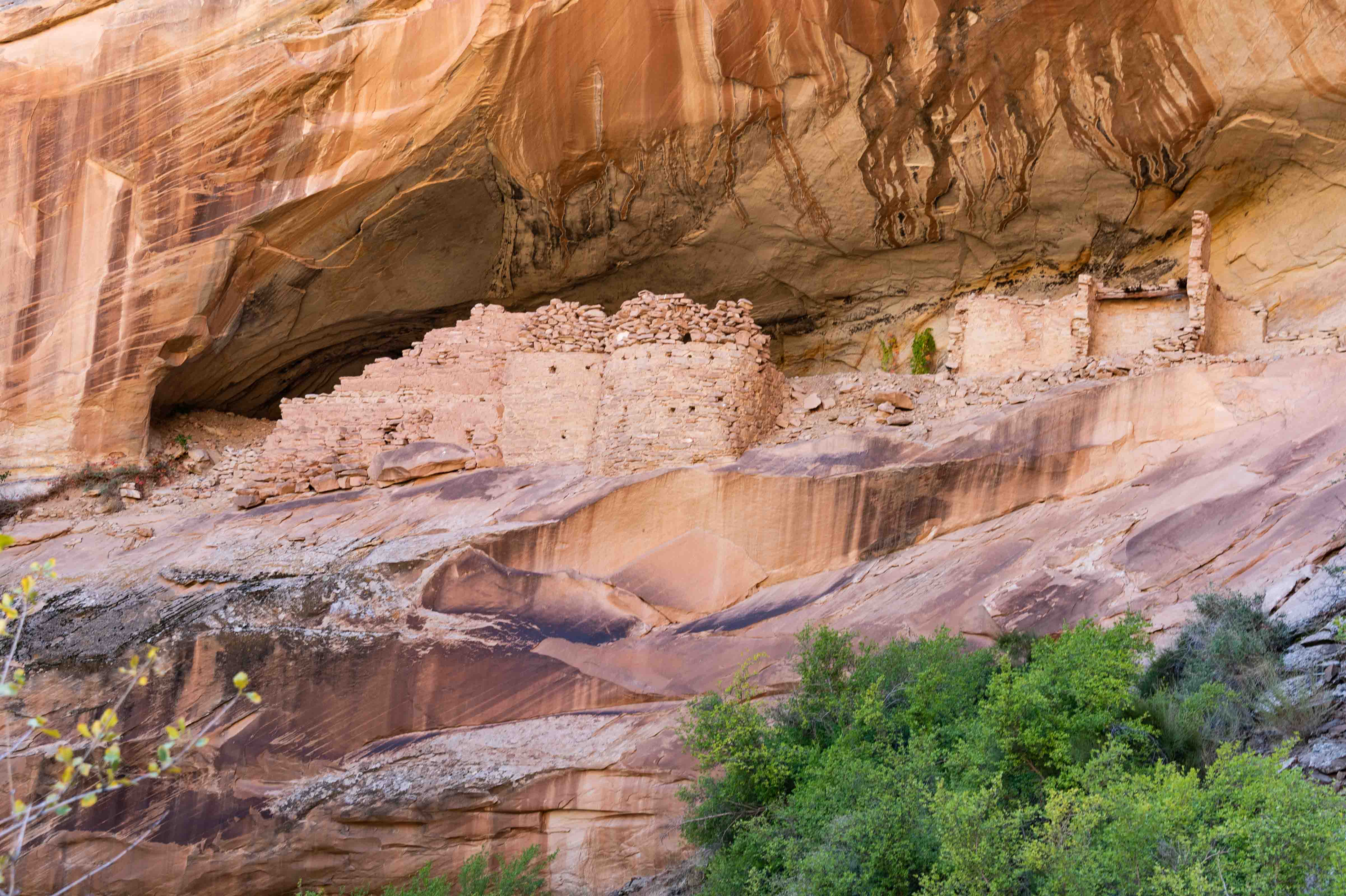
Butler Wash Ruins
Panoramic View of Ruins in Largest Alcove
Notice the spring center foreground
Small Ruin to the Left of the Main Alcoves
Arch to the Right of the Overlook
Butler Wash Dinosaur Tracks
The turnoff for the tracksite is 9.4 miles from the intersection of Utah-95 and US-191.
Turn left onto a dirt road and follow it for a short way to a parking lot with an interpretive kiosk.
The tracks are at the end of an easy 0.2-mile out-and-back trail.
Three of the dinosaur footprints were circled with small stones when I was there.
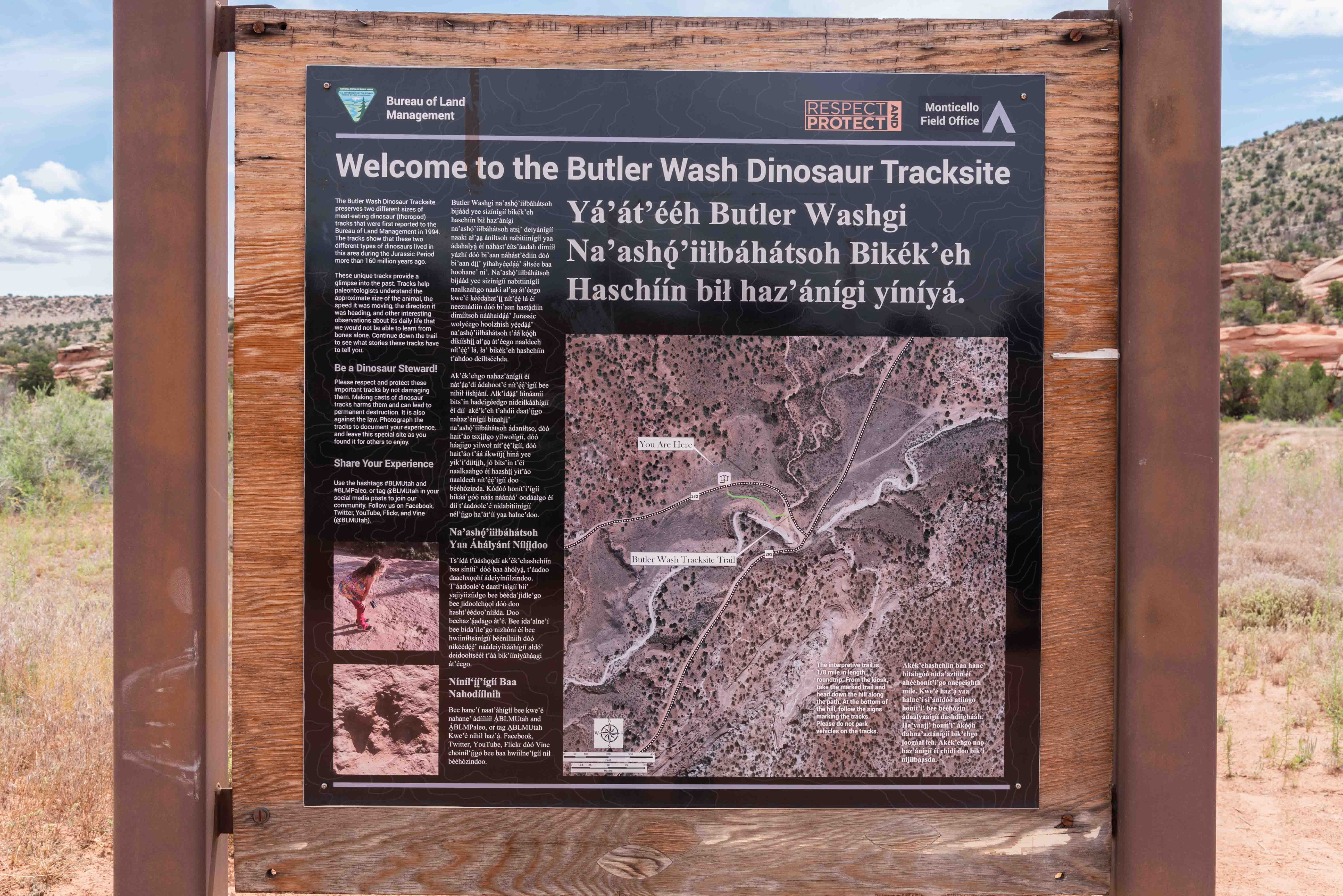
Interpretive Panel in English and Navajo
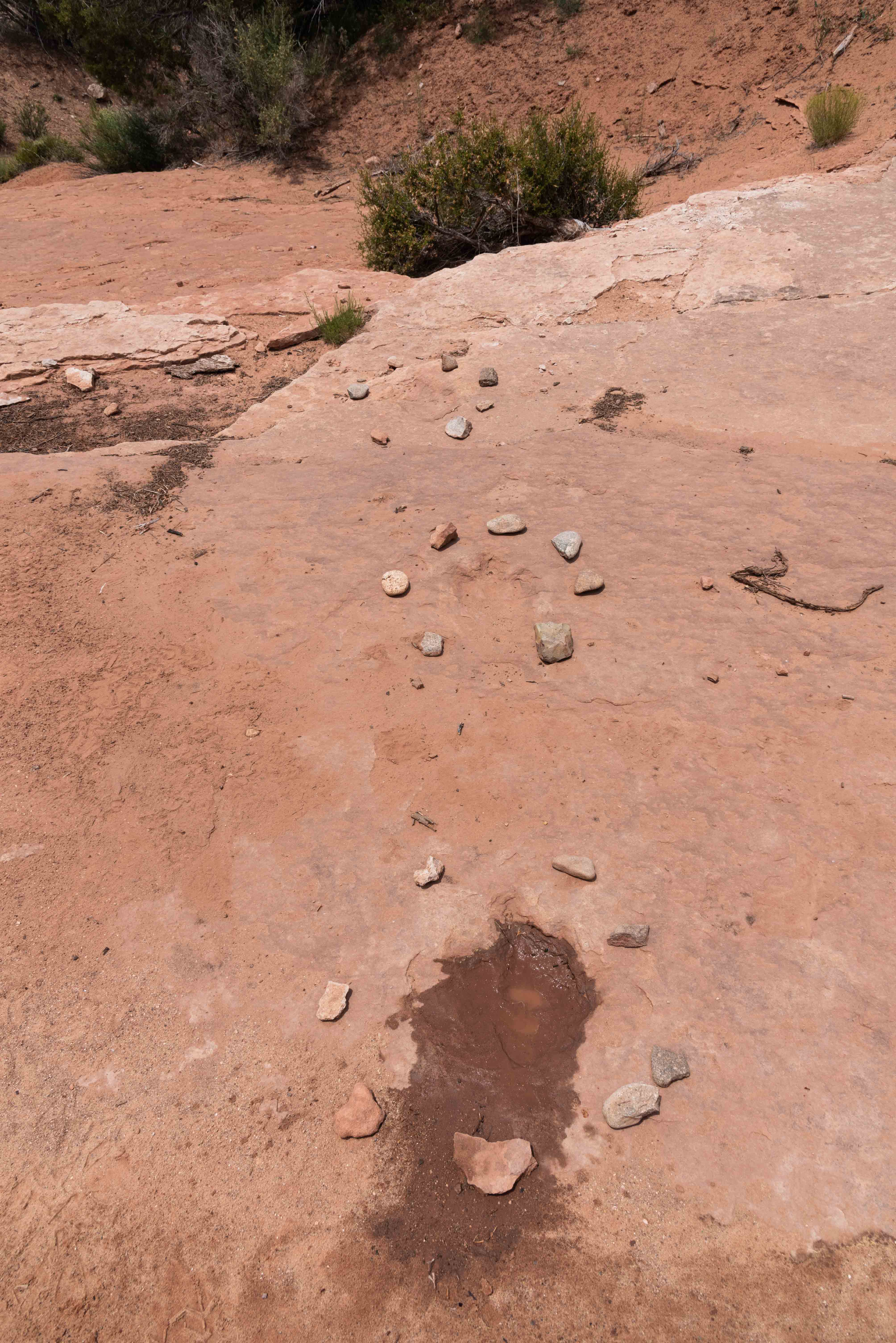
Well-marked Dinosaur Tracks
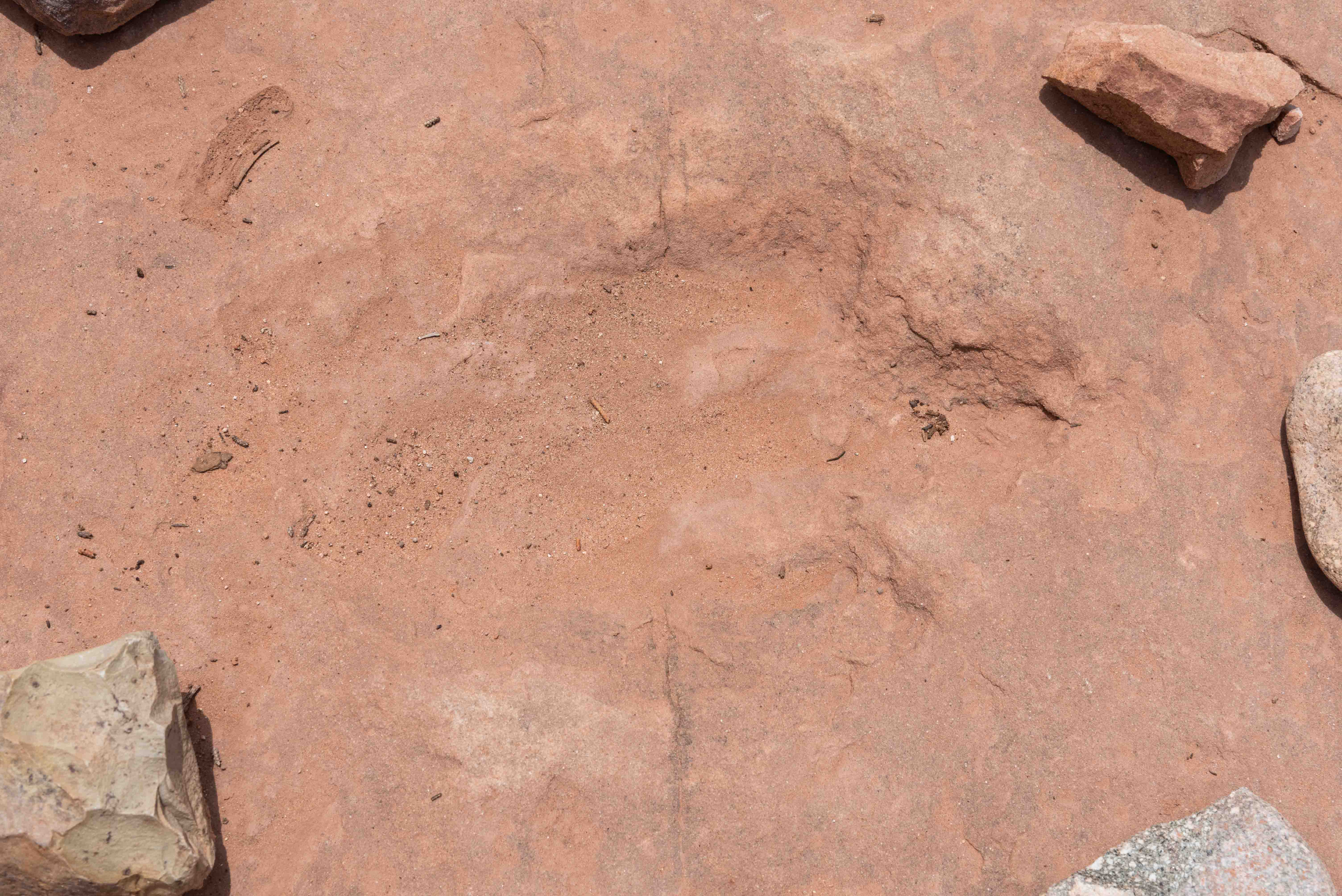
Dinosaur Track
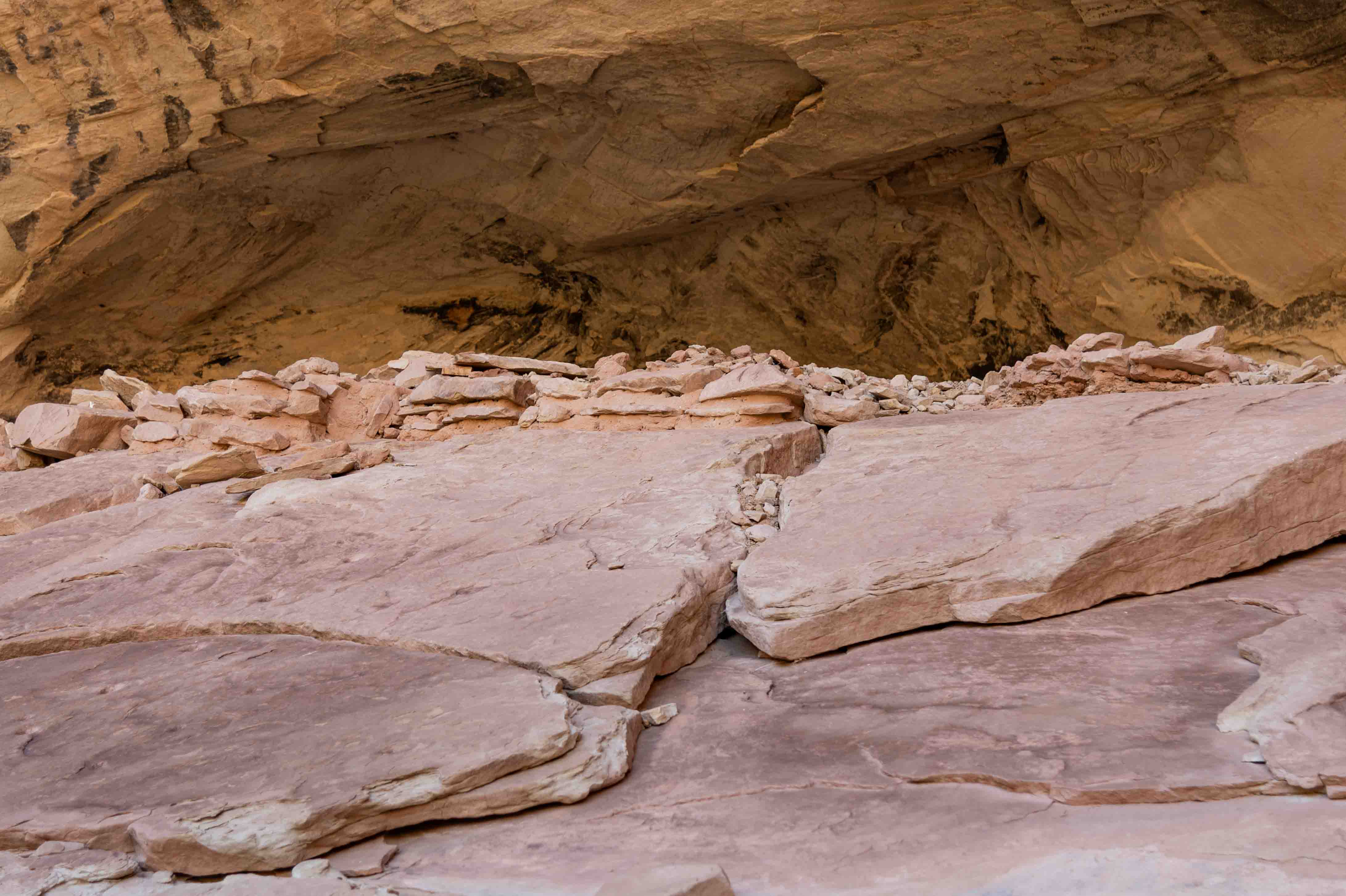
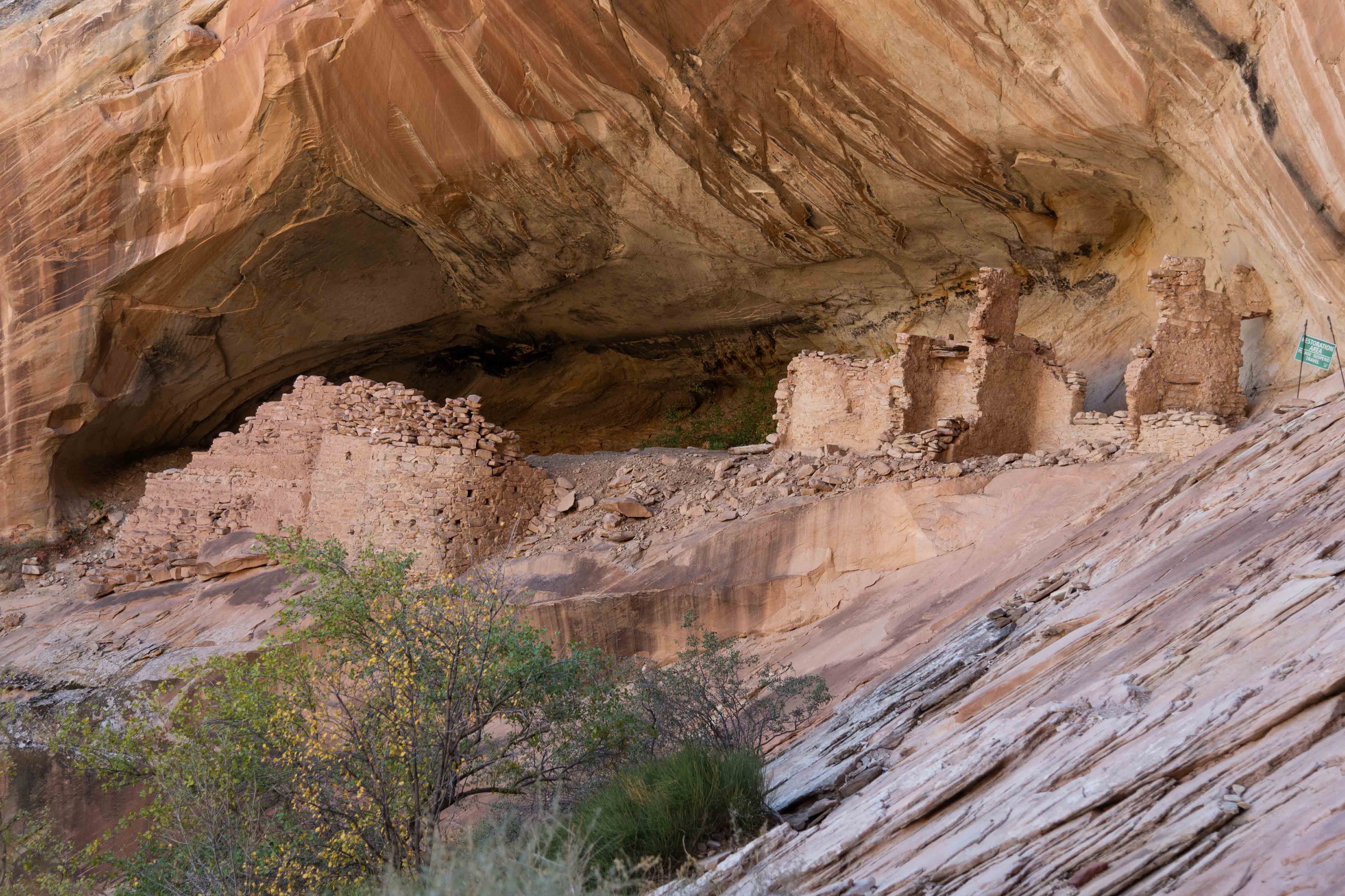
Mule Canyon Cave Towers
To get to Cave Towers drive west on Utah-95 for about 19 miles from its intersection with US-191.
Look for the dirt road and metal gate to the left between mile markers 102 and 103. Those with 4WD will
be able to drive to the parking lot enclosed by a wooden fence. Those with 2WD vehicles should
park on the right about 120 yards in and hike to the parking lot and trailhead.
The hike to the towers is an easy 1.4 mile out-and-back from the parking lot.
The trail ends at the head of Cave Canyon. There are ruins of 7 towers,
with additional ruins tucked into alcoves in the east canyon wall.
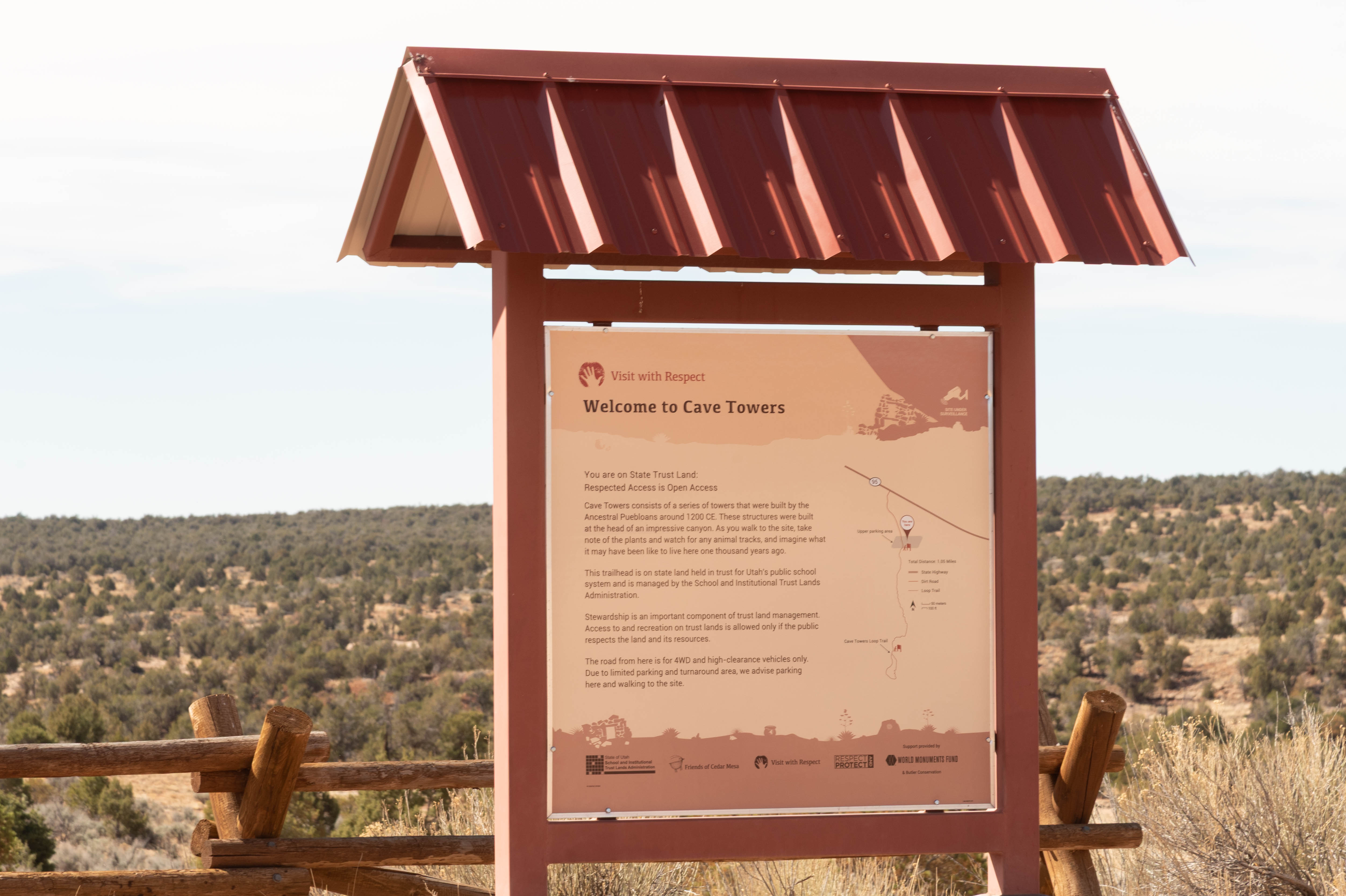
Sign in Parking Area
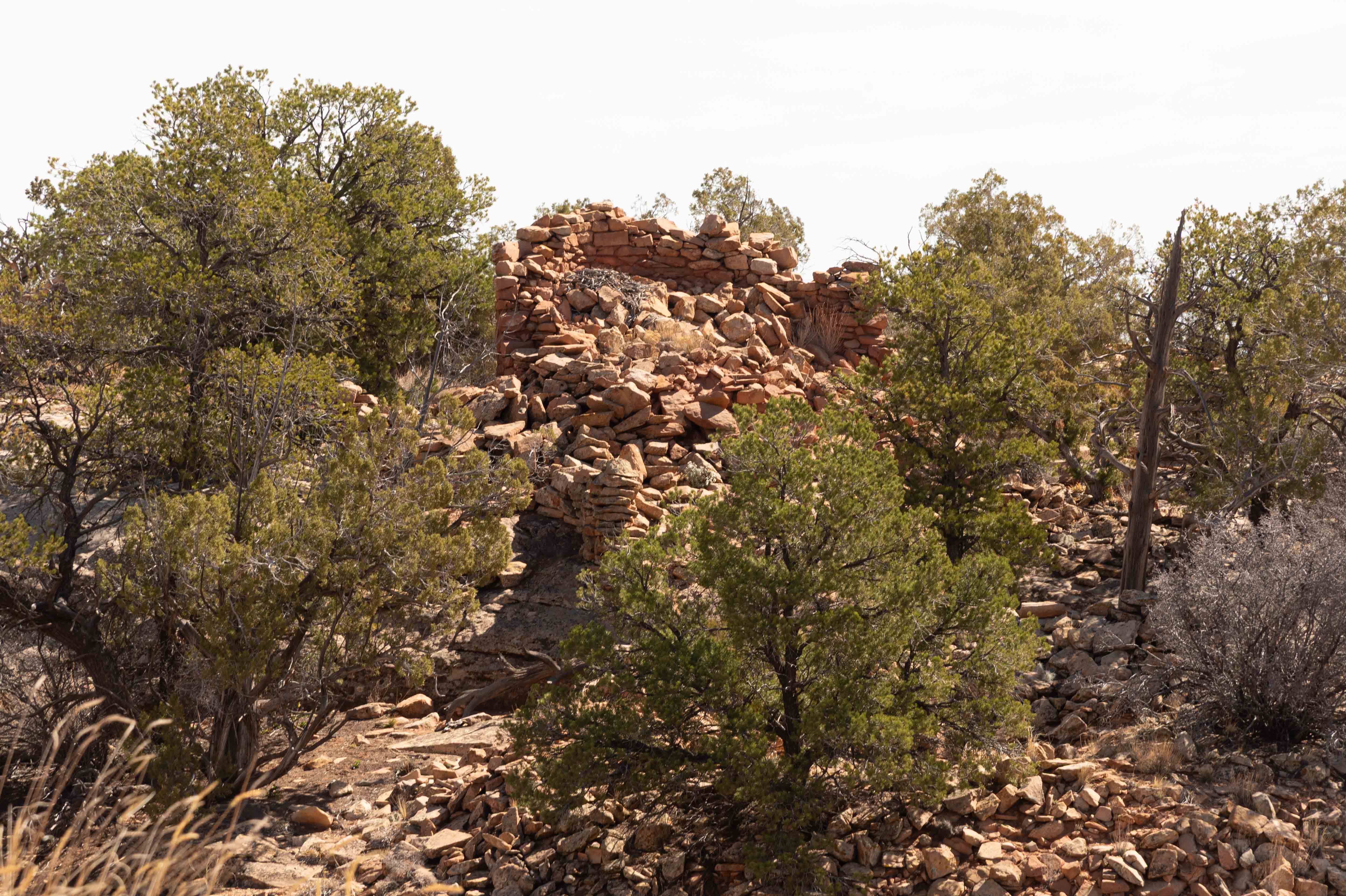
Tower Ruin
Cave Canyon

Panorama of the Ruins
Best Preserved Tower

Another View

Small ruin in the east canyon wall
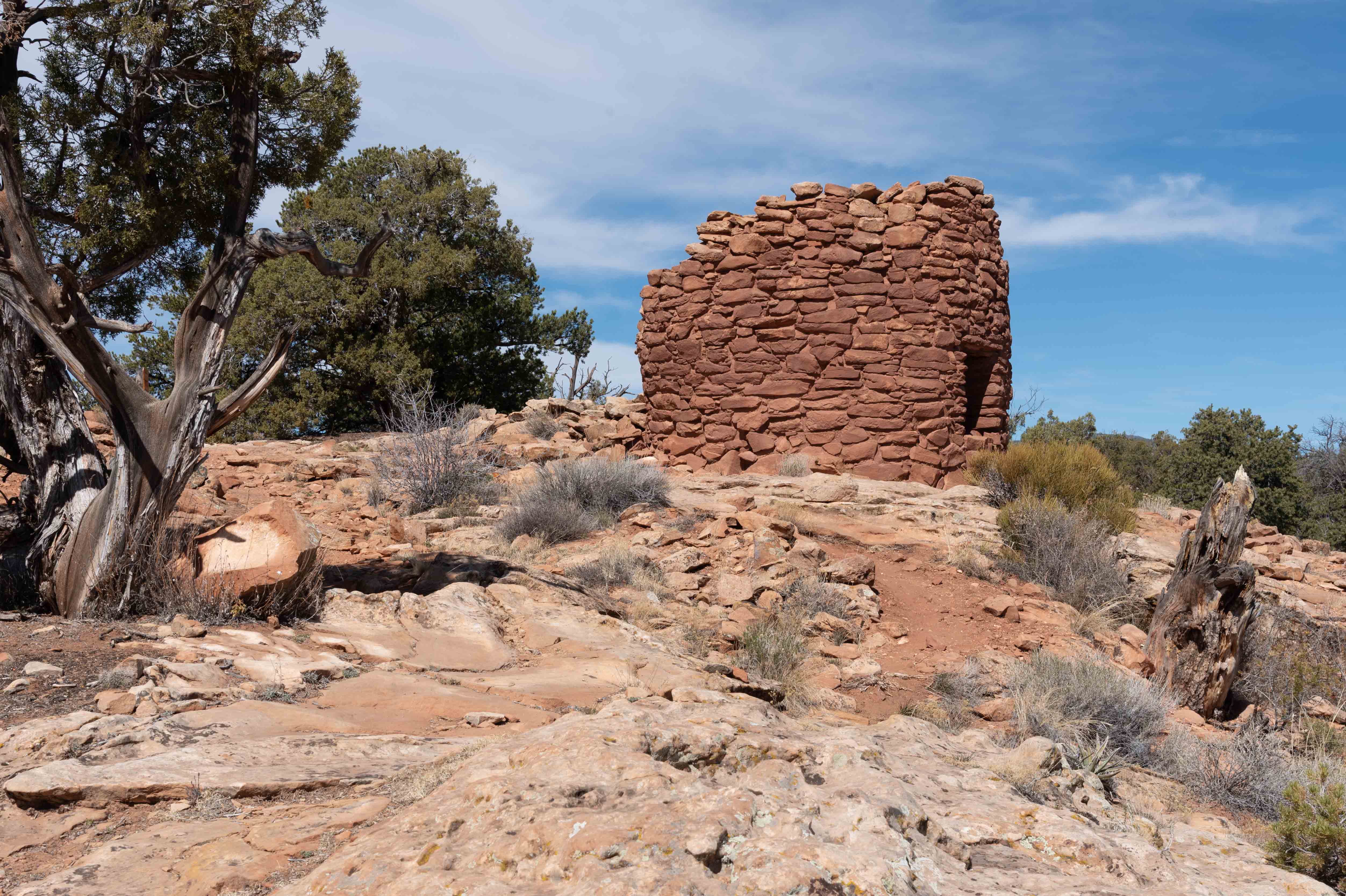
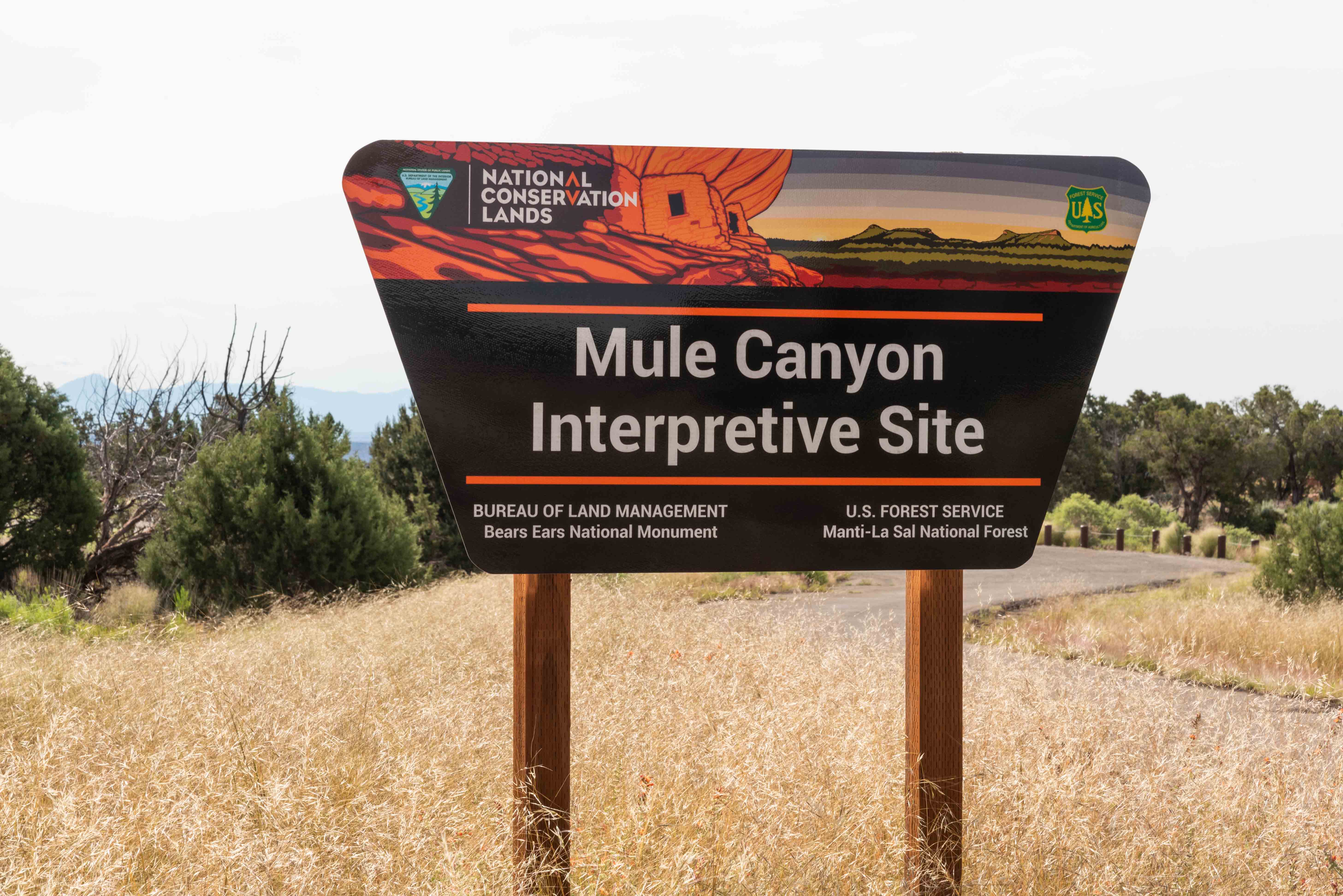
Mule Canyon Interpretive Site
The Mule Canyon Interpretive Site is located along Utah 95 on Cedar Mesa
in Southeastern Utah. The site is a complex of 700 year old Ancestral Puebloan
structures, including an excavated kiva, tower, and room block.
Interpretive signage, benches, and a vault toilet are included at no charge.
Mule Canyon Interpretive Site
Information about Mule Canyon Ruin
Tower
Room block
Kiva
House on Fire
Drive about 19 miles on UT-95 from its junction with US-191
and turn right onto Arch Canyon Road. The trailhead is 0.3 mile down this gravel road.
House on Fire is located in the south fork of Mule Canyon, a mile from the trailhead.
The entire hike is a little over 2 miles out-and-back, with an elevation gain of 69 ft.
There are other ruins scattered up and down canyon from House On Fire. House On Fire
sits under an overhang about 30 feet above the canyon floor. It gets its name from
the red glow of the sun shining on the rocks at mid-morning.
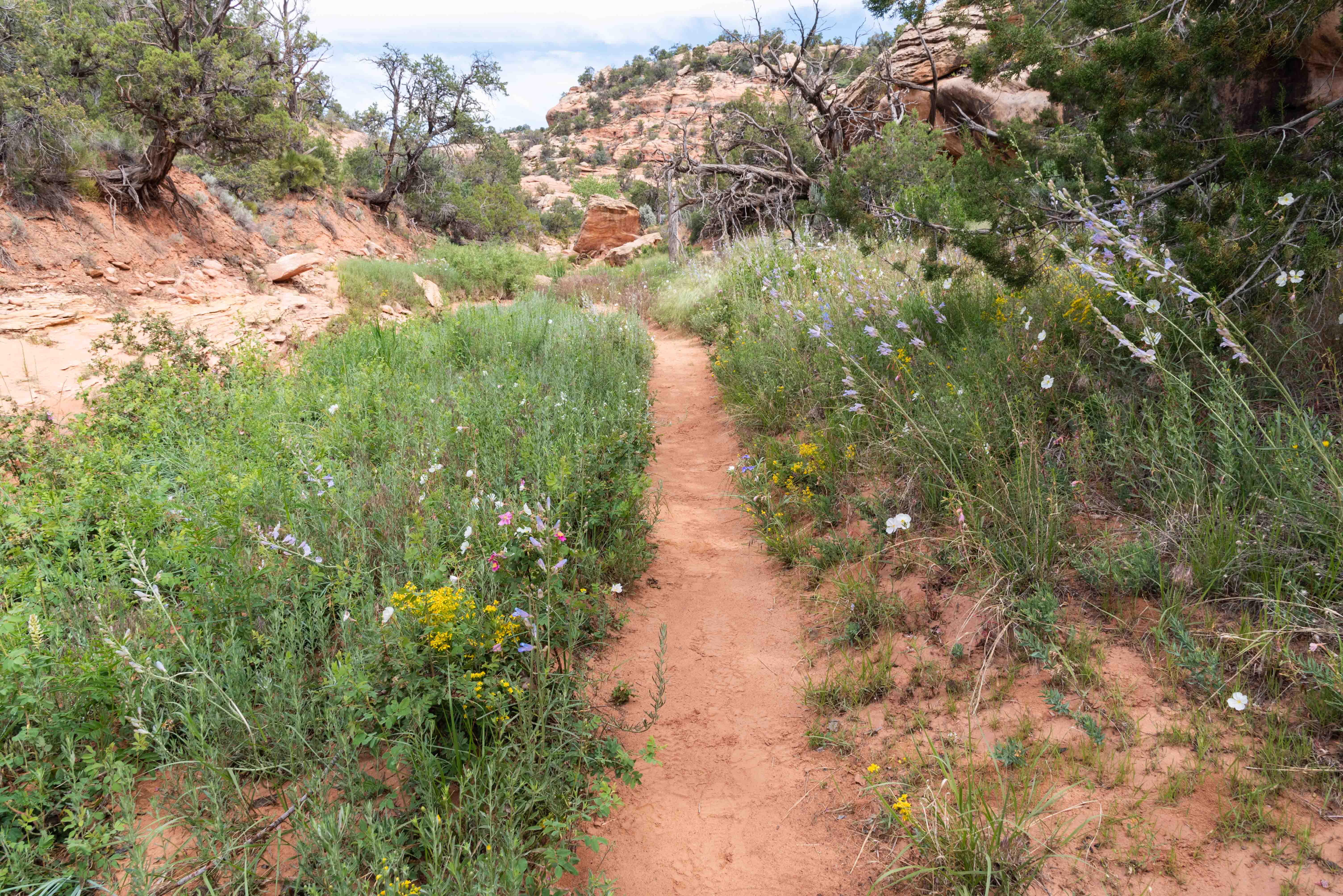
Trail to House on Fire
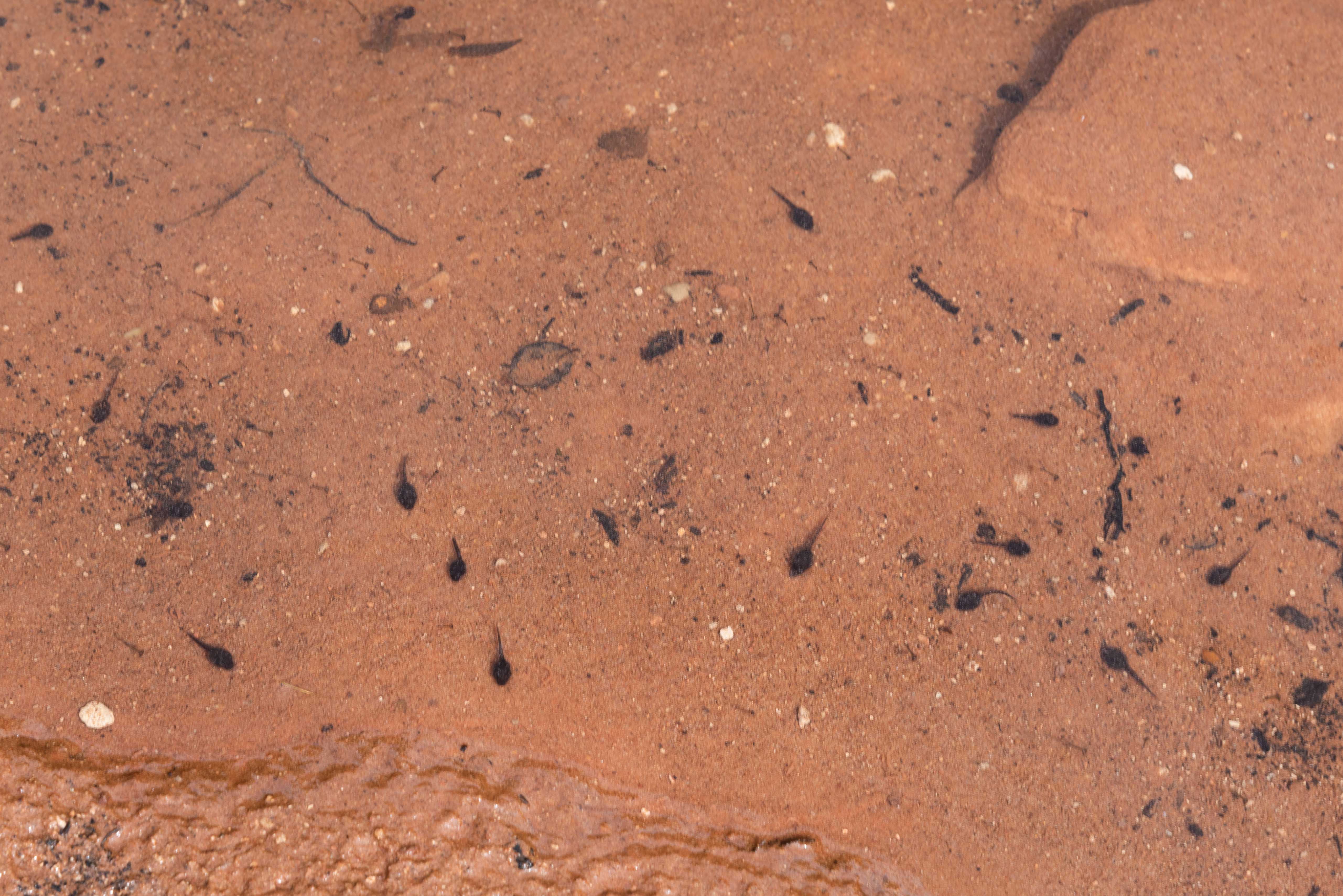
Tadpoles
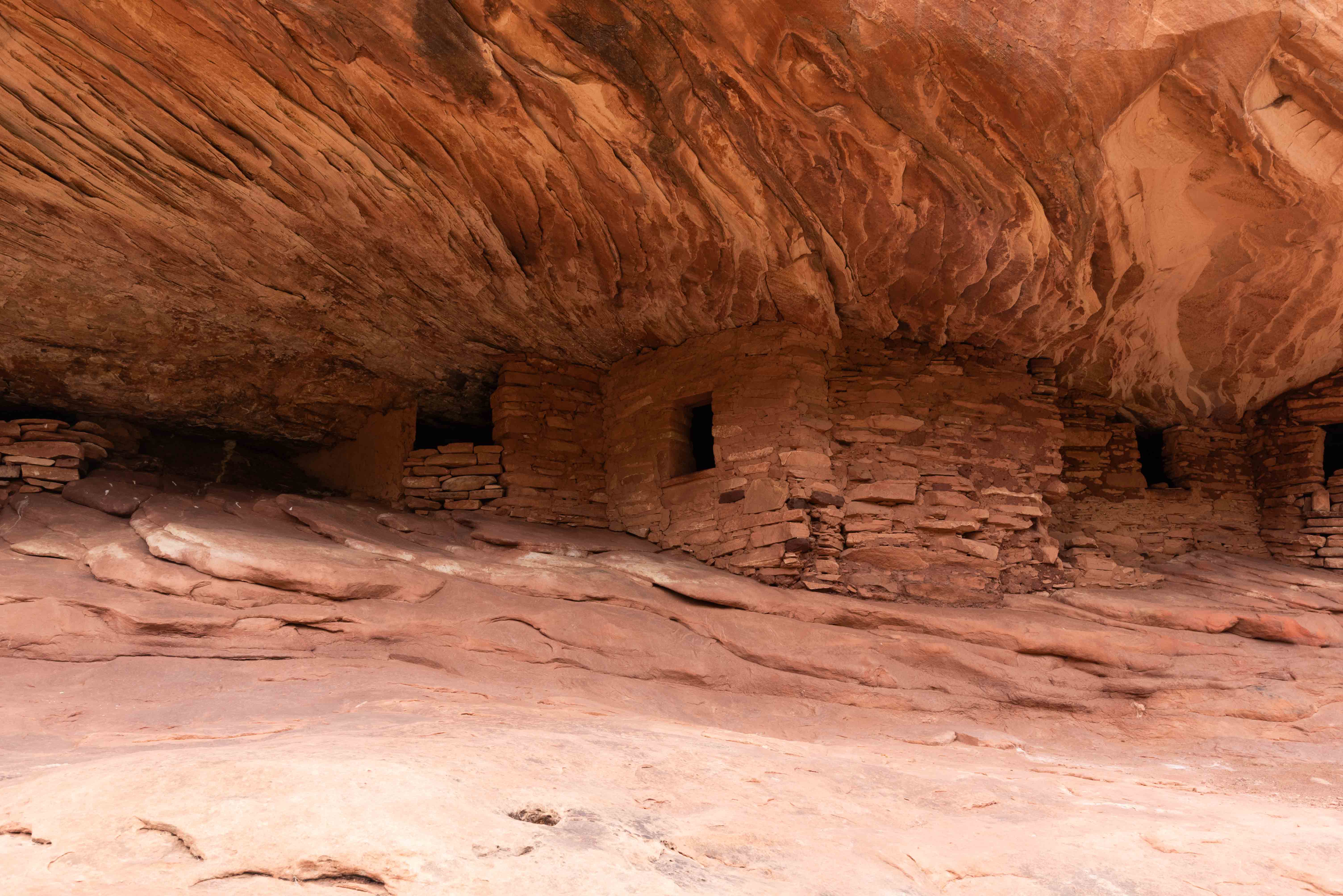
House on Fire rooms
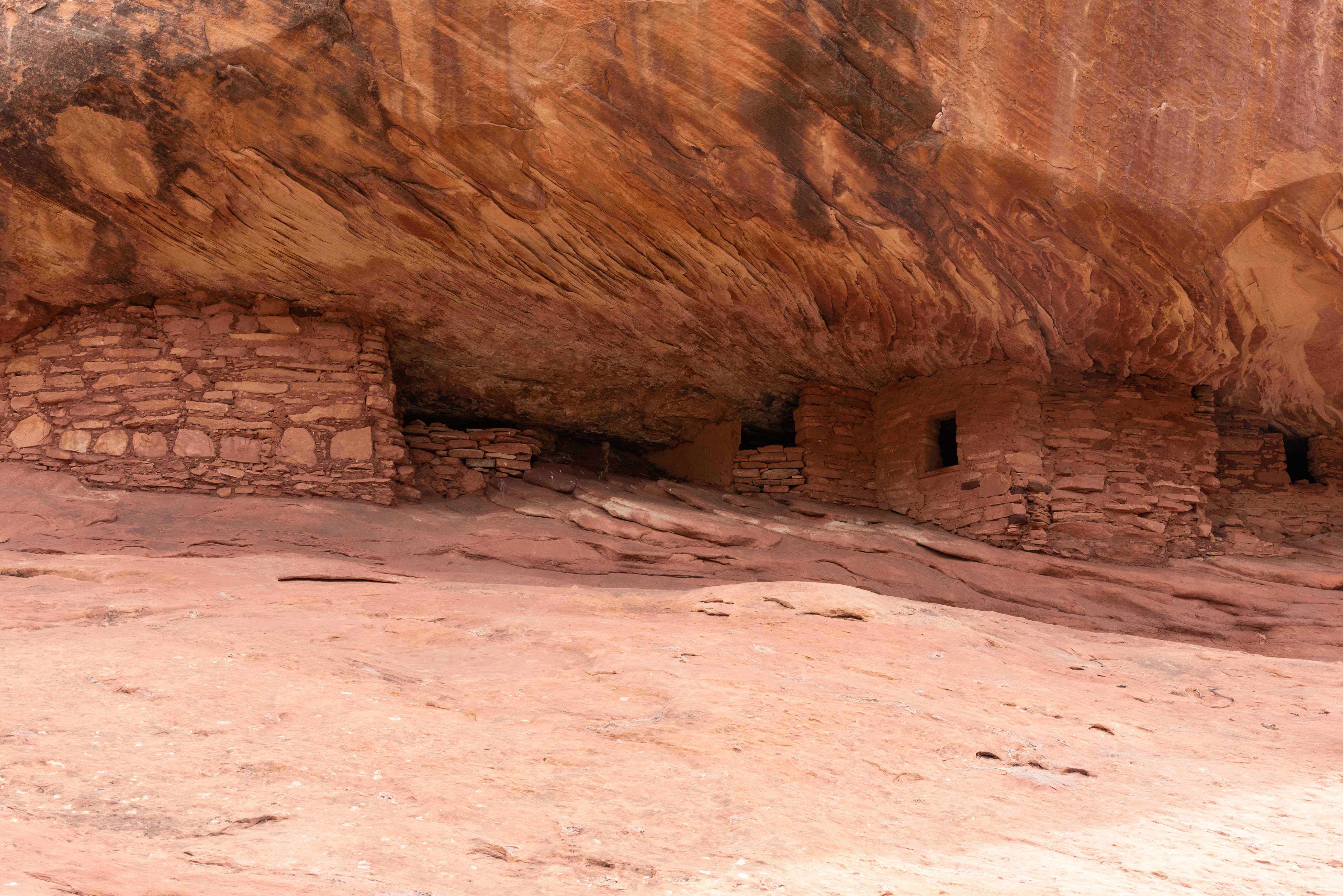
House on Fire rooms
House on Fire rooms
Background information obtained from Bureau of Land Management web sites, Wikipedia, and Microsoft CoPilot
Use the form on the Home Page to submit comments, questions, or suggestions. TD Productions Copyright © 2023-2025