Baxter Pass Road Trip
Today we're going on a road trip over Baxter Pass to the gilsonite mines in northeastern Utah.
First, a little background:
Gilsonite (also known as asphaltite, asphaltum, or uintahite) is a hydrocarbon resin that looks like obsidian. It's used as an additive to improve
quality and performance of oil-well drilling fluids, asphalt, inks, paints, and stains. Gilsonite is named after
Samuel Henry Gilson, who began mining it in 1888. He used it in varnishes, and it was the principle component
in Japan black lacquer used to paint Henry Ford's Model Ts. In order to cost-effectively transport the gilsonite ore, Gilson
built the Uintah Narrow Gauge Railroad. The track started in Mack, CO, climbed over the Book Cliffs at Baxter Pass,
then descended and ran along Evacuation Creek to the Black Dragon Mine in Utah. The Uintah Railroad connected with the Denver & Rio Grande Western Railroad in Mack.
Trucks began hauling the gilsonite in 1939 and that was the end of the railroad. The rails were pulled up, most of the engines scrapped, and towns along the rail line abandoned.
Today all that remains of the railroad are the walls of the railroad machine shop in Atchee and some rolling stock in Mack. The current road across Baxter Pass to the gilsonite
mines pretty much follows, and often is, the old Uintah track bed.
My friend Rick and I made the journey to the mines in July 2021 and we're here to do it again. So hop in the back of the truck and we'll be on our way.
FYI - The videos in this presentation were taken with a dashcam so the quality is not the best, but they do provide pretty good terrain views as we motor on down the road.
(They are best viewed full-screen). The times in the video captions are elapsed times from the start of the trip.
We start on 4 Road in Mack, CO. After about 7 miles 4 Rd becomes CR 201 as it
crosses the Mesa-Garfield county line. We continue for another 15.3 miles to the old railroad town
of Atchee. Atchee served as a supply, repair, and switching depot for the Uintah Narrow Gauge RR. About the only
thing left of Atchee are the walls of the railroad machine shop.
4 Road, Mesa County
Start
Garfield CR 201
20 minutes
Uintah Railroad Machine Shop
39°33'47.664" N 108°54'45.426" W 1961m/6434ft
Charlie watering the weeds
Our next stop after Atchee is the summit of Baxter Pass. The distance is about 6 miles.
The first half is relatively flat while the second half climbs the Book Cliffs at grades up to 7%.
Climbing the Book Cliffs
60 minutes
Baxter Pass Summit
1 hour 3 minutes
Baxter Pass Summit
39°34'57.18" N 108°57'10.098" W 2575m/8448ft
Panorama from Baxter Pass
Cows on the Road
1 hour 10 minutes
Once over Baxter Pass we continue more or less north on CR 201, descending the Book Cliffs at grades
from 3 to 5%.
Garfield CR 201
1 hour 15 minutes
5.6 miles and 2 switchbacks later we reach McAndrews Lake/Baxter Reservoir where CR 201
levels out and follows West Evacuation Creek. Look for some old houses just past Baxter Reservoir on the right.
Rounding the switchback near Baxter Reservoir
1 hour 27 minutes
Near McAndrews Lake (Baxter Reservoir)
39°36'57.498" N 108°58'21.66" W 2273m/7457ft
McAndrews Lake (Baxter Reservoir)
Possibly old railroad houses
3.3 miles from Baxter Reservoir we cross into Rio Blanco County and the road becomes CR 25.
Rio Blanco CR 25
1 hour 45 minutes
We travel 7.5 miles in Rio Blanco County before reaching the Colorado/Utah state line.
Once in Utah the road becomes Uintah County Road 4180, also known as Dragon Road. It's 3.3 miles from the
state line to the historic mining town of Dragon.
Crossing into Utah
1 hour 56 minutes
Historic Dragon
39°47'3.444" N 109°4'23.922" W 1773m/5817ft
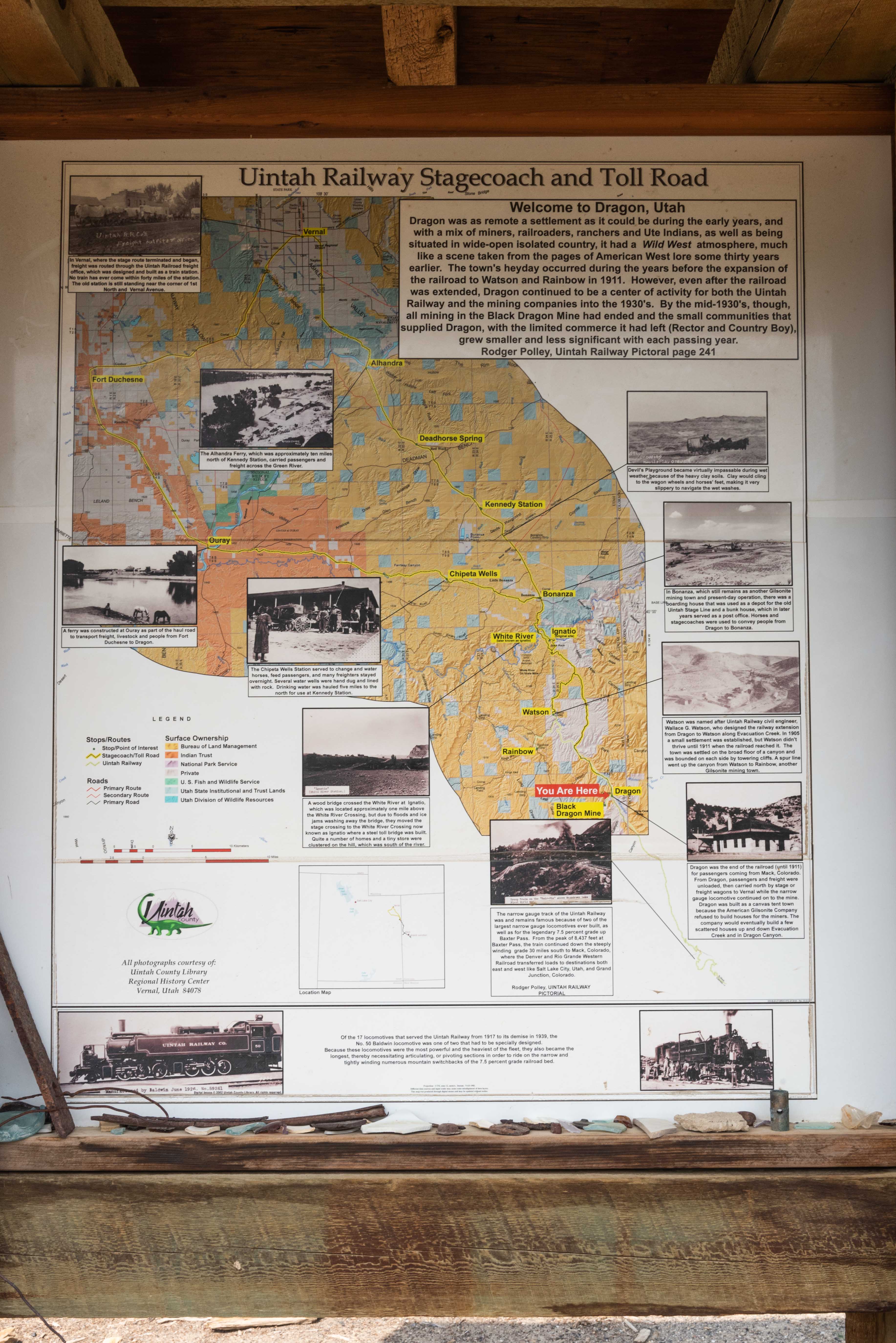
Uintah Railway Stagecoach and Toll Road
Two interpretive signs mark the Dragon townsite. First thing to do is explore the
area in back of the signs.

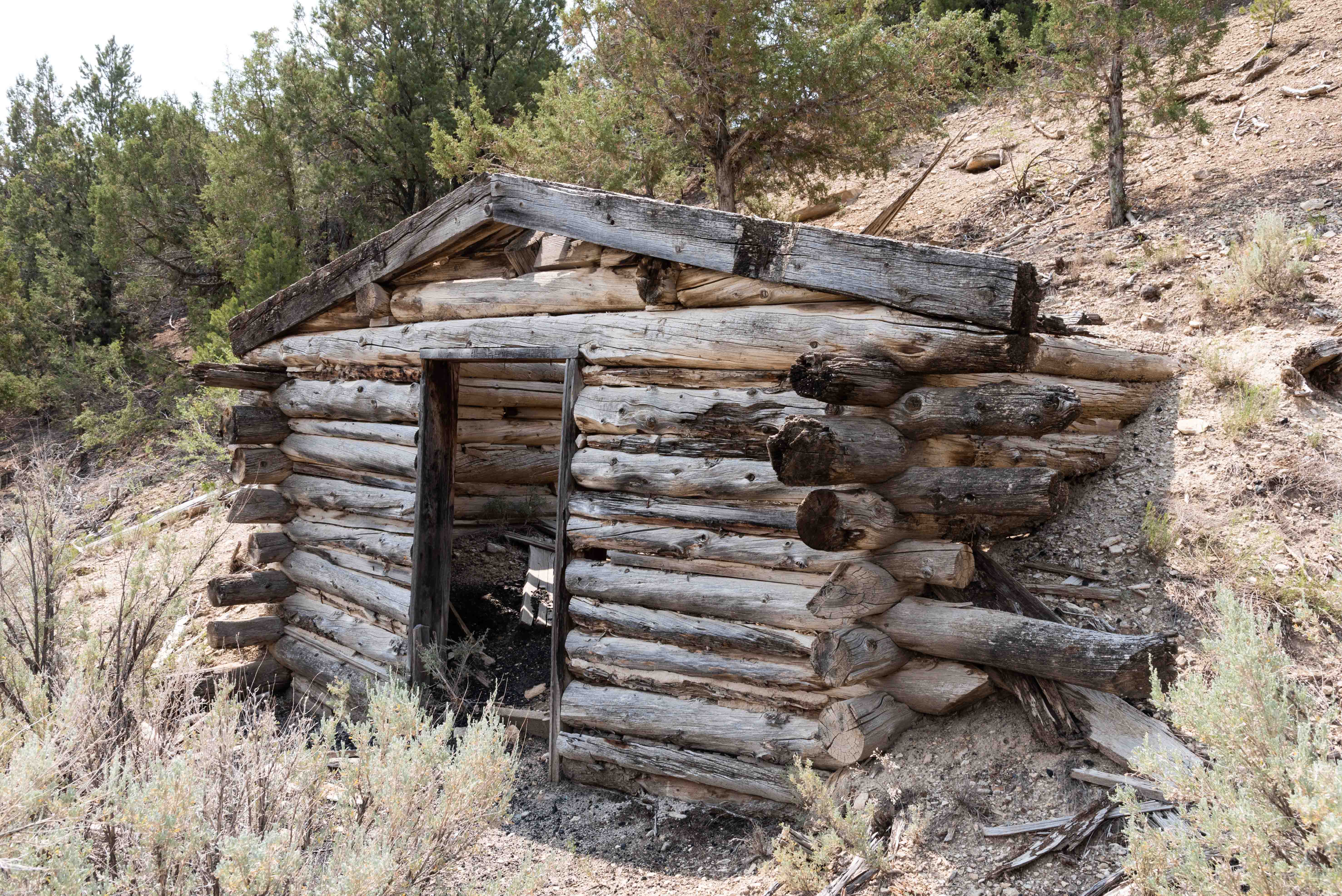
Pieces of Dragon
Lots of boards from collapsed buildings
Dragon Dwelling
After checking out the town ruins behind the signs take the
turnout just south of the signs for more town ruins.

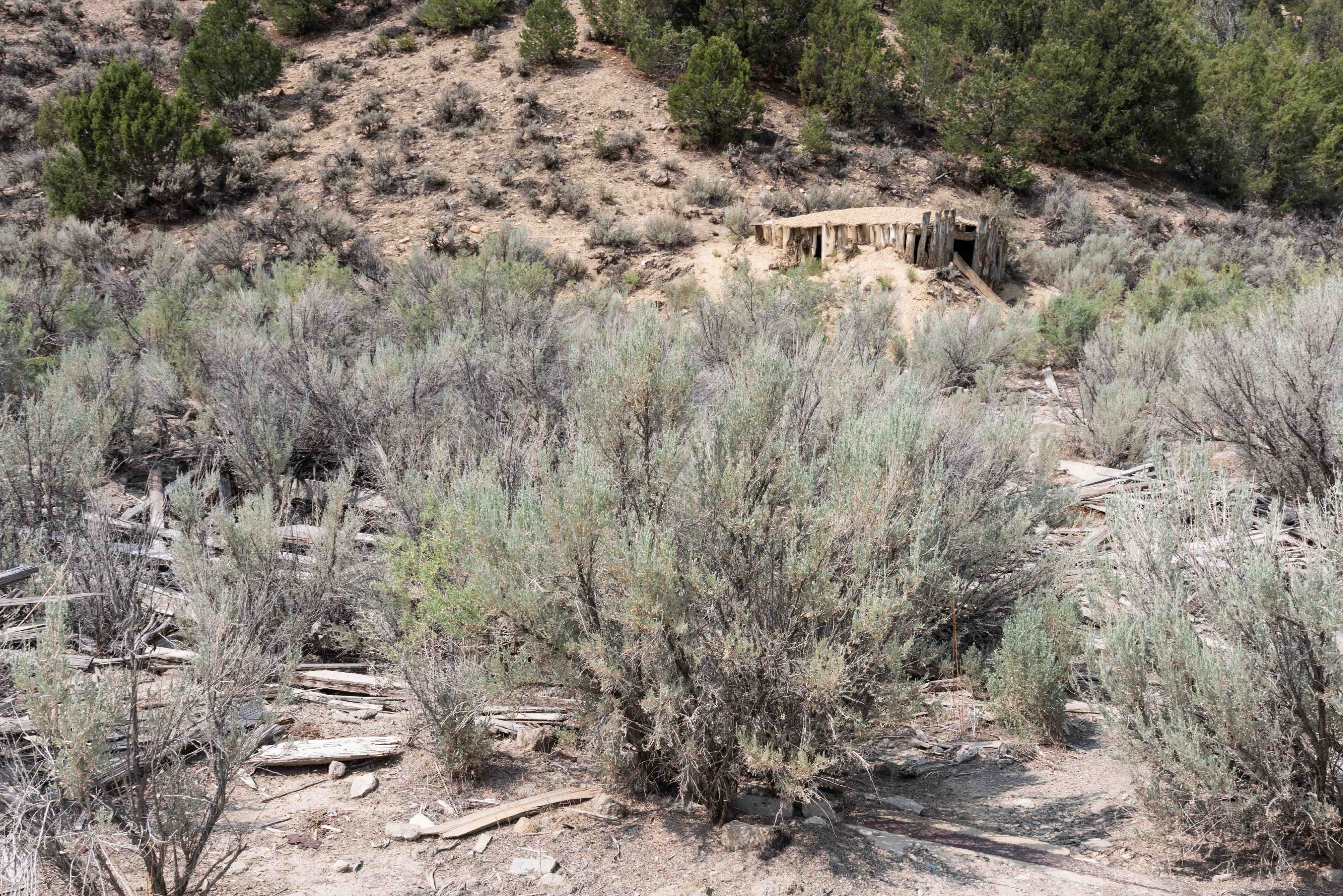
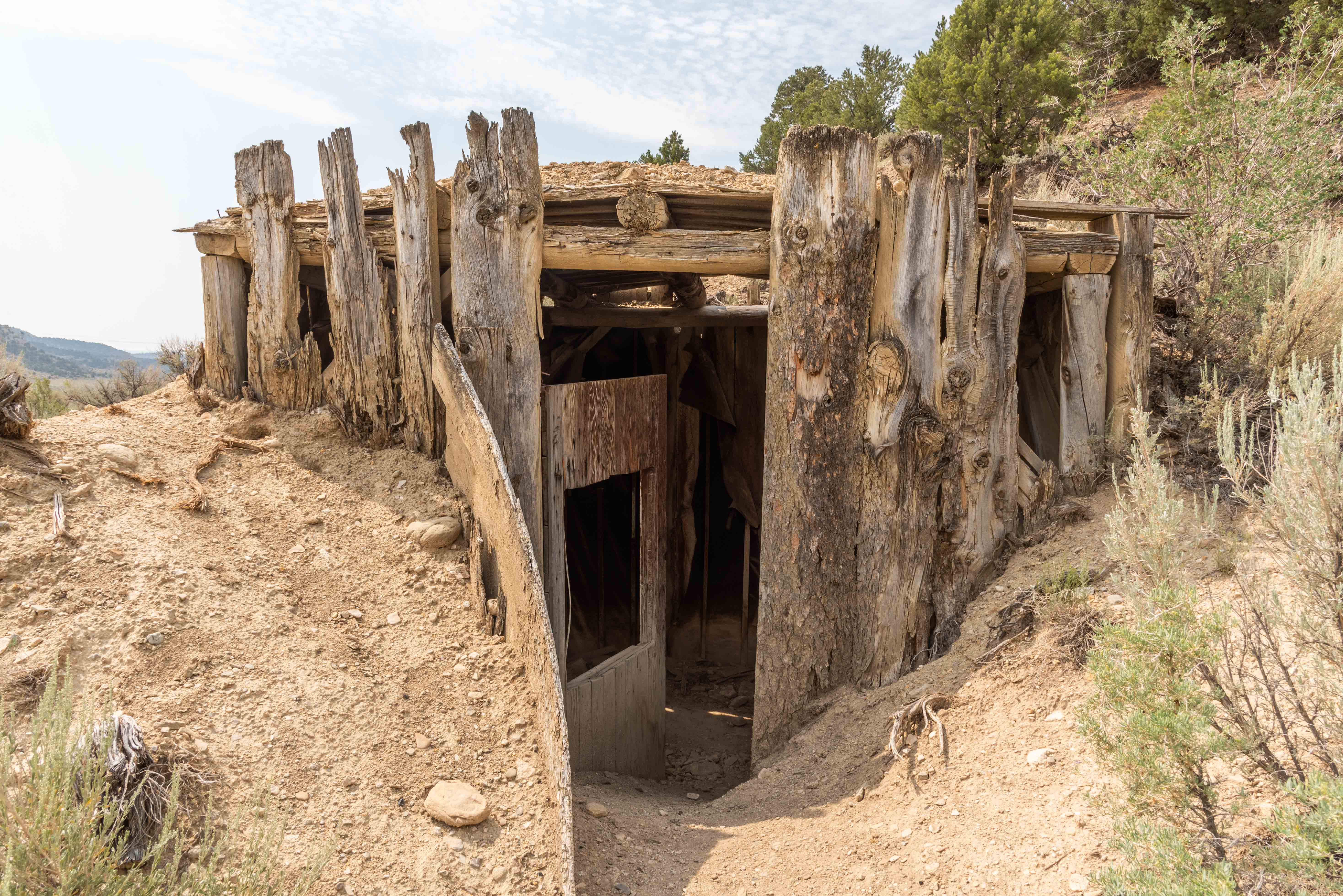
Concrete Structure
Another structure built into a hillside
It's time we left Dragon and press on to the mine.
Black Dragon Mine is located about 1.1 miles down Dragon Canyon Road. The turn for
Dragon Canyon Road is about a tenth of a mile north of the Dragon signs.
Arriving at Black Dragon Mine
2 hours 23 minutes
Mine remains
Left Mine Adit
Right Mine Adit
Black Dragon Mine
39°46'31.536" N 109°5'7.128" W W 1819m/5968ft

Stone Masonry
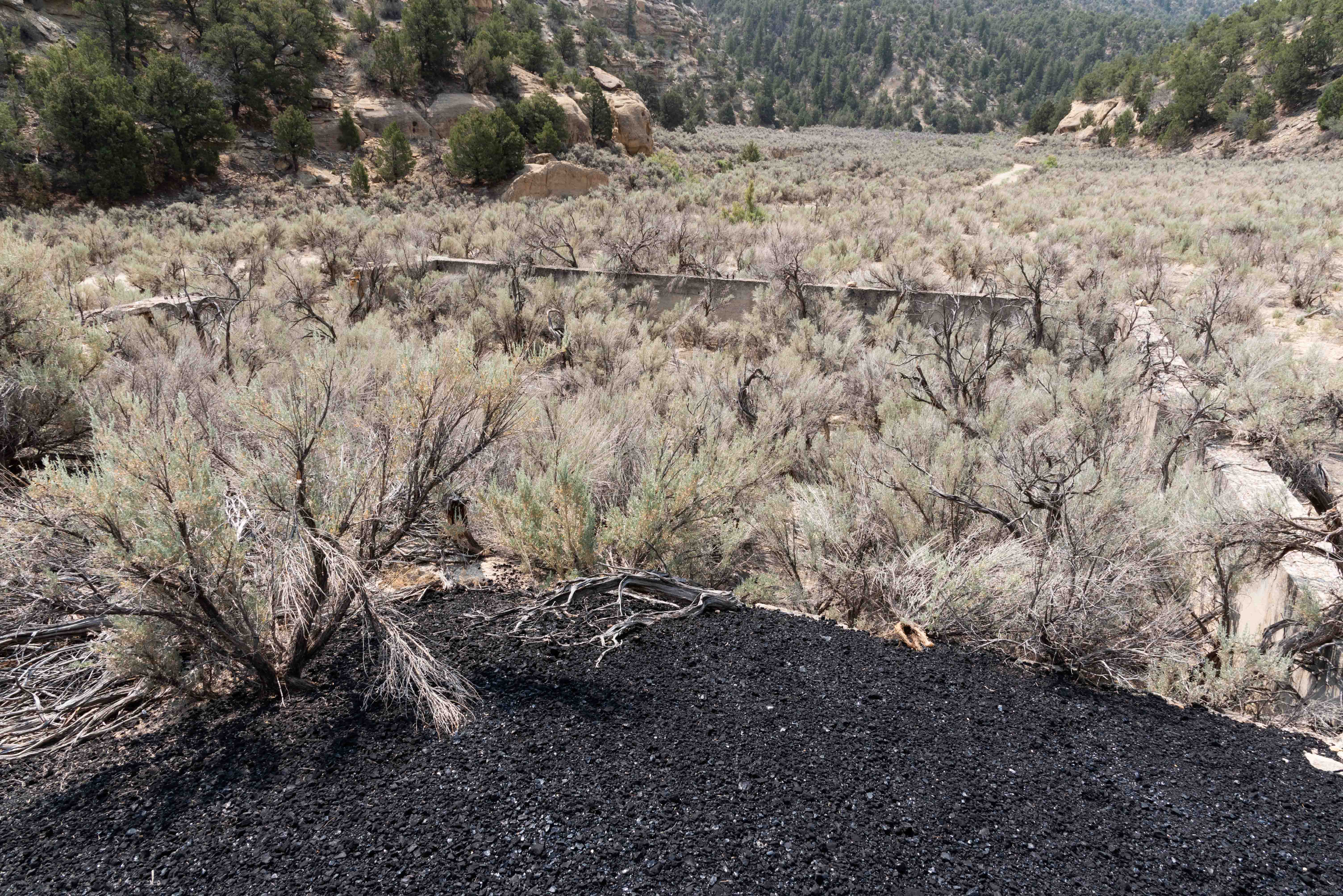
Gilsonite mound in front of building foundation
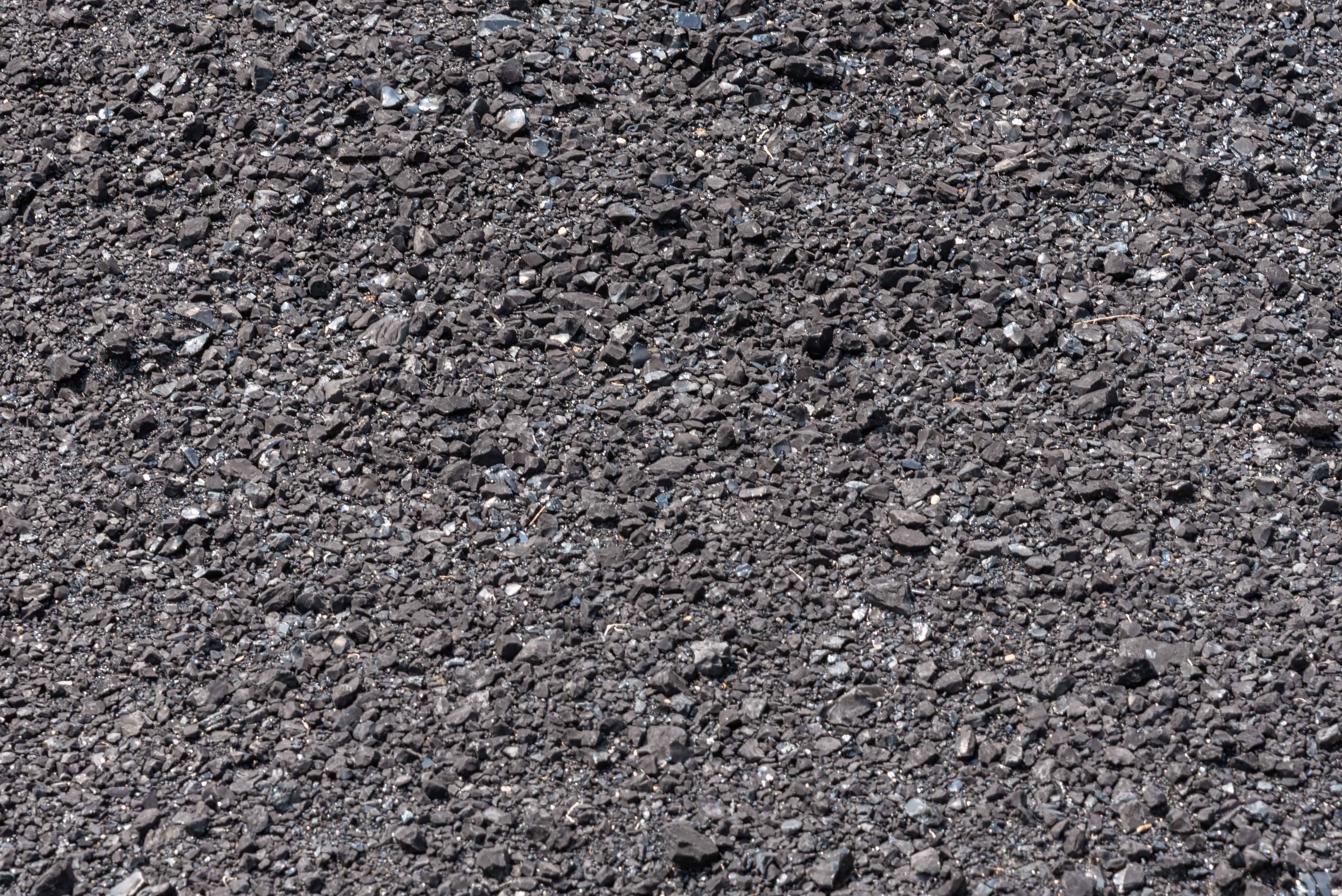
Gilsonite
Return to Dragon Road and head north. We come to the junction of county
roads 4180 and 4190 in 12.3 miles. Turn right to stay on CR 4180. From there it's about 3.8 miles to
Utah State Route 45. Turn right on SR 45 toward Bonanza. It looks like maybe we'll get an afternoon sprinkle.
CR 4180 and junction with Utah State Route 45
2 hours 51 minutes
We're making one more stop before we reach our final destination.
This is the White River overlook for some really great views.
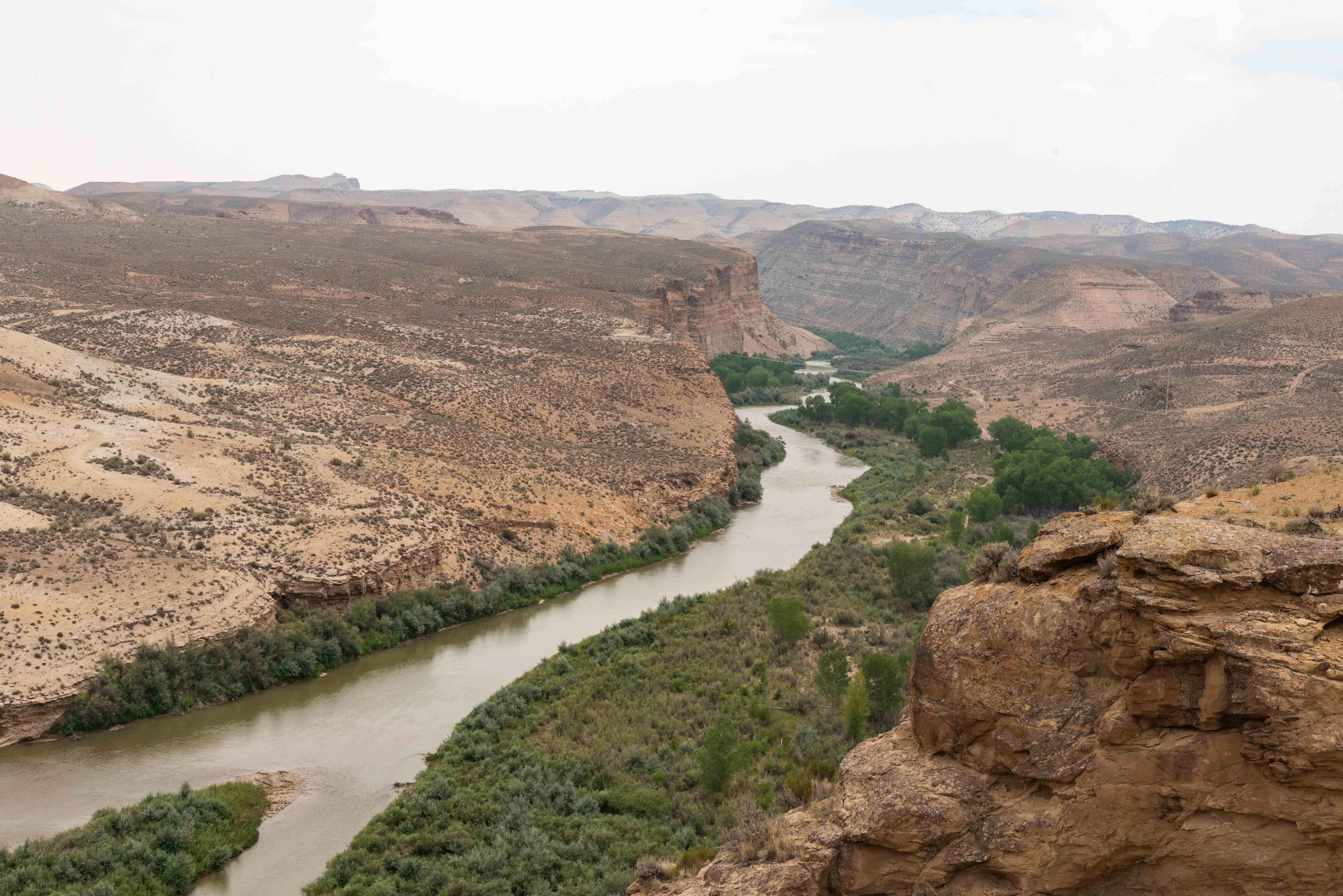
White River
We pull into Bonanza at the American Gilsonite Company to end our road trip.
Good thing too because it's starting to rain. The name Gilsonite is a registered trademark of the American Gilsonite Company, so they
tout themselves as the world’s only supplier of Gilsonite®. (Gilsonite deposits are found in several other countries).
End of the line - American Gilsonite Company
~ 3 hours
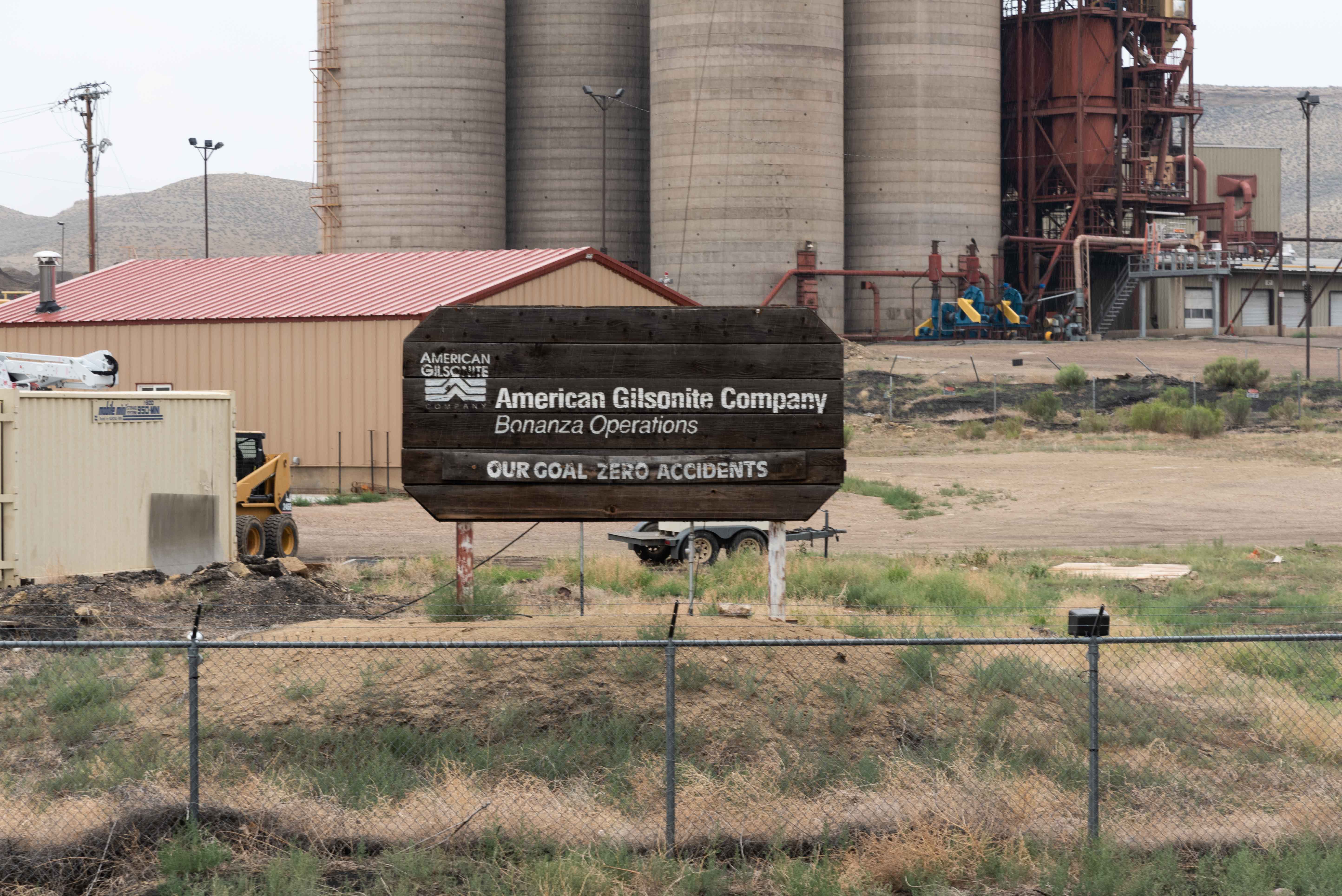
American Gilsonite Company
Even though our road trip has officially ended we still need to get back
to where we started. So, turn left on to Stanton Road (CR 3460) just south of Bonanza.
Stanton Road turns into Rio Blanco CR 21 once it crosses the Utah/Colorado state line and
dead ends into CO SR 64. Take SR 64 to Rangely and then CO SR 139 south to Loma and home.
The return trip is 100 miles and takes about 2 hours per Google Maps (I didn't time it). The whole round trip is
about 5 to 6 hours depending on driving speed and number and length of stops. SR 139 crosses the
Book Cliffs at Douglas Pass, so you're really getting two passes for the price of one on this trip.
Background information obtained from Wikipedia and the American Gilsonite Company website.
Use the form on the Home Page to submit comments, questions, or suggestions. TD Productions Copyright © 2021